BLUE
anappedroza.bsky.social

Cara pq as camisas femininas não abaixam o preço ptm a masculina 189 no pix e a feminina 332 vo me matar

0
AFslc.nws-bot.us

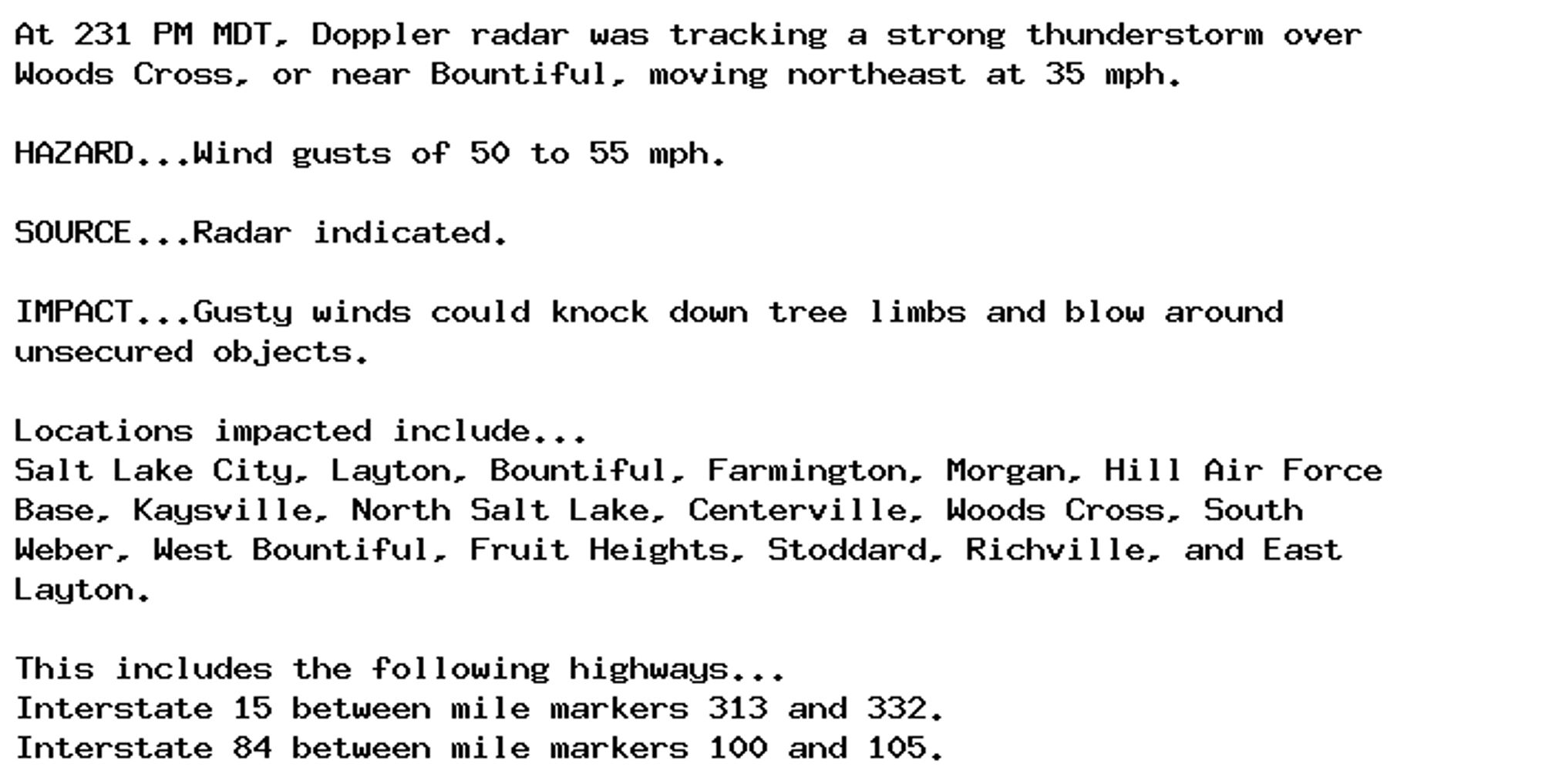
Special Weather Statement issued September 29 at 2:31PM MDT by NWS Salt Lake City UT Additional Details Here.

At 231 PM MDT, Doppler radar was tracking a strong thunderstorm over
Woods Cross, or near Bountiful, moving northeast at 35 mph.

HAZARD...Wind gusts of 50 to 55 mph.

SOURCE...Radar indicated.

IMPACT...Gusty winds could knock down tree limbs and blow around
unsecured objects.

Locations impacted include...
Salt Lake City, Layton, Bountiful, Farmington, Morgan, Hill Air Force
Base, Kaysville, North Salt Lake, Centerville, Woods Cross, South
Weber, West Bountiful, Fruit Heights, Stoddard, Richville, and East
Layton.

This includes the following highways...
Interstate 15 between mile markers 313 and 332.
Interstate 84 between mile markers 100 and 105.
0
AFunr.nws-bot.us

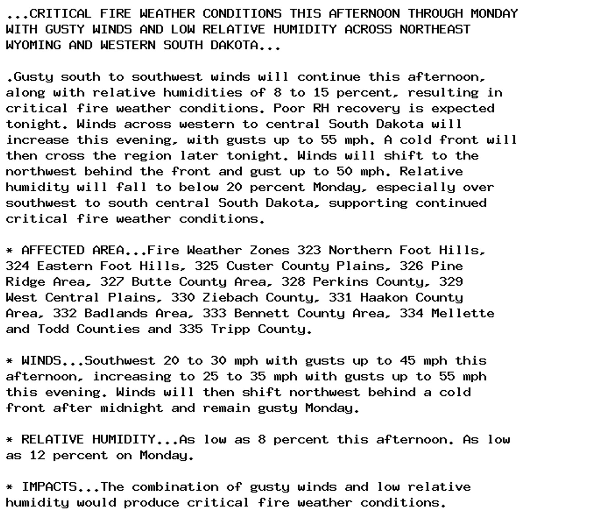
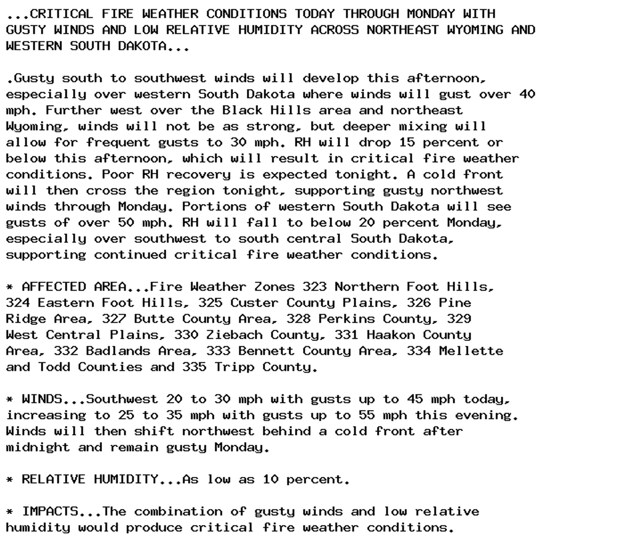
Red Flag Warning issued September 29 at 1:12PM MDT until September 30 at 8:00PM MDT by NWS Rapid City SD Additional Details Here.

...CRITICAL FIRE WEATHER CONDITIONS THIS AFTERNOON THROUGH MONDAY
WITH GUSTY WINDS AND LOW RELATIVE HUMIDITY ACROSS NORTHEAST
WYOMING AND WESTERN SOUTH DAKOTA...

.Gusty south to southwest winds will continue this afternoon,
along with relative humidities of 8 to 15 percent, resulting in
critical fire weather conditions. Poor RH recovery is expected
tonight. Winds across western to central South Dakota will
increase this evening, with gusts up to 55 mph. A cold front will
then cross the region later tonight. Winds will shift to the
northwest behind the front and gust up to 50 mph. Relative
humidity will fall to below 20 percent Monday, especially over
southwest to south central South Dakota, supporting continued
critical fire weather conditions.

* AFFECTED AREA...Fire Weather Zones 323 Northern Foot Hills,
324 Eastern Foot Hills, 325 Custer County Plains, 326 Pine
Ridge Area, 327 Butte County Area, 328 Perkins County, 329
West Central Plains, 330 Ziebach County, 331 Haakon County
Area, 332 Badlands Area, 333 Bennett County Area, 334 Mellette
and Todd Counties and 335 Tripp County.

* WINDS...Southwest 20 to 30 mph with gusts up to 45 mph this
afternoon, increasing to 25 to 35 mph with gusts up to 55 mph
this evening. Winds will then shift northwest behind a cold
front after midnight and remain gusty Monday.

* RELATIVE HUMIDITY...As low as 8 percent this afternoon. As low
as 12 percent on Monday.

* IMPACTS...The combination of gusty winds and low relative
humidity would produce critical fire weather conditions.
0
BMbarmas.bsky.social

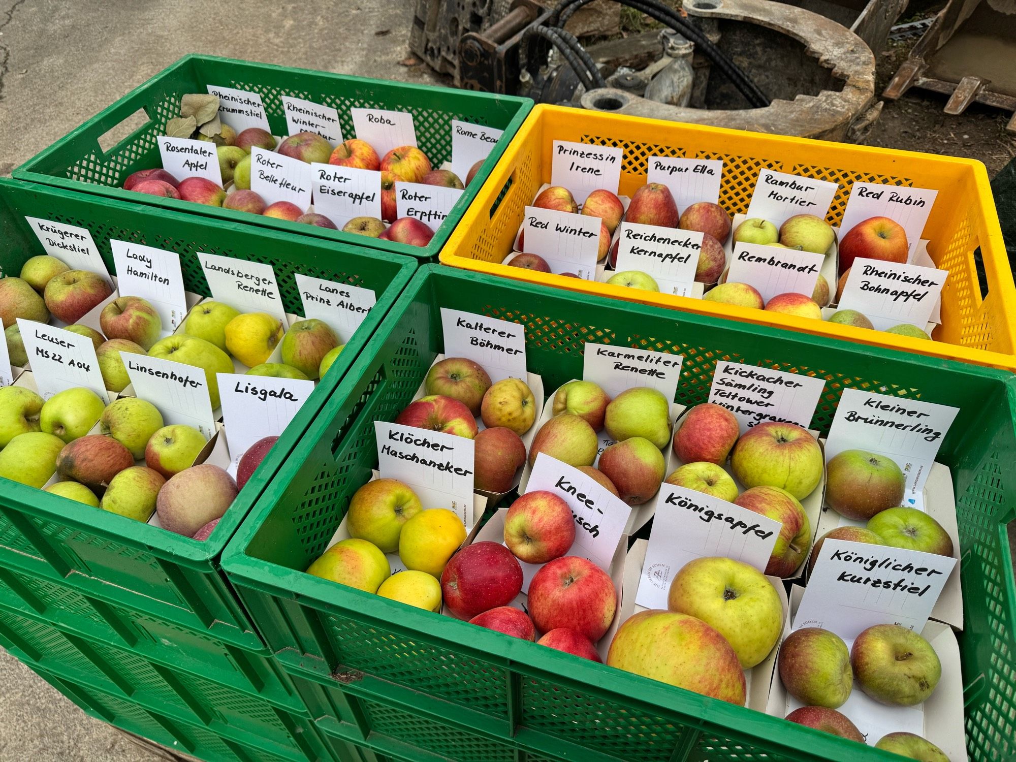
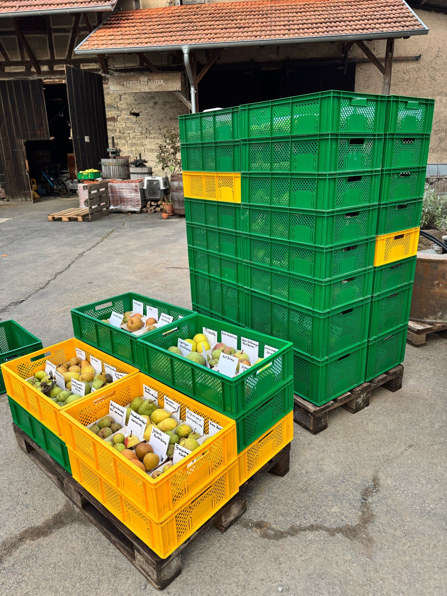
Earlier today, unloading the truck. 332 varieties of apple and pear, and we’ll have them on show here next weekend. Glad the labels didn’t come loose during transport!Might need to put the pears in a cool room though.

Four fruit crates each containing eight different prices of Apple labelled
Two pallets, the one on the right stacked with 32 fruit crates filled with apples and one on the left with a measly 10 crates with pears
0
TOsteverogersjr.bsky.social

Dia 10# O Capitão América, ao descobrir a corrupção no governo, decide se aposentar e entrega seu escudo e uniforme, mostrando que sua lealdade é ao povo, e não ao governo. Capitain america #332(1968)

0
Ggeodesic.bsky.social

ConnecTrade Puzzle #332 🟦🟦🟦🟨 🟩🟩🟦🟩 🟦🟦🟦🟦 🟥🟥🟥🟥 🟨🟨🟨🟩 🟩🟩🟩🟩 🟨🟨🟨🟨 oec.world/en/games/con...

0
Sshadoworcslayer.bsky.social

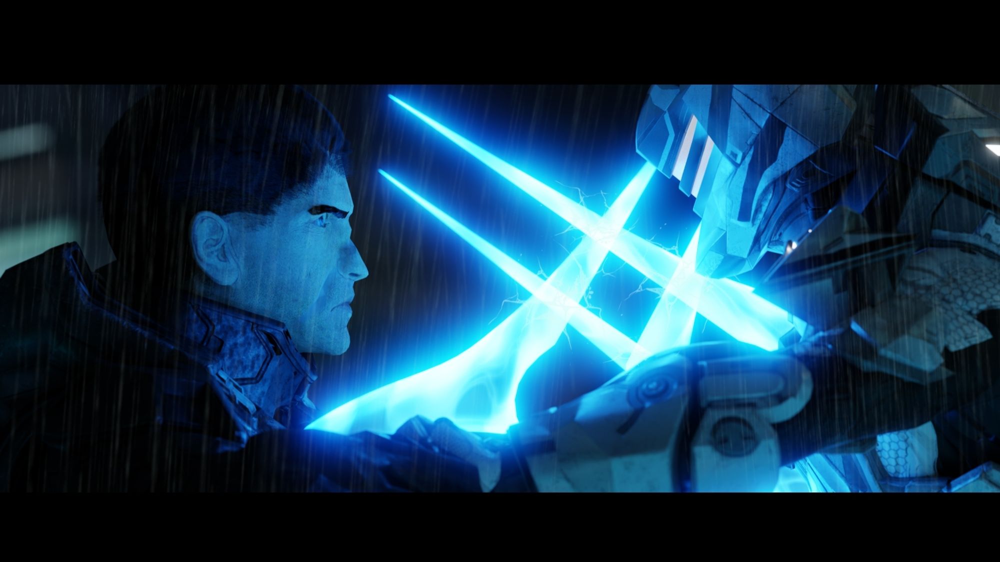
Duel of the Fates - one of my all time favorite Halo renders. Featuring Jackson-332 (left) and rogue Spartan-IV Austin Rex (right) #blender#blender3d#fanart#3dart

0
AFunr.nws-bot.us

Red Flag Warning issued September 29 at 1:07AM MDT until September 30 at 8:00PM MDT by NWS Rapid City SD Additional Details Here.

...CRITICAL FIRE WEATHER CONDITIONS TODAY THROUGH MONDAY WITH
GUSTY WINDS AND LOW RELATIVE HUMIDITY ACROSS NORTHEAST WYOMING AND
WESTERN SOUTH DAKOTA...

.Gusty south to southwest winds will develop this afternoon,
especially over western South Dakota where winds will gust over 40
mph. Further west over the Black Hills area and northeast
Wyoming, winds will not be as strong, but deeper mixing will
allow for frequent gusts to 30 mph. RH will drop 15 percent or
below this afternoon, which will result in critical fire weather
conditions. Poor RH recovery is expected tonight. A cold front
will then cross the region tonight, supporting gusty northwest
winds through Monday. Portions of western South Dakota will see
gusts of over 50 mph. RH will fall to below 20 percent Monday,
especially over southwest to south central South Dakota,
supporting continued critical fire weather conditions.

* AFFECTED AREA...Fire Weather Zones 323 Northern Foot Hills,
324 Eastern Foot Hills, 325 Custer County Plains, 326 Pine
Ridge Area, 327 Butte County Area, 328 Perkins County, 329
West Central Plains, 330 Ziebach County, 331 Haakon County
Area, 332 Badlands Area, 333 Bennett County Area, 334 Mellette
and Todd Counties and 335 Tripp County.

* WINDS...Southwest 20 to 30 mph with gusts up to 45 mph today,
increasing to 25 to 35 mph with gusts up to 55 mph this evening.
Winds will then shift northwest behind a cold front after
midnight and remain gusty Monday.

* RELATIVE HUMIDITY...As low as 10 percent.

* IMPACTS...The combination of gusty winds and low relative
humidity would produce critical fire weather conditions.
0
syokichi.bsky.social

2024シーズン 第28節 対東京V(味の素スタジアム) 1-2 シュート 19(枠内 8) パス成功 332 CK 6 ボール保持 57% ひょっとして相性悪い?ホームで引き分け、アウェイでは黒星。チームは立て直しの真っ最中ということは理解しつつも、勝ち点を獲れず踏ん張れないチームを見てしまうとガッカリしてしまう。知念の不在も響いたのだろうか?

【東京ヴェルディ×鹿島アントラーズ|ハイライト】2024明治安田J1リーグ第28節|2024シーズン|Jリーグ

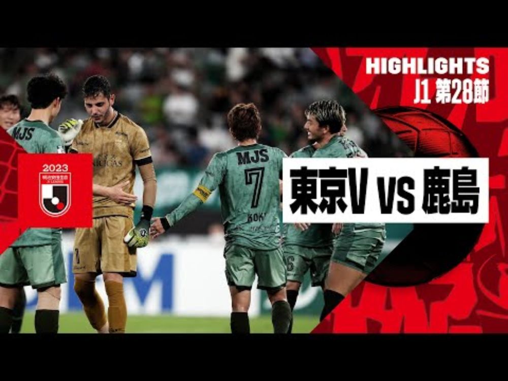
YouTube video by DAZN Japan

1