Special Weather Statement issued September 29 at 7:20PM EDT by NWS Blacksburg VA Additional Details Here.
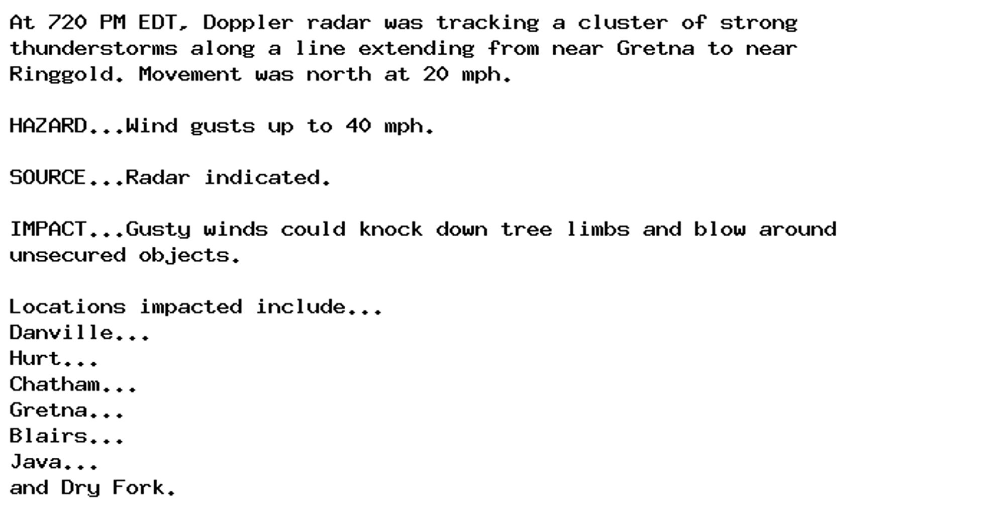
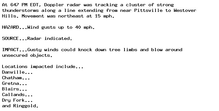
NEW WEATHER ADVISORY: Special Weather Statement At 720 PM EDT, Doppler radar was tracking a cluster of strong thunderstorms along a line extending from near Gretna to near Ringgold. Movement was north at 20 mph. HAZARD...Wind gusts up to 40 mph.... See more: watchedsky.social/app/alerts/...
Flash Flood Warning issued September 29 at 7:13PM EDT until September 29 at 9:45PM EDT by NWS Baltimore MD/Washington DC Additional Details Here.
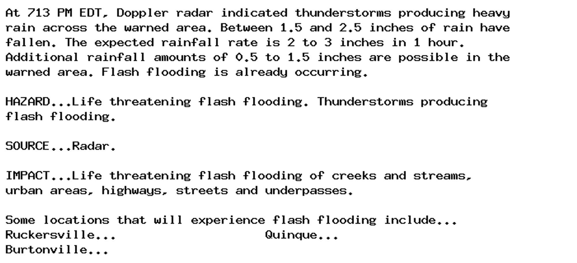
NEW WEATHER ADVISORY: Flash Flood Warning At 713 PM EDT, Doppler radar indicated thunderstorms producing heavy rain across the warned area. Between 1.5 and 2.5 inches of rain have fallen. The expected rainfall rate is 2 to 3 inches in 1 hour.... See more: watchedsky.social/app/alerts/...
Small Craft Advisory issued September 29 at 2:47PM AKDT until September 30 at 5:00PM AKDT by NWS Juneau AK Additional Details Here.
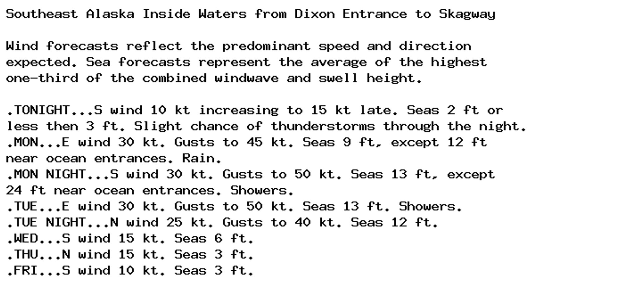
Small Craft Advisory issued September 29 at 2:47PM AKDT until September 30 at 5:00PM AKDT by NWS Juneau AK Additional Details Here.
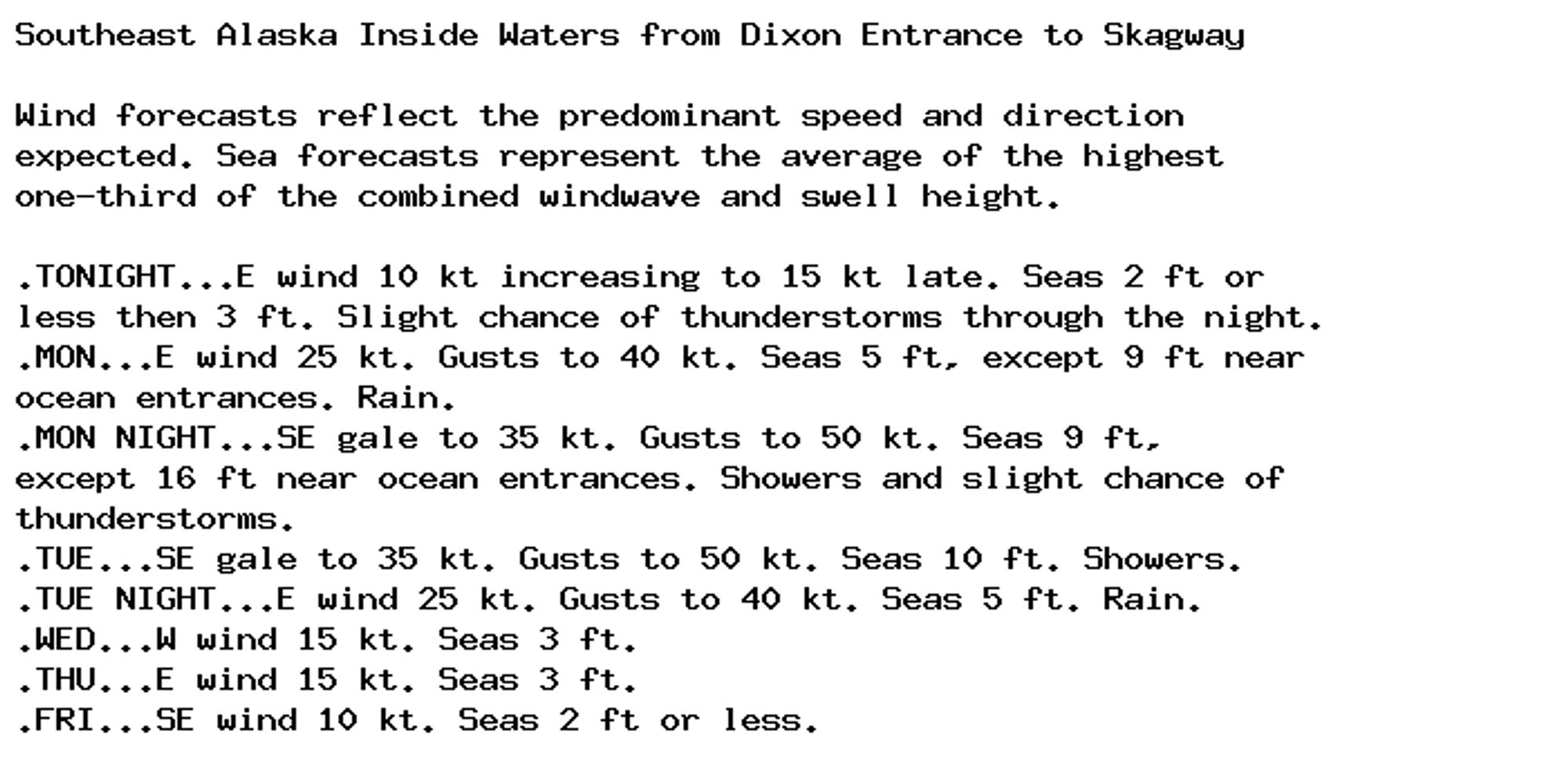
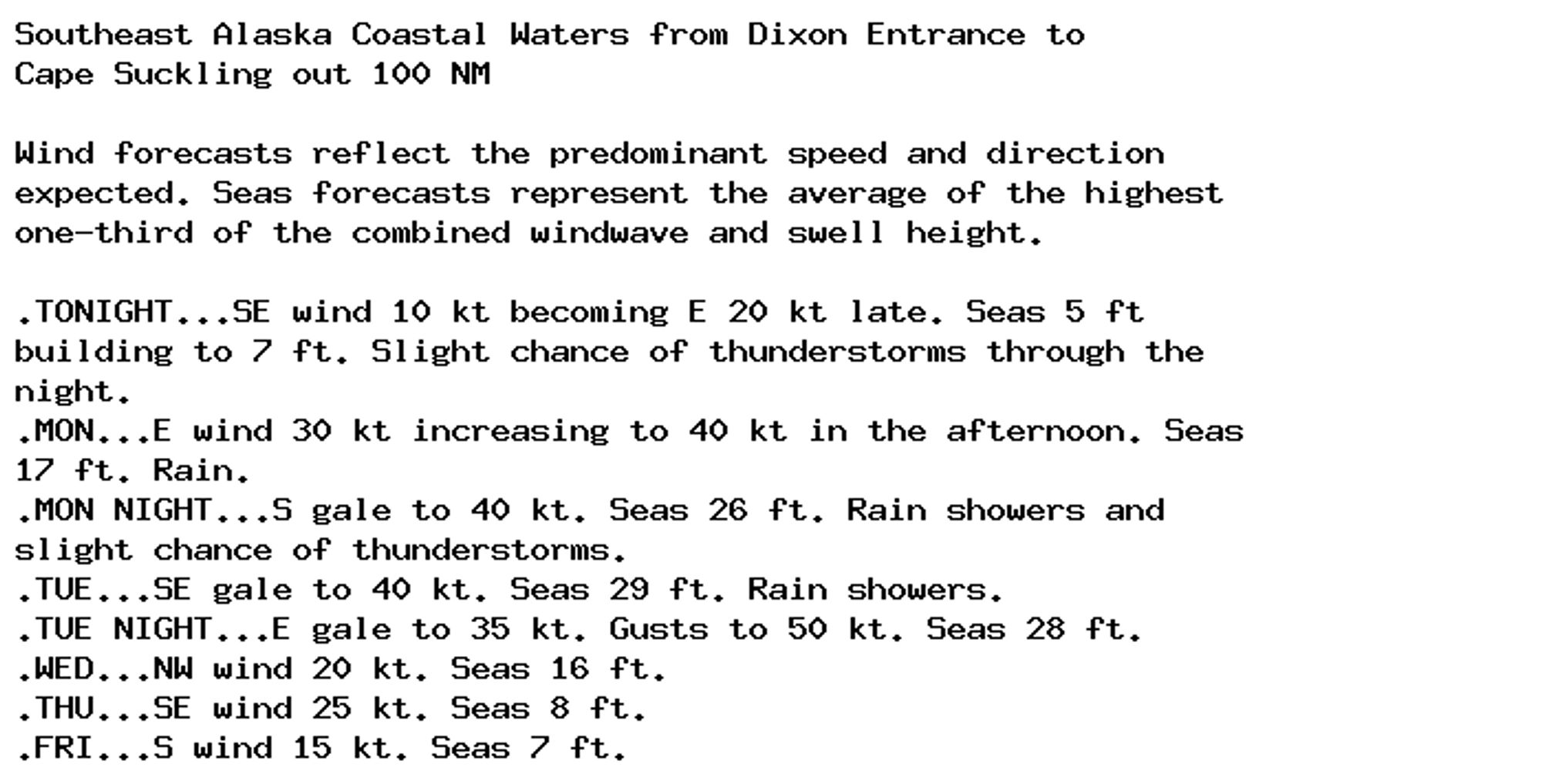
Gale Warning issued September 29 at 2:47PM AKDT until September 30 at 5:00PM AKDT by NWS Juneau AK Additional Details Here.
Special Weather Statement issued September 29 at 6:47PM EDT by NWS Blacksburg VA Additional Details Here.
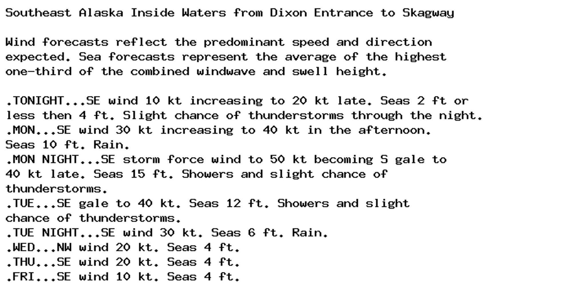
Gale Warning issued September 29 at 2:49PM AKDT until September 30 at 5:00PM AKDT by NWS Juneau AK Additional Details Here.
Gale Warning issued September 29 at 2:49PM AKDT until September 30 at 5:00PM AKDT by NWS Juneau AK Additional Details Here.