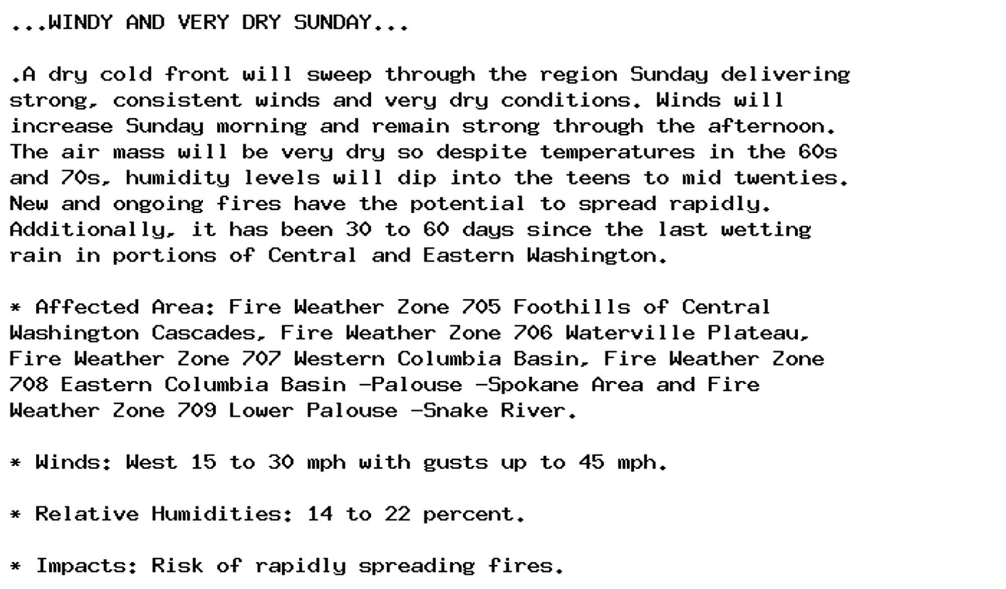
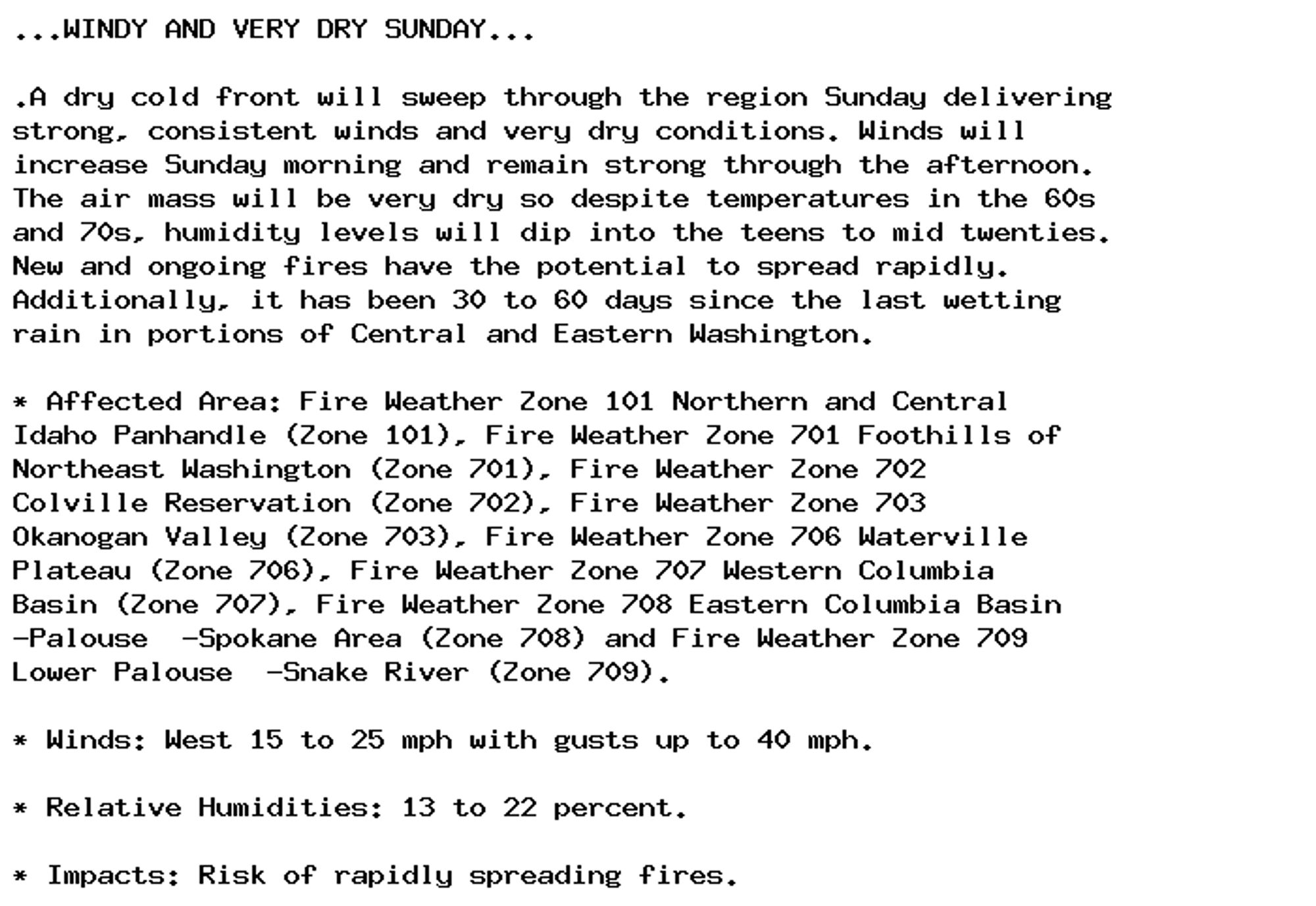
Red Flag Warning issued September 29 at 5:58AM PDT until September 29 at 7:00PM PDT by NWS Spokane WA Additional Details Here.
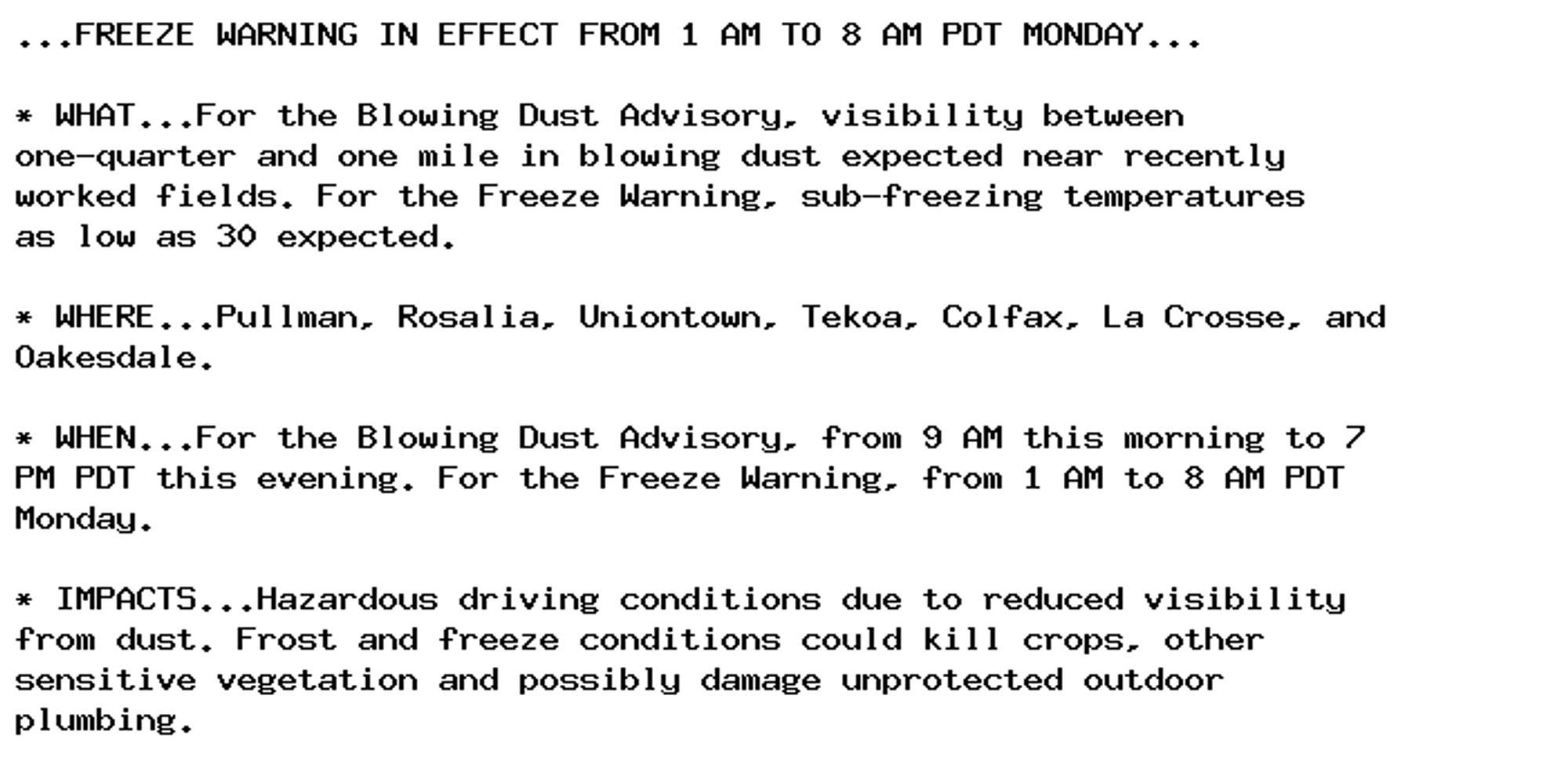
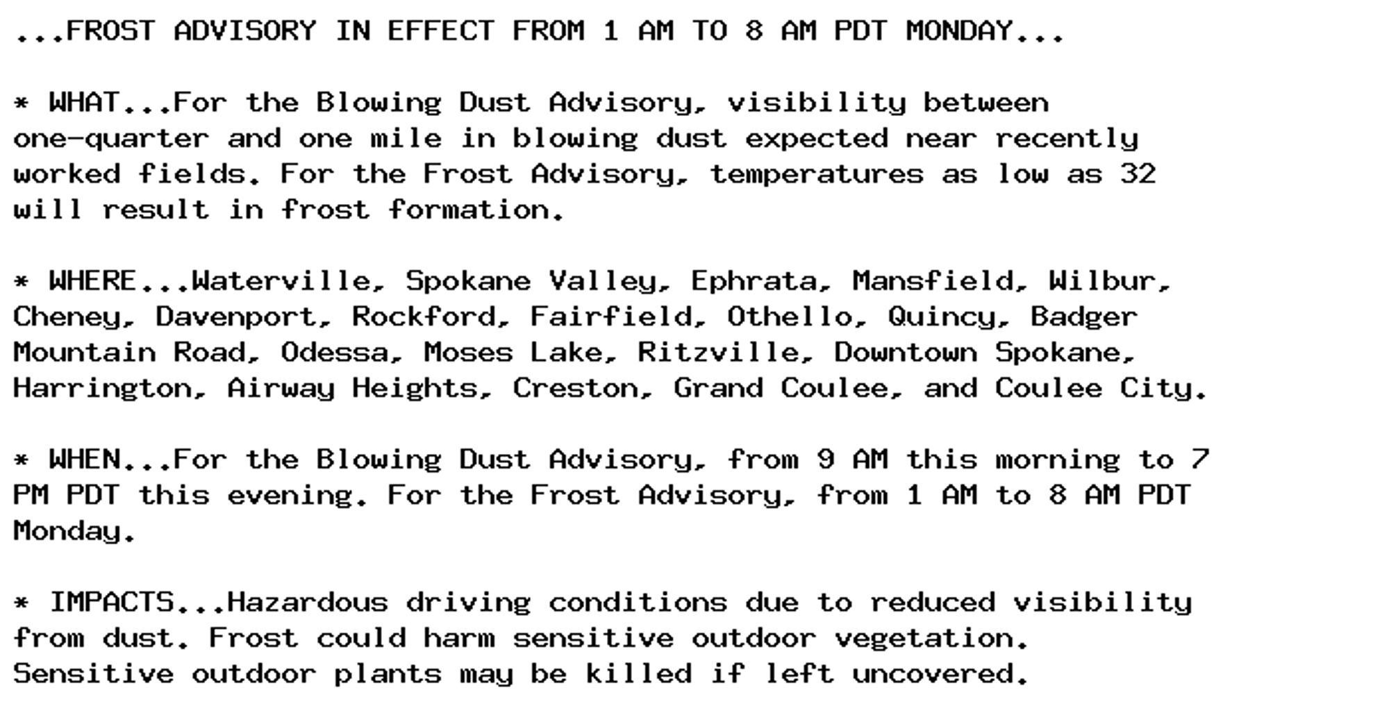
Blowing Dust Advisory issued September 29 at 4:54AM PDT until September 29 at 7:00PM PDT by NWS Spokane WA Additional Details Here.
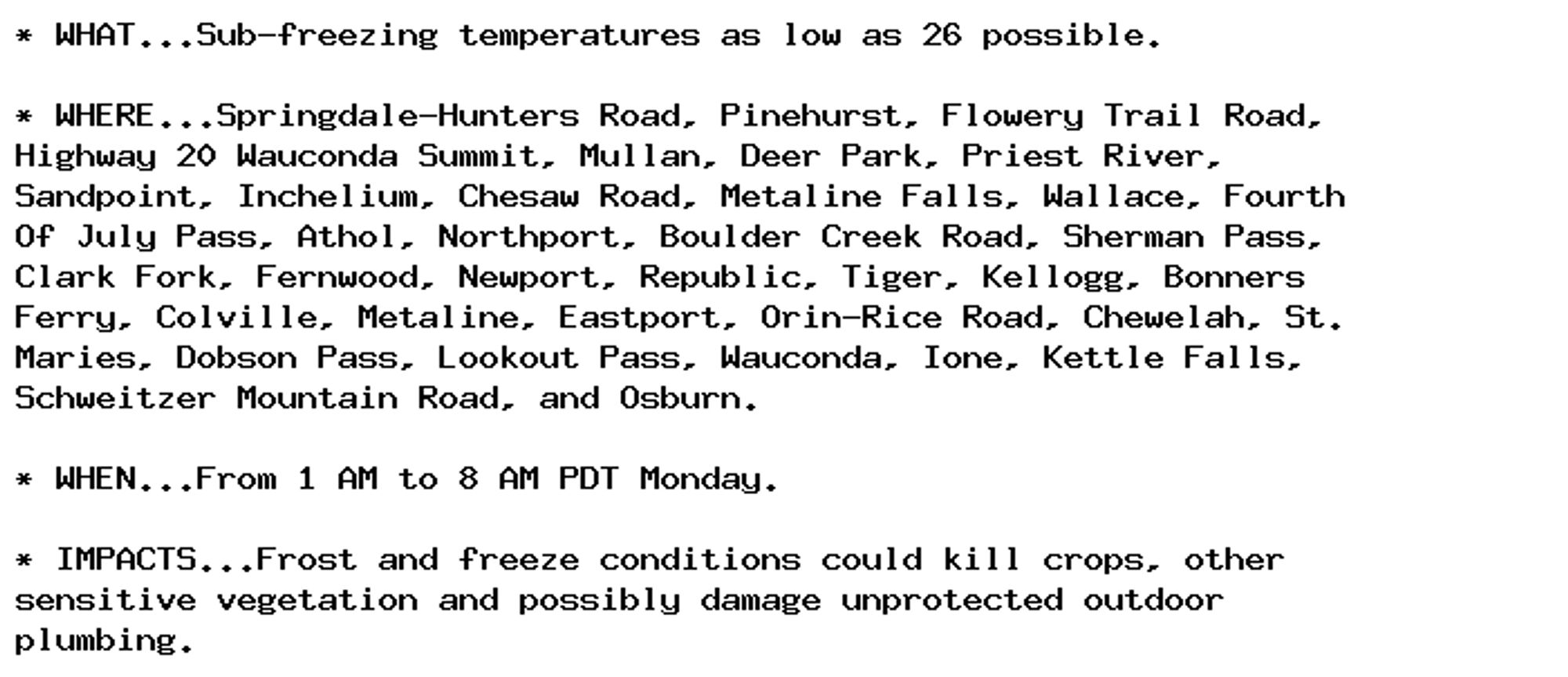
Freeze Warning issued September 29 at 4:54AM PDT until September 30 at 8:00AM PDT by NWS Spokane WA Additional Details Here.
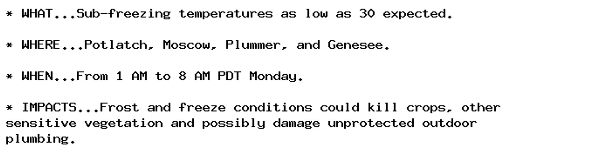
Freeze Warning issued September 29 at 4:54AM PDT until September 30 at 8:00AM PDT by NWS Spokane WA Additional Details Here.
Blowing Dust Advisory issued September 29 at 4:54AM PDT until September 29 at 7:00PM PDT by NWS Spokane WA Additional Details Here.
Freeze Warning issued September 29 at 4:54AM PDT until September 30 at 8:00AM PDT by NWS Spokane WA Additional Details Here.
Red Flag Warning issued September 28 at 1:49PM PDT until September 29 at 7:00PM PDT by NWS Spokane WA Additional Details Here.
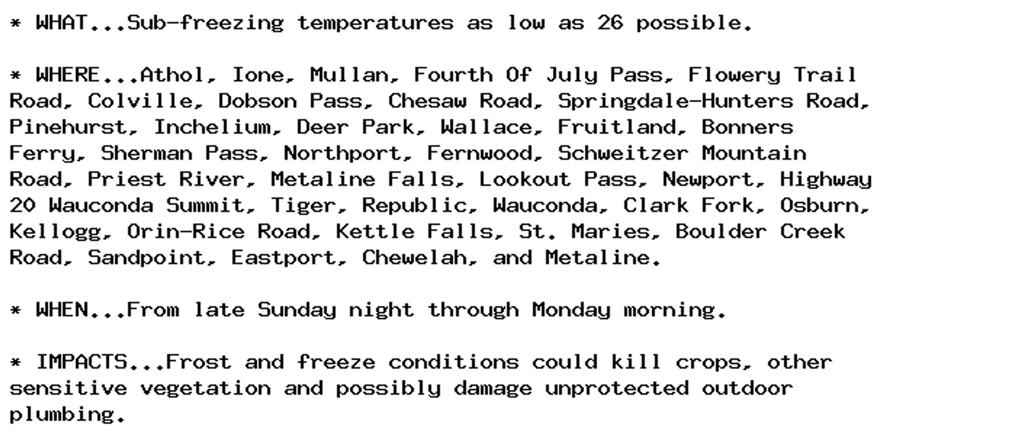
🚨 Freeze Watch issued September 28 at 12:54PM PDT until September 30 at 8:00AM PDT by NWS Spokane WA 🚨 Additional Details Here.
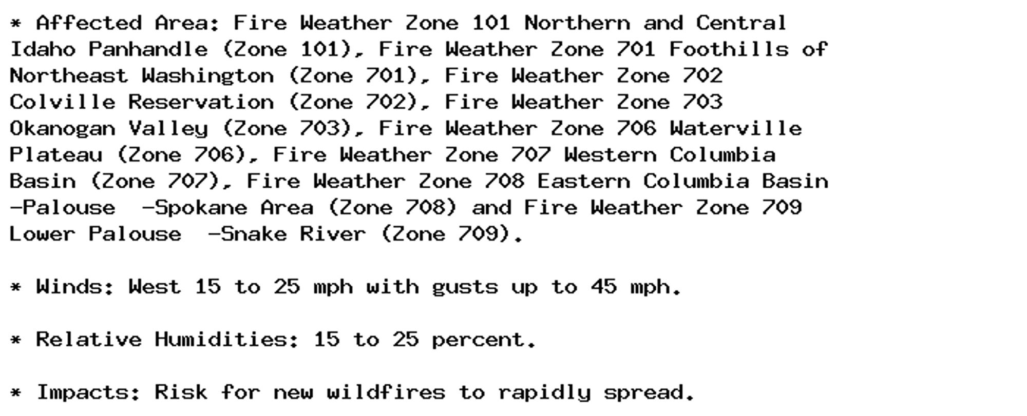
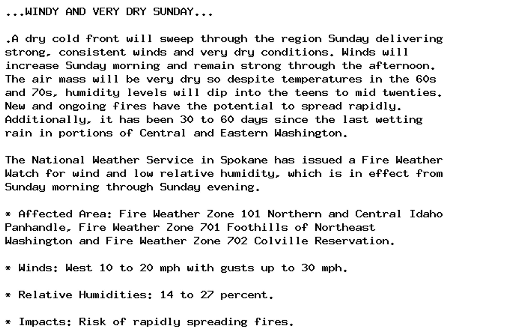
🚨 Fire Weather Watch issued September 28 at 3:11AM PDT until September 29 at 7:00PM PDT by NWS Spokane WA 🚨 Additional Details Here.
🚨 Fire Weather Watch issued September 28 at 3:11AM PDT until September 29 at 7:00PM PDT by NWS Spokane WA 🚨 Additional Details Here.