BLUE
AF
Alerts from NWS Spokane WA (UNOFFICIAL)
@otx.nws-bot.us
Unofficial bot sharing alerts from NWS Spokane WA (GEG). This account is not monitored. Contact @wandrme.paxex.aero if needed.
168 followers1 following19 posts
AFotx.nws-bot.us

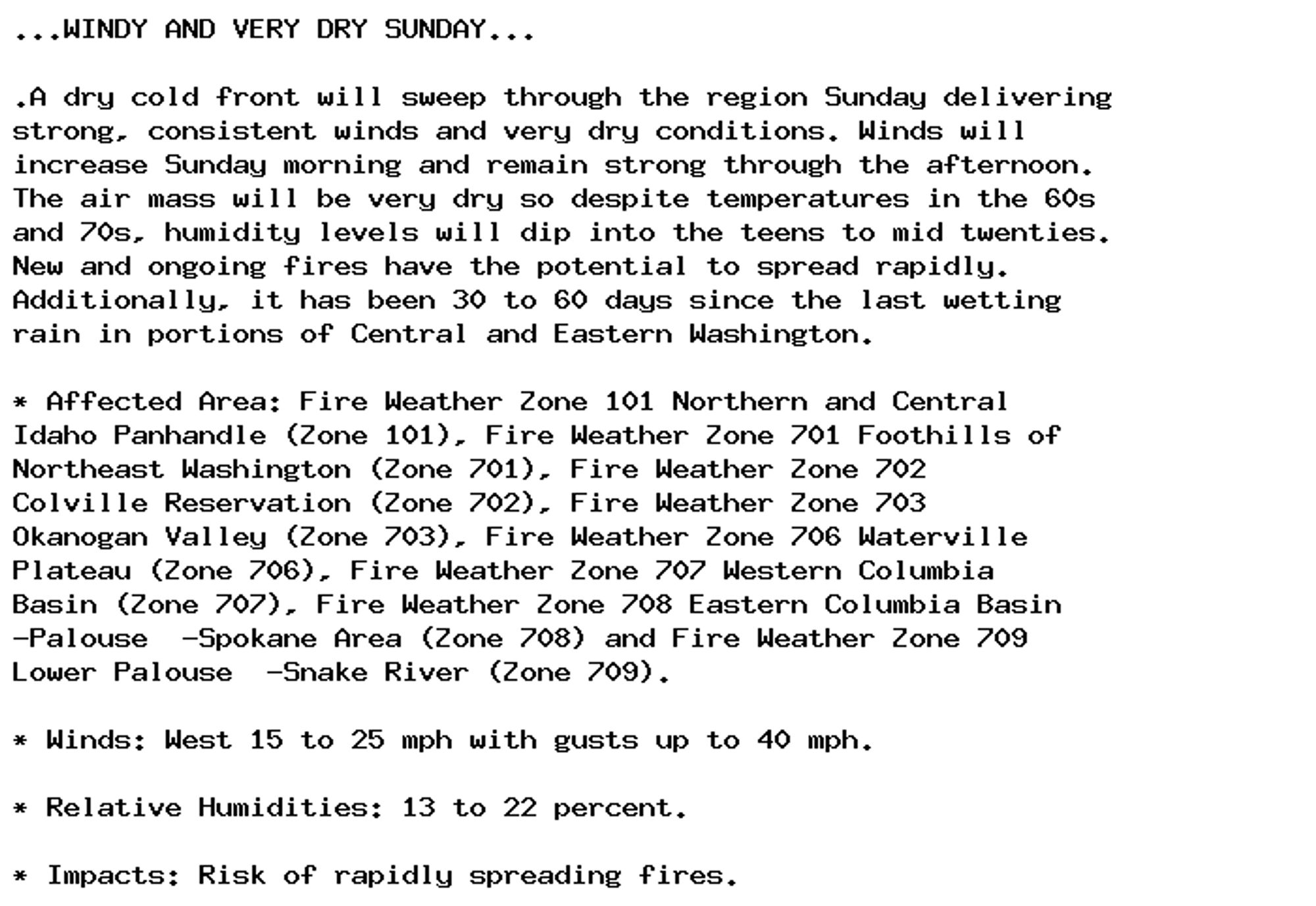
Red Flag Warning issued September 28 at 1:49PM PDT until September 29 at 7:00PM PDT by NWS Spokane WA Additional Details Here.

...WINDY AND VERY DRY SUNDAY...

.A dry cold front will sweep through the region Sunday delivering
strong, consistent winds and very dry conditions. Winds will
increase Sunday morning and remain strong through the afternoon.
The air mass will be very dry so despite temperatures in the 60s
and 70s, humidity levels will dip into the teens to mid twenties.
New and ongoing fires have the potential to spread rapidly.
Additionally, it has been 30 to 60 days since the last wetting
rain in portions of Central and Eastern Washington.

* Affected Area: Fire Weather Zone 101 Northern and Central
Idaho Panhandle (Zone 101), Fire Weather Zone 701 Foothills of
Northeast Washington (Zone 701), Fire Weather Zone 702
Colville Reservation (Zone 702), Fire Weather Zone 703
Okanogan Valley (Zone 703), Fire Weather Zone 706 Waterville
Plateau (Zone 706), Fire Weather Zone 707 Western Columbia
Basin (Zone 707), Fire Weather Zone 708 Eastern Columbia Basin
-Palouse  -Spokane Area (Zone 708) and Fire Weather Zone 709
Lower Palouse  -Snake River (Zone 709).

* Winds: West 15 to 25 mph with gusts up to 40 mph.

* Relative Humidities: 13 to 22 percent.

* Impacts: Risk of rapidly spreading fires.
0

AF
Alerts from NWS Spokane WA (UNOFFICIAL)
@otx.nws-bot.us
Unofficial bot sharing alerts from NWS Spokane WA (GEG). This account is not monitored. Contact @wandrme.paxex.aero if needed.
168 followers1 following19 posts