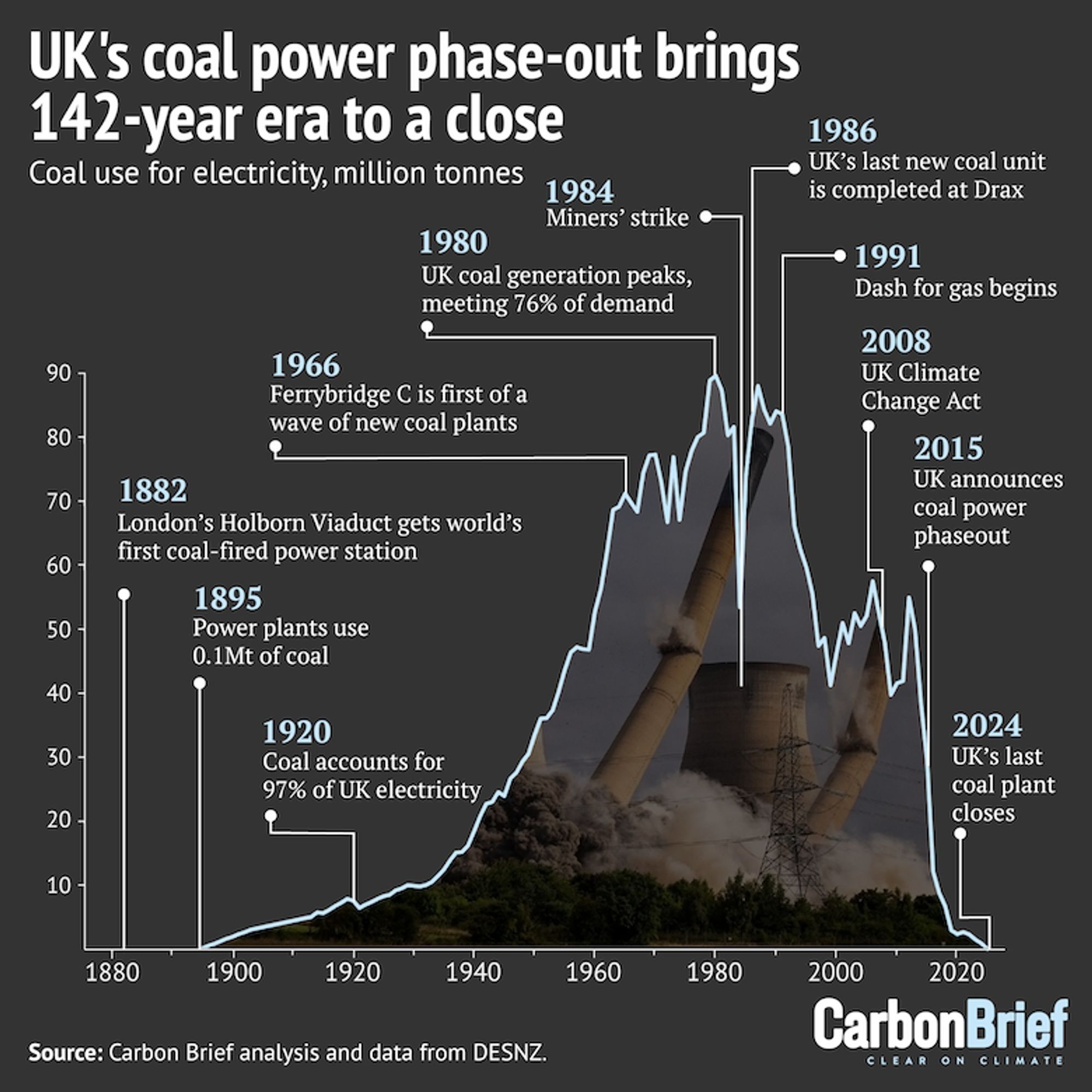
ダイダン(1980) 東証P 始値2957円 高値3130円 安値2956円 終値3080円 前日比+140円(+4.76%) VWAP3073.0677円 出来高242,200株 前日比130,900株減(-35.08%) 信用倍率22.63倍 売残15100株 買残341700株 貸借倍率0倍 貸株残0株 融資残46400株 回転日数2.4日 O/U比率-14.11% OVER 45300株 UNDER 34100株 [2024/10/01 15:00]
140 * 371 = 51940
万博期間中の朝ラッシュ時は乗車率が約140%と予想 混雑緩和に向け大阪メトロで『時差出勤』の実証実験 | MBSニュース https://www.mbs.jp/news/kansainews/20241001/GE00060830.shtml#万博
経緯:ギリギリまで原稿してようやく間に合う入稿したのに〇営業日納品のとこの選択を普通にミスり、イベント当日に届くことになった新刊をキンコ〜ズで同じくらいの数刷って手製本した イベントから帰宅すると余部込みで注文の140%の冊数が届いていた
Ik heb eens schoenen besteld in de VS. Die waren 70 euro en ik heb er finaal 140 betaald.
たまにめっちゃ判りにくい文章に出会った時に、文章自体が要点を得ない難解なものなのか、自分の読解力がポンコツなだけなのか、どっちなのか分からなくてモヤモヤする事が多々ある。^^; Xの場合は140文字に収めるために色々そぎ落としてたら、肝心な部分が無くなってる事も多いけど。w
E. T. A. Hoffmann Sämtliche Werke (Leder) DKV 2001-2004 www.suhrkamp.de/werkausgabe/e-t-a-hoffmann-saemtliche-werke-leder-w-140 Follow my timeline re book tips on German Idealism and European context. For my #philosophy in this tradition, visit the website in my profile.

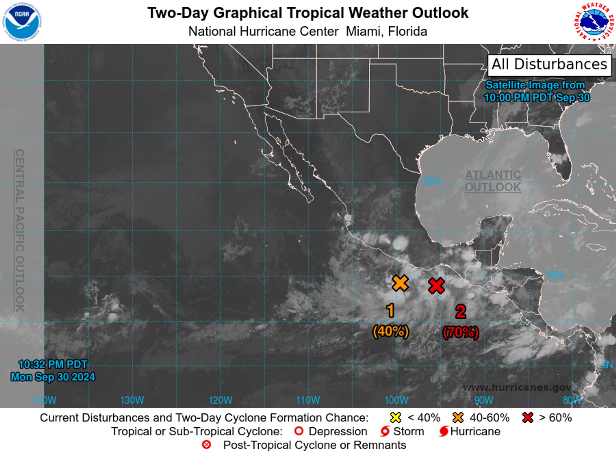
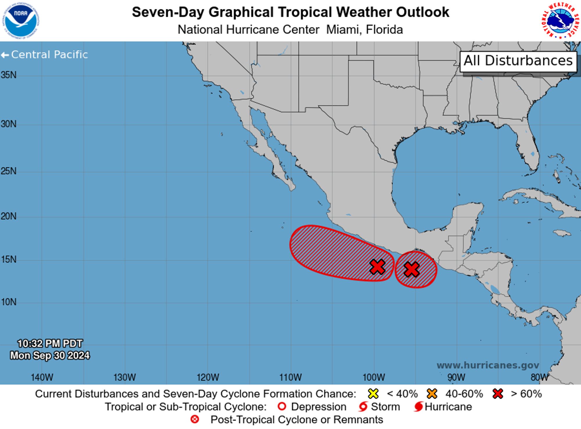
NWS National Hurricane Center Miami FL 1100 PM PDT Mon Sep 30 2024 For the eastern North Pacific...east of 140 degrees west longitude:
(faltam 140 dias ainda )