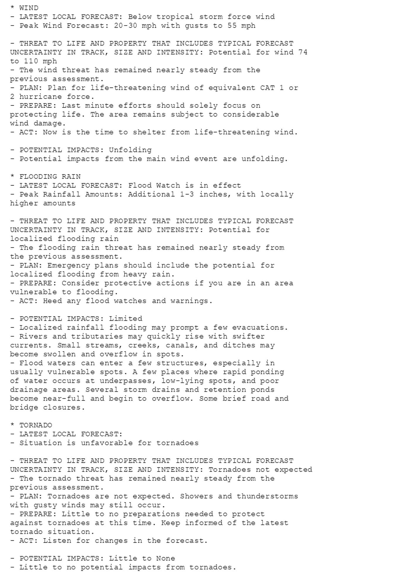
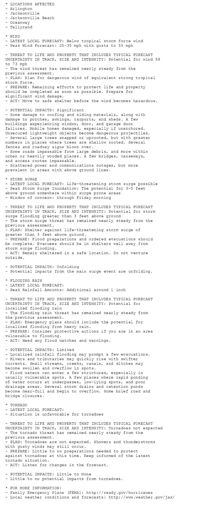
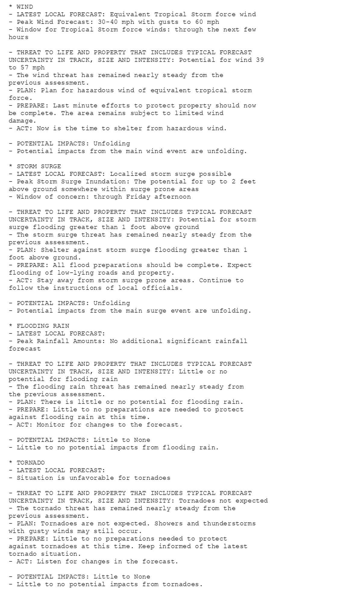
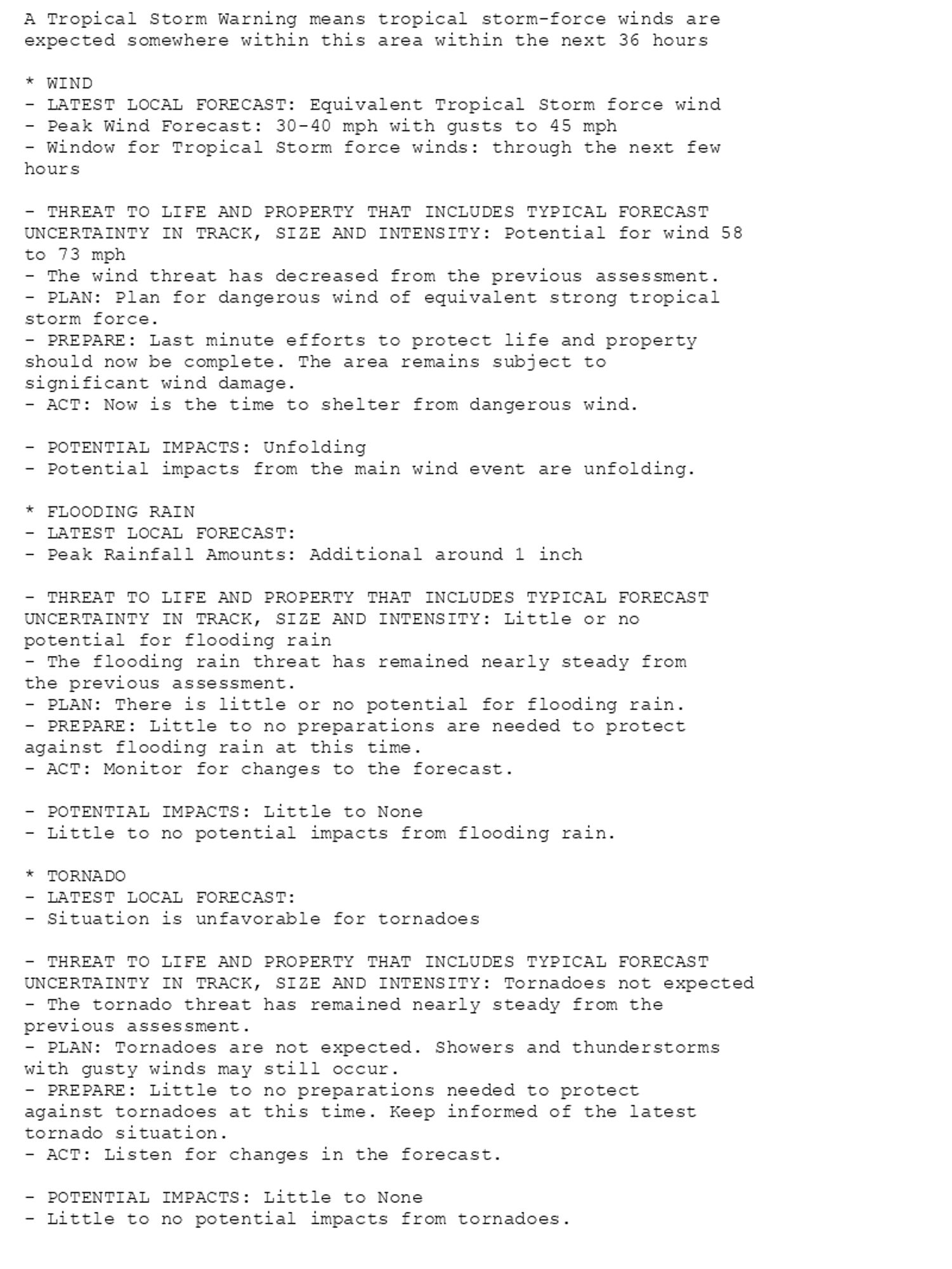
🚨🚨🚨 Storm Surge Warning issued October 10 at 8:02AM EDT by NWS Jacksonville FL 🚨🚨🚨 Additional Details Here. (5/8)
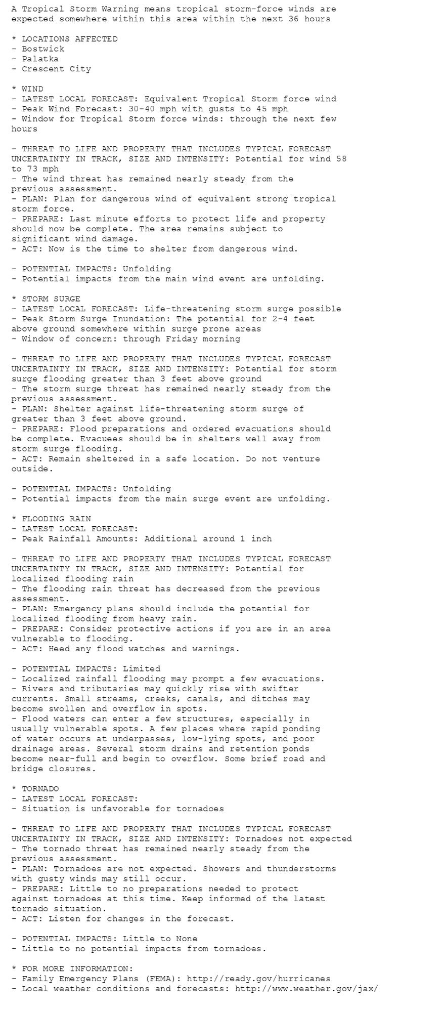
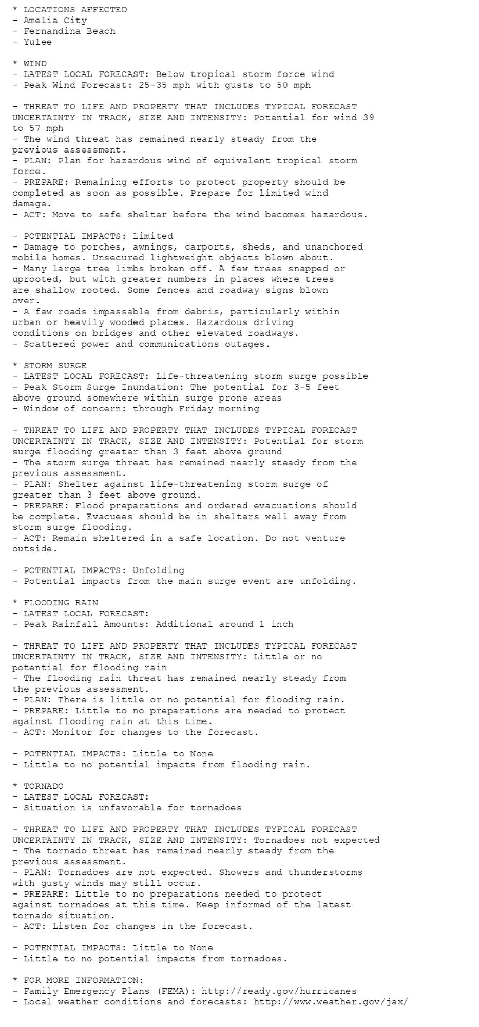
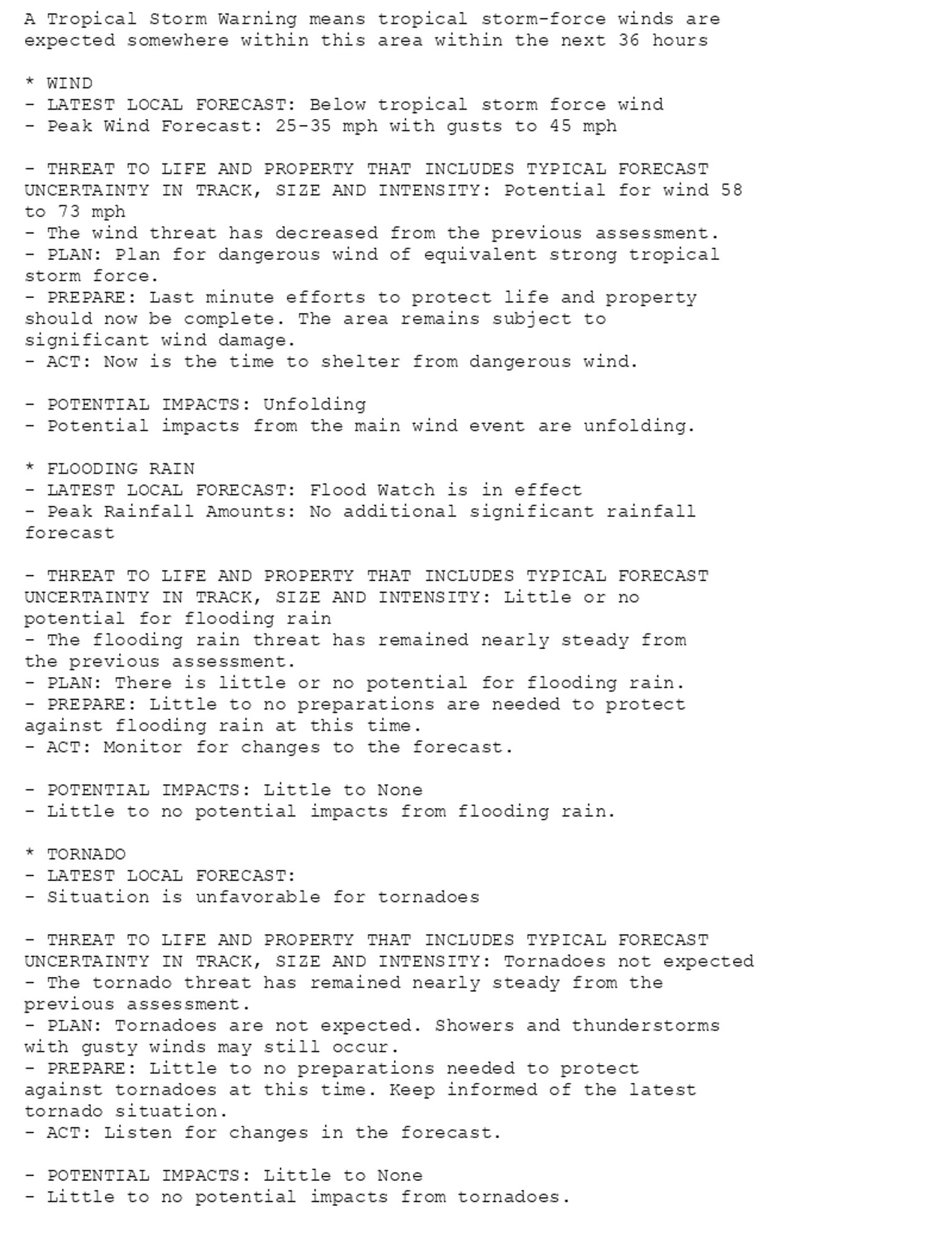
🚨🚨🚨 Storm Surge Warning issued October 10 at 8:02AM EDT by NWS Jacksonville FL 🚨🚨🚨 Additional Details Here. (4/8)
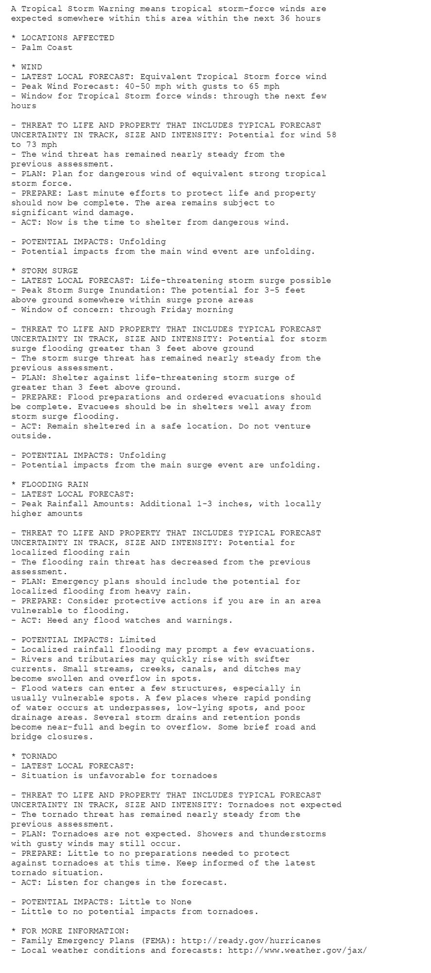
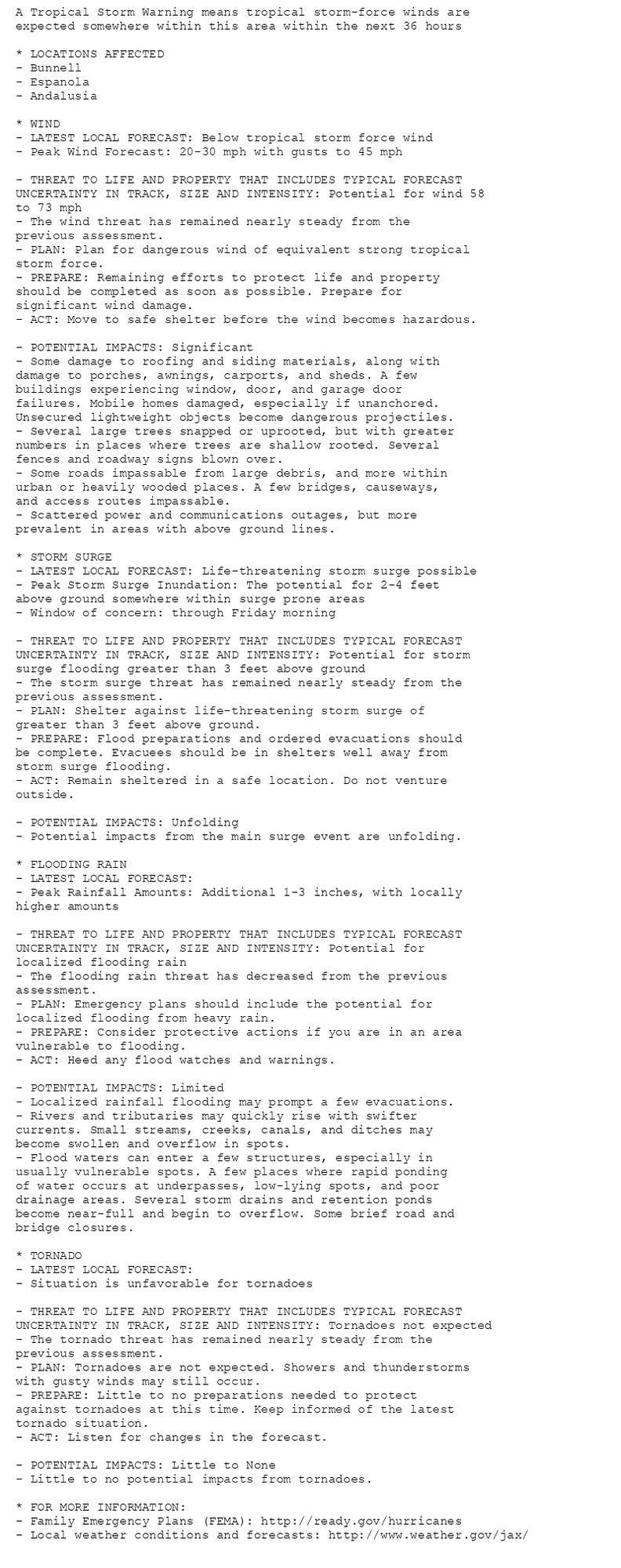
🚨🚨🚨 Storm Surge Warning issued October 10 at 8:02AM EDT by NWS Jacksonville FL 🚨🚨🚨 Additional Details Here. (3/8)
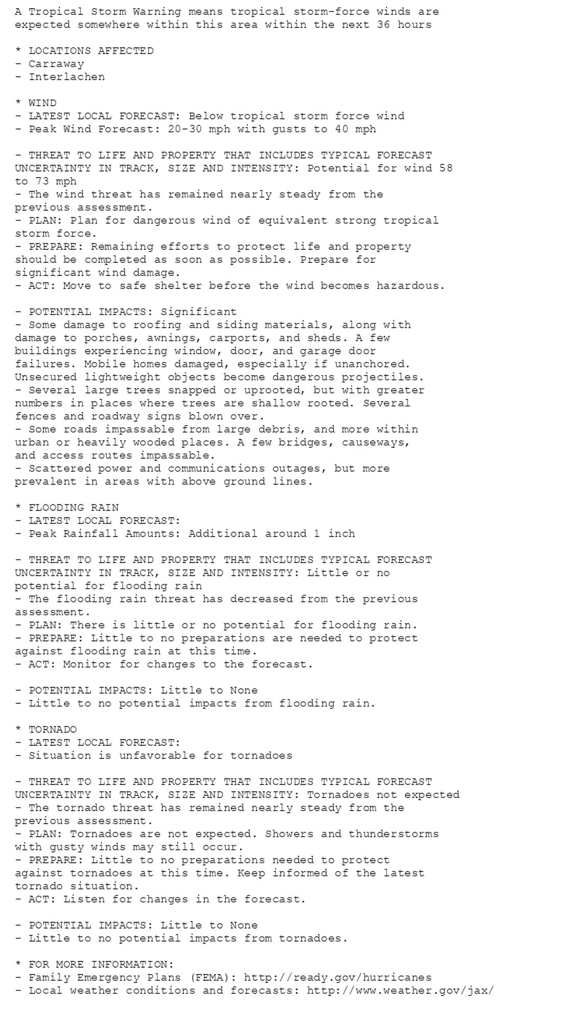
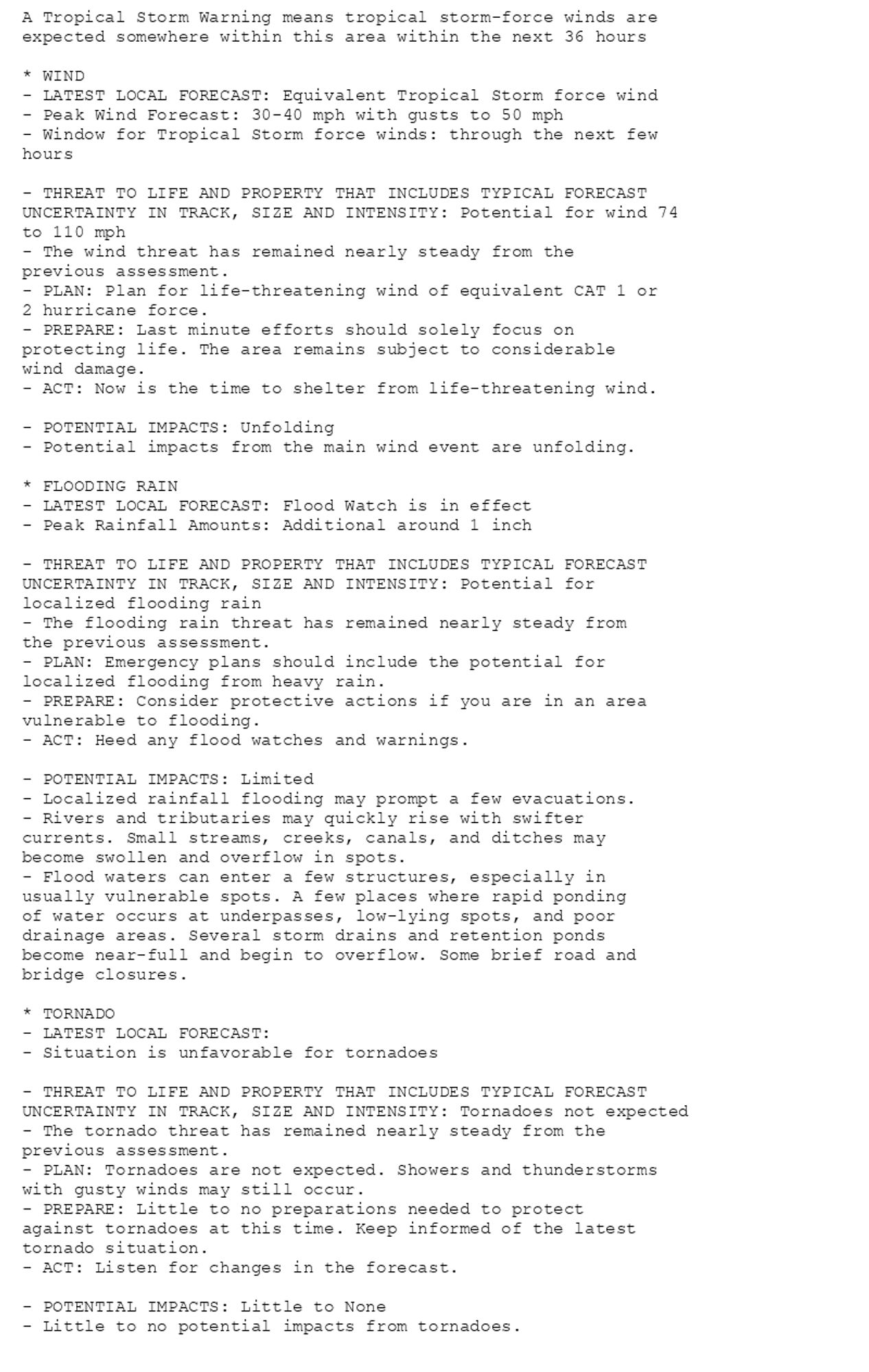
🚨🚨🚨 Storm Surge Warning issued October 10 at 8:02AM EDT by NWS Jacksonville FL 🚨🚨🚨 Additional Details Here. (2/8)
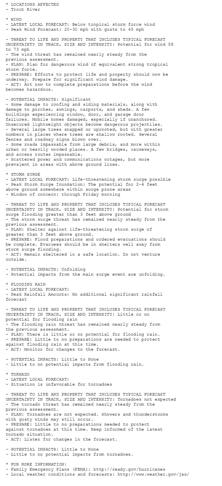
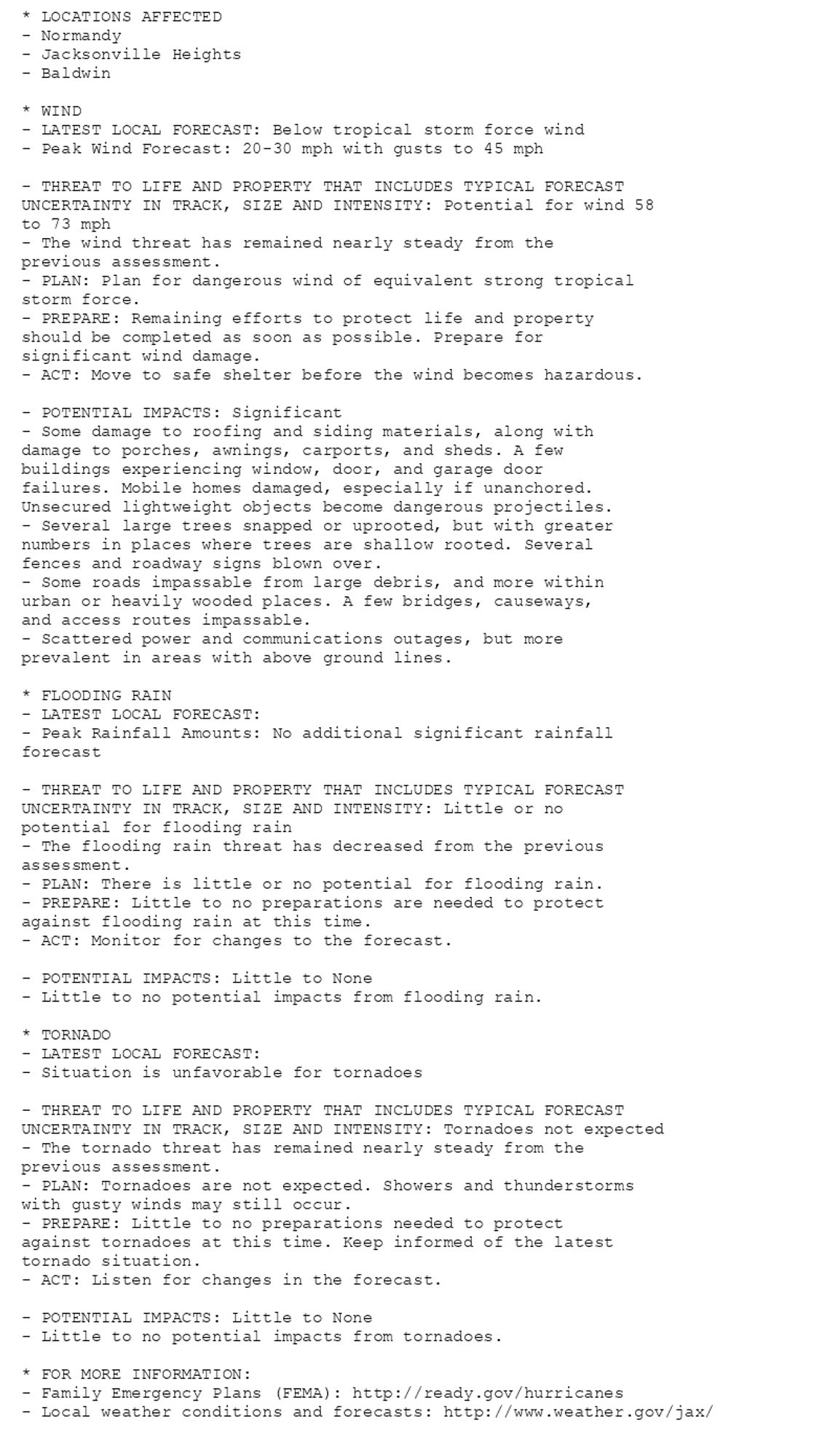
🚨🚨🚨 Storm Surge Warning issued October 10 at 8:02AM EDT by NWS Jacksonville FL 🚨🚨🚨 Additional Details Here. (1/8)
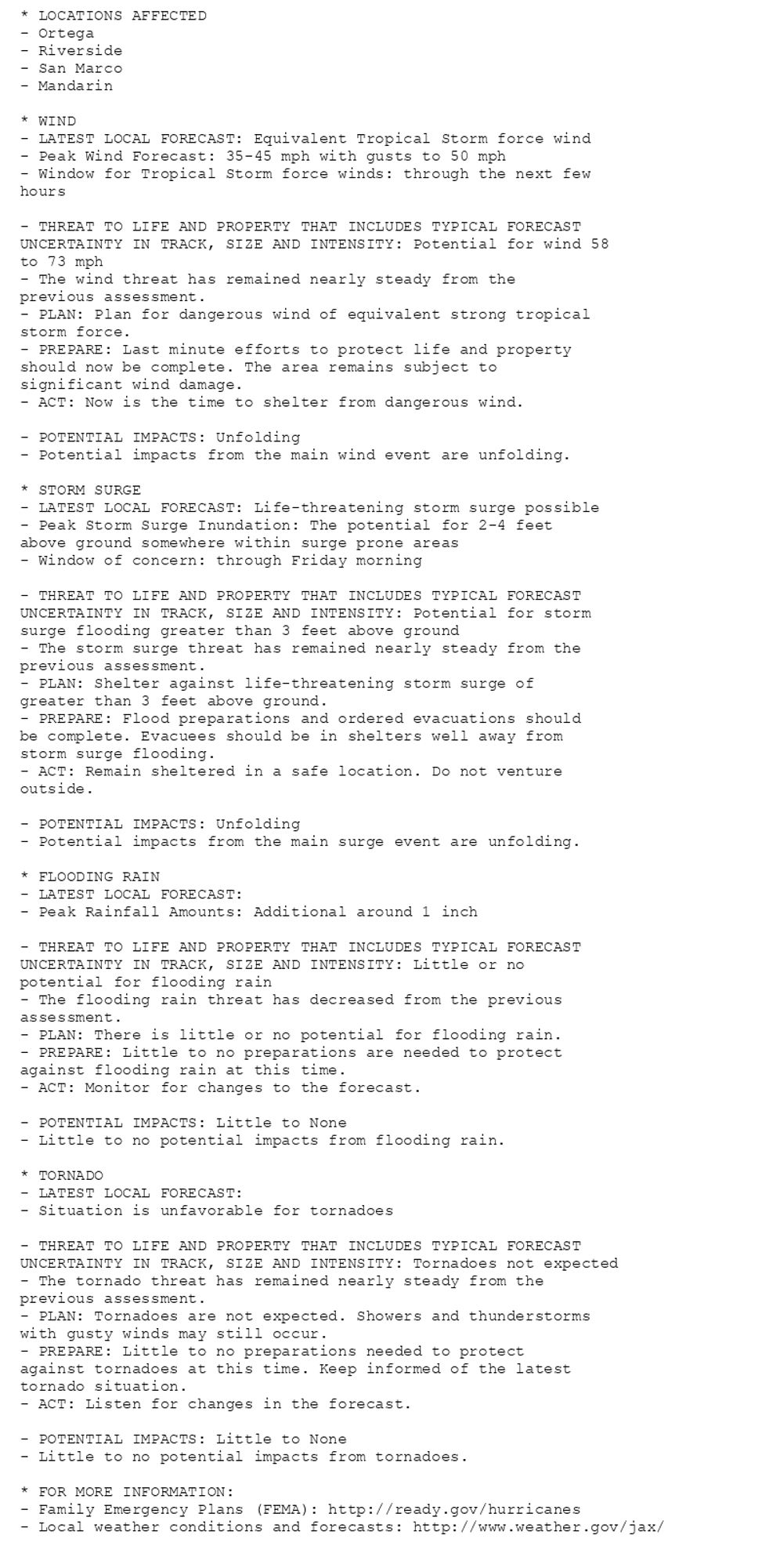
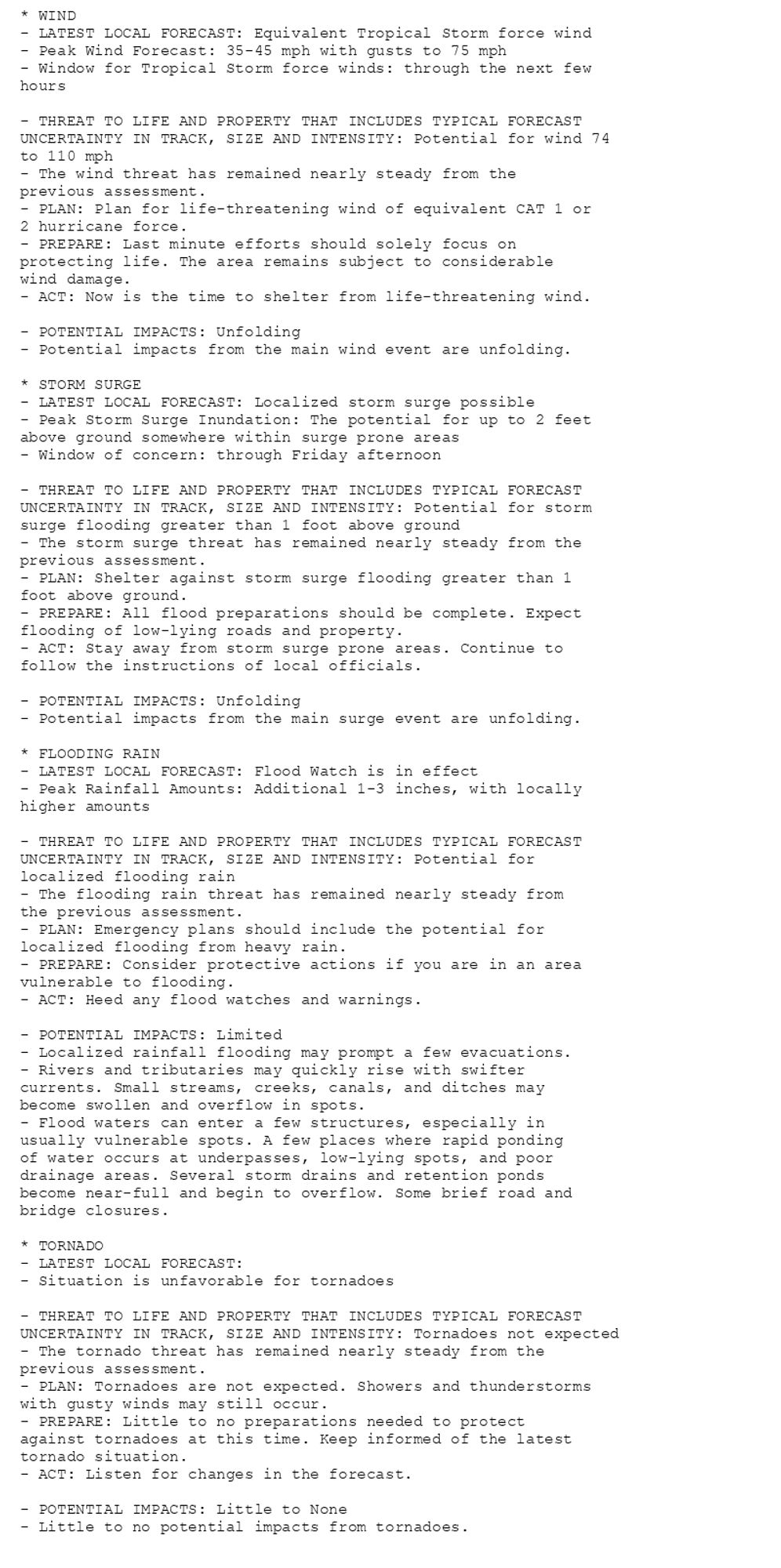
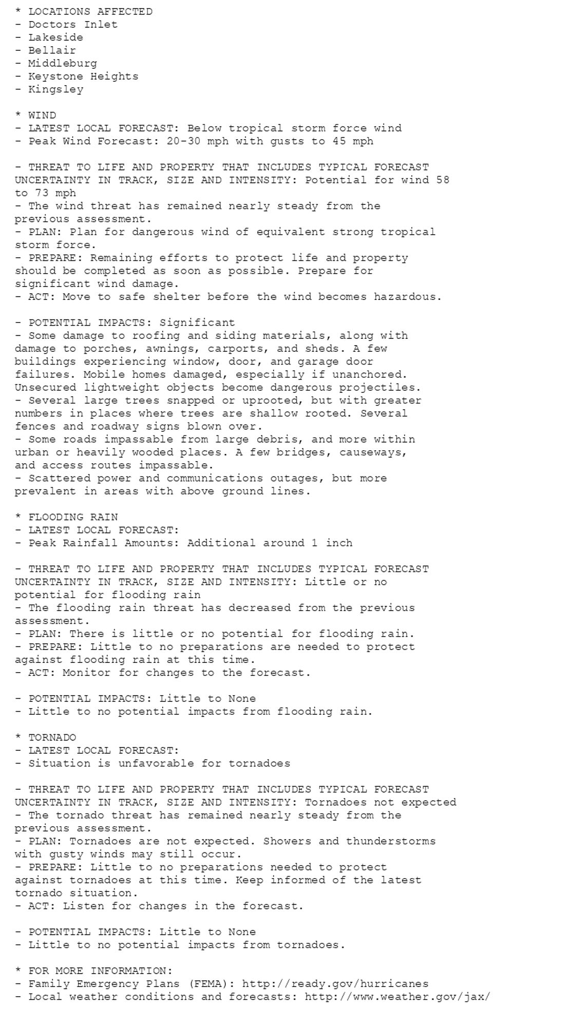
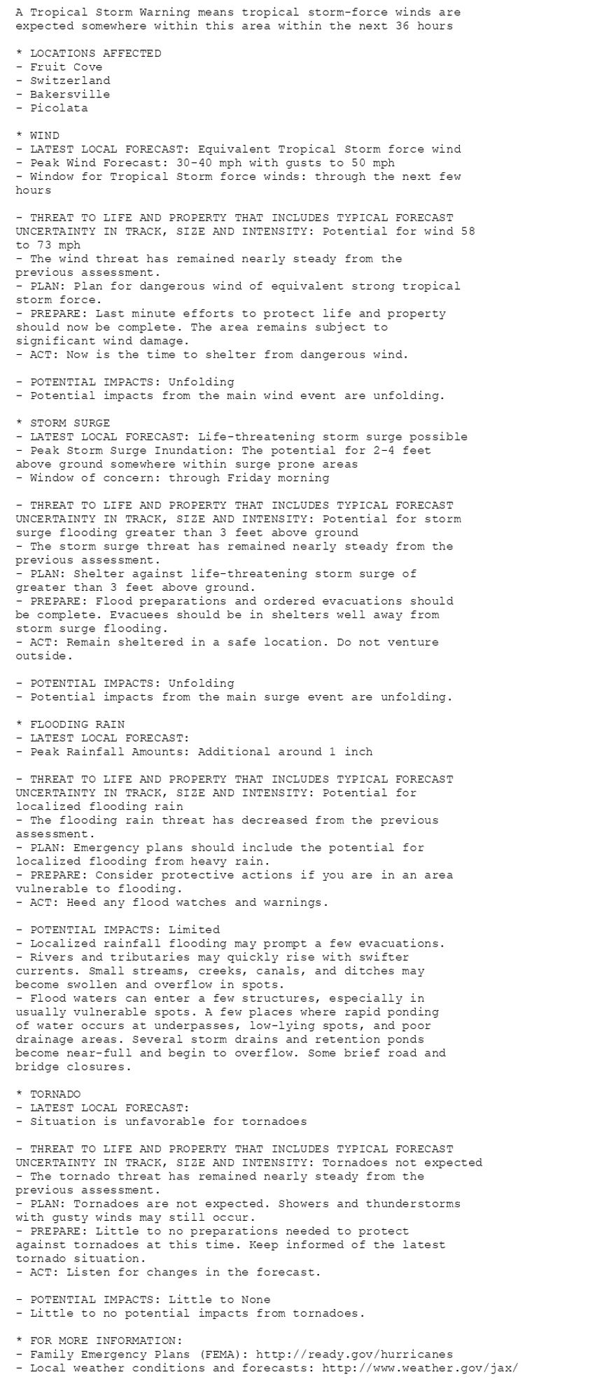
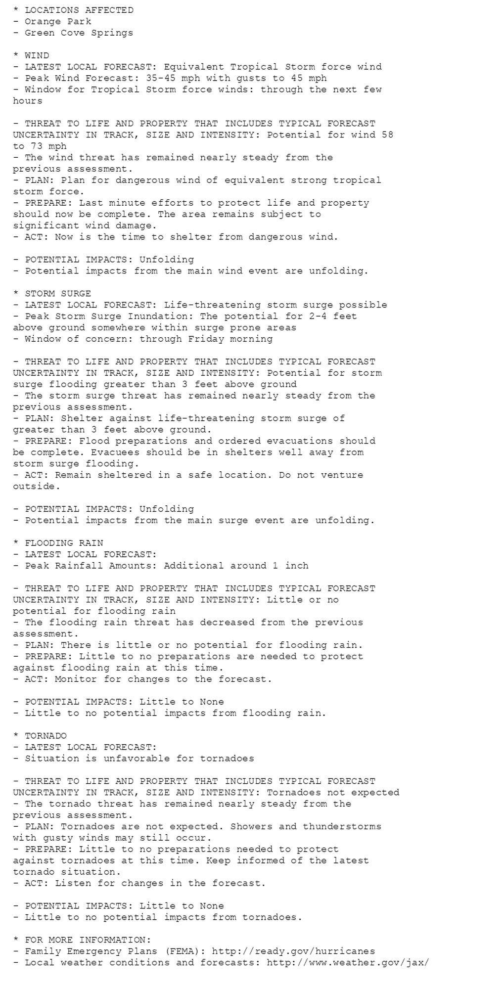
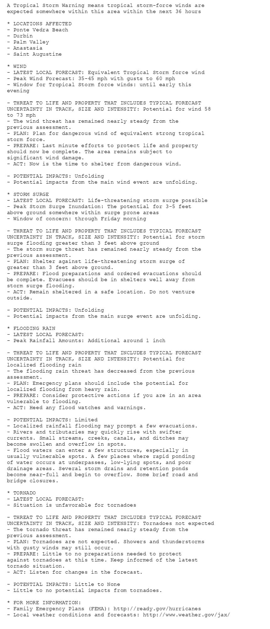
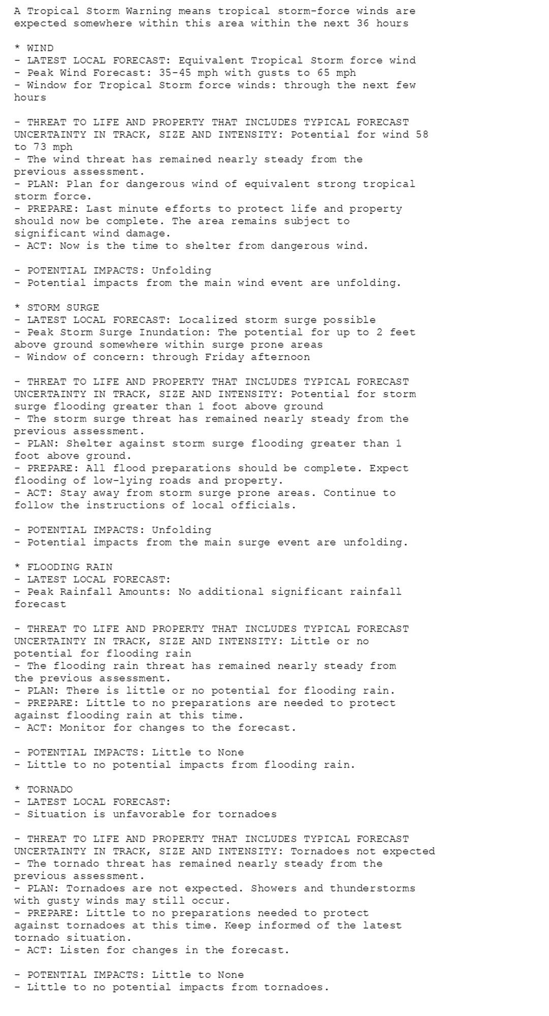
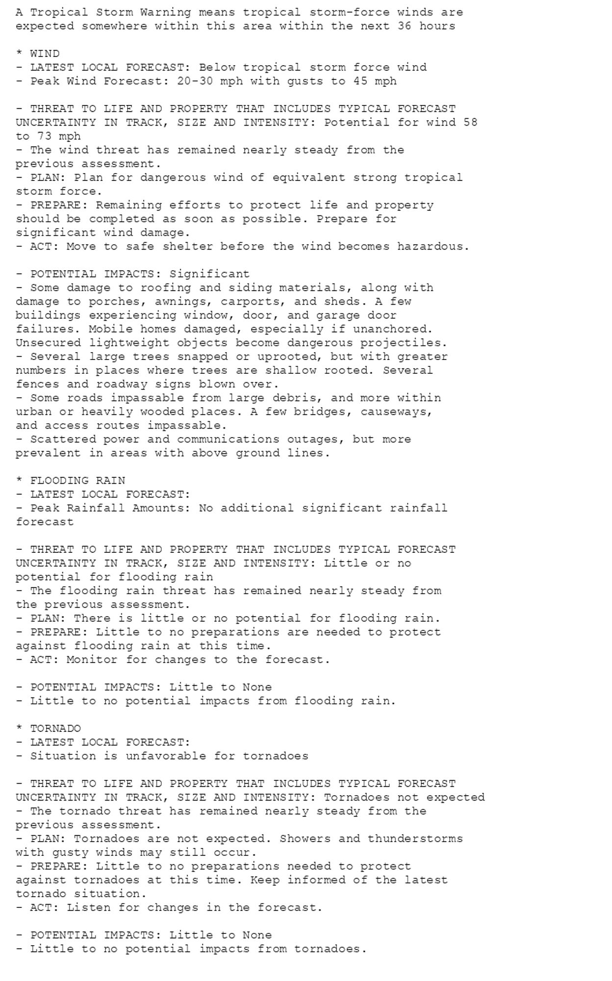
🚨🚨🚨 Hurricane Warning issued October 10 at 8:11AM EDT by NWS Melbourne FL 🚨🚨🚨 Additional Details Here.(6/6)
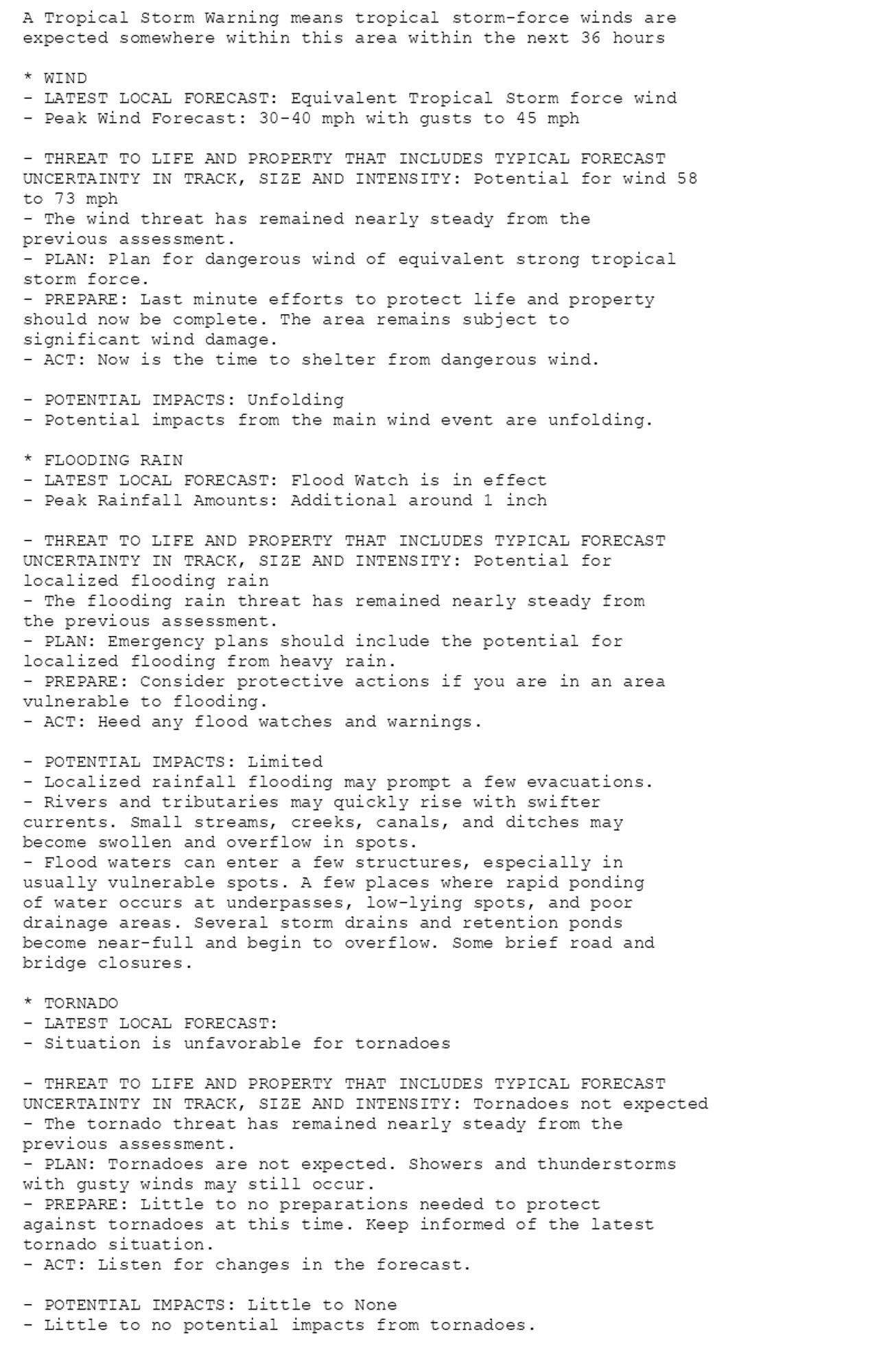
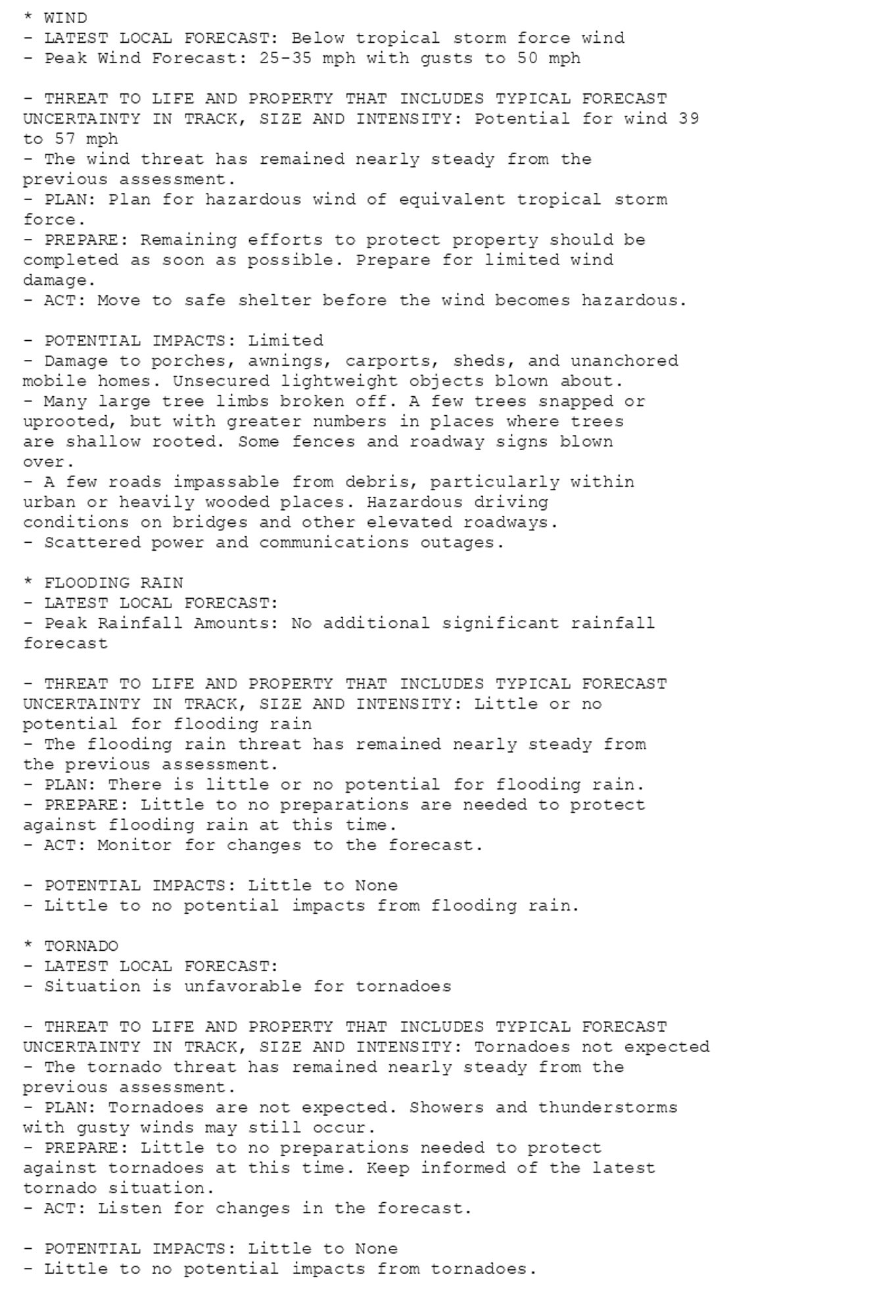
🚨🚨🚨 Hurricane Warning issued October 10 at 8:11AM EDT by NWS Melbourne FL 🚨🚨🚨 Additional Details Here. (5/6)
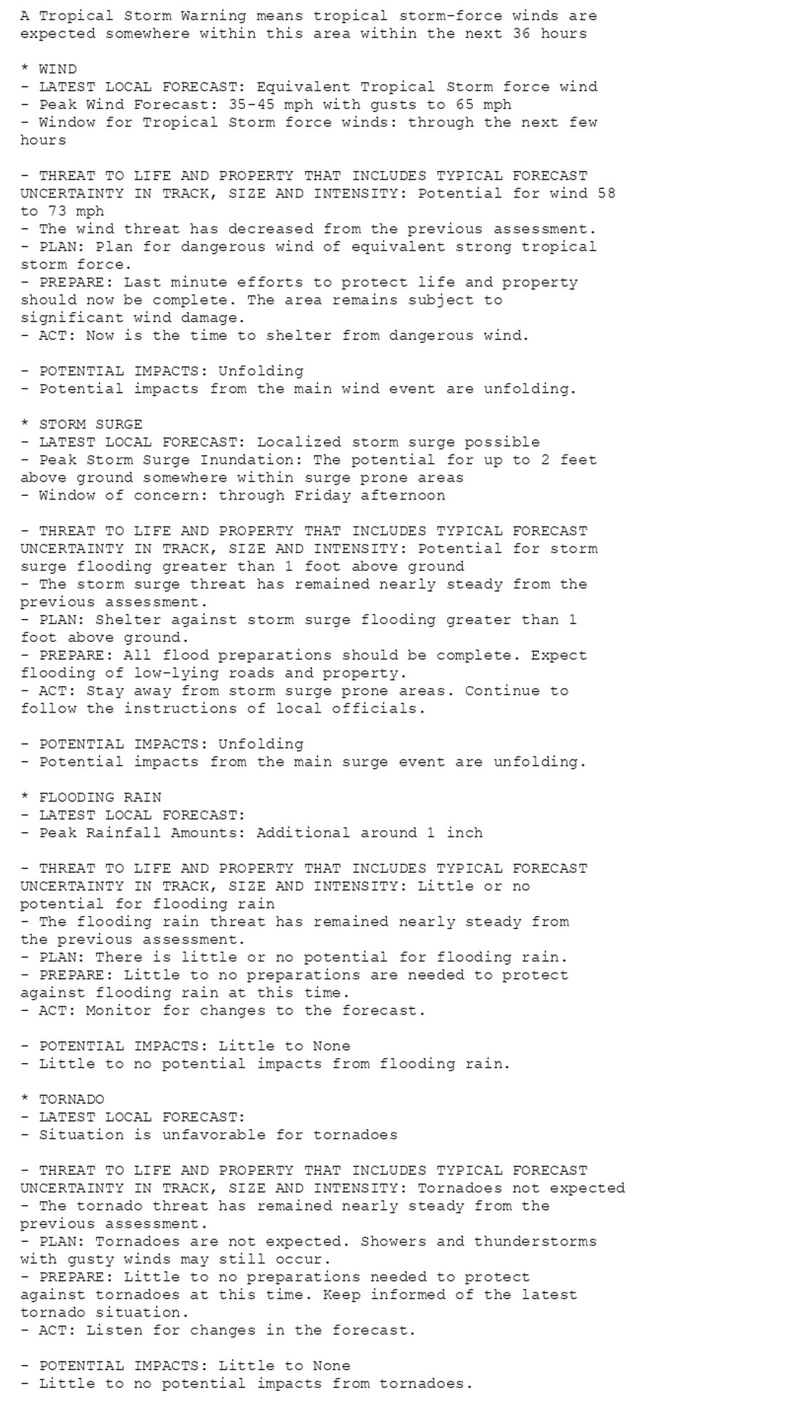
🚨🚨🚨 Hurricane Warning issued October 10 at 8:11AM EDT by NWS Melbourne FL 🚨🚨🚨 Additional Details Here. (4/6)
🚨🚨🚨 Hurricane Warning issued October 10 at 8:11AM EDT by NWS Melbourne FL 🚨🚨🚨 Additional Details Here. (3/6)

🚨🚨🚨 Hurricane Warning issued October 10 at 8:11AM EDT by NWS Melbourne FL 🚨🚨🚨 Additional Details Here. (2/6)