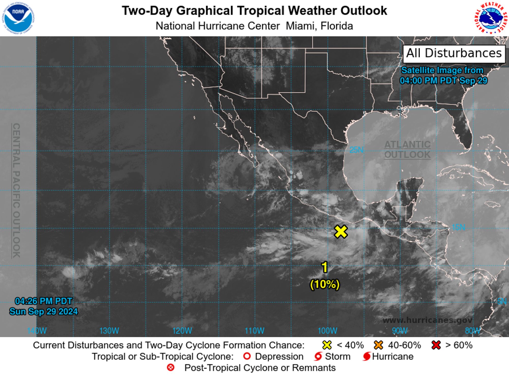
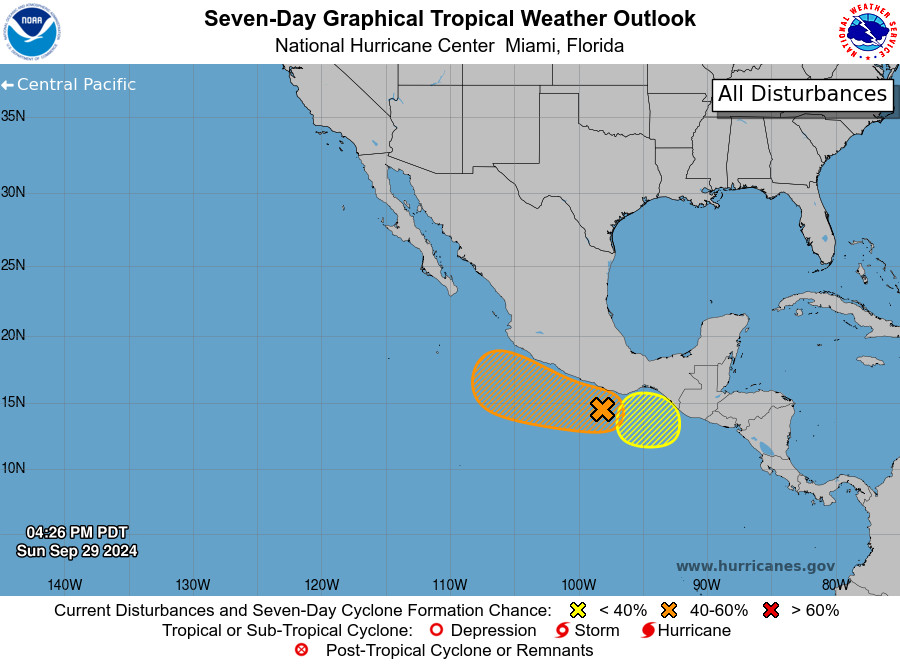
NWS National Hurricane Center Miami FL 500 PM PDT Sun Sep 29 2024 For the eastern North Pacific...east of 140 degrees west longitude:

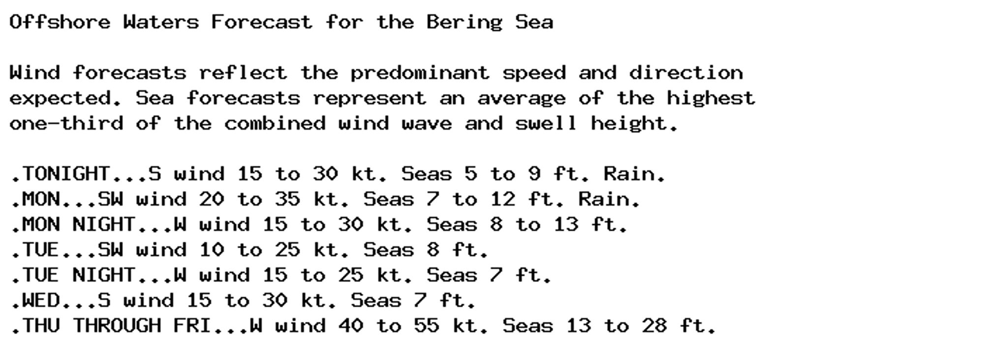
Gale Warning issued September 29 at 3:39PM AKDT until September 30 at 5:00PM AKDT by NWS Anchorage AK Additional Details Here.
Gale Warning issued September 29 at 3:39PM AKDT until September 30 at 5:00PM AKDT by NWS Anchorage AK Additional Details Here.
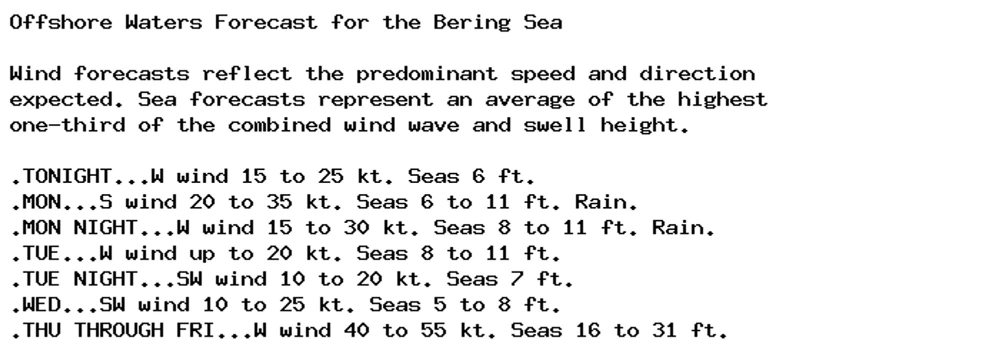
Storm Warning issued September 29 at 3:43PM AKDT until October 1 at 5:00AM AKDT by NWS Anchorage AK Additional Details Here.
Storm Warning issued September 29 at 3:43PM AKDT until October 1 at 5:00AM AKDT by NWS Anchorage AK Additional Details Here.
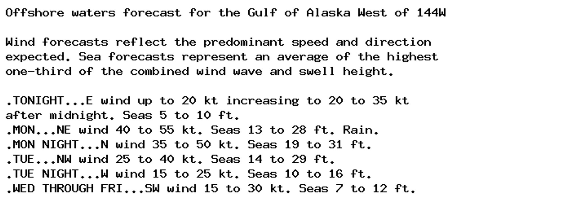
NEW WEATHER ADVISORY: Storm Warning Offshore waters forecast for the Gulf of Alaska West of 144W Wind forecasts reflect the predominant speed and direction expected. Sea forecasts represent an average of the highest one-third of the combined wind... See more: watchedsky.social/app/alerts/...
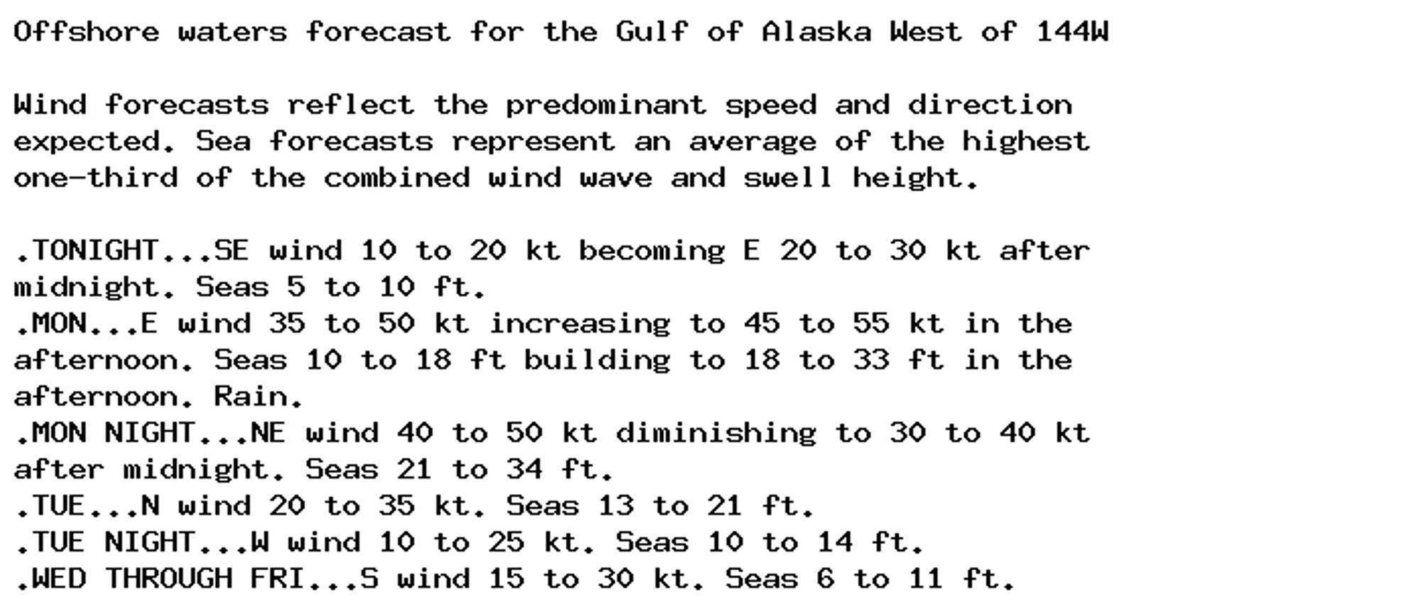
NEW WEATHER ADVISORY: Storm Warning Offshore waters forecast for the Gulf of Alaska West of 144W Wind forecasts reflect the predominant speed and direction expected. Sea forecasts represent an average of the highest one-third of the combined wind... See more: watchedsky.social/app/alerts/...