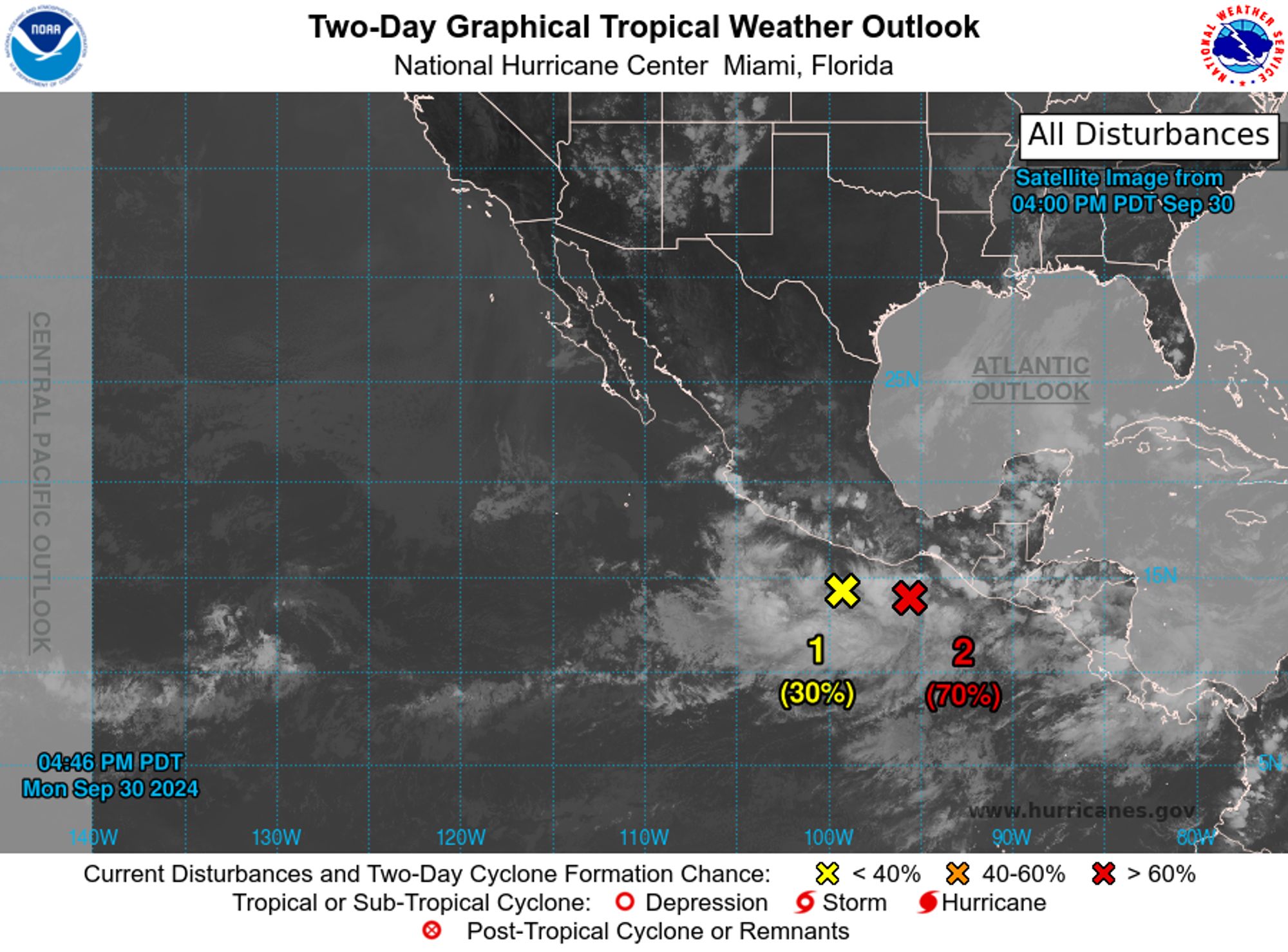
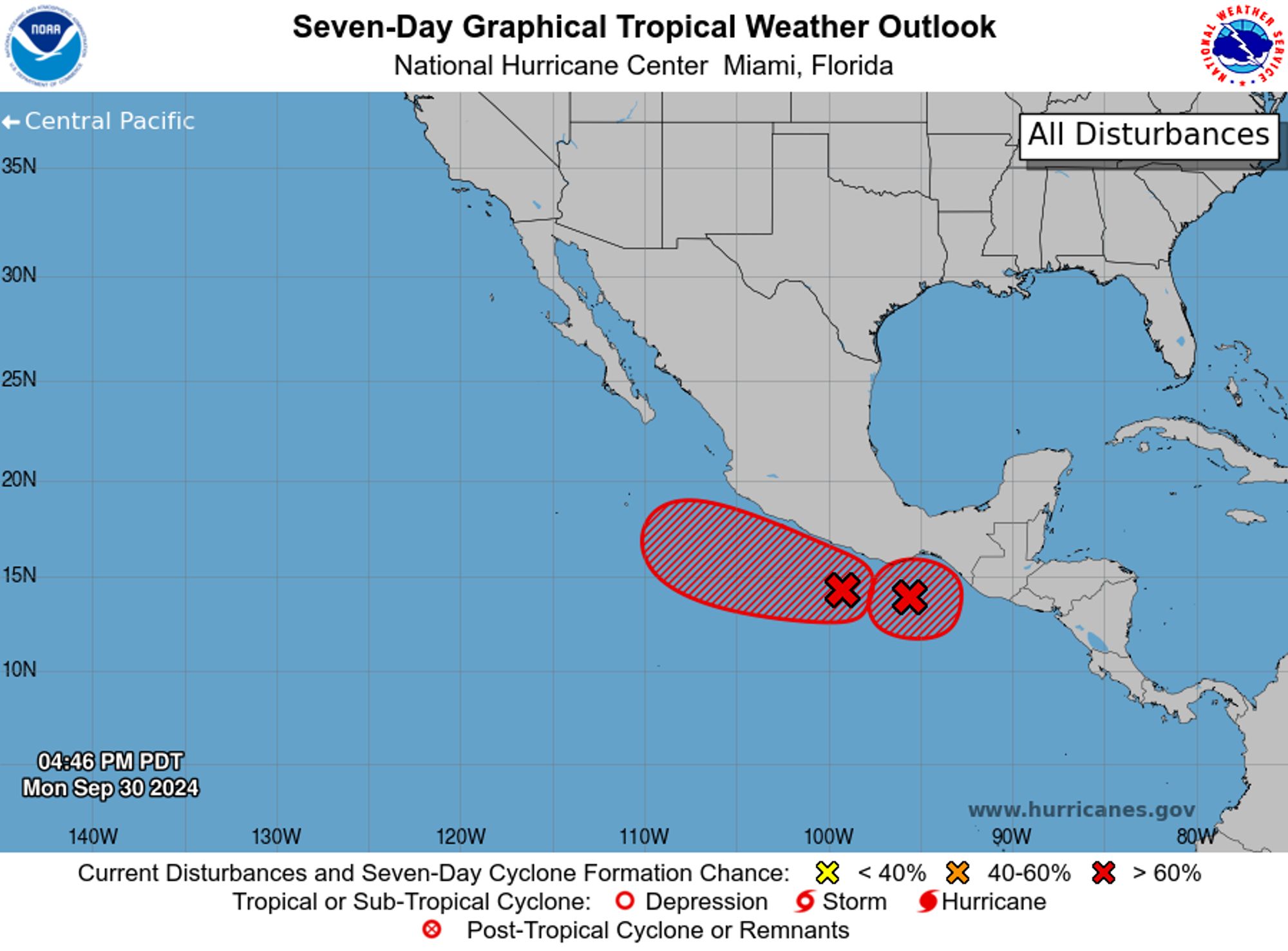
NWS National Hurricane Center Miami FL 500 PM PDT Mon Sep 30 2024 For the eastern North Pacific...east of 140 degrees west longitude:
This is total bullshit. We have every ability to stop Israel in their tracks. We just have to cut off the money and weapons. The US is too busy loving how much money they're making from giving Israel weapons to murder more brown people in the middle East with.
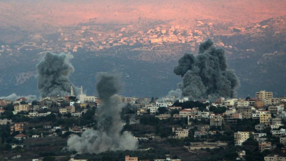
Israel’s apparently impending ground incursion into Lebanon will drive home a new strategic reality of a year of war — the once-mighty US is powerless to rein in its ally or to influence other major b...
Israeli airstrikes have just targeted Al-Shuja'iyya School sheltering displaced families in the Al-Tuffah neighborhood, east of #Gaza#Palestine#PalestinianGenocide#IsraelWarCrimes#ICJ#ICC
LOL “Iran has tried to avoid conflict with Israel and failed”🔴 www.theguardian.com/commentisfre... 📌Having wasted💰BILLIONS💰on terrorism instead of its economy only to watch Hezbollah, Hamas, the Houthi & other low IQ Middle East proxies outfoxed, Khamenei regime now seeks security in nuclear bomb.▼

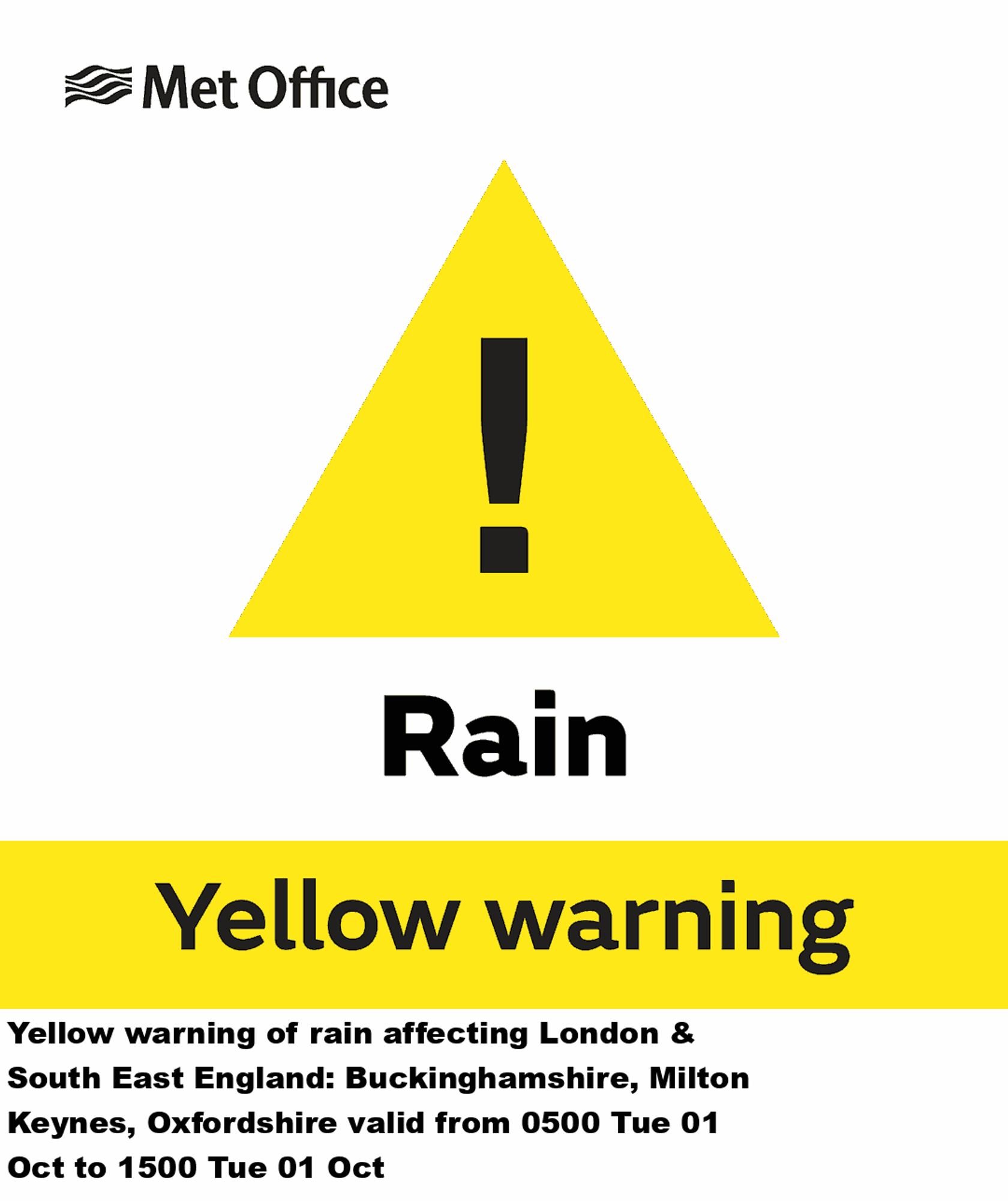
Yellow warning of rain affecting London & South East England valid from 0500 Tue 01 Oct to 1500 Tue 01 Oct Additional Details Here.
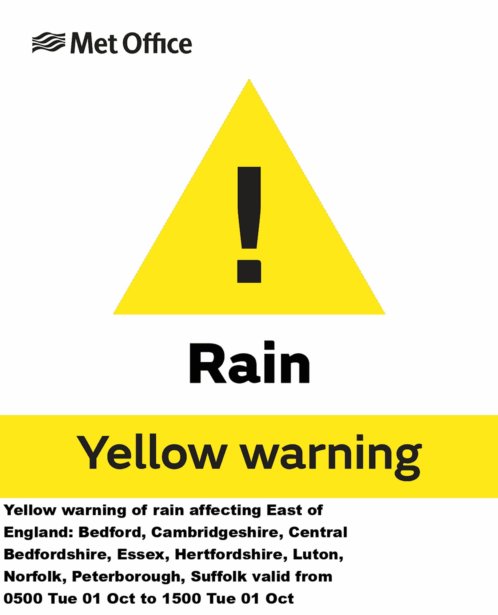
Yellow warning of rain affecting East of England valid from 0500 Tue 01 Oct to 1500 Tue 01 Oct Additional Details Here.
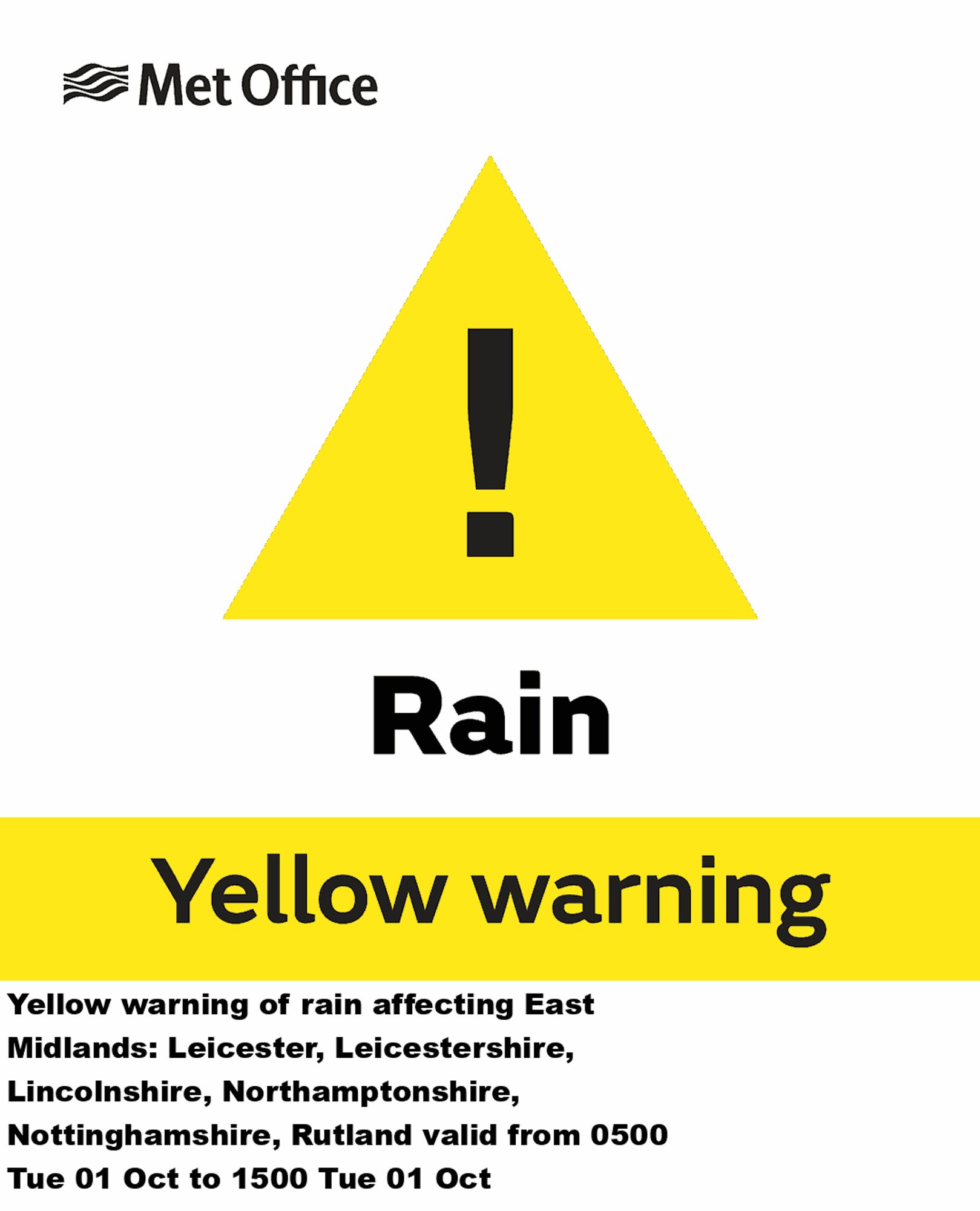
Yellow warning of rain affecting East Midlands valid from 0500 Tue 01 Oct to 1500 Tue 01 Oct Additional Details Here.
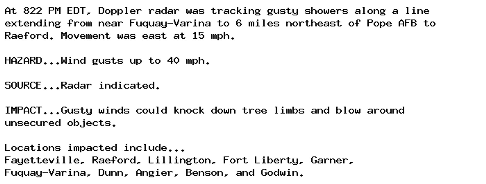
Special Weather Statement issued September 30 at 8:24PM EDT by NWS Raleigh NC Additional Details Here.
Biden Said He Wouldn't Send Troops to Middle East Day Before Deployment Pentagon spokesperson Brigadier General Pat Ryder did not specify how many personnel would be deployed or their mission.