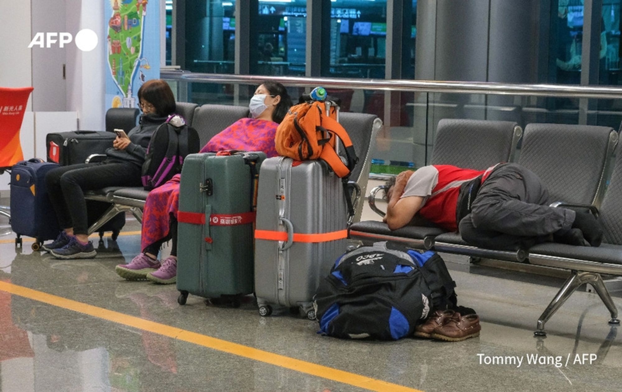
Taiwan shuts down as Typhoon Krathon approaches. Taiwan shut down schools and closed its financial markets on Wednesday as Typhoon Krathon pounded its south and east with torrential rains and winds ahead of its expected landfall https://u.afp.com/5RP8


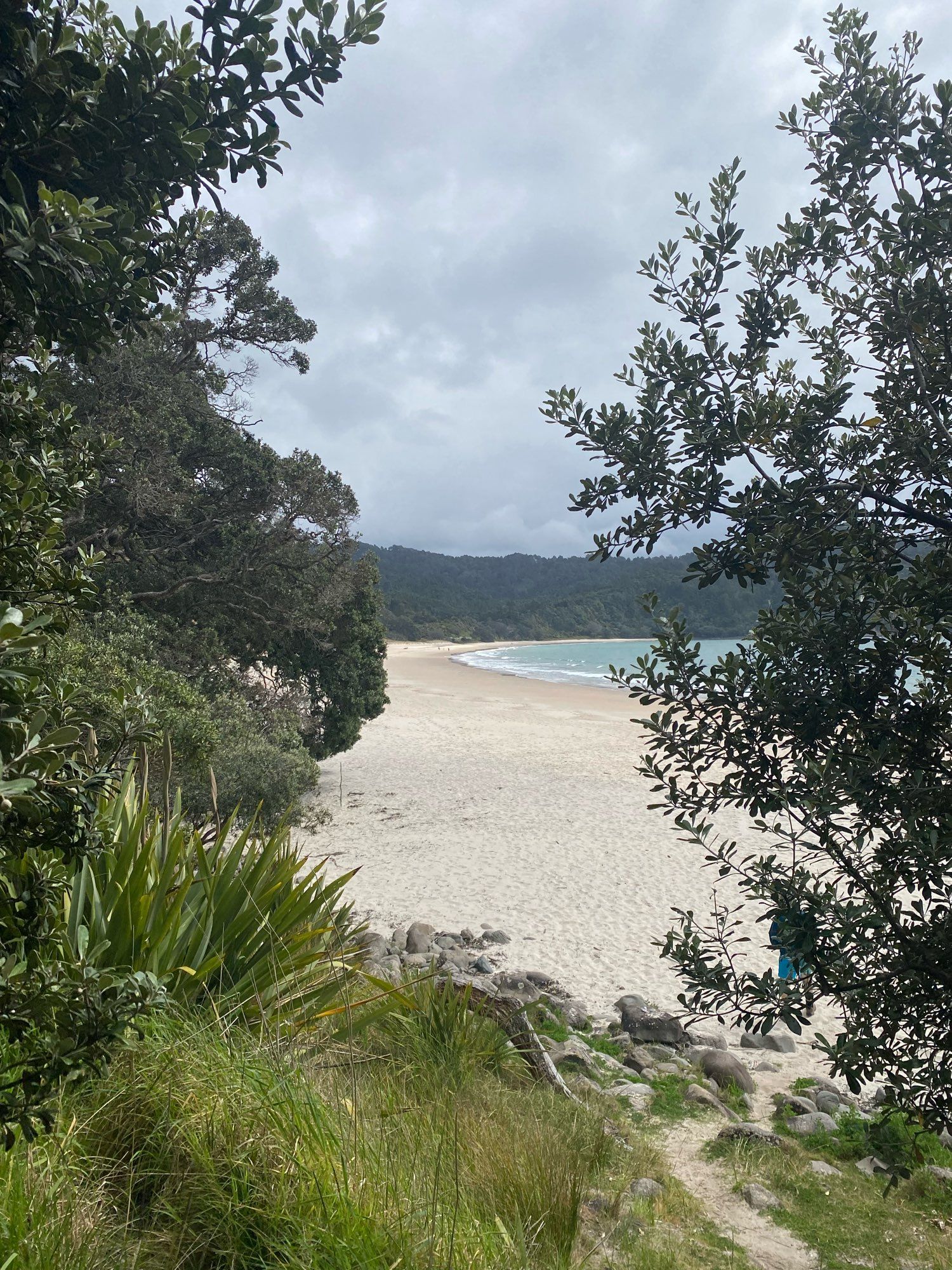
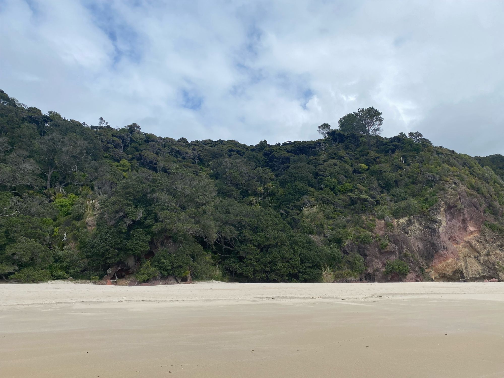
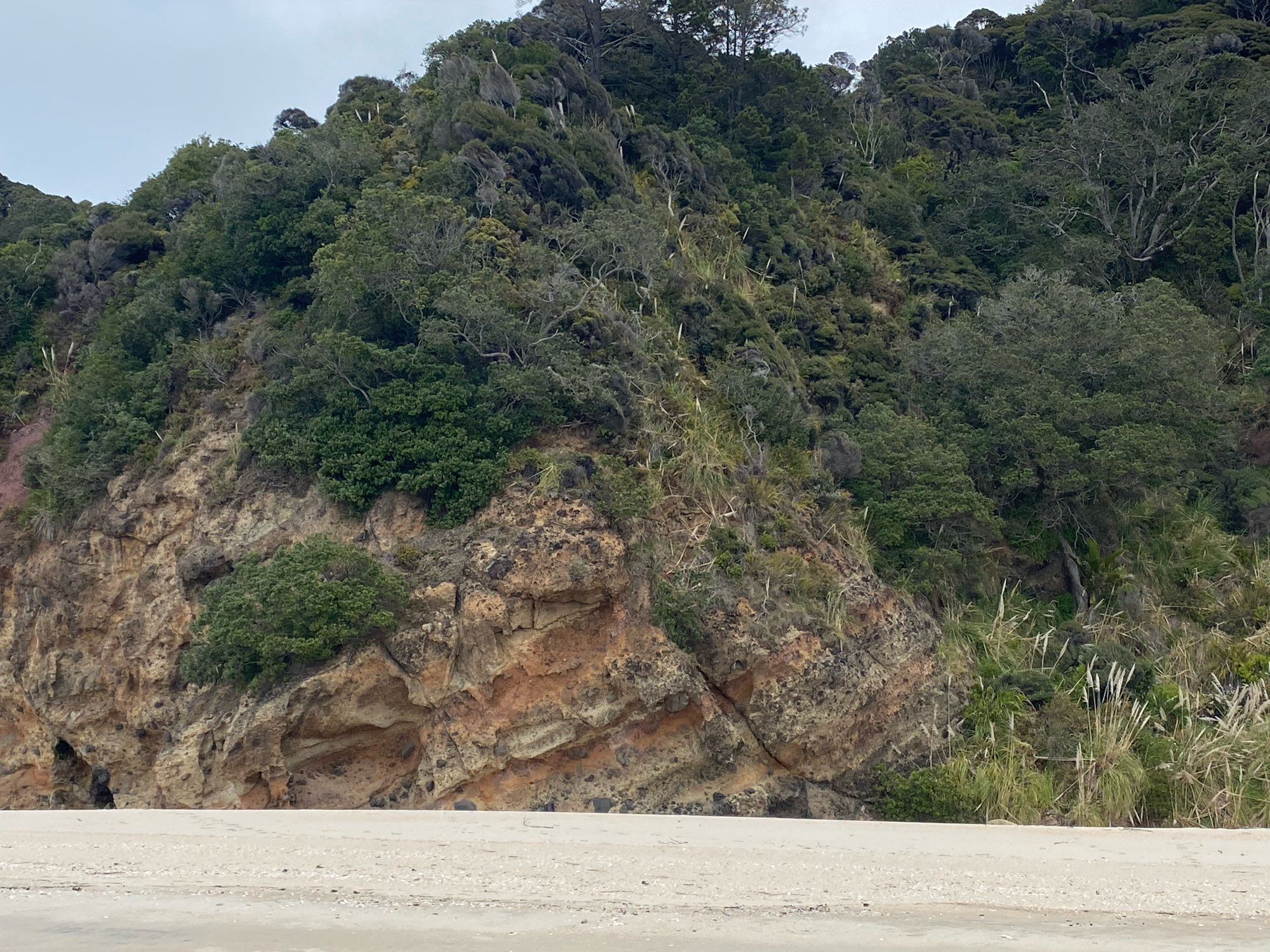
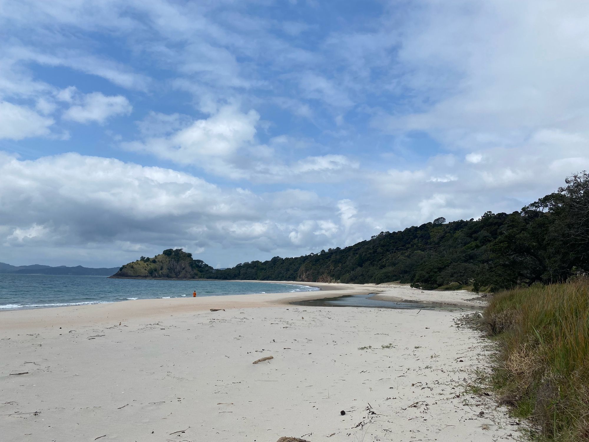
Also, went to Wainuiototo (New Chum’s Beach) yesterday and it was incredible to see how Aotearoa New Zealand must have looked for millions of years. And we saw Tūturiwhatu (dotterel)! www.nzbirdsonline.org.nz/species/new-...
no i didn't trip on the stairs coming in I'm just making a Kramer entrance


Small Craft Advisory issued October 1 at 9:58PM EDT until October 2 at 11:00PM EDT by NWS Marquette MI Additional Details Here.
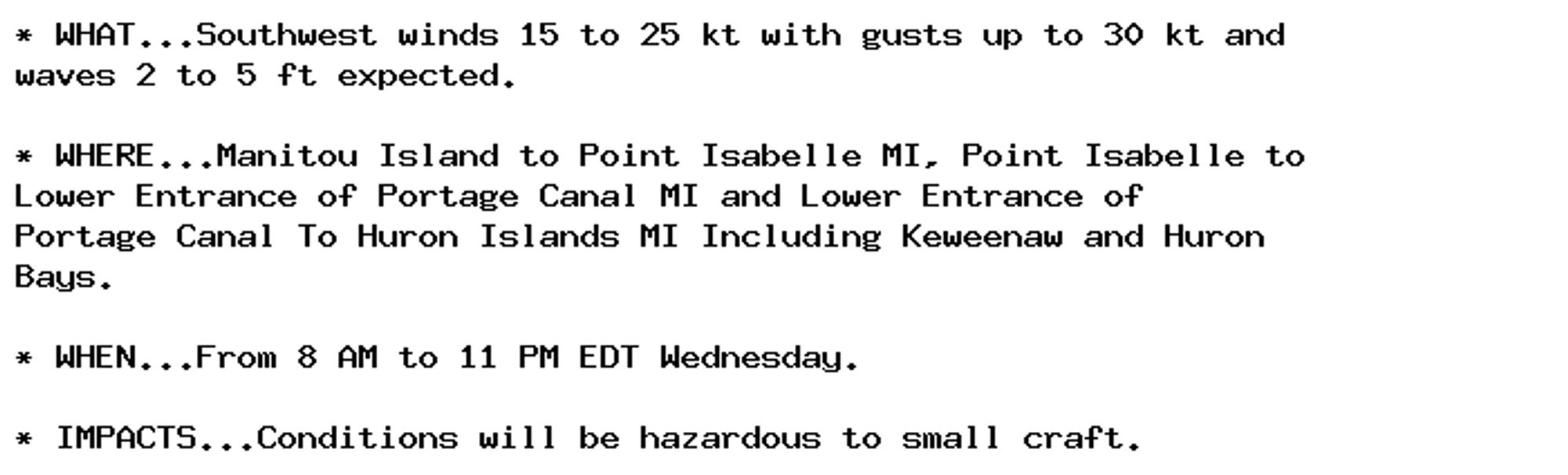
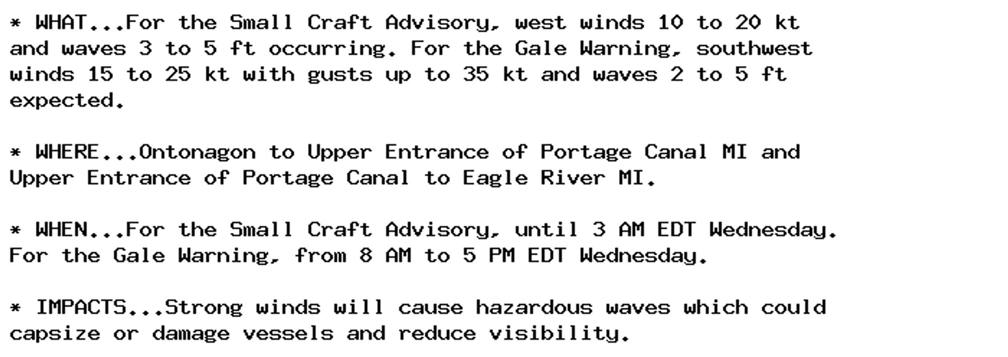
Small Craft Advisory issued October 1 at 9:58PM EDT until October 2 at 3:00AM EDT by NWS Marquette MI Additional Details Here.
Gale Warning issued October 1 at 9:58PM EDT until October 2 at 5:00PM EDT by NWS Marquette MI Additional Details Here.
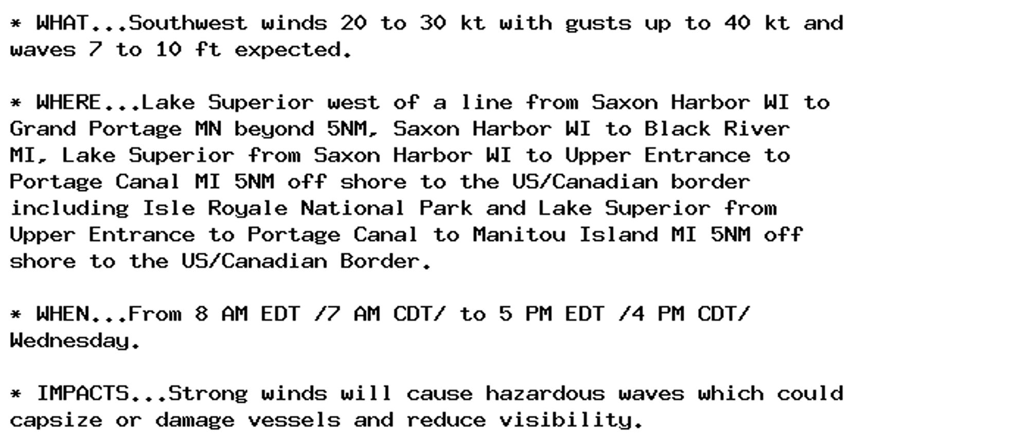
Gale Warning issued October 1 at 9:58PM EDT until October 2 at 5:00PM EDT by NWS Marquette MI Additional Details Here.