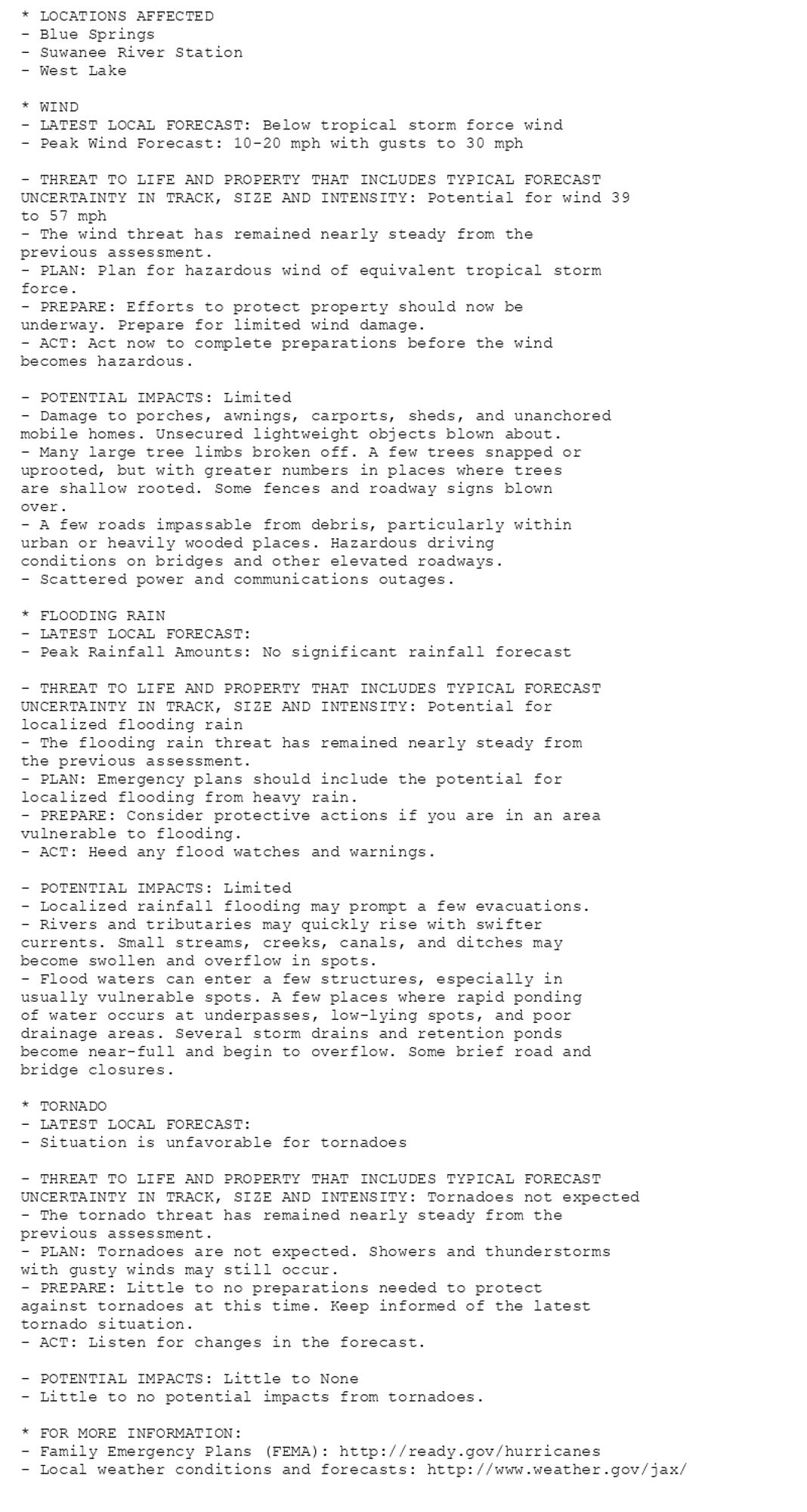
🚨🚨🚨 Hurricane Watch issued October 9 at 11:04AM EDT by NWS Jacksonville FL 🚨🚨🚨 Additional Details Here.(14/14)
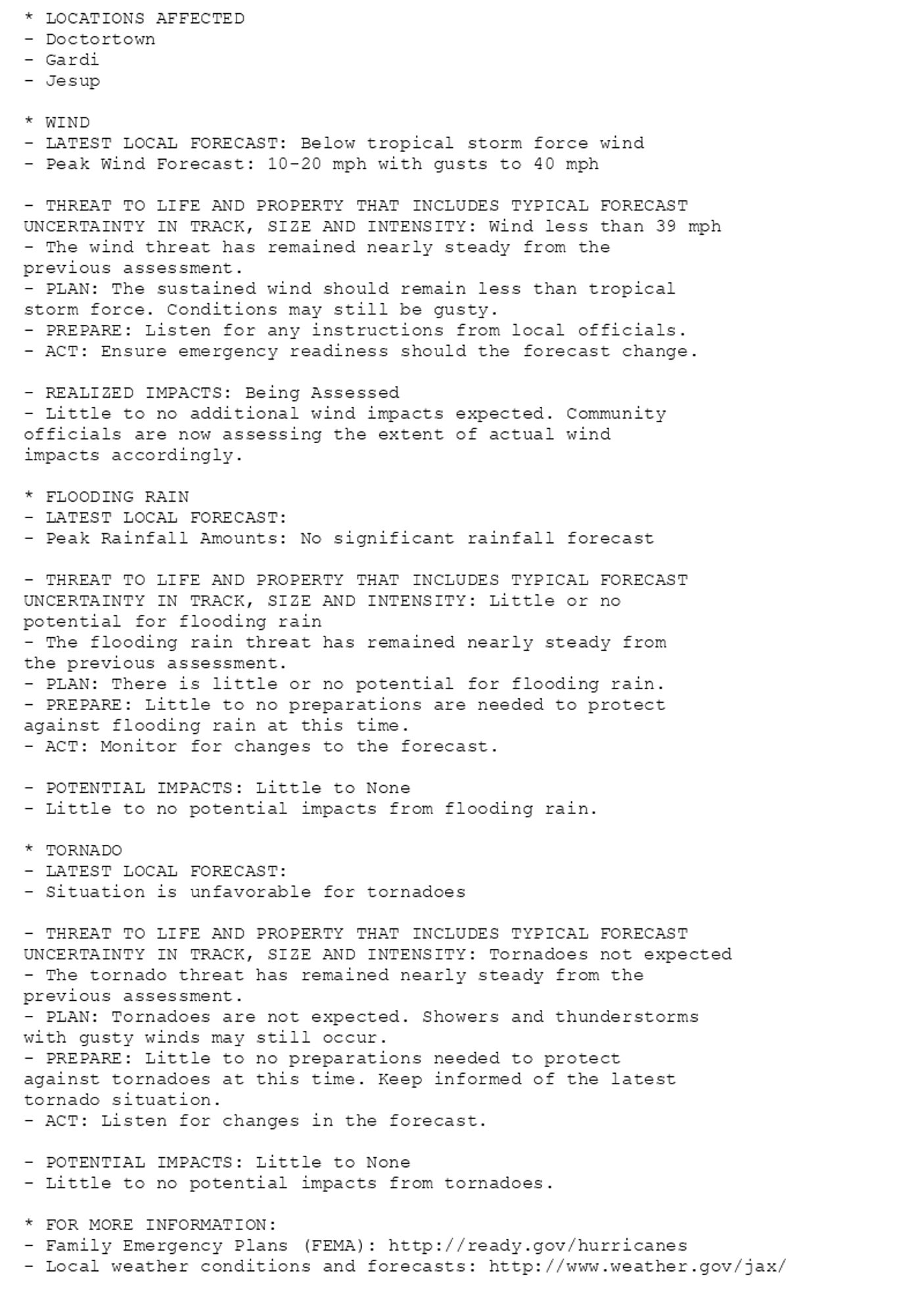
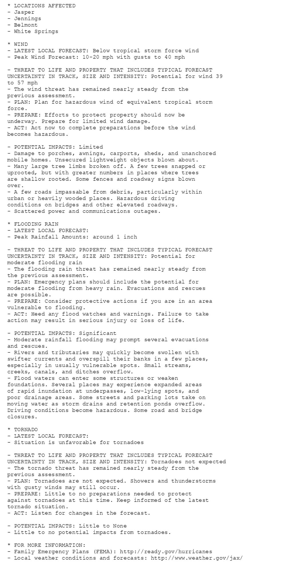
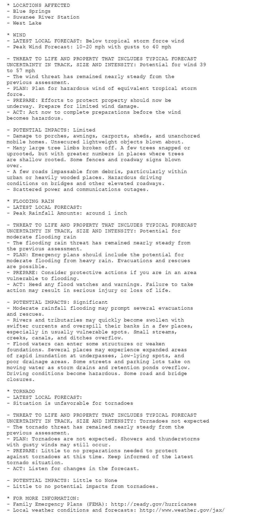
NEW WEATHER ADVISORY: Tropical Storm Watch * LOCATIONS AFFECTED - Doctortown - Gardi - Jesup * WIND - LATEST LOCAL FORECAST: Below tropical storm force wind - Peak Wind Forecast: 10-20 mph with gusts to 40 mph - THREAT TO LIFE AND PROPERTY THAT... See more: watchedsky.social/app/alerts/...
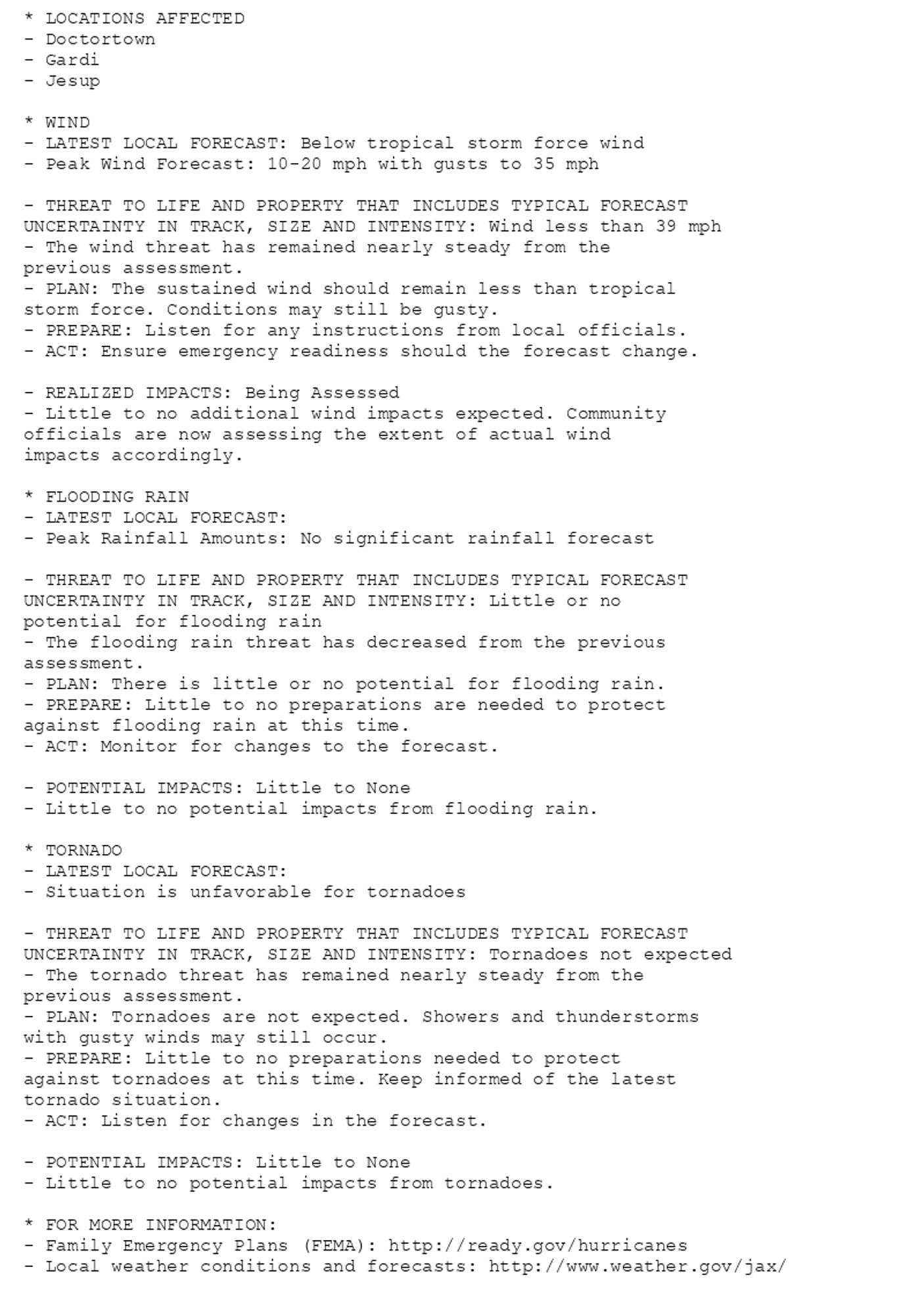
🚨🚨🚨 Hurricane Watch issued October 9 at 5:17AM EDT by NWS Jacksonville FL 🚨🚨🚨 Additional Details Here.(14/14)

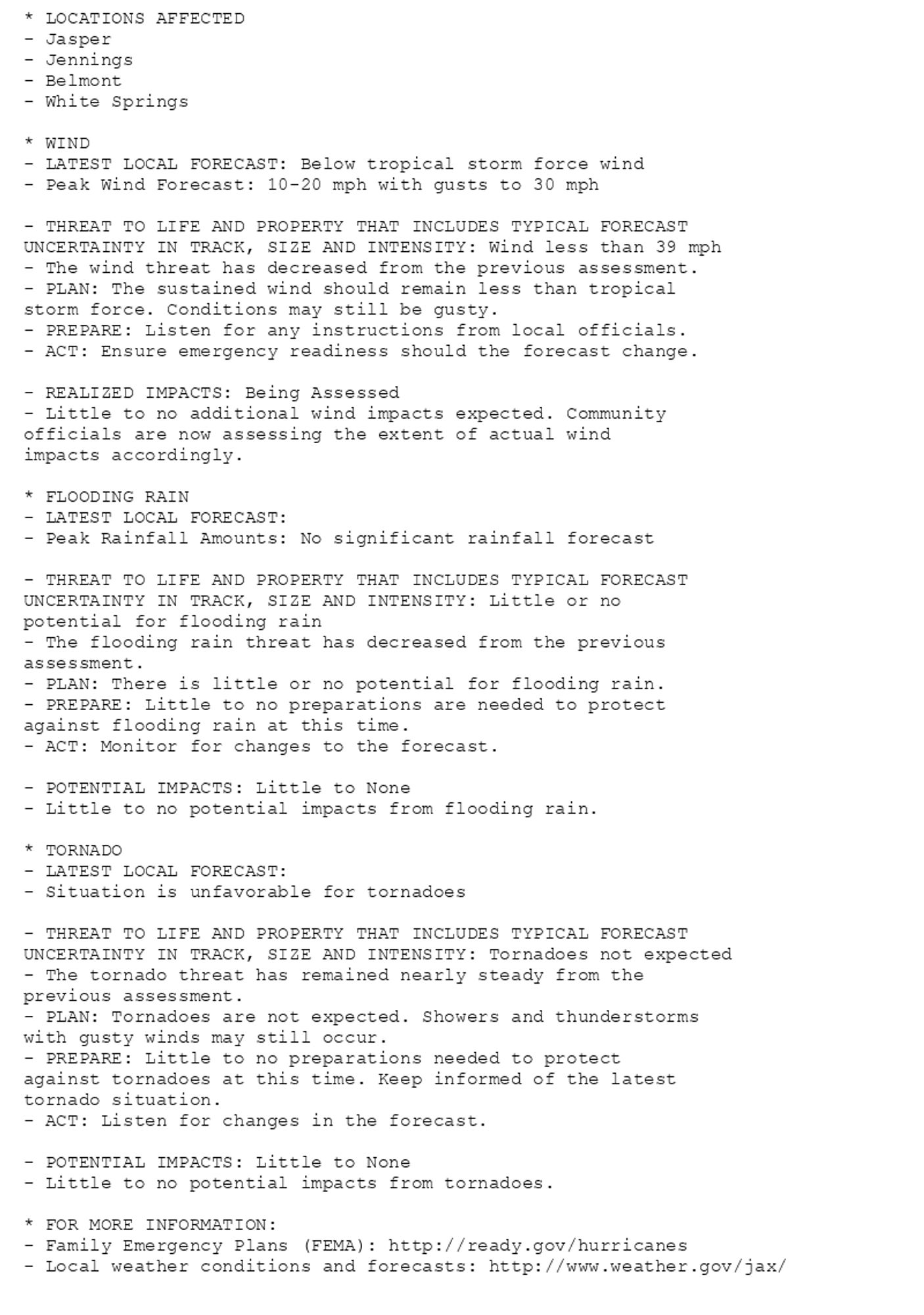
NEW WEATHER ADVISORY: Tropical Storm Watch * LOCATIONS AFFECTED - Doctortown - Gardi - Jesup * WIND - LATEST LOCAL FORECAST: Below tropical storm force wind - Peak Wind Forecast: 10-20 mph with gusts to 30 mph - THREAT TO LIFE AND PROPERTY THAT... See more: watchedsky.social/app/alerts/...
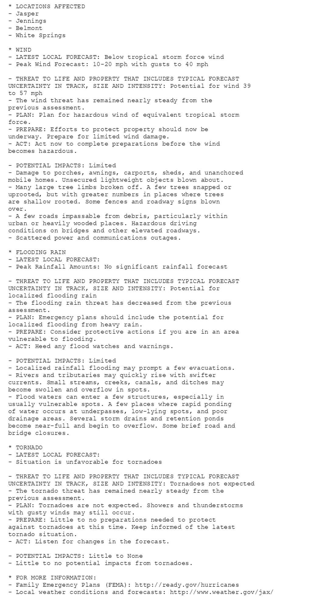
🚨🚨🚨 Hurricane Watch issued October 8 at 11:00PM EDT by NWS Jacksonville FL 🚨🚨🚨 Additional Details Here.(14/14)
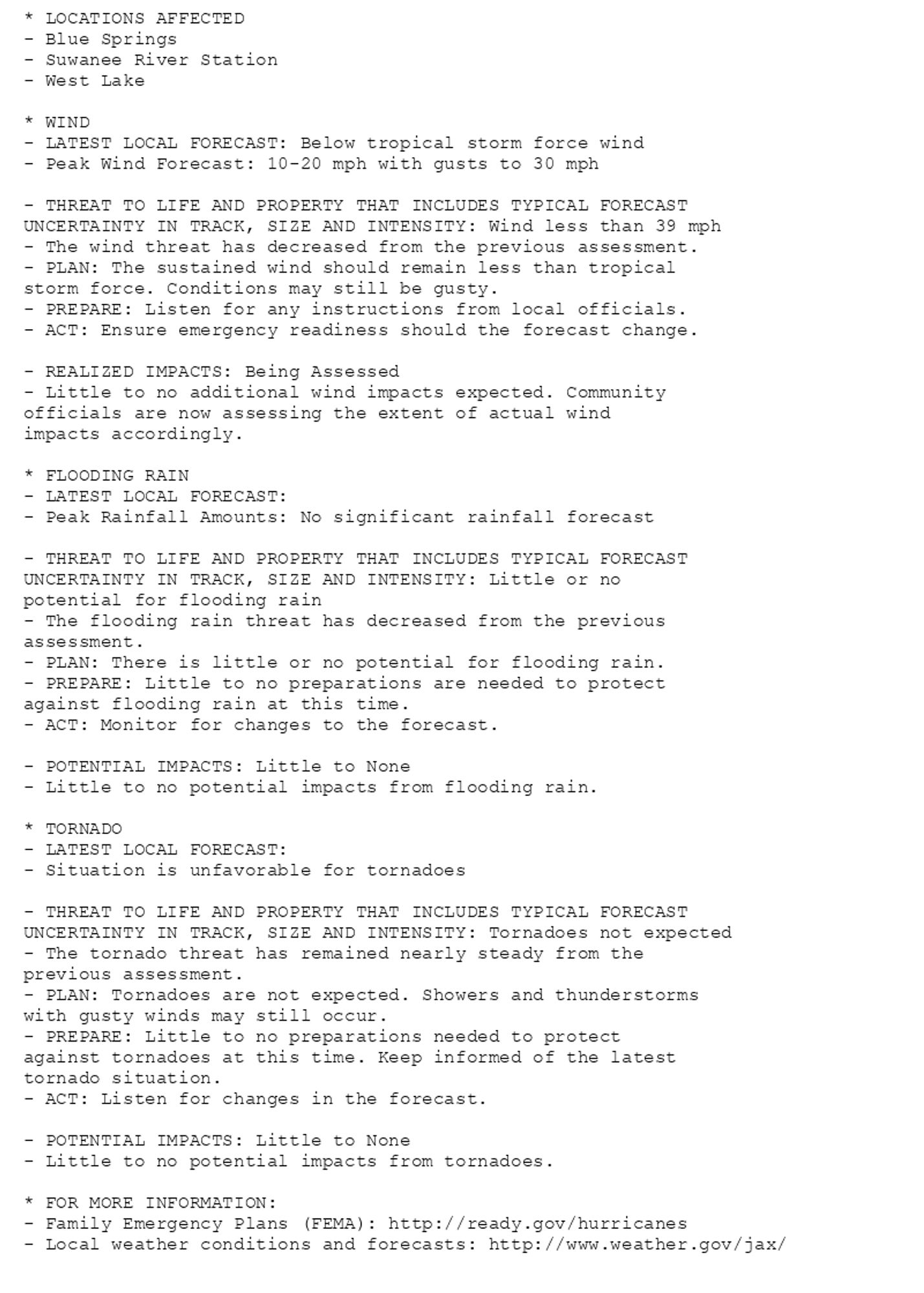
NEW WEATHER ADVISORY: Tropical Storm Watch * LOCATIONS AFFECTED - Doctortown - Gardi - Jesup * WIND - LATEST LOCAL FORECAST: Below tropical storm force wind - Peak Wind Forecast: 10-20 mph with gusts to 30 mph - THREAT TO LIFE AND PROPERTY THAT... See more: watchedsky.social/app/alerts/...
🚨🚨🚨 Hurricane Watch issued October 8 at 5:03PM EDT by NWS Jacksonville FL 🚨🚨🚨 Additional Details Here.(14/14)
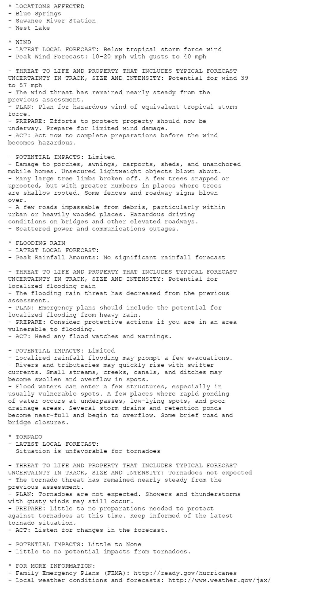
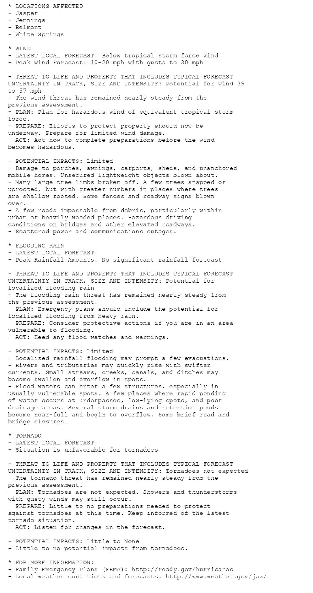
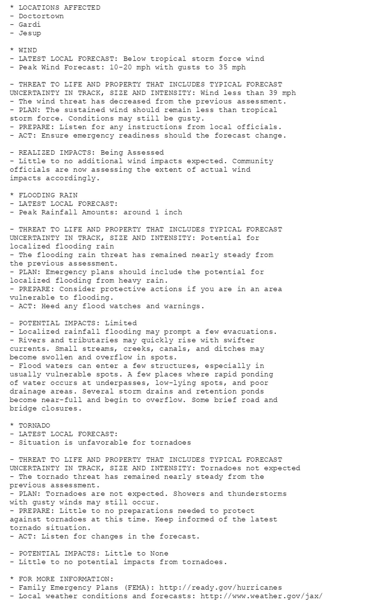
NEW WEATHER ADVISORY: Tropical Storm Watch * LOCATIONS AFFECTED - Doctortown - Gardi - Jesup * WIND - LATEST LOCAL FORECAST: Below tropical storm force wind - Peak Wind Forecast: 10-20 mph with gusts to 35 mph - THREAT TO LIFE AND PROPERTY THAT... See more: watchedsky.social/app/alerts/...
🚨🚨🚨 Hurricane Watch issued October 8 at 11:05AM EDT by NWS Jacksonville FL 🚨🚨🚨 Additional Details Here.(14/14)
NEW WEATHER ADVISORY: Tropical Storm Watch * LOCATIONS AFFECTED - Doctortown - Gardi - Jesup * WIND - LATEST LOCAL FORECAST: Below tropical storm force wind - Peak Wind Forecast: 10-20 mph with gusts to 35 mph - THREAT TO LIFE AND PROPERTY THAT... See more: watchedsky.social/app/alerts/...