🚨🚨🚨 Tropical Storm Watch issued October 8 at 4:37AM EDT by NWS Miami FL 🚨🚨🚨 Additional Details Here. (1/6)
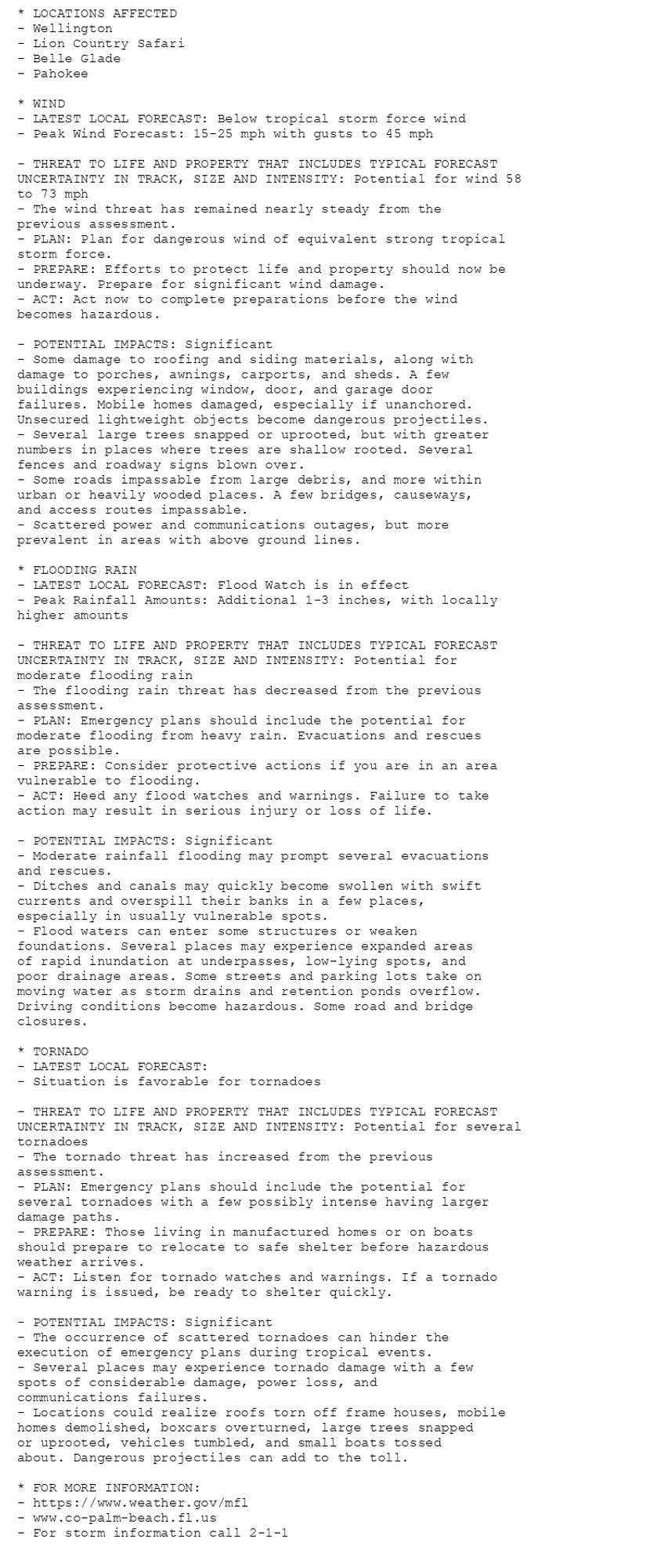
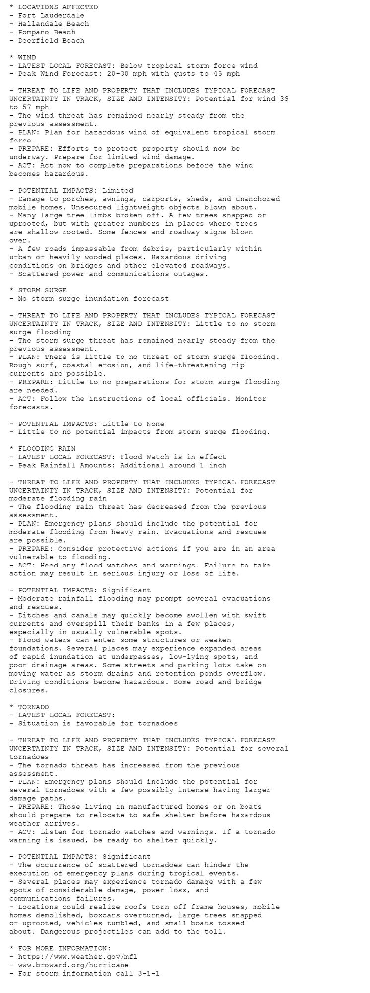
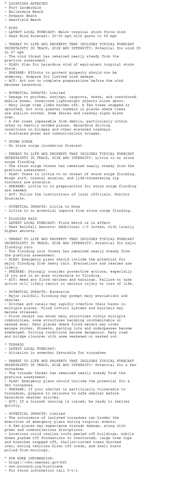
NEW WEATHER ADVISORY: Tropical Storm Watch * LOCATIONS AFFECTED - Fort Lauderdale - Hallandale Beach - Pompano Beach - Deerfield Beach * WIND - LATEST LOCAL FORECAST: Below tropical storm force wind - Peak Wind Forecast: 20-30 mph with gusts to 45... See more: watchedsky.social/app/alerts/...
🚨🚨🚨 Tropical Storm Watch issued October 7 at 10:52PM EDT by NWS Miami FL 🚨🚨🚨 Additional Details Here.
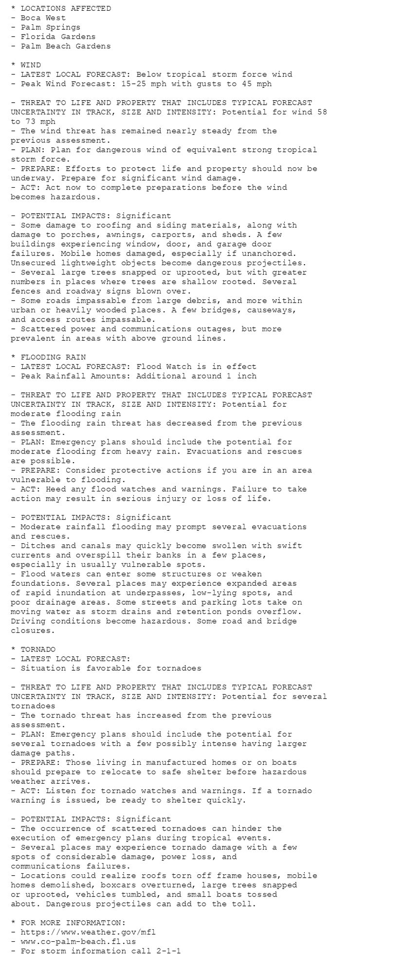
NEW WEATHER ADVISORY: Tropical Storm Watch * LOCATIONS AFFECTED - Fort Lauderdale - Hallandale Beach - Pompano Beach - Deerfield Beach * WIND - LATEST LOCAL FORECAST: Below tropical storm force wind - Peak Wind Forecast: 20-30 mph with gusts to 45... See more: watchedsky.social/app/alerts/...
🚨🚨🚨 Tropical Storm Watch issued October 7 at 5:00PM EDT by NWS Miami FL 🚨🚨🚨 Additional Details Here.

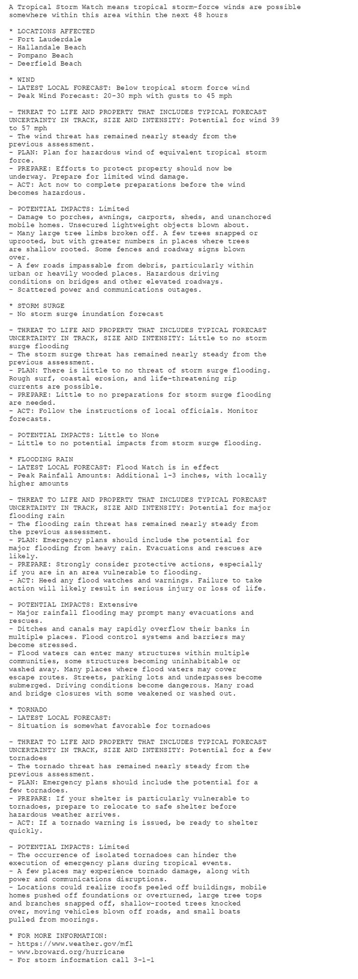
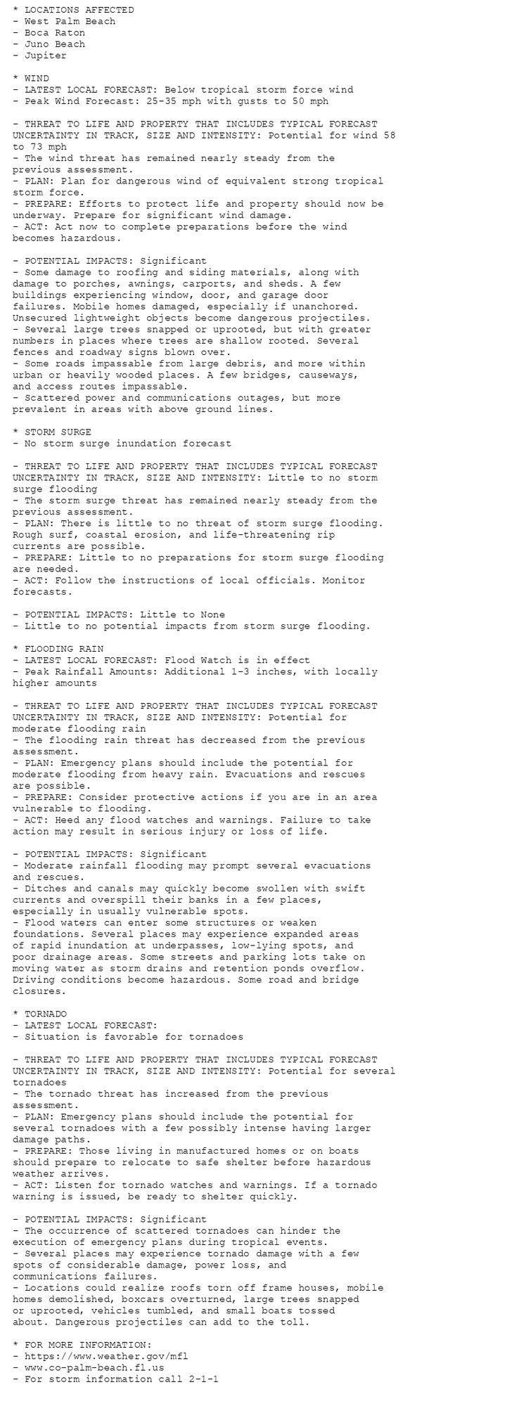
NEW WEATHER ADVISORY: Tropical Storm Watch A Tropical Storm Watch means tropical storm-force winds are possible somewhere within this area within the next 48 hours * LOCATIONS AFFECTED - Fort Lauderdale - Hallandale Beach - Pompano Beach - Deerfield... See more: watchedsky.social/app/alerts/...
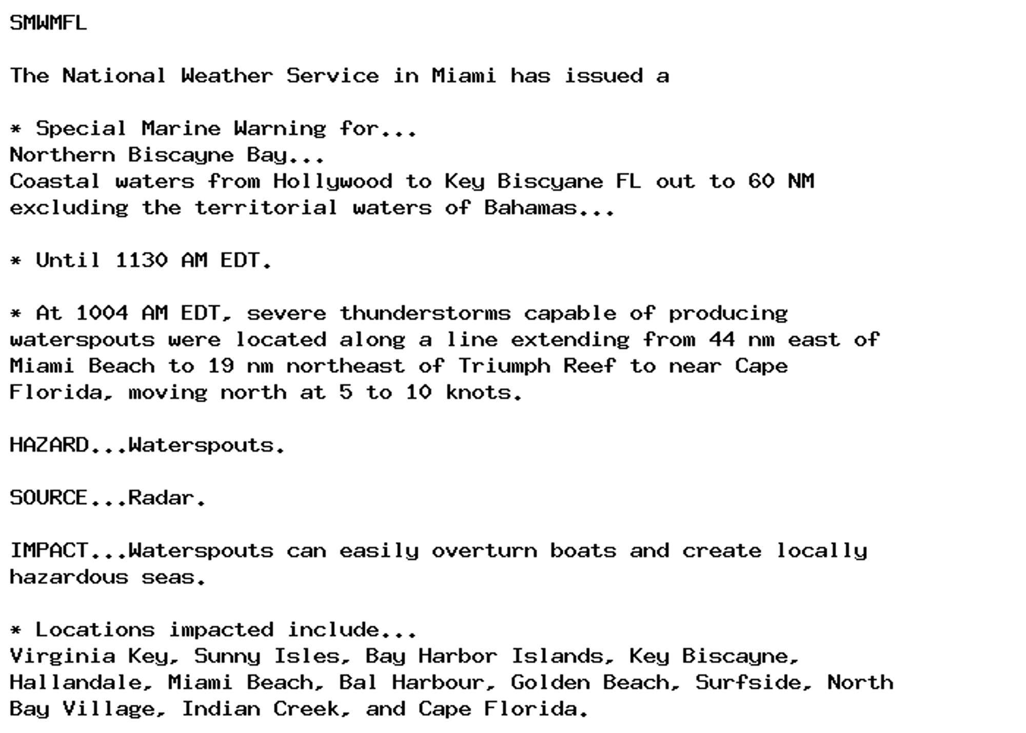
🚨 Special Marine Warning issued October 7 at 10:05AM EDT until October 7 at 11:30AM EDT by NWS Miami FL 🚨 Additional Details Here.
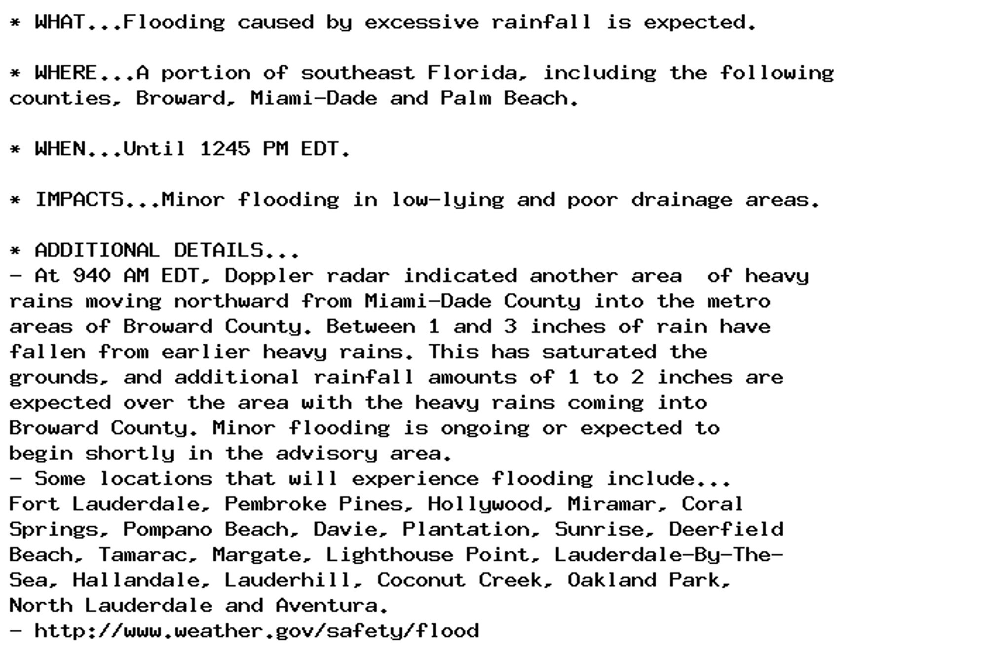
Flood Advisory issued October 7 at 9:42AM EDT until October 7 at 12:45PM EDT by NWS Miami FL Additional Details Here.
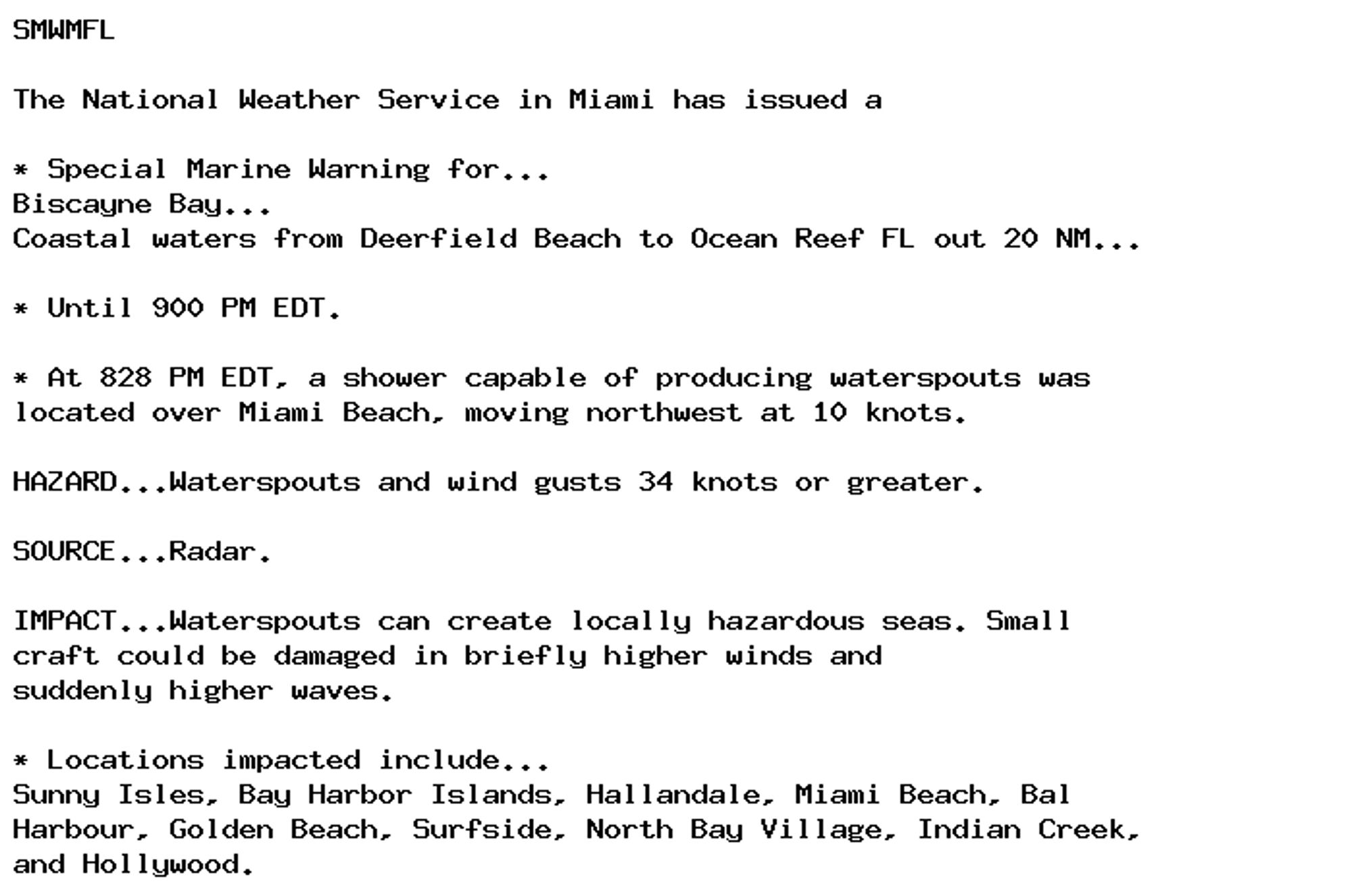
🚨 Special Marine Warning issued October 6 at 8:28PM EDT until October 6 at 9:00PM EDT by NWS Miami FL 🚨 Additional Details Here.
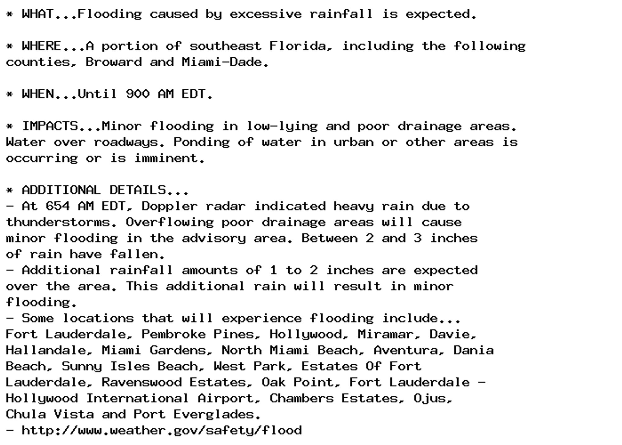
Flood Advisory issued October 5 at 6:54AM EDT until October 5 at 9:00AM EDT by NWS Miami FL Additional Details Here.