People have kindly asked for ways to help - Blue Ridge Public Radio has a good list. Little towns like Old Fort, Swannanoa, Spruce Pine, Little Switzerland, and Chimney Rock need bigtime help www.bpr.org/bpr-news/202...
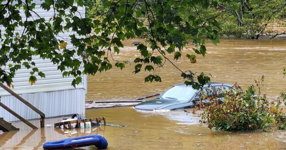
Hurricane Helene unleashed devastating flooding in the mountains of North Carolina. Here are ways to help local flood victims in Western North Carolina by donating relief funds or volunteering.
Ah yeah that makes sense. I only ask cause my friend's parents run a campground up near Spruce Pine, and from the sound of it all the surface roads are basically toast. I wasn't sure if there was, like, an "acceptable risk" factor in play.
I used a Kaypro II and a Hayes modem to dial up BBSes and eventually, The Internet via a guy who was semi-unofficially selling dial-up access: email and Usenet News, thanks to pine and tin. Hello, MDM730!
Awwwwwww pine was so cute!
the big dog of dover ran through the clover and into the stand of white pine which trees shouted "rover! 😡" and threw him right over the cliff and straight into the brine
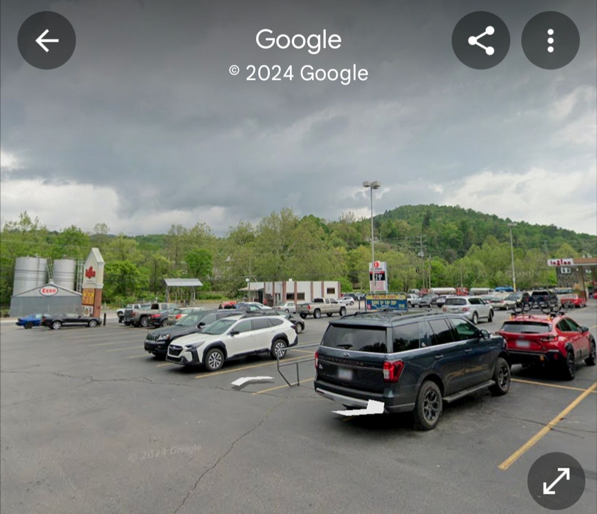
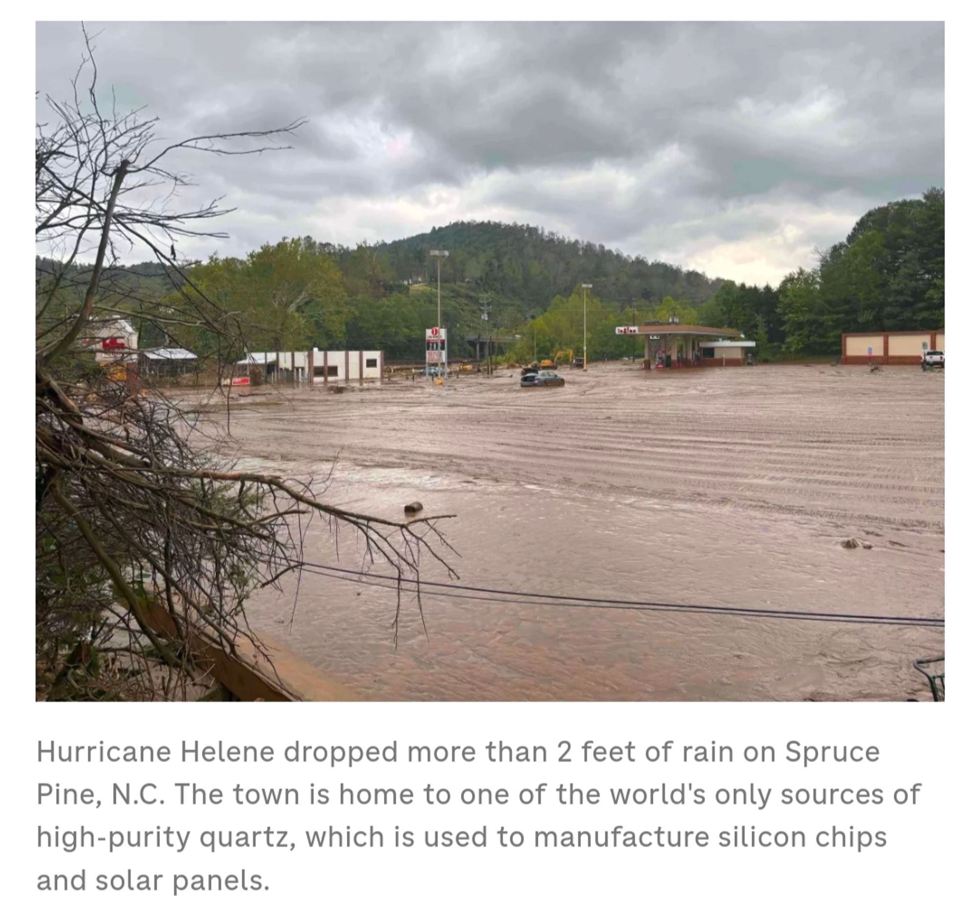
Everybody is obsessed that Spruce Pine has some high purity quartz www.npr.org/2024/09/30/n... The Ingles parking lot, but Walmart is up on a hill
Love this time of year when I get to run on a soft, bouncy blanket of pine needles. Also, love the crunch they make. Different from a leaf crunch.
Much more haute cuisine than me today - tomato & mozzarella salad + apple for lunch; and steamed vegetables (aubergine, carrots, cauliflower & broccoli) sprinkled with parmesan and pine nuts + natural yoghurt & blueberries for dinner. I'm only an occasional cook. 😁
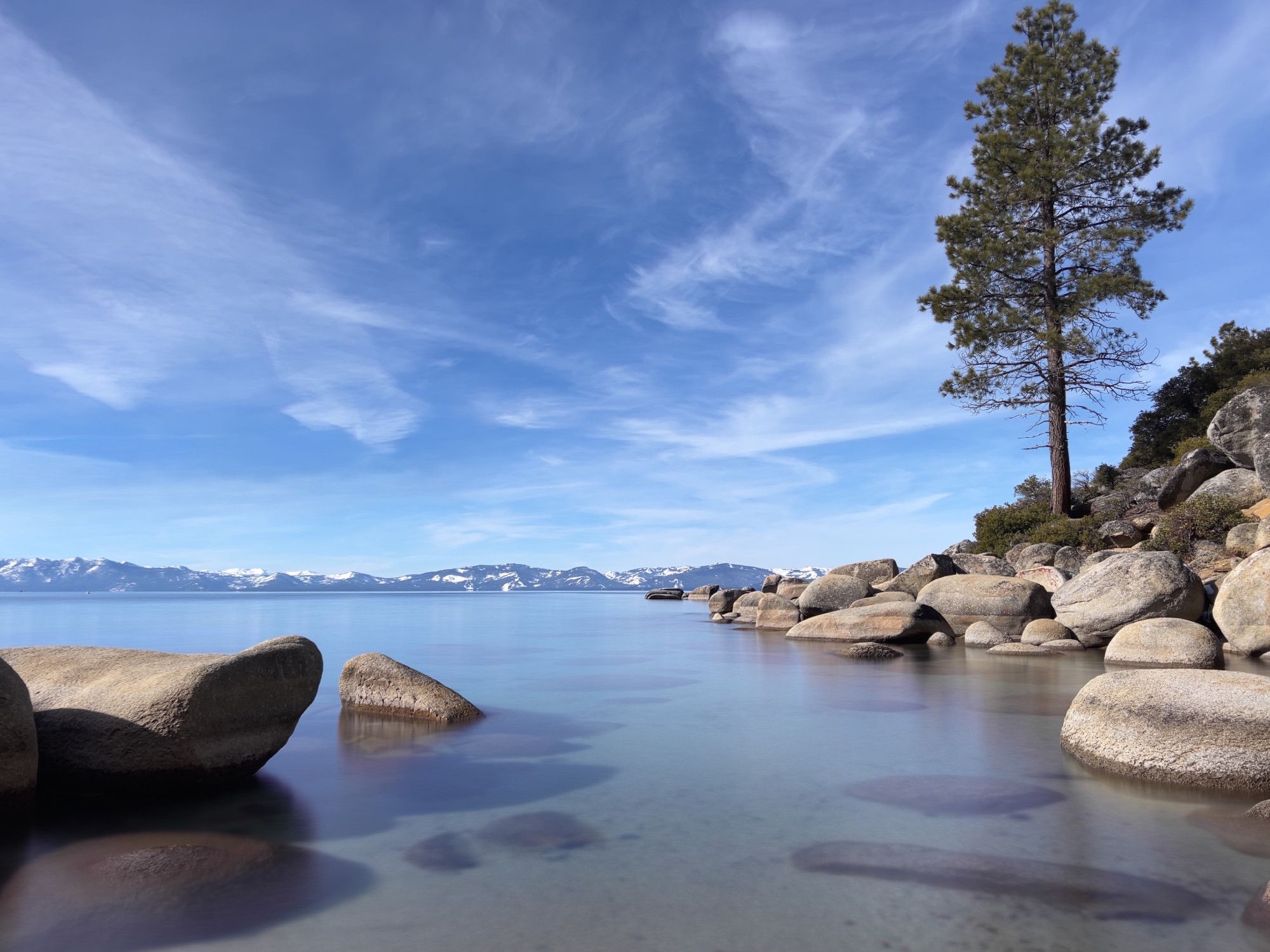
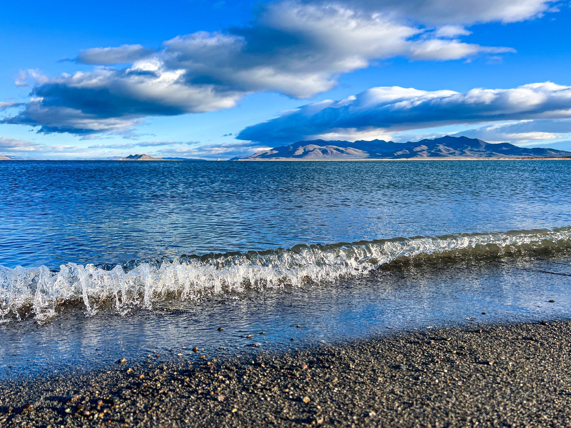
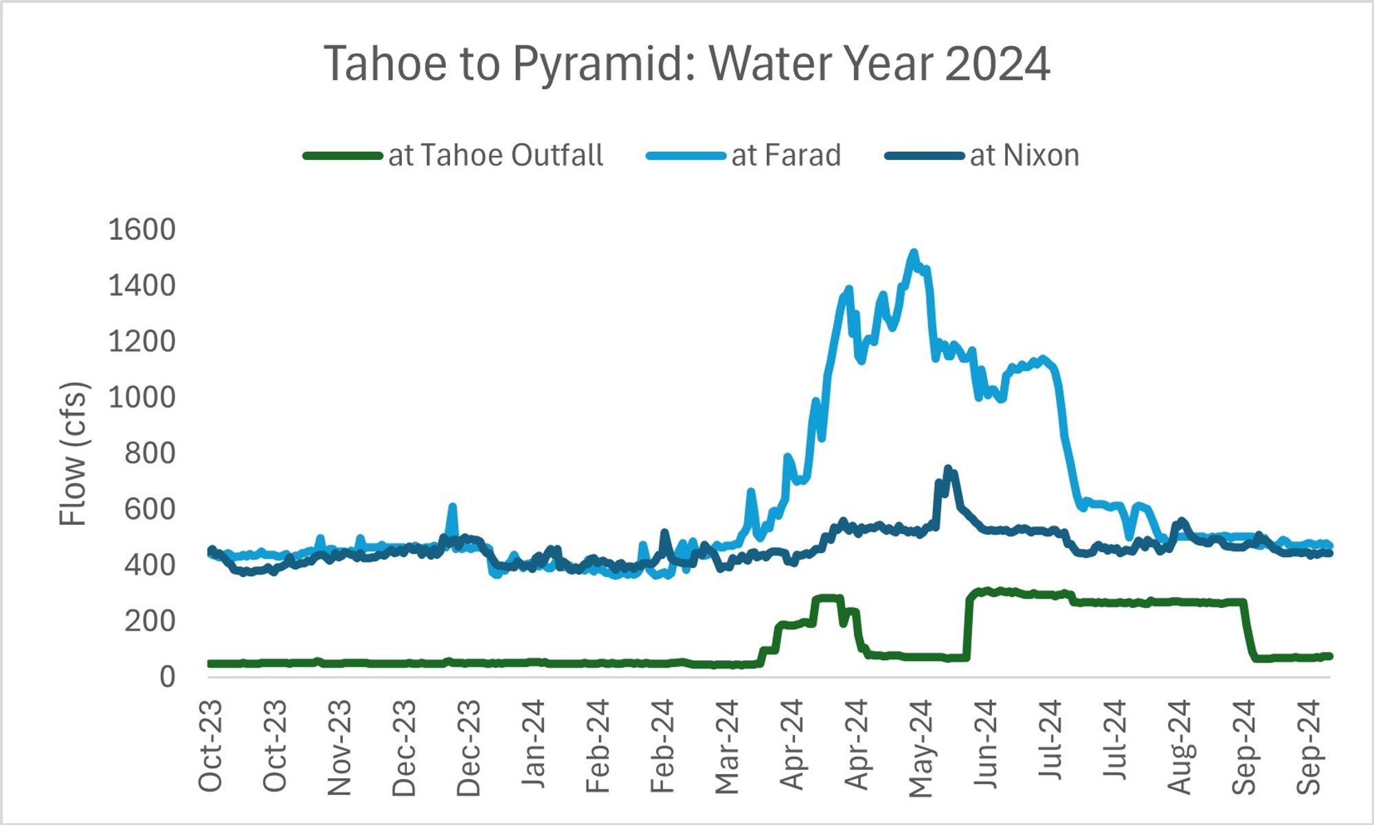
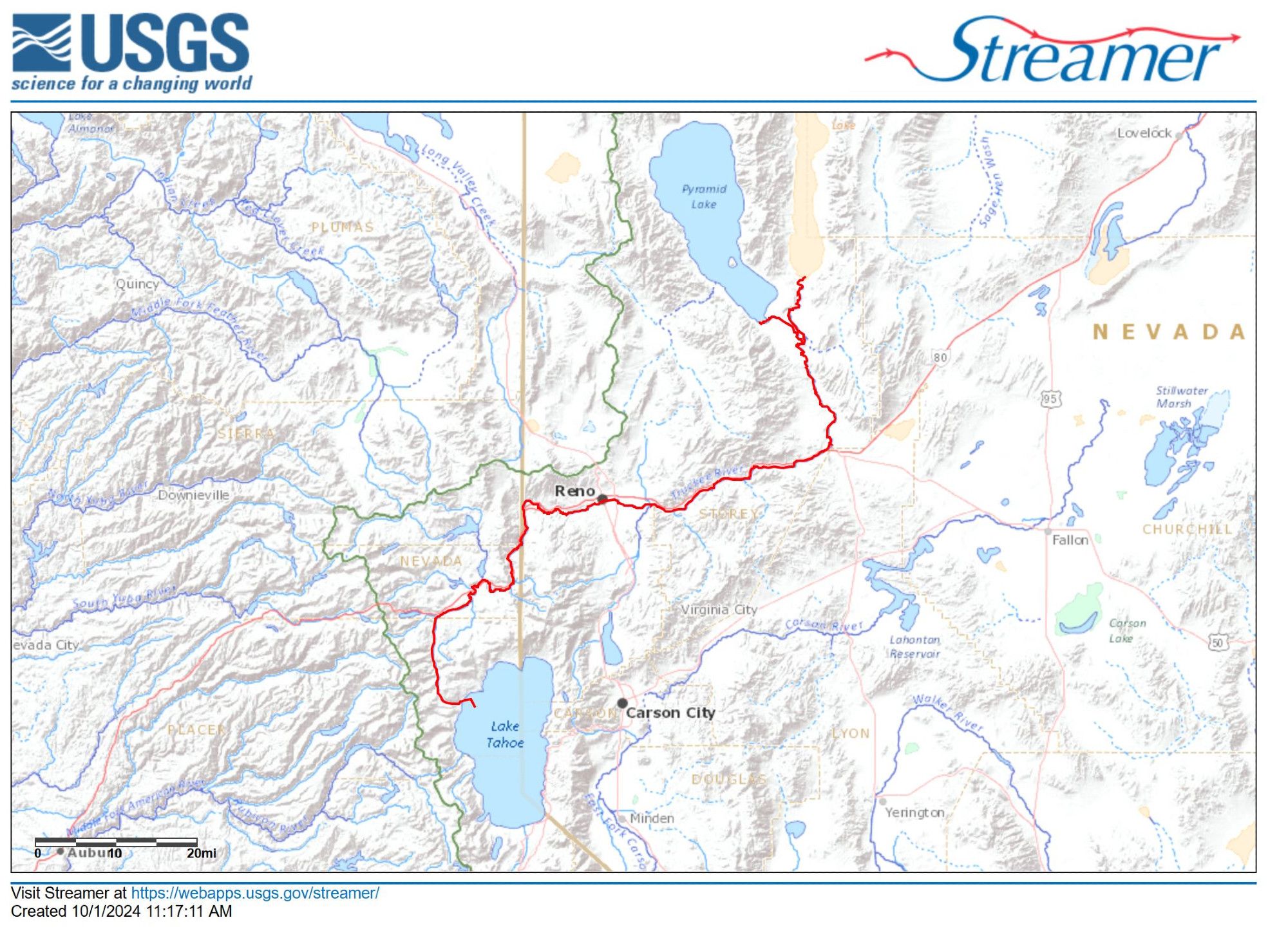
Happy New Year, ya water nerds! From my watershed to yours, wishing you normal seasonal hydrographs, uses always beneficial & in-stream flows for ecosystem biodiversity. From the lacustrine twins, montane Lake Tahoe to endorheic Pyramid Lake, connected by 120 miles of Truckee River. #WaterYear