BLUE
CSyegwxnerdery.bsky.social

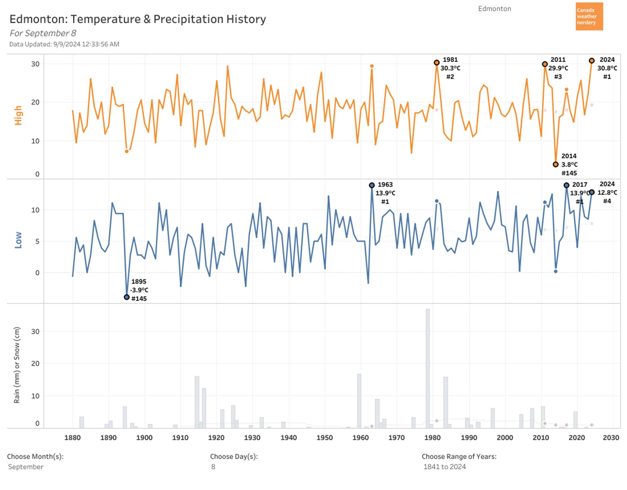
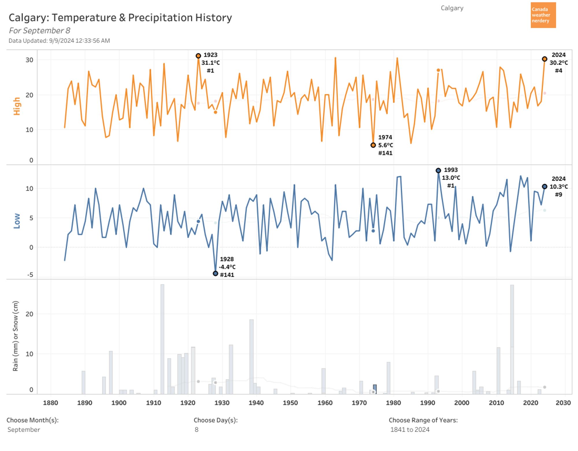
September 8th gets a new record High of 30.8°C in Edmonton, ahead of 1981's 30.3°C. #yegwx#yycwxpublic.tableau.com/shared/SPTSB...

1
CSyegwxnerdery.bsky.social

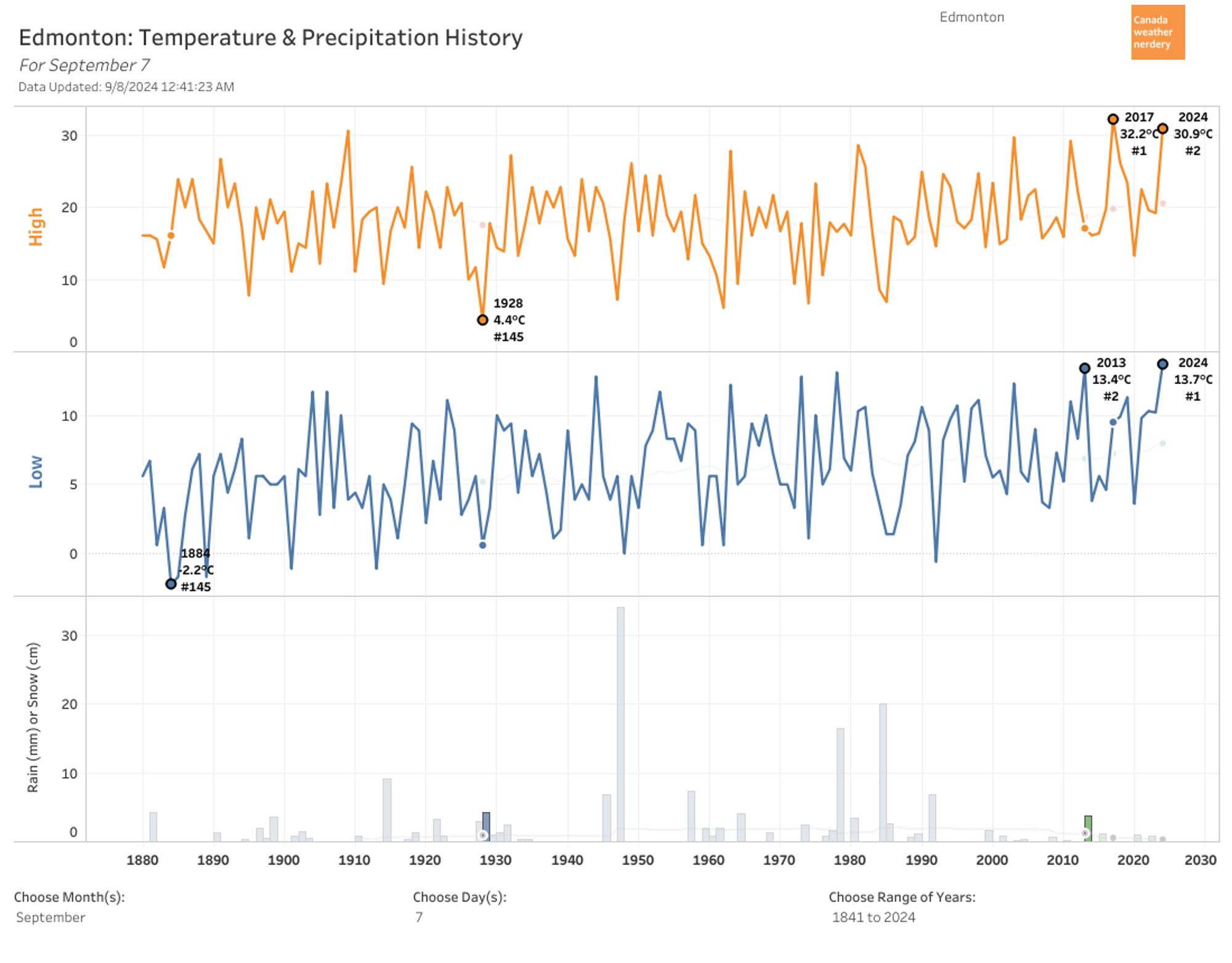
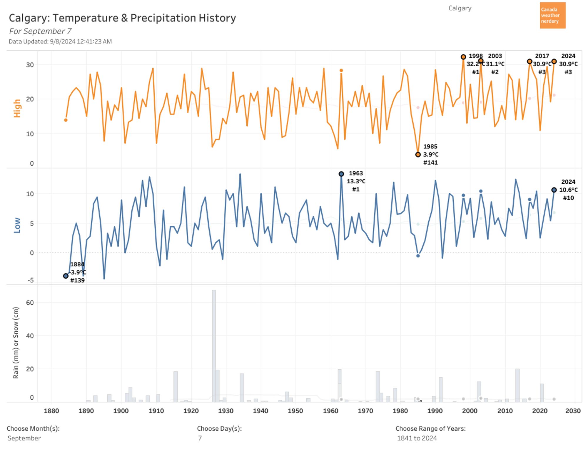
September 7th's High of 30.9°C was Edmonton's 2nd warmest on record, behind 2017's 32.2°C. #yegwx#yycwxpublic.tableau.com/shared/S4N4K...

1
CSyegwxnerdery.bsky.social

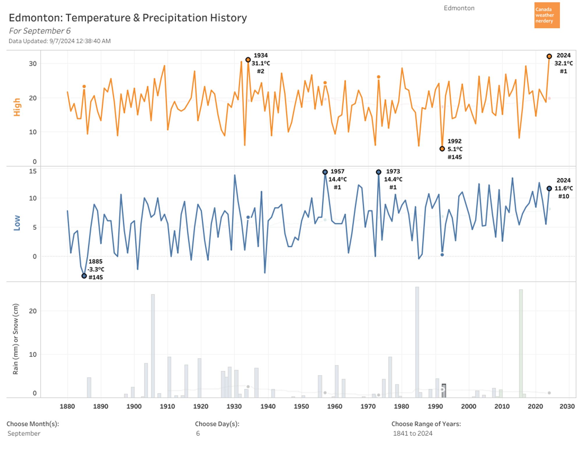
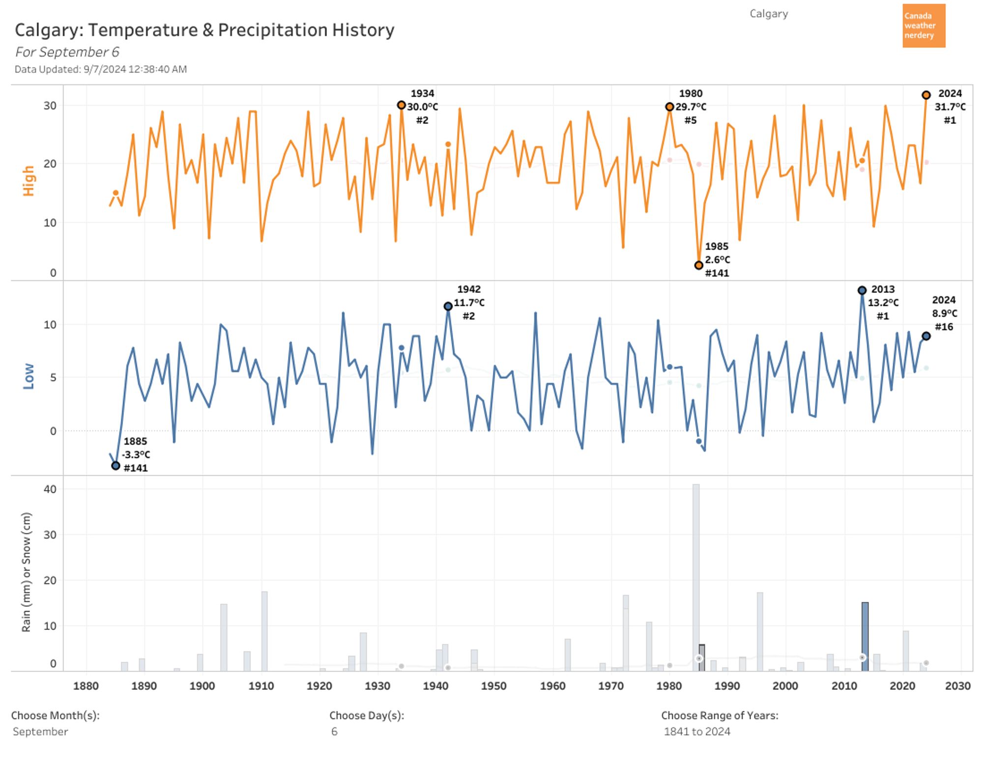
September 6th gets a new record High of 32.1°C in Edmonton, ahead of 31.1°C from 1934. And Calgary's 31.7°C breaks their old record of 30°C from 2003 & 1934... public.tableau.com/shared/DZCWG...#yegwx#yycwx#yycweather

1
Aalisonborealis.bsky.social

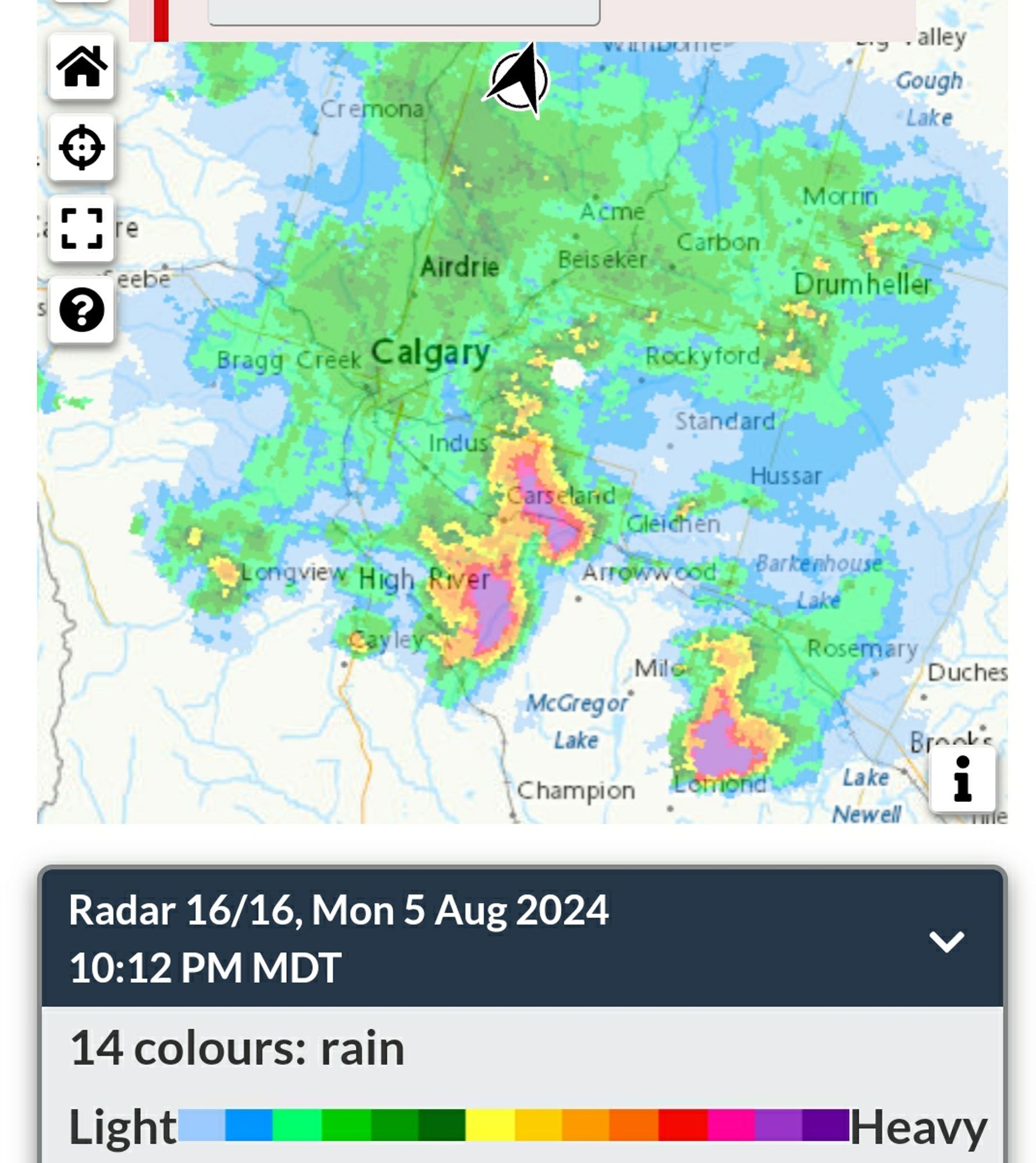
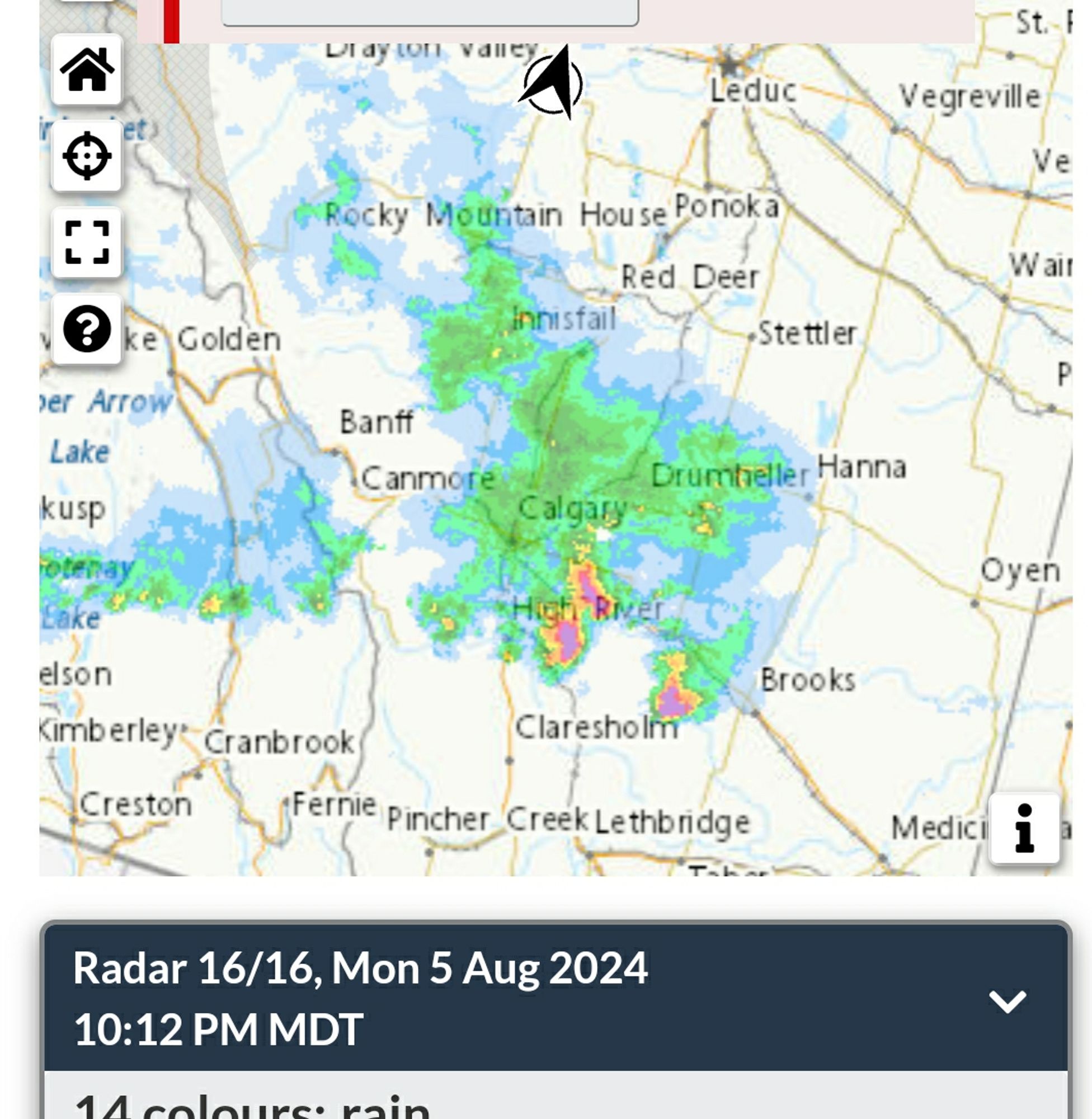
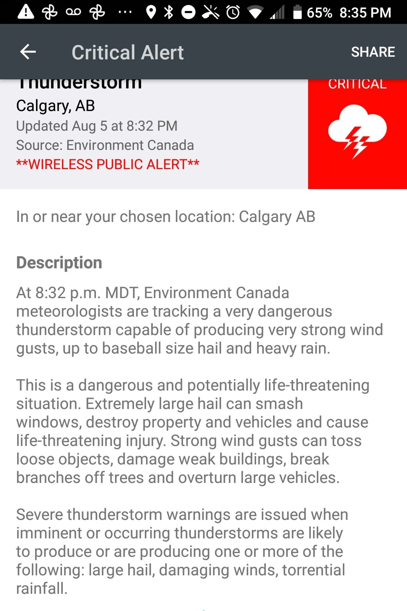
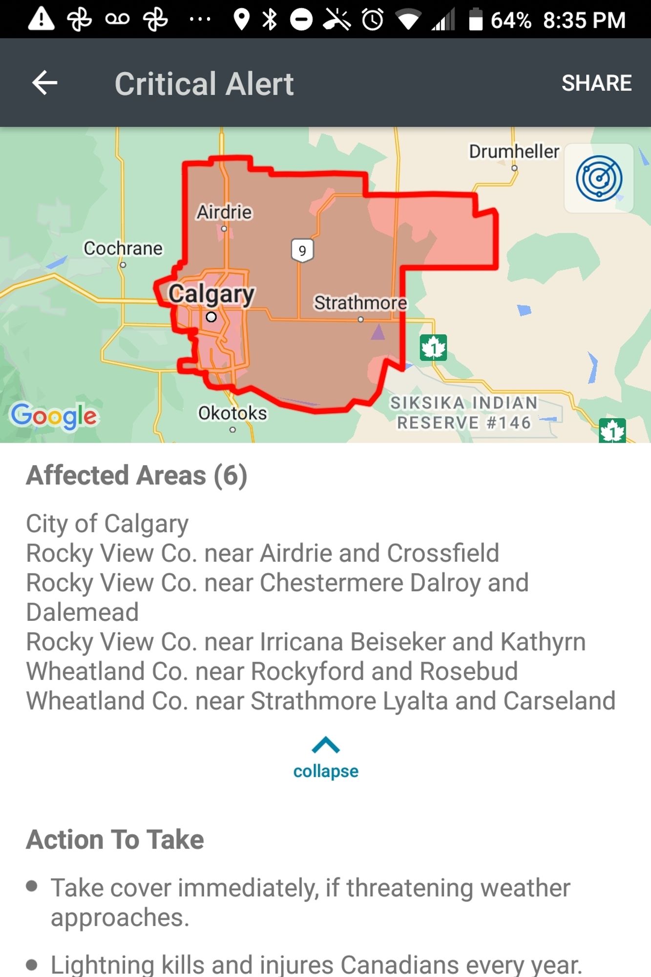
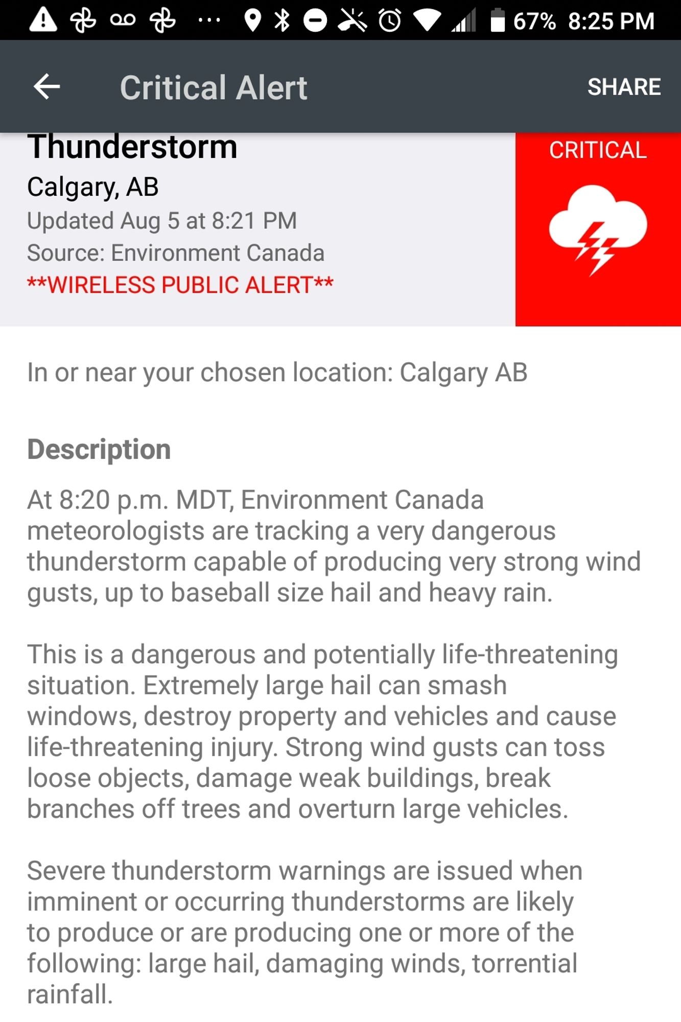
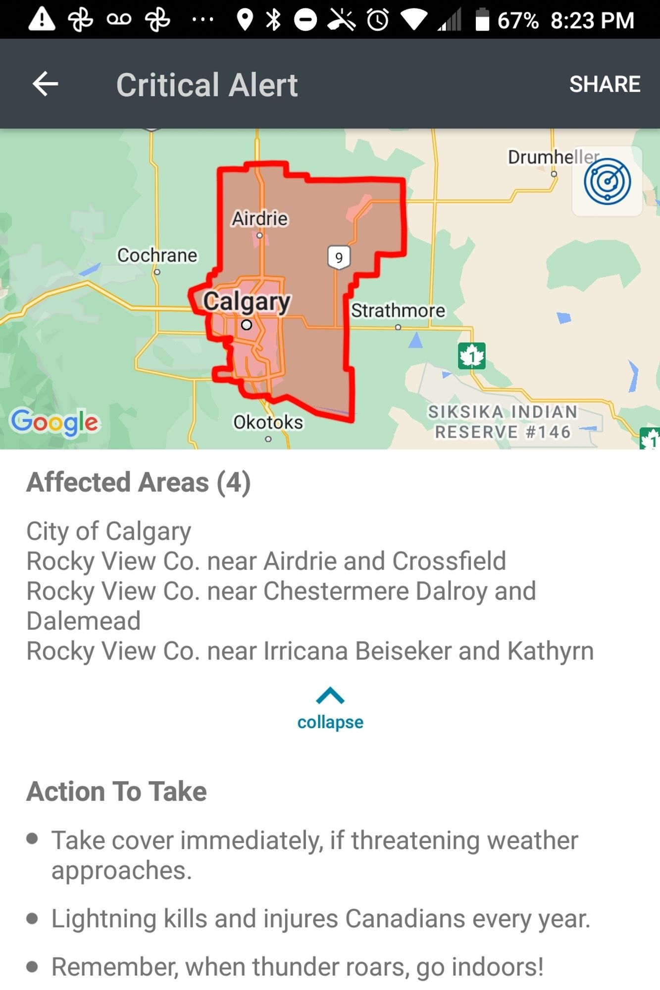
The storm warning remains in effect (though it has been reduced on environment Canada's Calgary page to a watch weather.gc.ca#yyc#yycwx#abstorm

A zoomed-in radar map of the Calgary area, showing the extent of the storm and its biggest storm cells.

The storm system extends over most of the frame, from Cremona in the NW, Bragg Creek and Longview in the SW to Drumheller in the NE and Rosemary and Lake Newell in the SW.

Storm cells with heavy precipitation are located over Carseland, Gleichen and Arrow Wood, east of High River over McGregor Lake, and east of Lomond and Milo, headed towards Rosemary.
A more zoomed-out radar map of the Calgary-southern Alberta area shows that this storm system stretches from Drayton Valley - Rocky Mountain House in the NW to almost Brooks in the SE.

The heaviest precipitation is falling in the south, headed eastward towards Brooks, north of Claresholm.

More precipitation is moving into Alberta from SE BC in a horizontal line from Nakusp and Kootenay Lake towards the Calgary area (if it crosses the Rockies)
0
Aalisonborealis.bsky.social

This is a fast-moving storm. Updated again. #yyc#yycwx#abstorm

Critical alert
Thunderstorm
Calgary AB
Updated Aug 5 at 8:32pm

At 8:32pm MDT environment canada meteorologists are tracking a very dangerous thunderstorm capable of producing very strong wind gusts, up to baseball-sized hail and heavy rain.

This is a dangerous and potentially life-threatening situation. Extremely large hail can smash windows, destroy property and vehicles and cause life-threatening injuries. Strong wind gusts can toss loose objects, damage weak buildings, break branches off trees and overturn large vehicles.

Severe thunderstorm warnings are issued when imminent or occurring thunderstorms are likely to produce or are producing one or more of the following: large hail, damaging winds, torrential rainfall.
Updated map of affected area: calgary, areas north and east of Calgary extending past Airdrie and eastwards to include Strathmore and just south of Drumheller.

Affected areas (6)
City of Calgary
Rocky view Co near Airdrie and Crossfield
Rocky view Co near Chestermere Dalroy and Dalemead
Rockyview Co near Irricana Deiseker and Kathryn
Wheatland Co near Rockyford and Rosebud
Wheatland Co near Strathmore Lyalta and Carseland

Action to take 
Take cover immediately if threatening weather approaches
Lightning kills and injures Canadians every year
When thunder roars, go indoors.
1
Aalisonborealis.bsky.social

Updated #yycwx#yyc#abstorm Baseball-sized hail still possible. Stay inside. Storm moving east.

Critical alert
Thunderstorm
Calgary AB
Updated Aug 5 at 8:21pm

At 8:20pm MDT environment canada meteorologists are tracking a very dangerous thunderstorm capable of producing very strong wind gusts, up to baseball-sized hail and heavy rain.

This is a dangerous and potentially life-threatening situation. Extremely large hail can smash windows, destroy property and vehicles and cause life-threatening injuries. Strong wind gusts can toss loose objects, damage weak buildings, break branches off trees and overturn large vehicles.

Severe thunderstorm warnings are issued when imminent or occurring thunderstorms are likely to produce or are producing one or more of the following: large hail, damaging winds, torrential rainfall.
Map of Calgary and area including Airdrie, areas north and east of Calgary.

Affected areas (4)
City od Calgary
Rocky View Co near Airdrie and Crossfield
Rocky View Co near Chestermere, Dalroy and Dalemead
Rocky View Co near Irricana, Beiseker, and Kathryn

Action to take
Take cover immediately if threatening weather approaches.
Lightning kills and injures Canadians every year.
Remember, when thunder roars, go indoors!
1
DSwatershedlab.bsky.social

Baseball size hail. Buckle up. #YYCwx

3
Ccindylouwho2.com

23 degrees at midnight is a bit warm for Calgary, not to mention that it's 27 with the humidex. Really tough for folks without AC. #yyc#yycwx

Weather report, showing 23 C at midnight in Calgary.
1
Ccindylouwho2.com

just had pea-sized hail in the Beltline during this thunderstorm. Happy Stampede! #Calgary#yycwx#CalgaryStampede

0