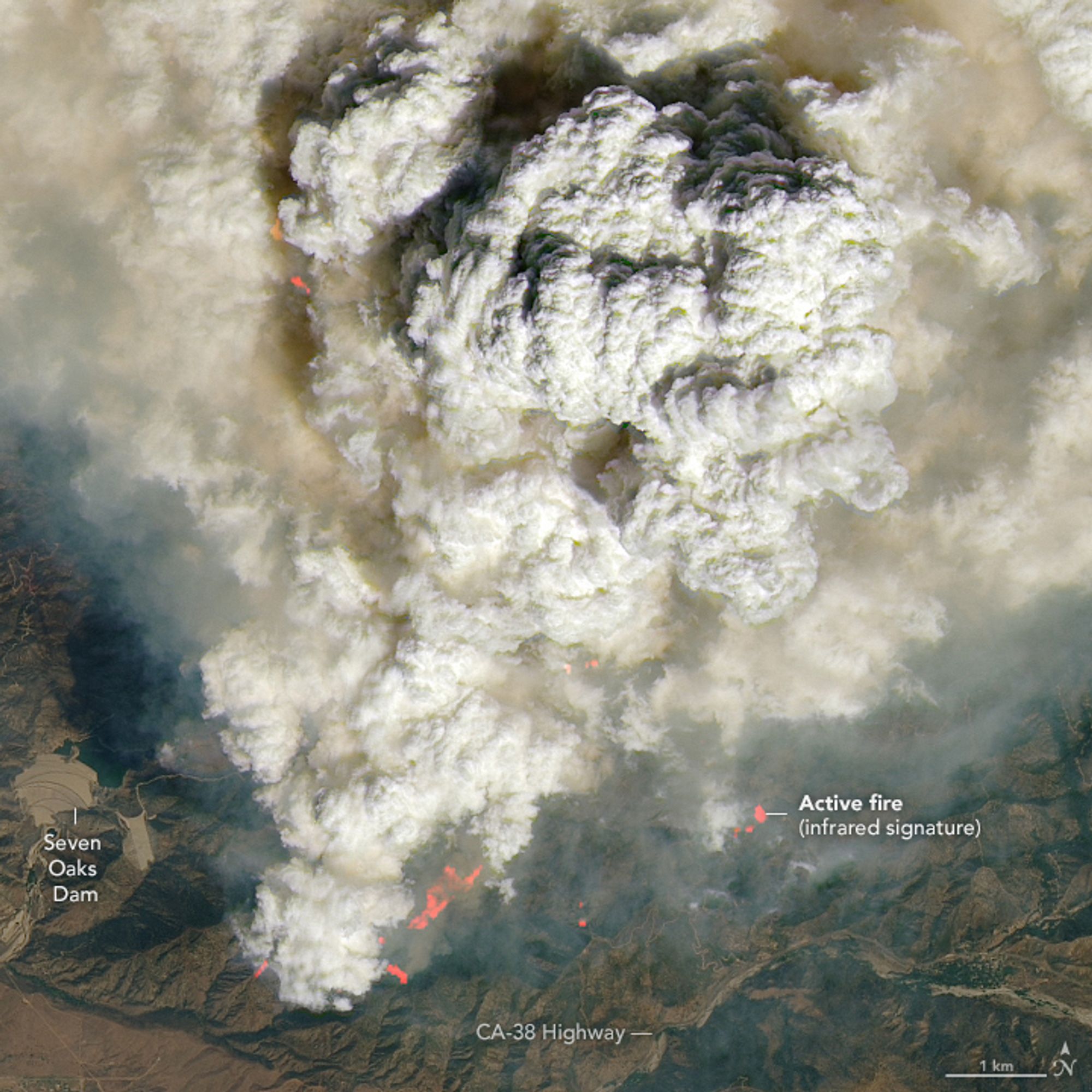
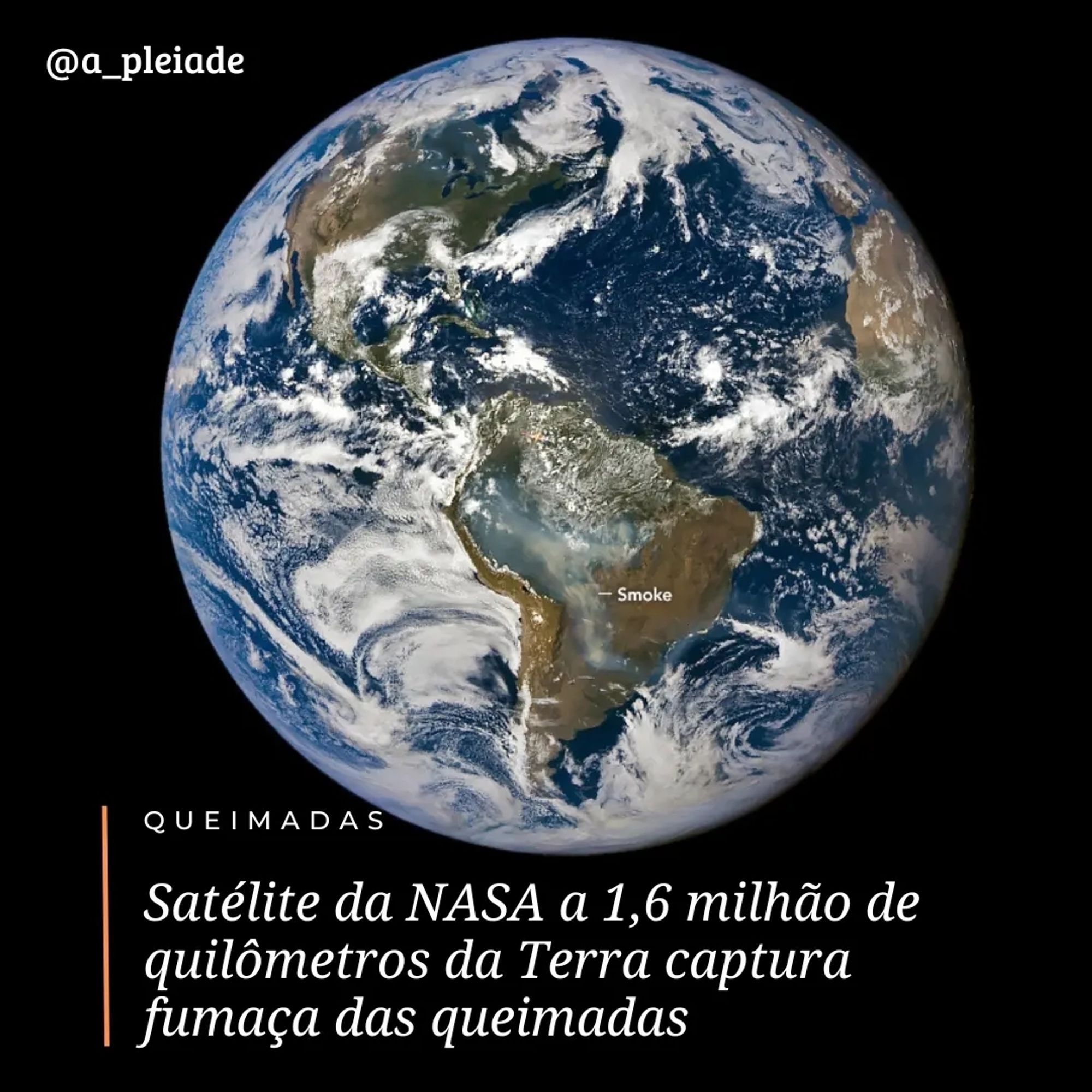
A cerca de 1,6 milhão de quilômetros de distância da Terra, o gerador de imagens EPIC (Earth Polychromatic Imaging Camera) da NASA no satélite DSCOVR (Deep Space Climate Observatory) capturou esta imagem da fumaça saindo das chamas em 3 de setembro de 2024.
I love seeing NASA Earth Observatory images showing up in places like NPR! Satellite images show Helene’s devastation is visible from space www.npr.org/2024/10/04/n...
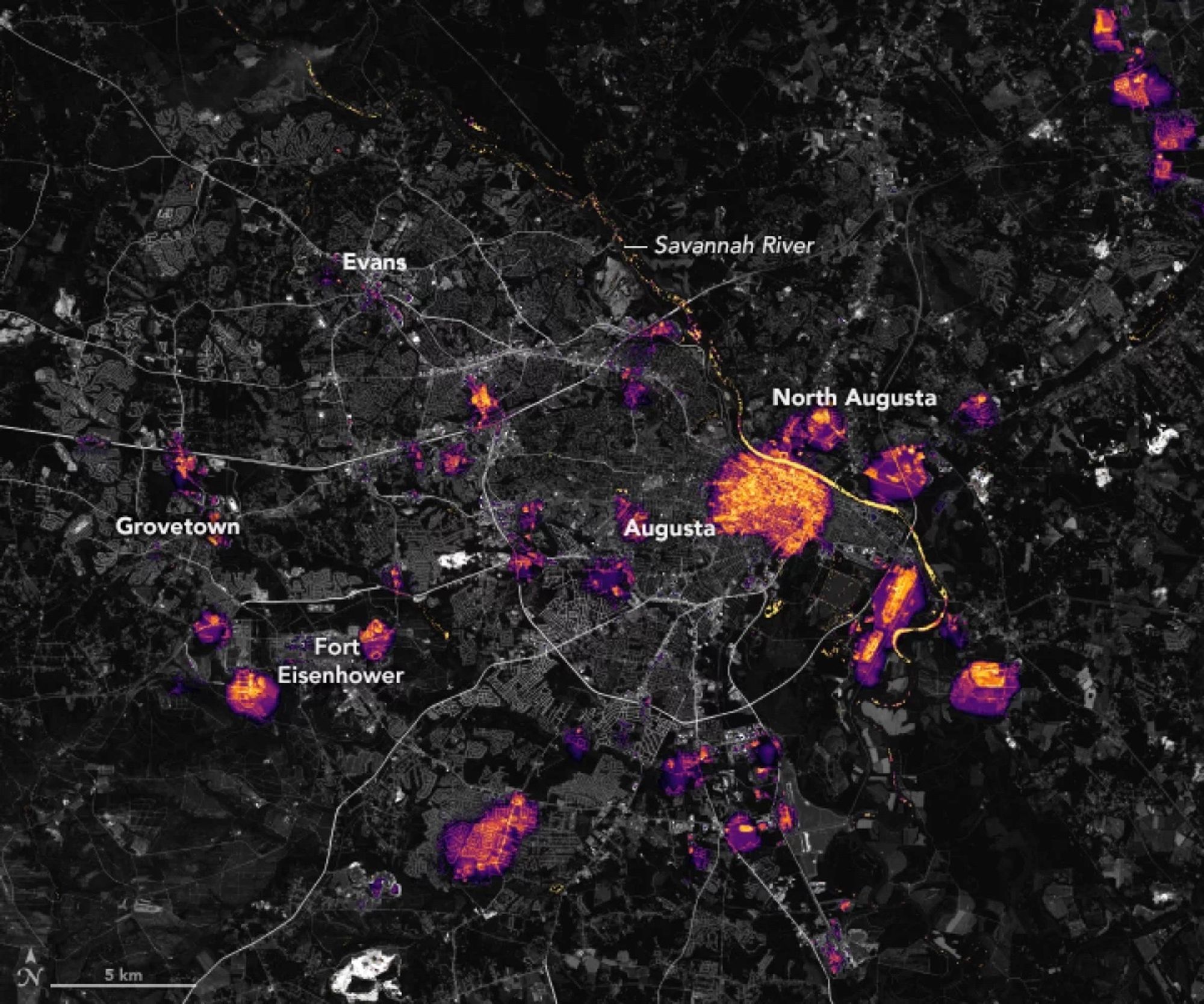
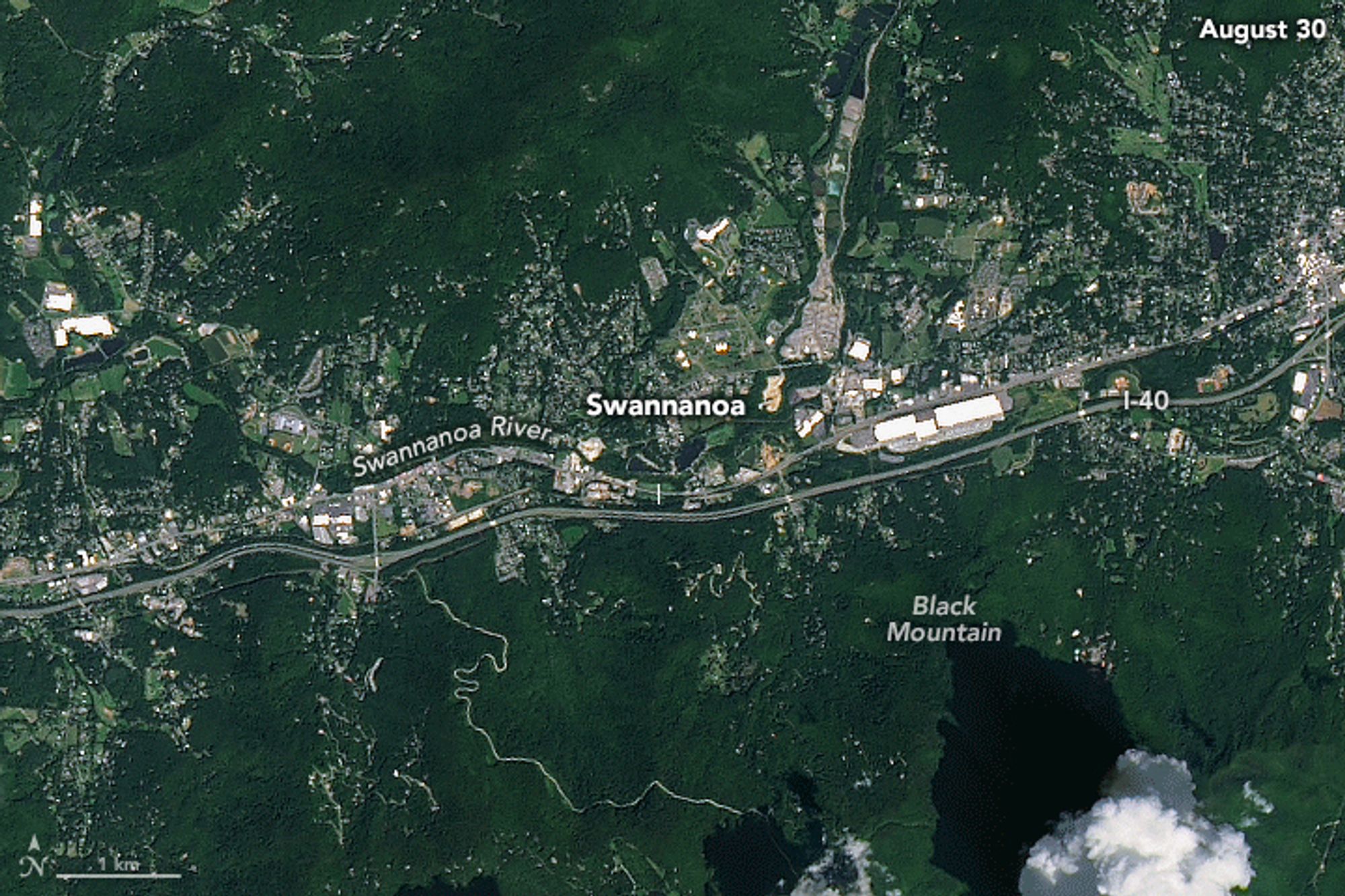
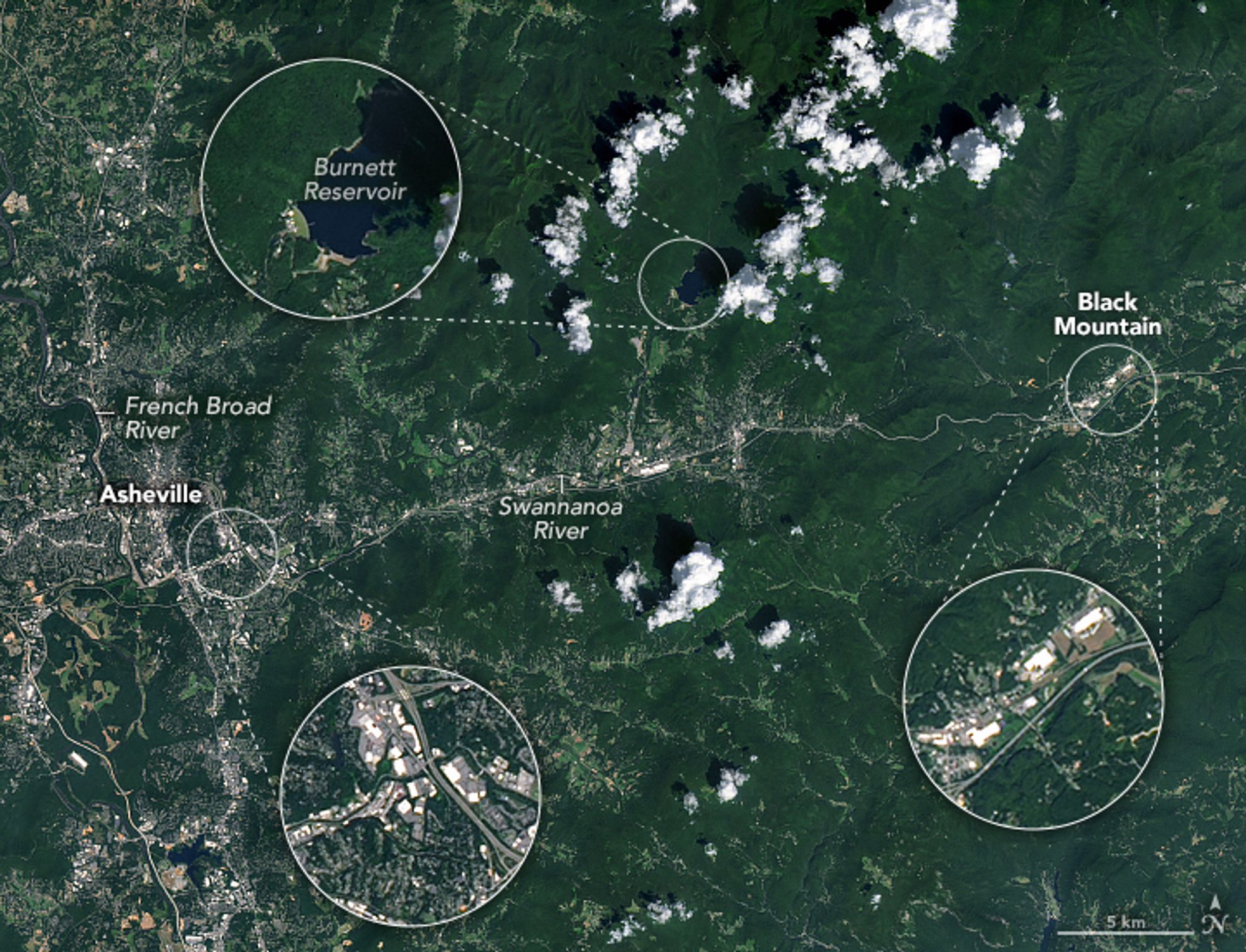
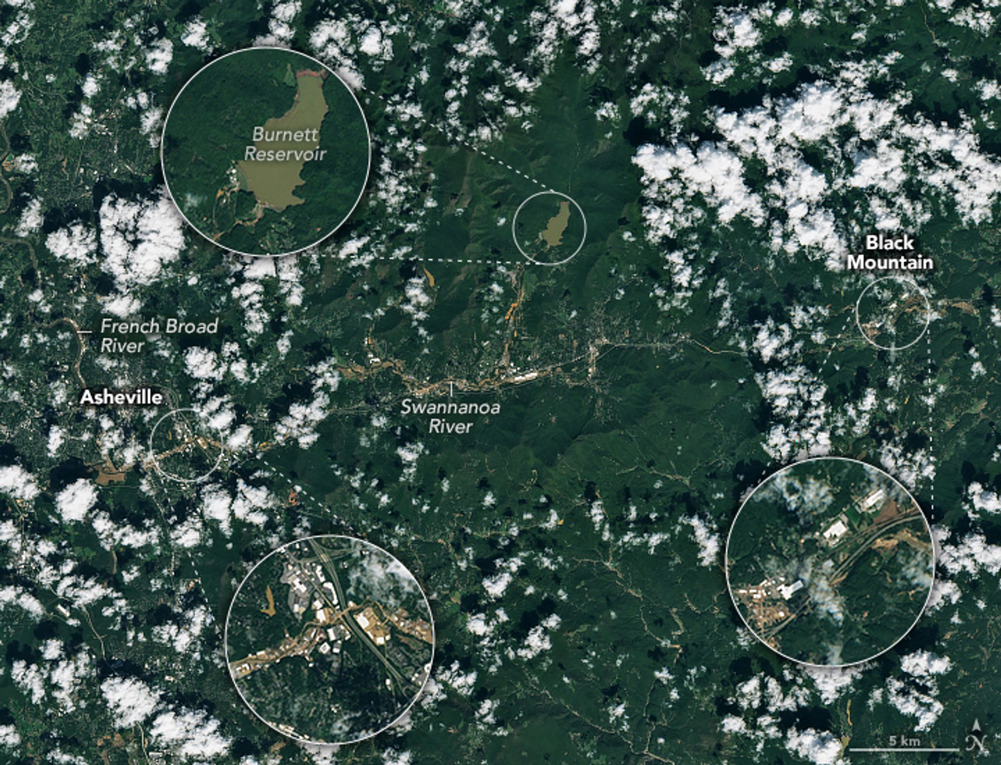
Before and after flash floods swamped western North Carolina. earthobservatory.nasa.gov/images/15341...#Asheville#BlackMountain#Swannanoa
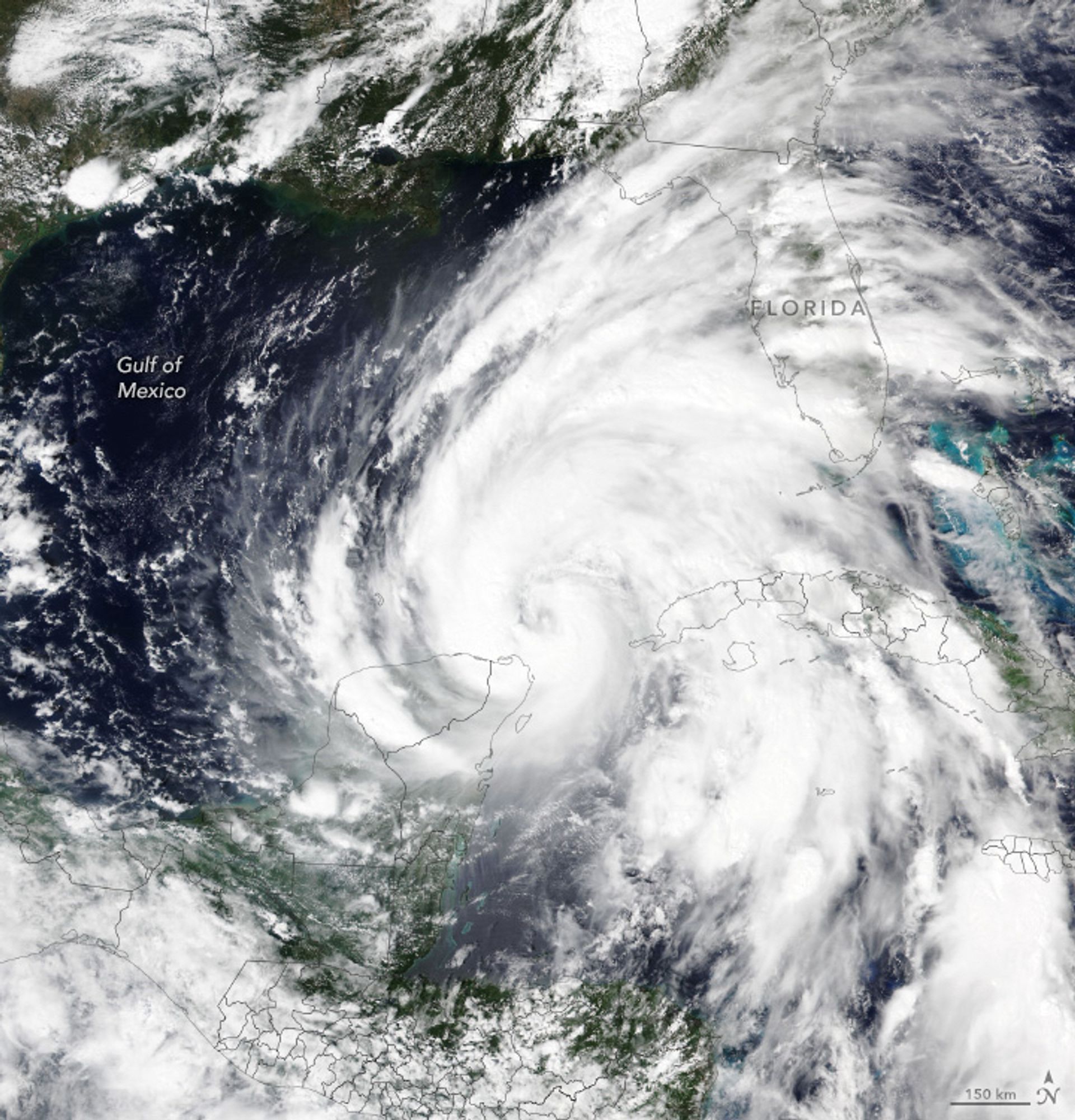
Warm water from the Loop Current helped fuel #Helene#Florida’searthobservatory.nasa.gov/images/15337...


And by Sunday I mean September. Jet lag…😅
Quick, where is this? What is this? And what makes it interesting? Our Sunday puzzler is out. earthobservatory.nasa.gov/blogs/earthm... 🛰️
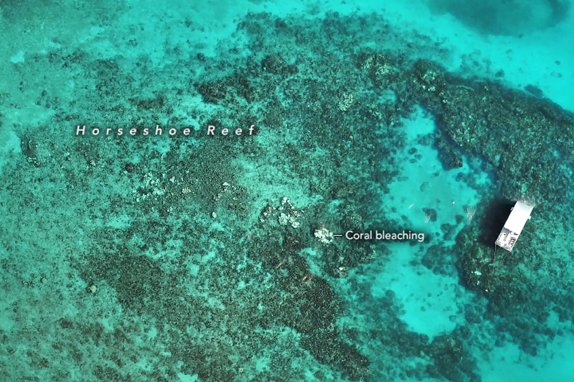
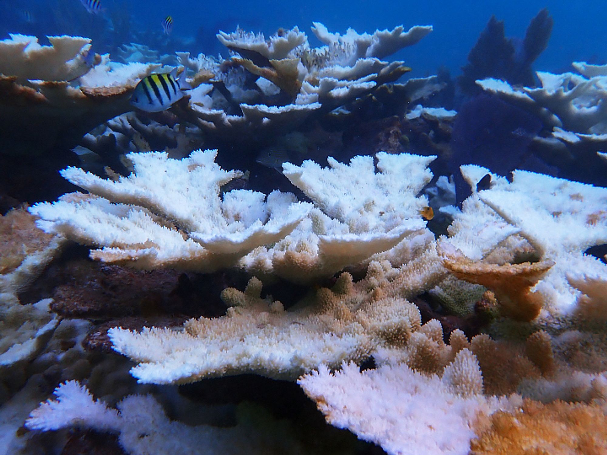
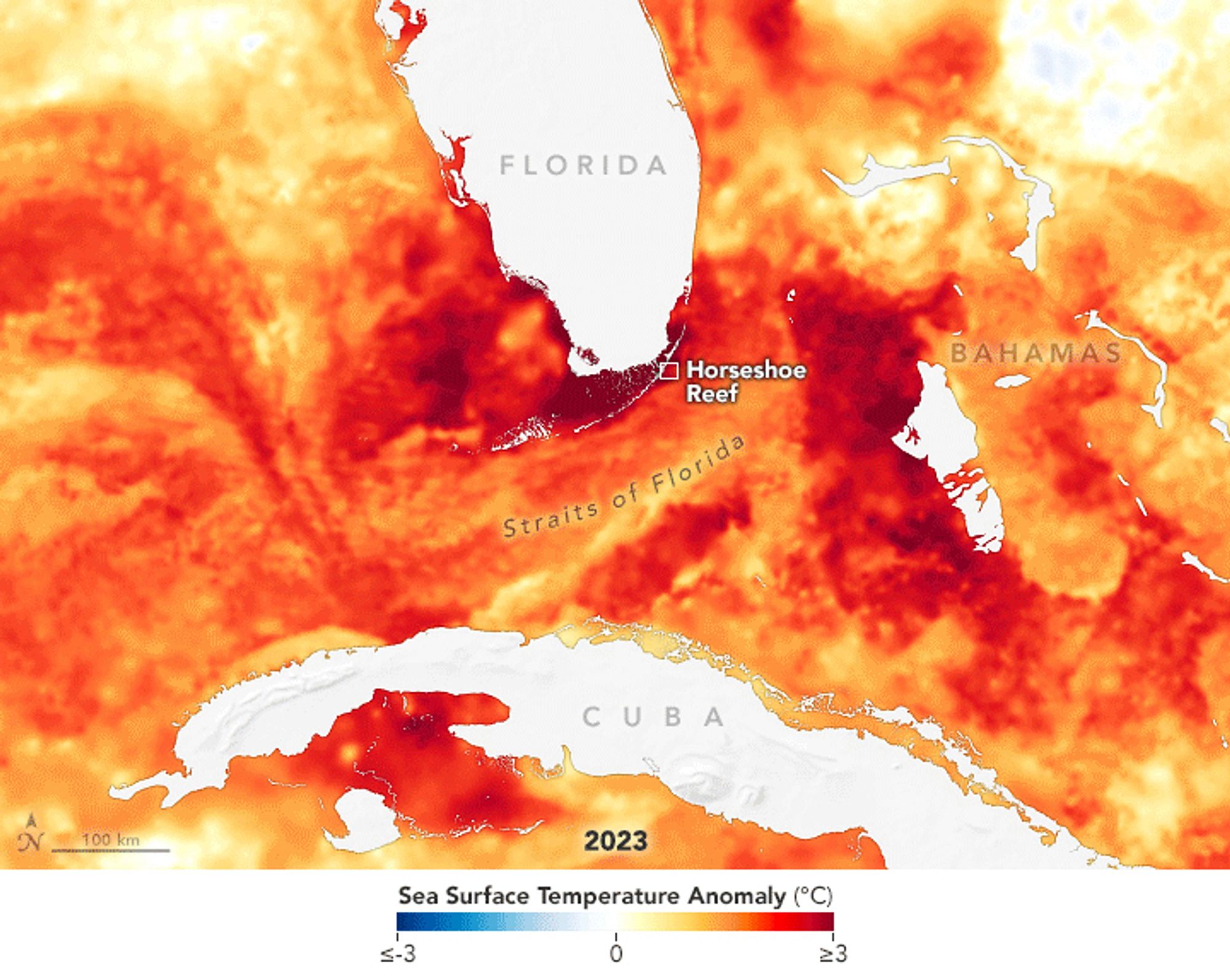
After a brutally hot summer in 2023 that caused widespread bleaching and coral death, summer 2024 was more favorable for Florida’s vulnerable reefs. earthobservatory.nasa.gov/images/15330...