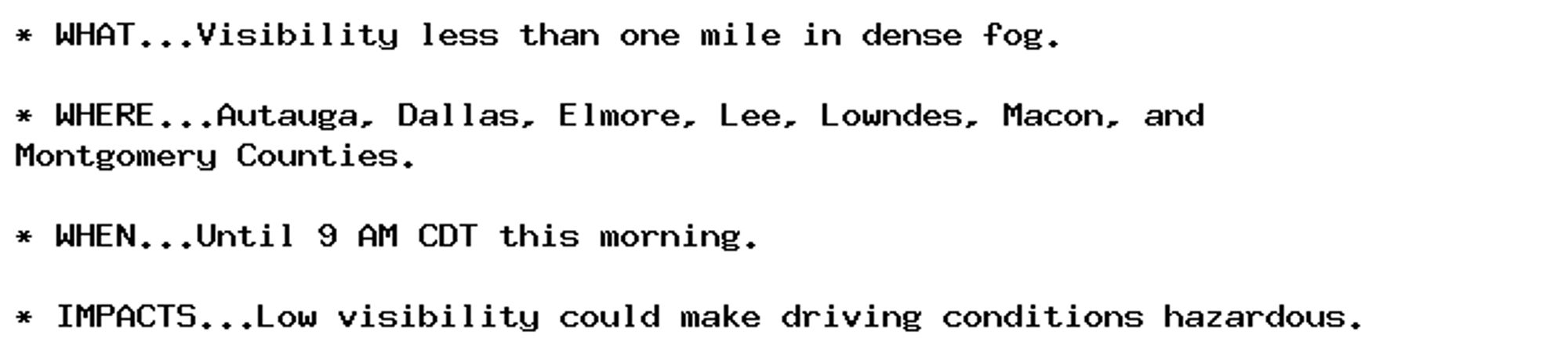
Dense Fog Advisory issued September 30 at 8:19AM CDT until September 30 at 10:00AM CDT by NWS Birmingham AL Additional Details Here.
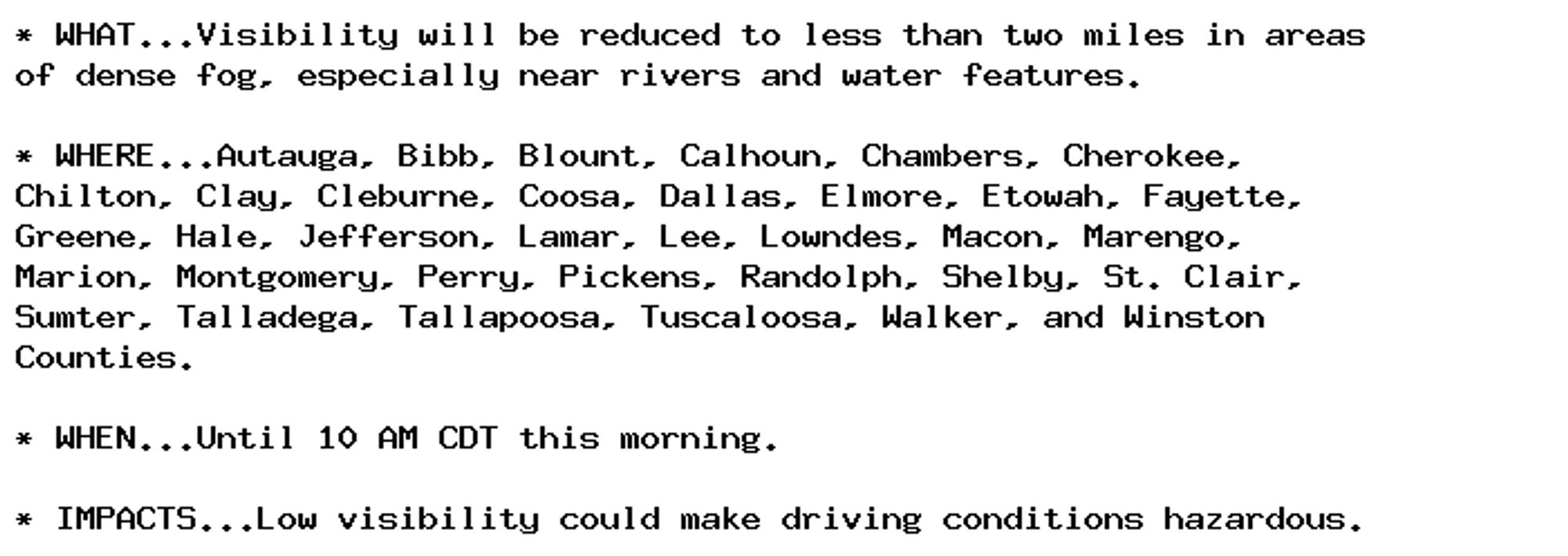
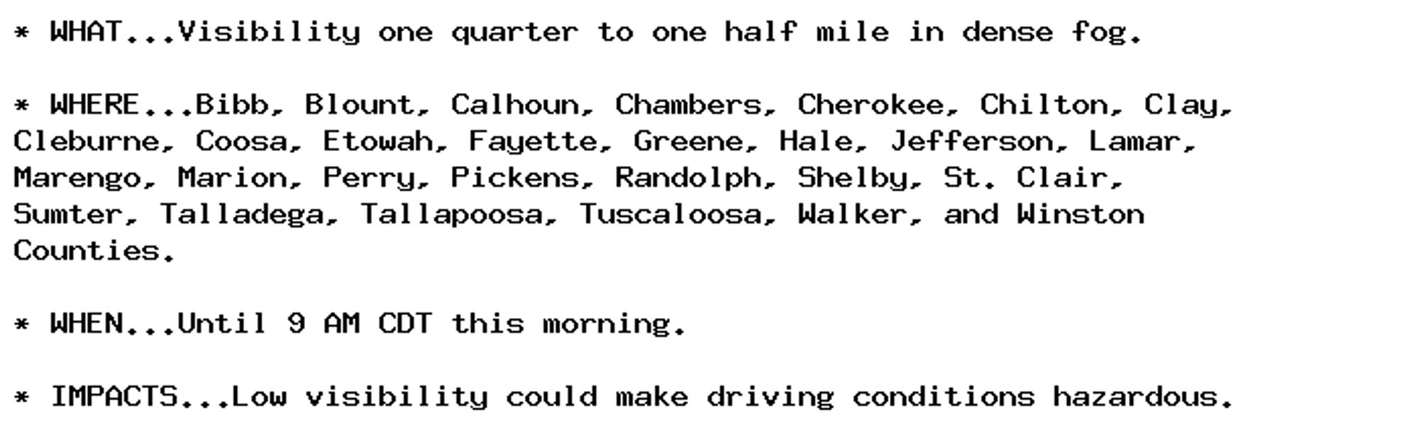
Dense Fog Advisory issued September 30 at 6:26AM CDT until September 30 at 9:00AM CDT by NWS Birmingham AL Additional Details Here.
Dense Fog Advisory issued September 30 at 6:26AM CDT until September 30 at 9:00AM CDT by NWS Birmingham AL Additional Details Here.
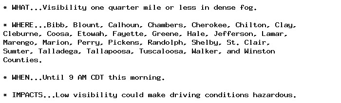
Dense Fog Advisory issued September 30 at 3:16AM CDT until September 30 at 9:00AM CDT by NWS Birmingham AL Additional Details Here.
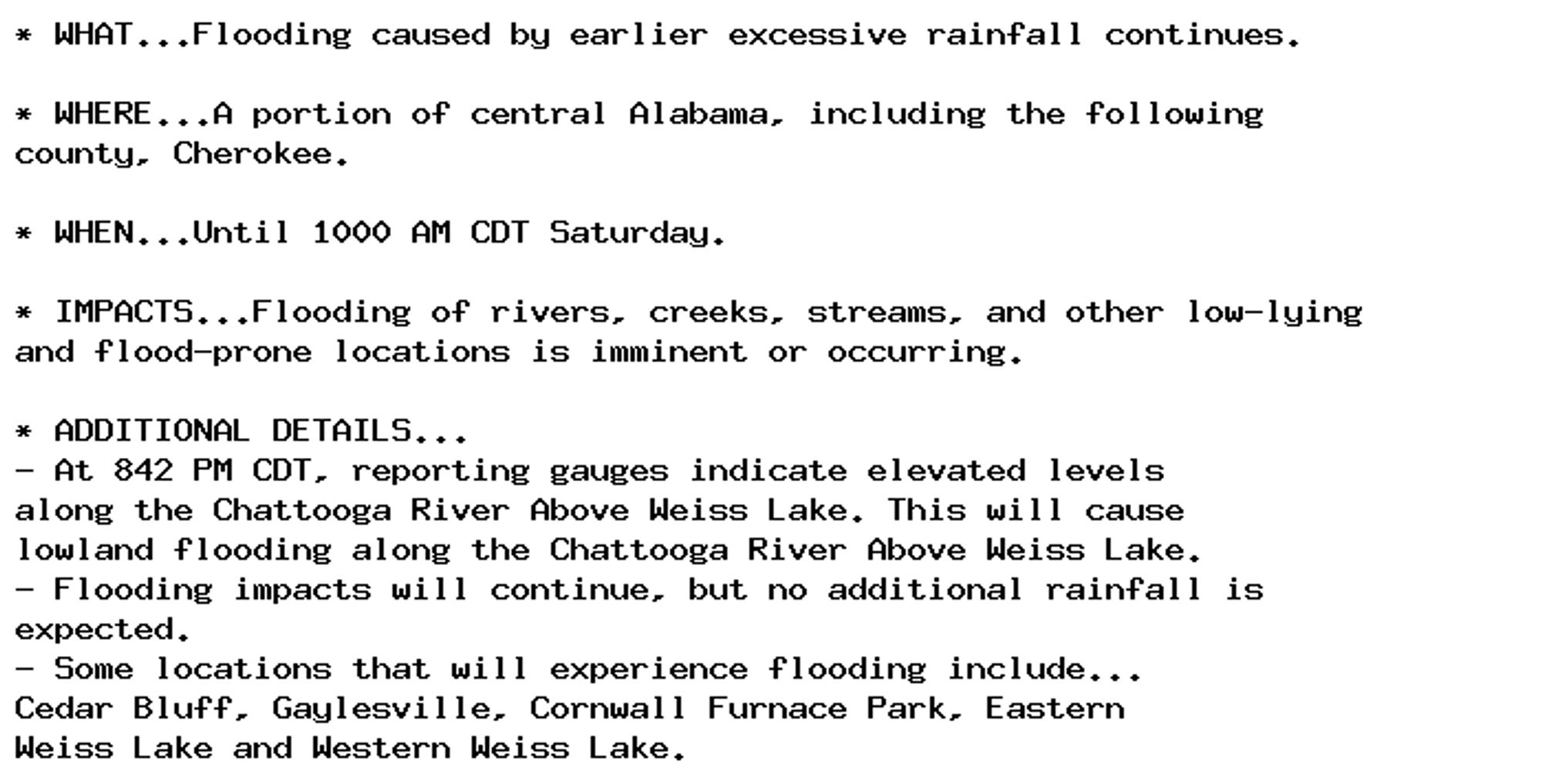
🚨 Flood Warning issued September 27 at 8:42PM CDT until September 28 at 10:00AM CDT by NWS Birmingham AL 🚨 Additional Details Here.
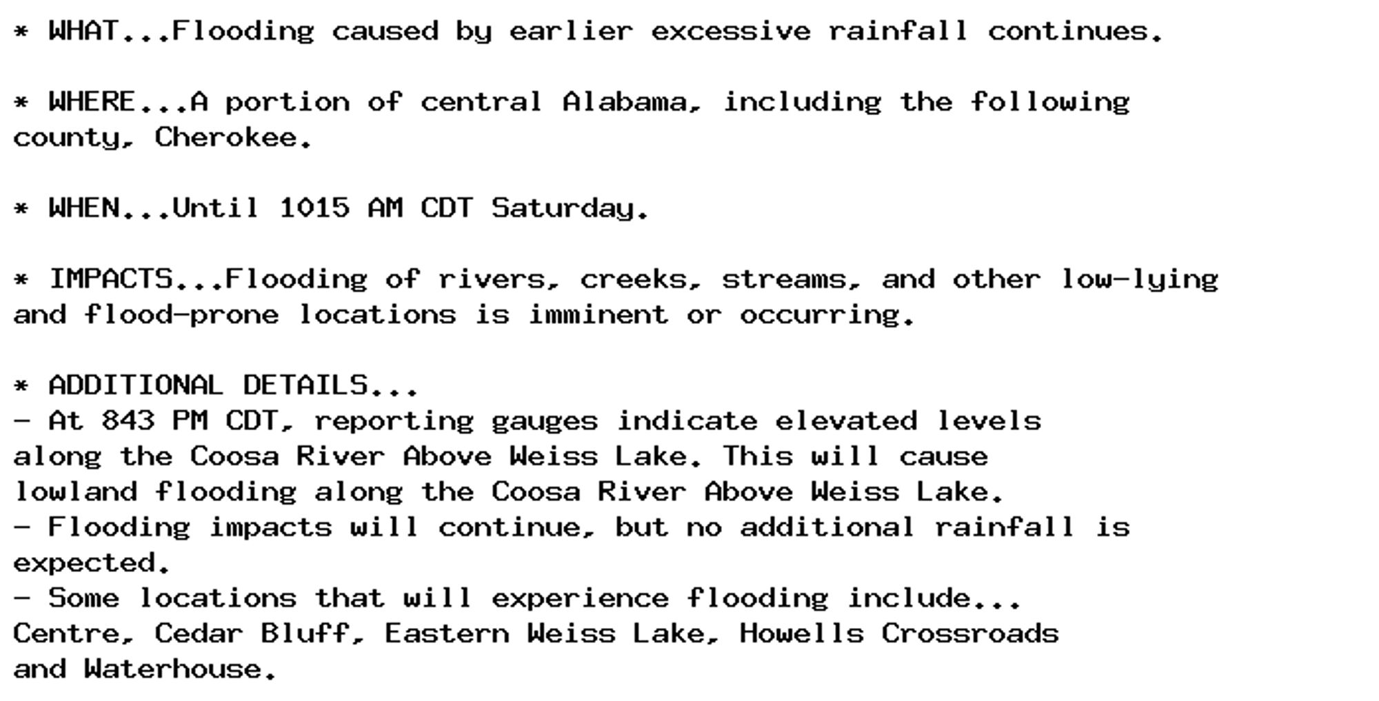
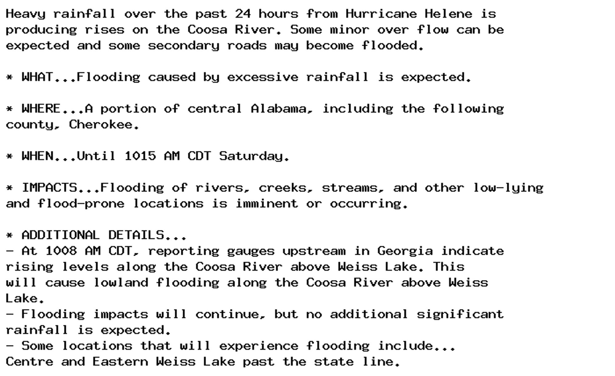
🚨 Flood Warning issued September 27 at 8:43PM CDT until September 28 at 10:15AM CDT by NWS Birmingham AL 🚨 Additional Details Here.
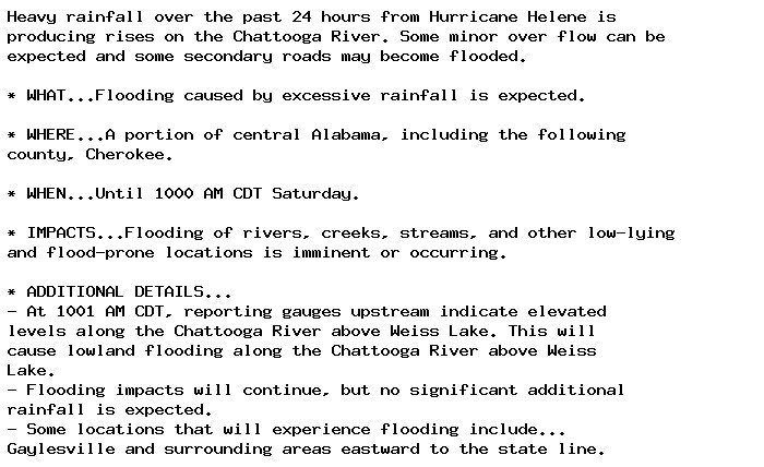
Flood Warning issued September 27 at 10:06AM CDT until September 28 at 10:00AM CDT by NWS Birmingham AL Additional Details Here.
Flood Warning issued September 27 at 10:16AM CDT until September 28 at 10:15AM CDT by NWS Birmingham AL Additional Details Here.
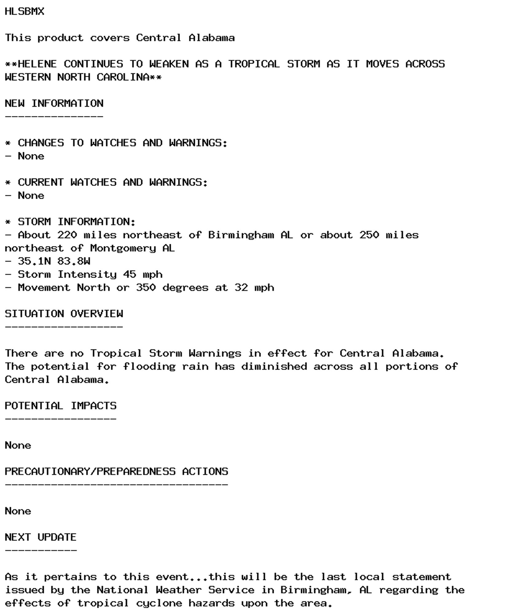
Tropical Cyclone Statement issued September 27 at 11:37AM CDT by NWS Birmingham AL Additional Details Here.
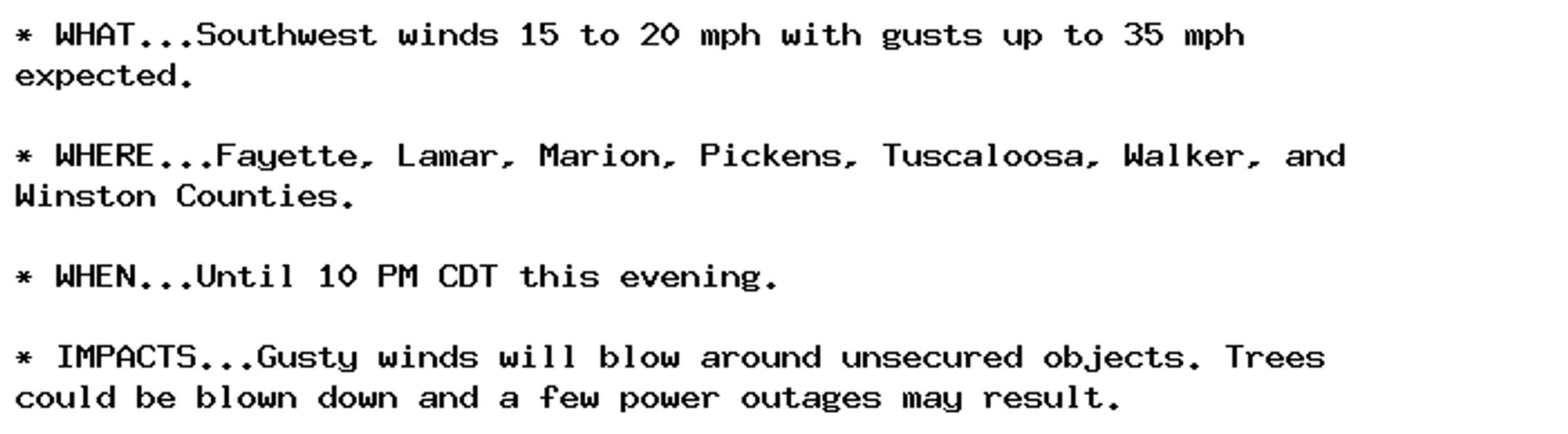
Wind Advisory issued September 27 at 12:05PM CDT until September 27 at 10:00PM CDT by NWS Birmingham AL Additional Details Here.