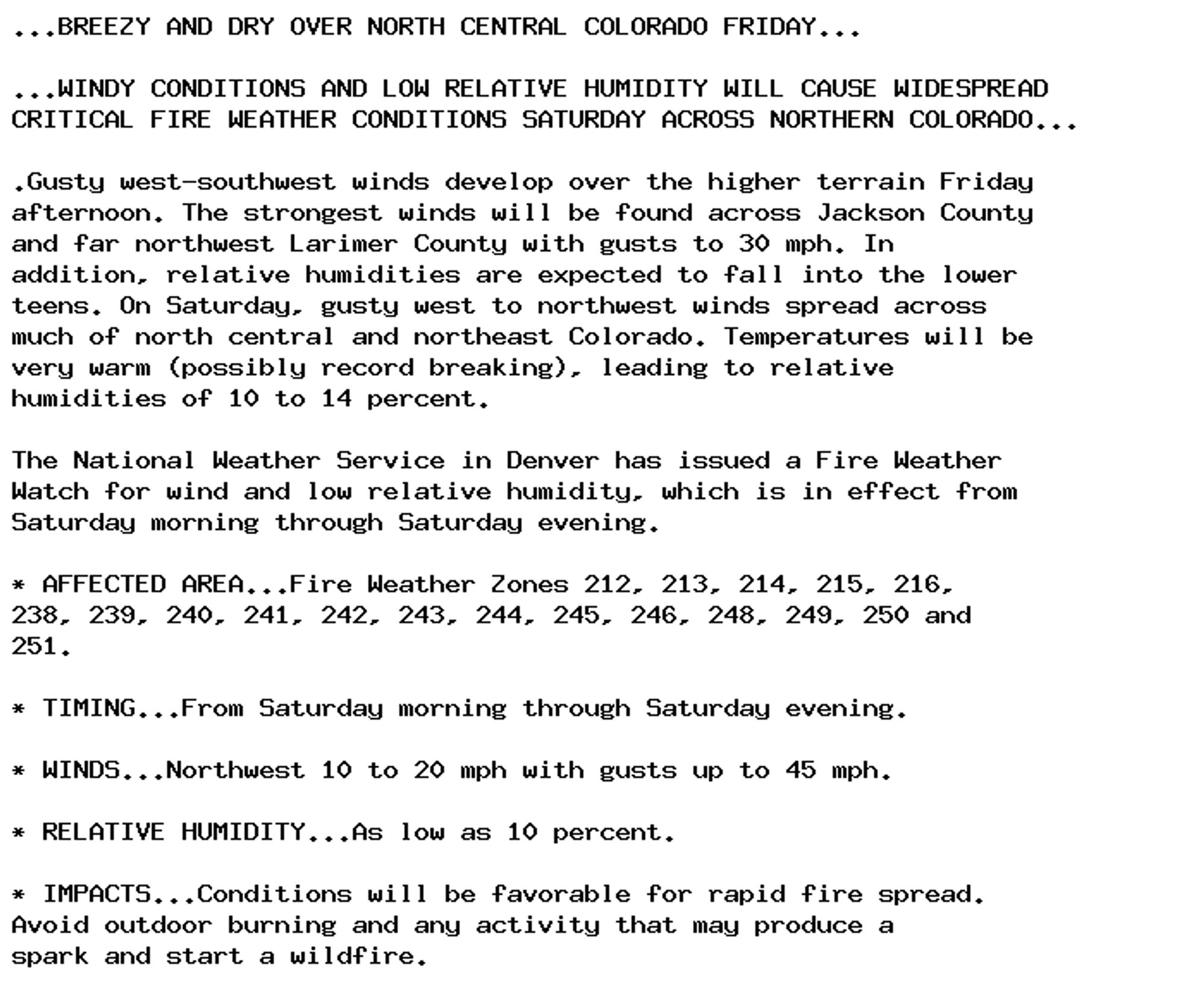
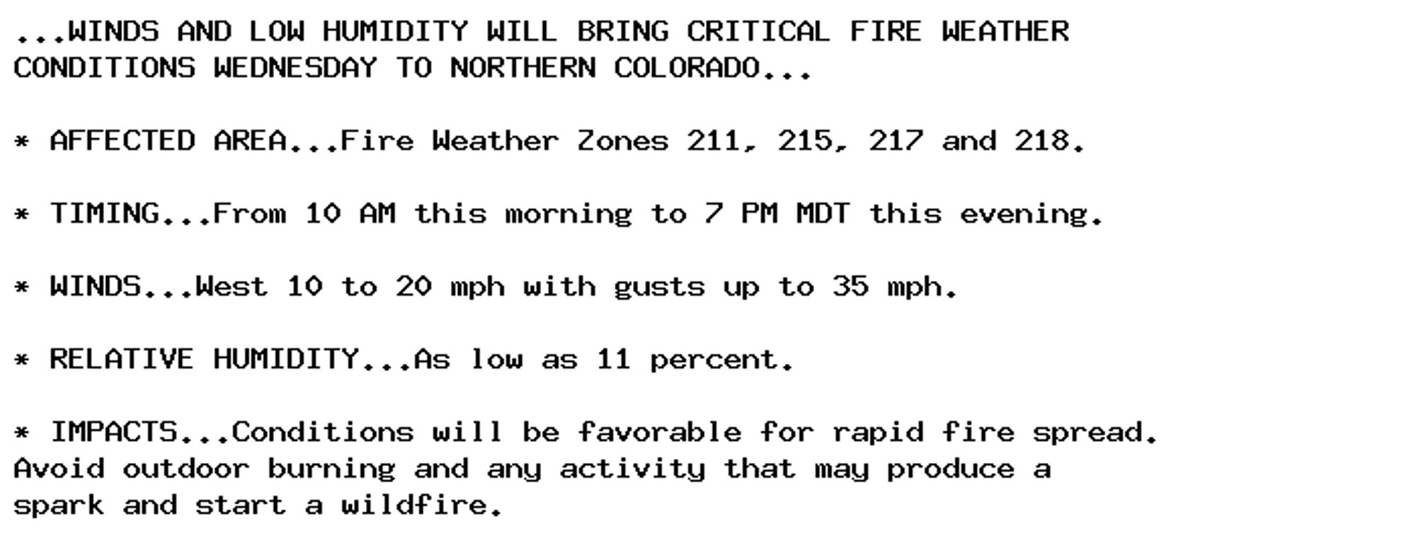
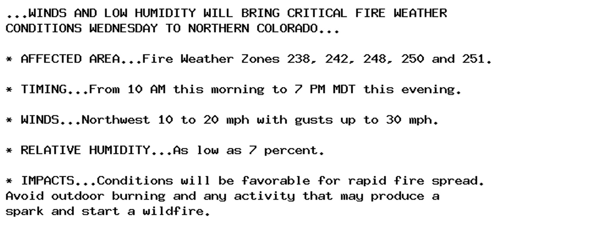
🚨 Fire Weather Watch issued October 3 at 2:18PM MDT until October 5 at 9:00PM MDT by NWS Denver CO 🚨 Additional Details Here.
🚨 Fire Weather Watch issued October 3 at 2:18PM MDT until October 5 at 9:00PM MDT by NWS Denver CO 🚨 Additional Details Here.
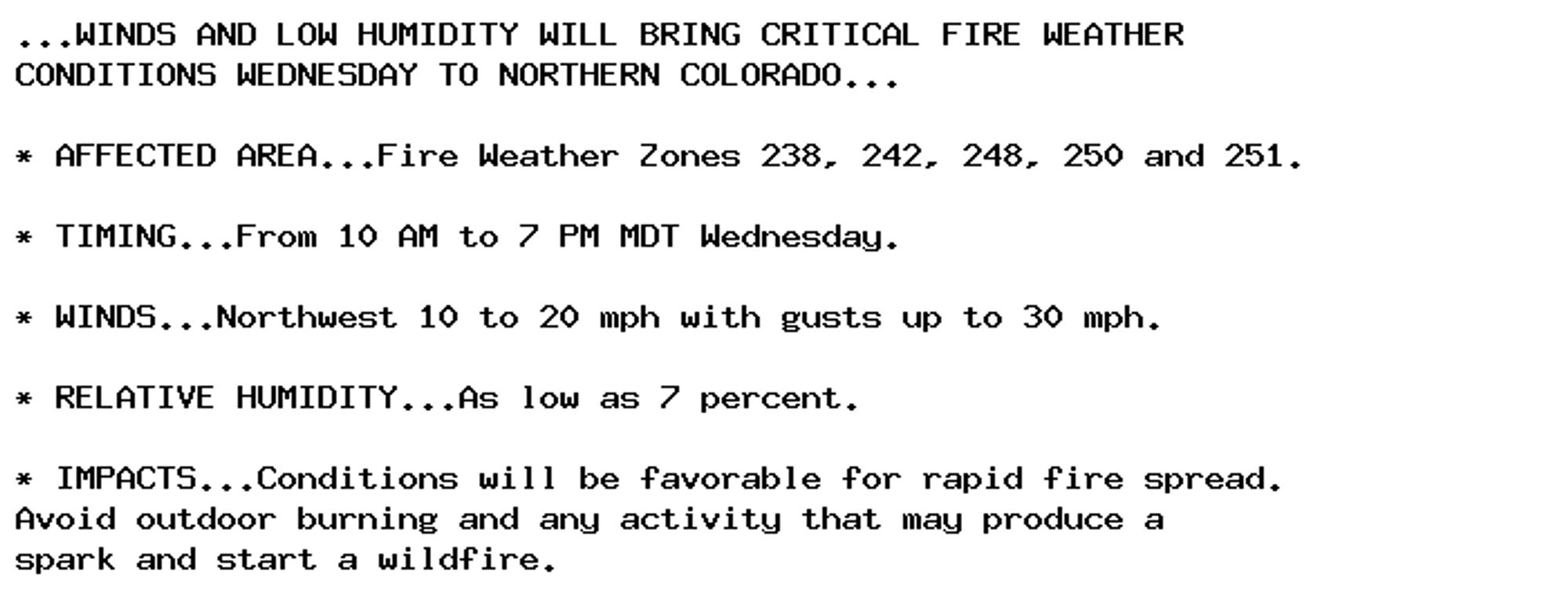
🚨 Red Flag Warning issued October 3 at 2:18PM MDT until October 4 at 7:00PM MDT by NWS Denver CO 🚨 Additional Details Here.
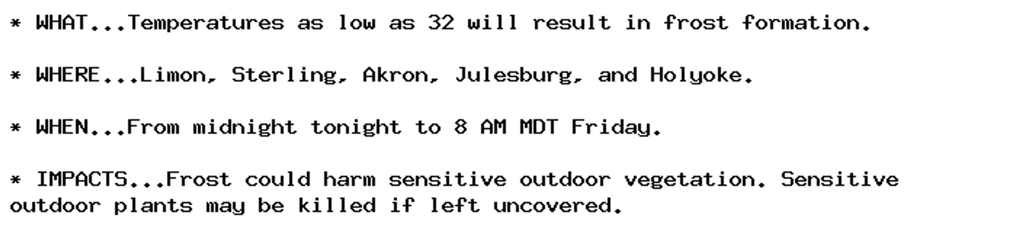
Frost Advisory issued October 3 at 12:38PM MDT until October 4 at 8:00AM MDT by NWS Denver CO Additional Details Here.
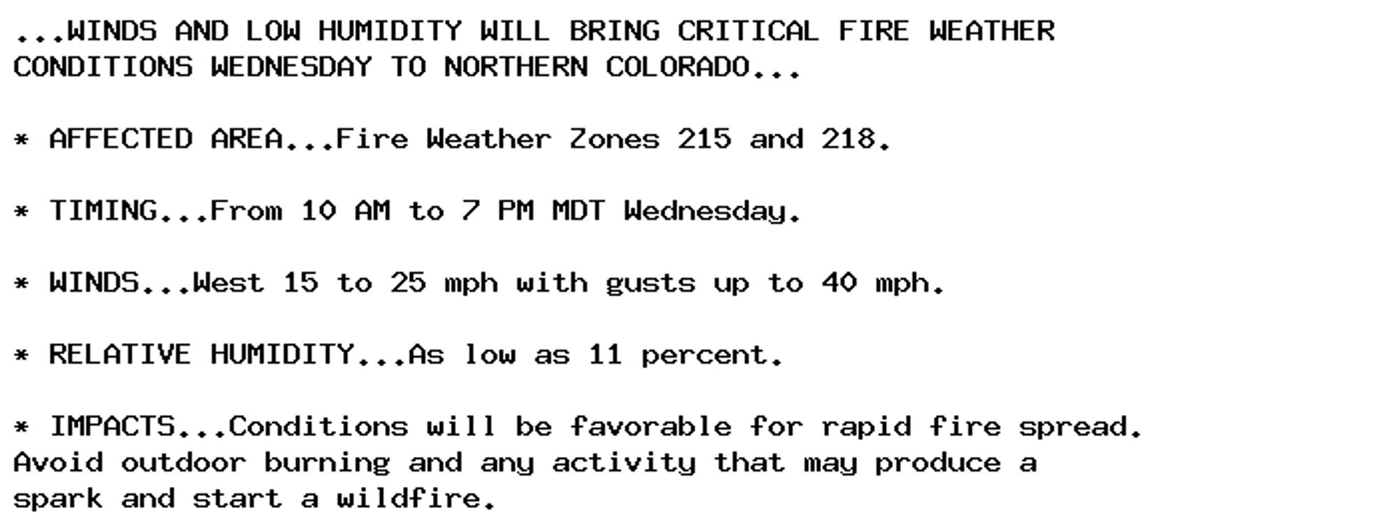
🚨 Red Flag Warning issued October 2 at 1:48PM MDT until October 2 at 7:00PM MDT by NWS Denver CO 🚨 Additional Details Here.
🚨 Red Flag Warning issued October 2 at 1:48PM MDT until October 2 at 7:00PM MDT by NWS Denver CO 🚨 Additional Details Here.
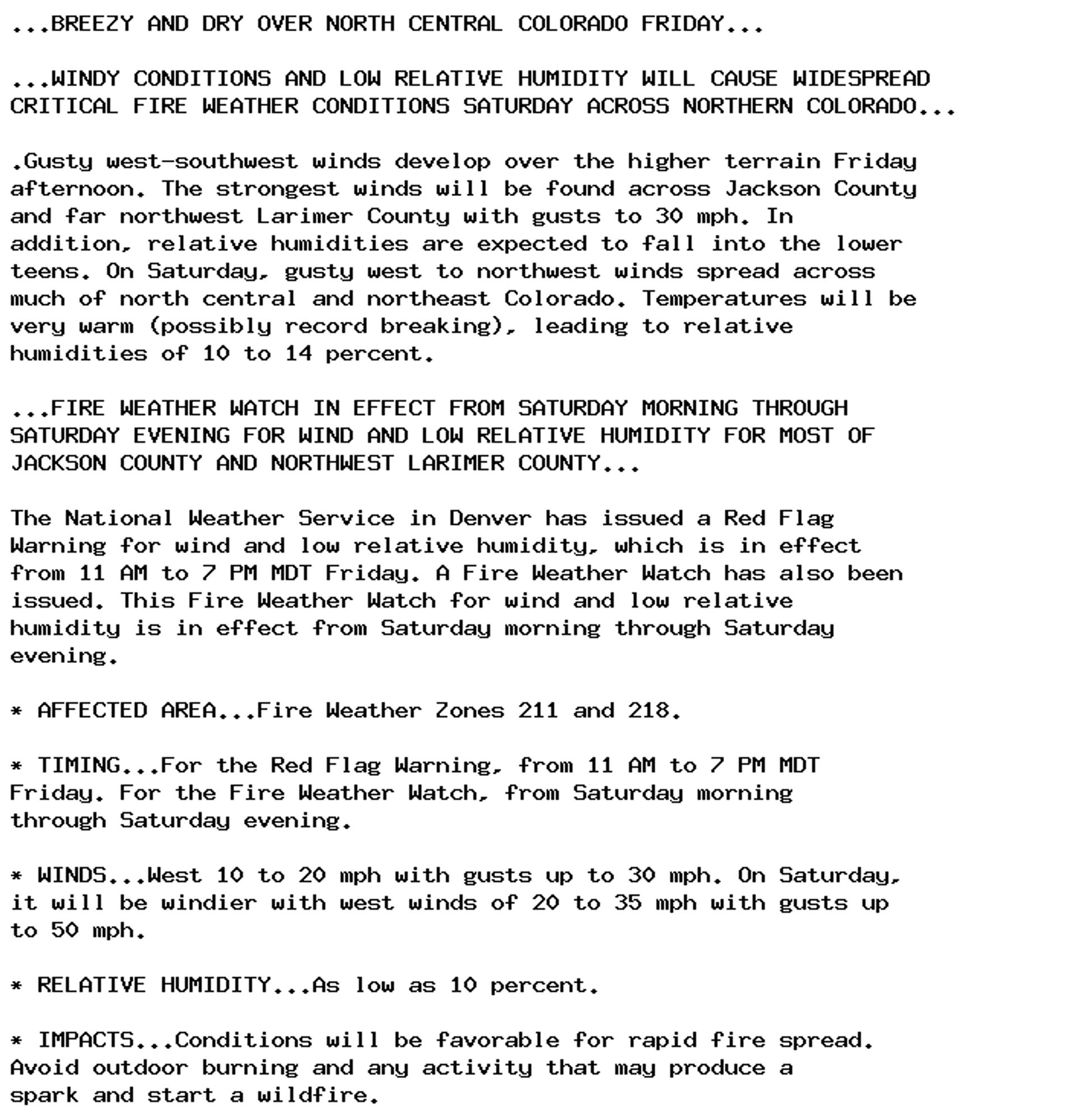
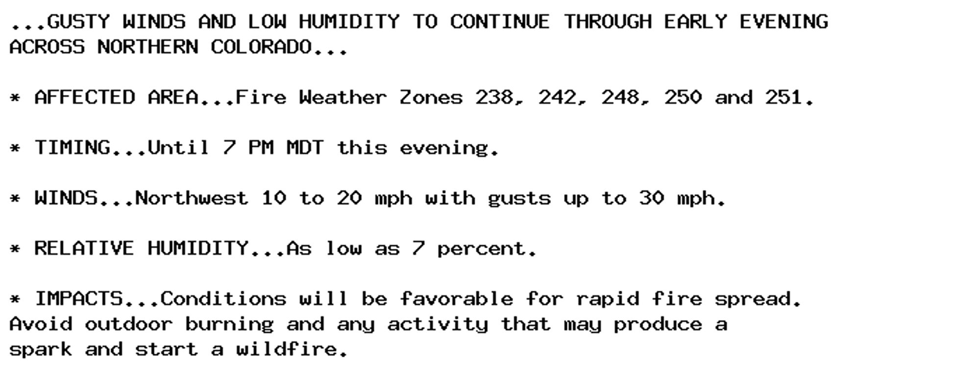
🚨 Red Flag Warning issued October 2 at 2:45AM MDT until October 2 at 7:00PM MDT by NWS Denver CO 🚨 Additional Details Here.
🚨 Red Flag Warning issued October 2 at 2:45AM MDT until October 2 at 7:00PM MDT by NWS Denver CO 🚨 Additional Details Here.
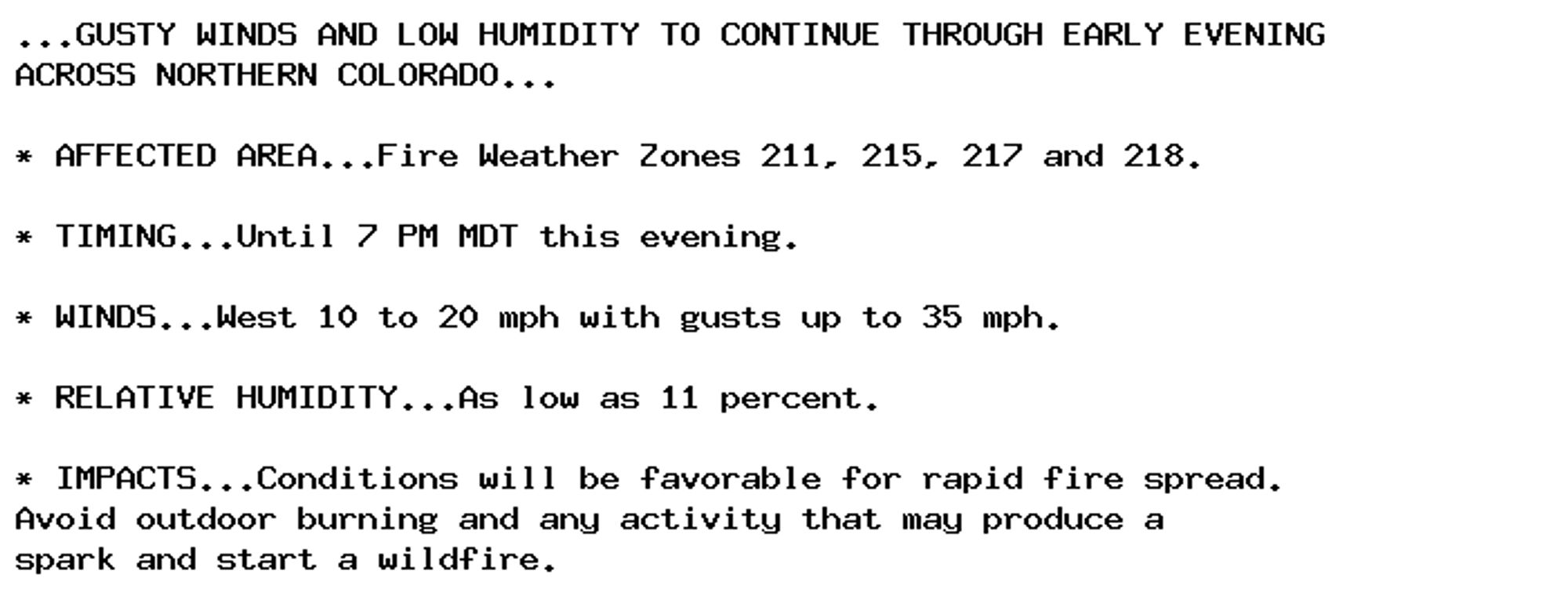
🚨 Red Flag Warning issued October 1 at 6:34PM MDT until October 2 at 7:00PM MDT by NWS Denver CO 🚨 Additional Details Here.
🚨 Red Flag Warning issued October 1 at 6:34PM MDT until October 2 at 7:00PM MDT by NWS Denver CO 🚨 Additional Details Here.