If you would like to get Philipp's report direct to your inbox, you can sign-up to our mailing list here: eepurl.com/dj-6Y1
This week we publish new data on the US's use of #AgentOrange#Laos#dioxin contaminated herbicide was used.

Interesting noises from Labour on global leadership on climate security but as we point here, there are domestic and international actions on mitigating military GHG emissions that must be part of that - if the UK is to be viewed as a credible actor.
my piece for @bylinetimes.bsky.social Like David Lammy, the military recognises the threat of climate breakdown. But that hasn't stopped the sector's vast emissions bylinetimes.com/2024/09/19/c...

Like David Lammy, the military recognises the threat of climate breakdown. But that hasn’t stopped the sector's vast emissions
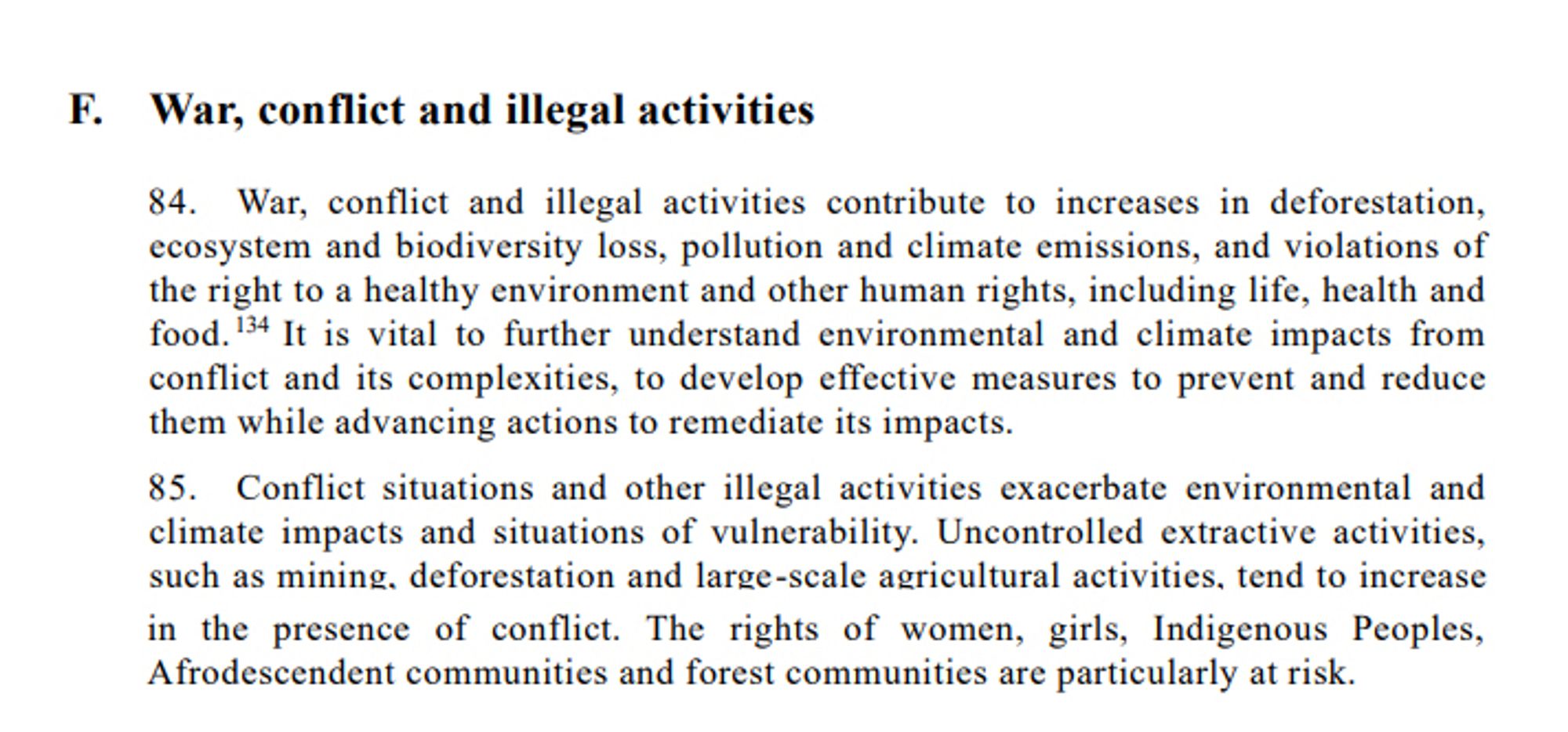
Fantastic to see the UN Human Rights Council special rapporteur on the environment address the impacts of armed conflicts on the enjoyment of the Right to Healthy Environment in her first report to the UN General Assembly. #UNGAdocuments.un.org/doc/undoc/ge...
"Somalia has emitted roughly as much carbon dioxide from fossil fuels since the 1950s as the US economy does in an average three days" Yes, that does say three days www.bbc.co.uk/news/article...
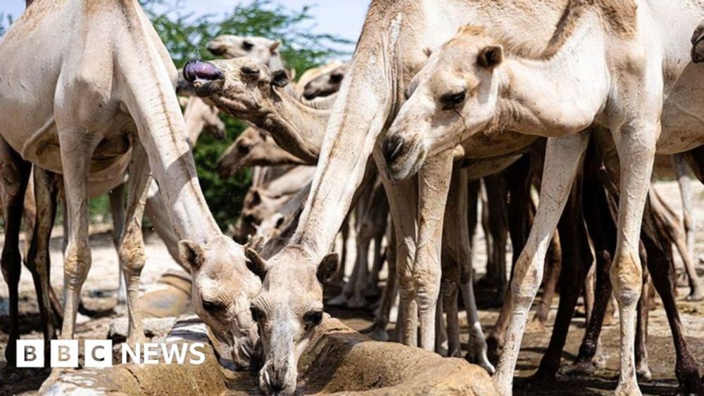
Despite facing a catastrophic combination of challenges, there is optimism in the African country.
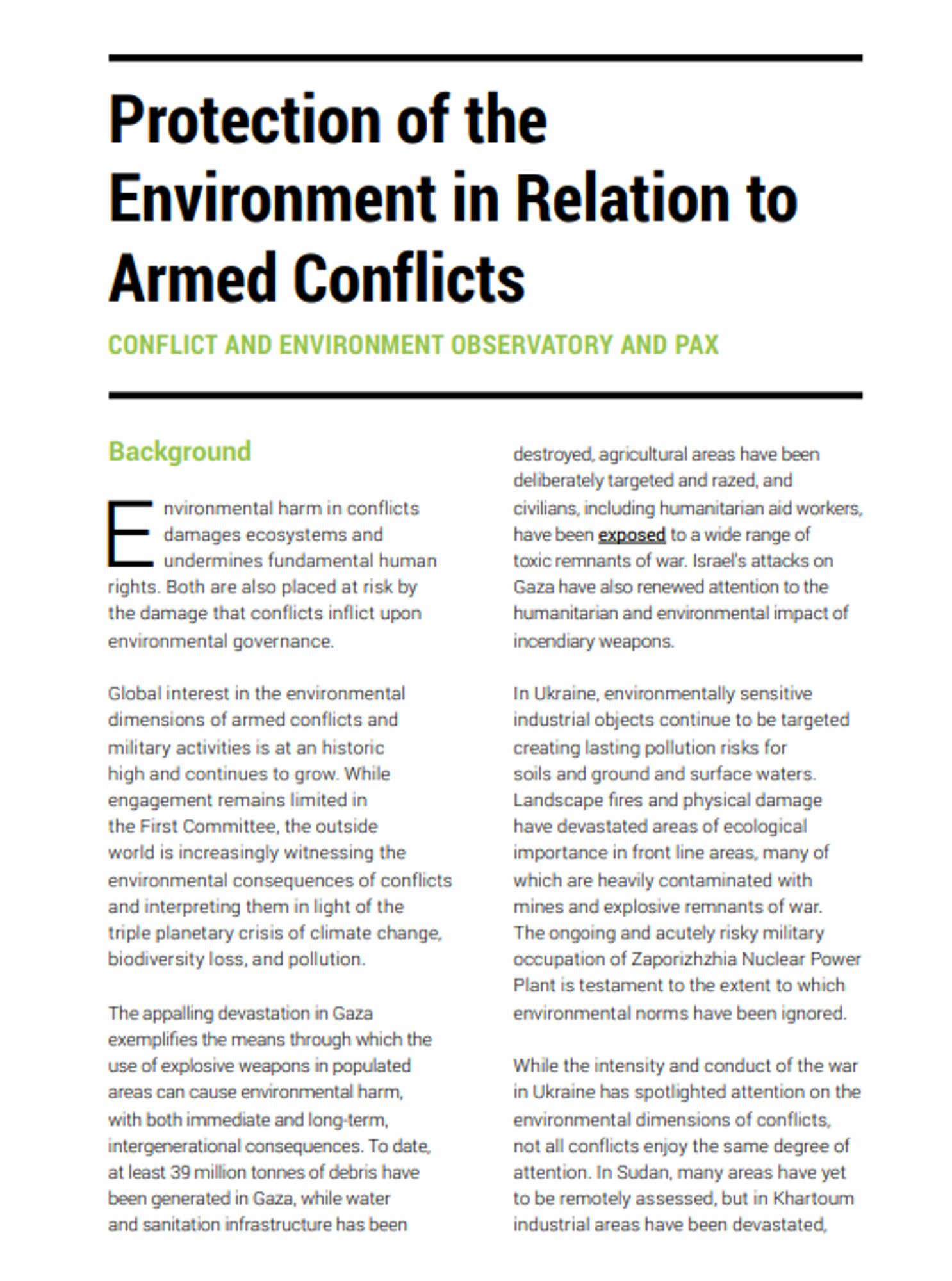
The UN General Assembly starts soon. Reaching Critical Will's First Committee Briefing Book is always a fantastic resource to catch up with what's going on in the world of humanitarian disarmament. We contributed the chapter on PERAC, read it here: www.reachingcriticalwill.org/resources/pu...#UNGA

This project is just the latest addition to our remote environmental assessment methodology for #Ukraineceobs.org/mapping-the-... 6/6
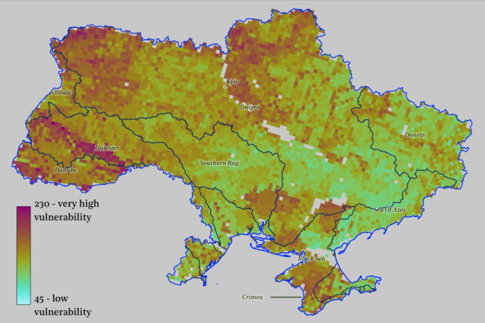
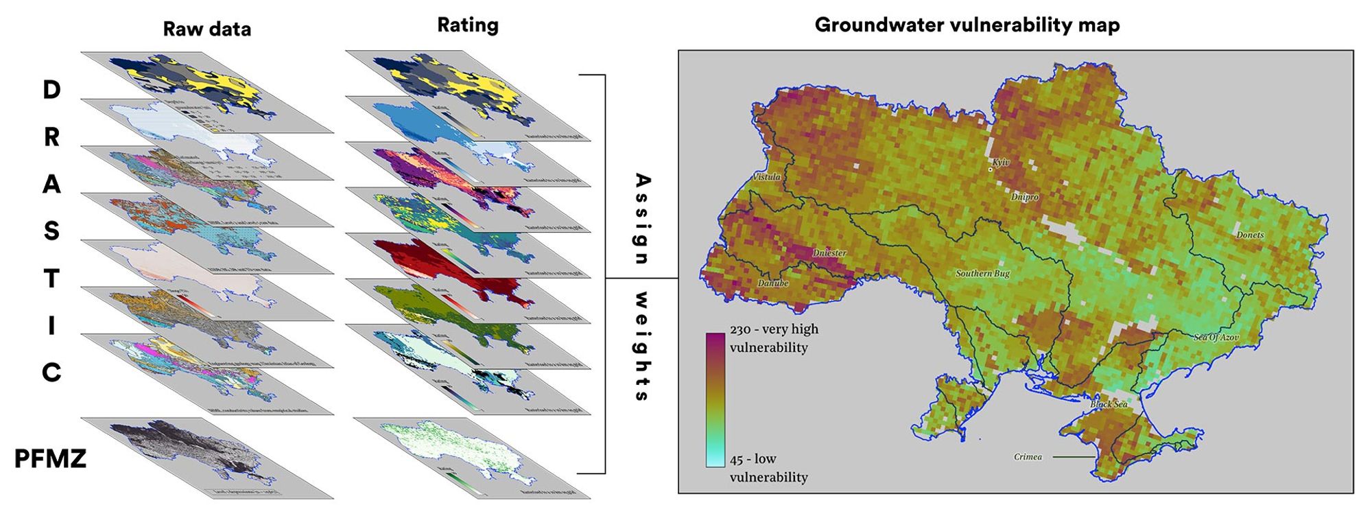
The latest tool in our ongoing remote assessment of Ukraine is a map of how vulnerable its groundwater is to pollution caused by the war.
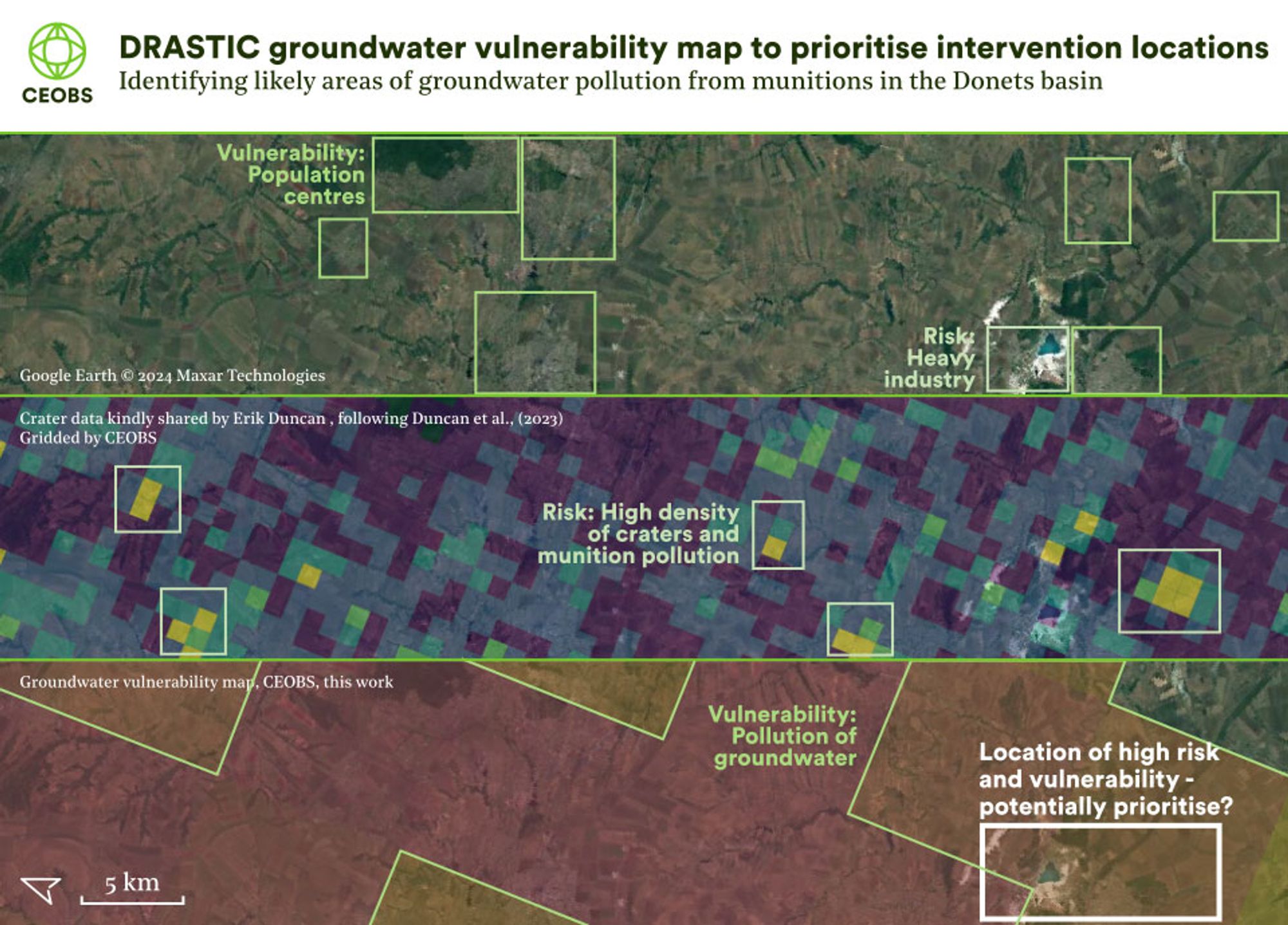
Once you have that, you can start identifying priority sites for intervention by adding extra layers, like cratering rates and population density. 5/6
We used the DRASTIC model developed by the US EPA to model the risks across Ukraine. We fed it with a stack of open access data, such as on aquifer and soil type. It makes map like this. ⬇️ 4/6