BLUE
Profile banner
CS
CoCoRaHS Station KY-JC-6
@cocorahskyjc6.bsky.social
I'm a Community Collaborative Rain, Hail, and Snow volunteer and severe storm spotter/#wx watcher inside the Daniel Boone N.F. for NWS Jackson KY as well as operating Weather Underground PWS KKYMCKEE31 wunderground.com/dashboard/pws/KKYMCKEE31
53 followers169 following1.2k posts
CScocorahskyjc6.bsky.social

🙏🙏🙏🫂🫂🫂🙏🙏🙏

0
CScocorahskyjc6.bsky.social

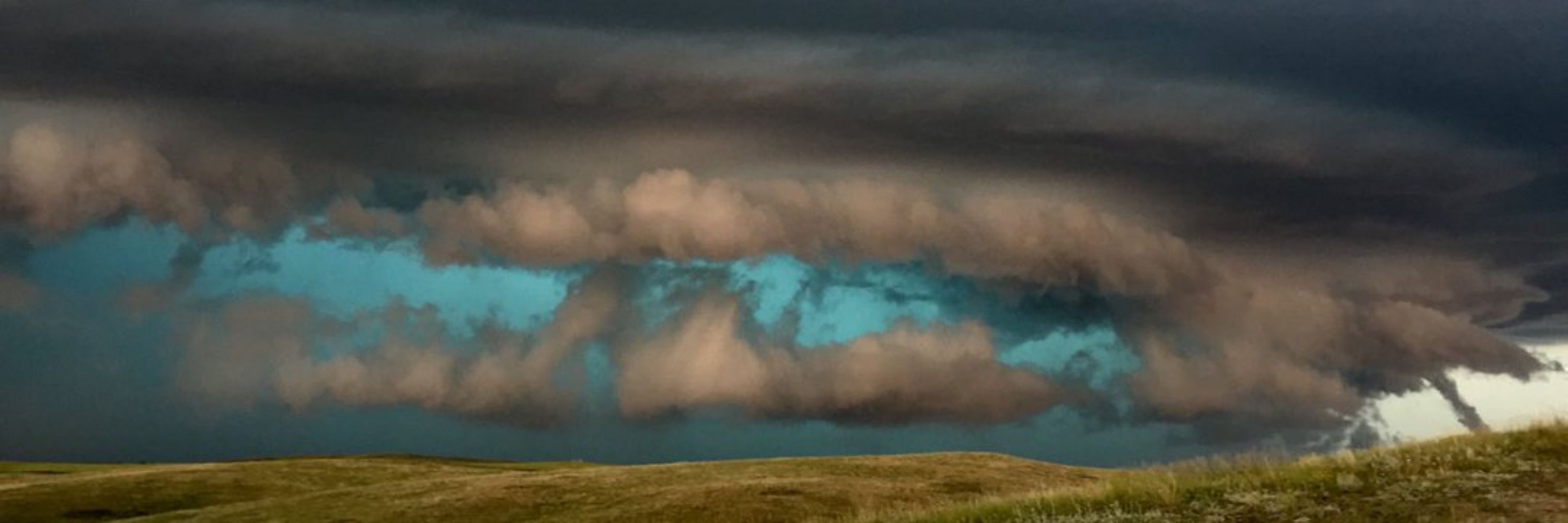
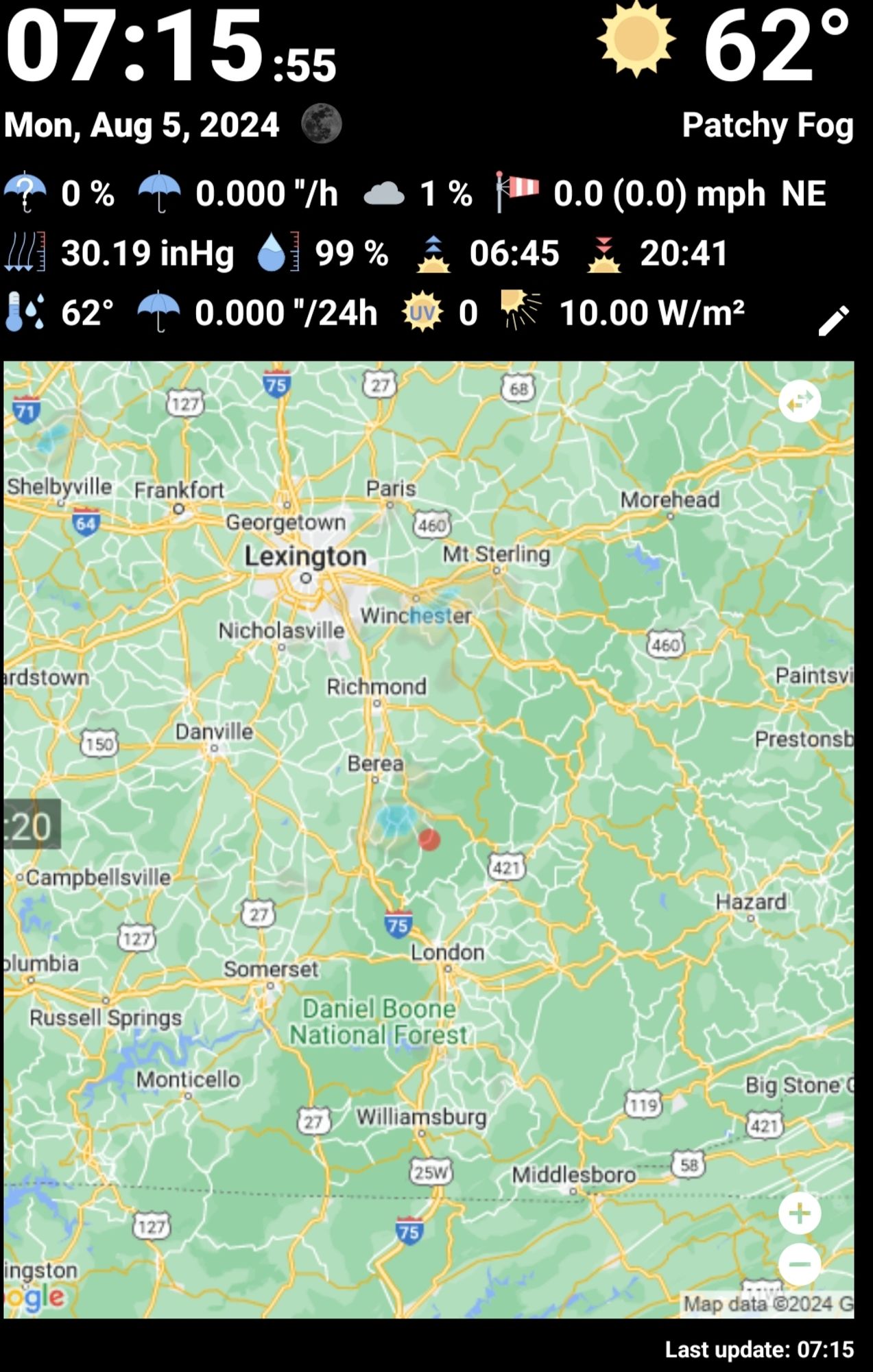
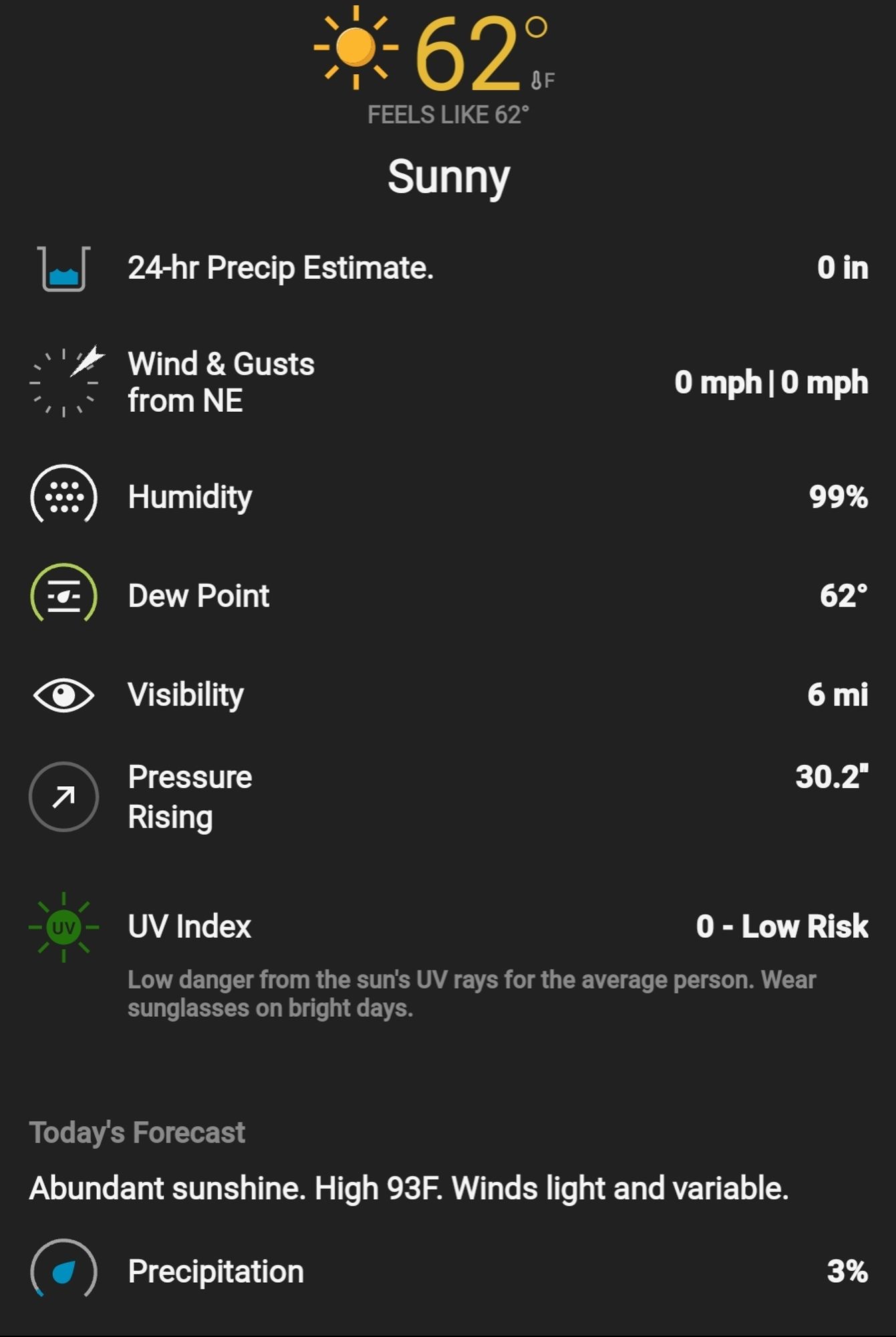
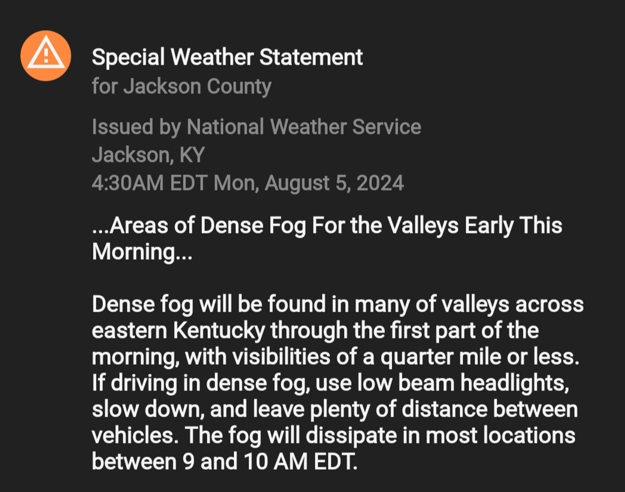
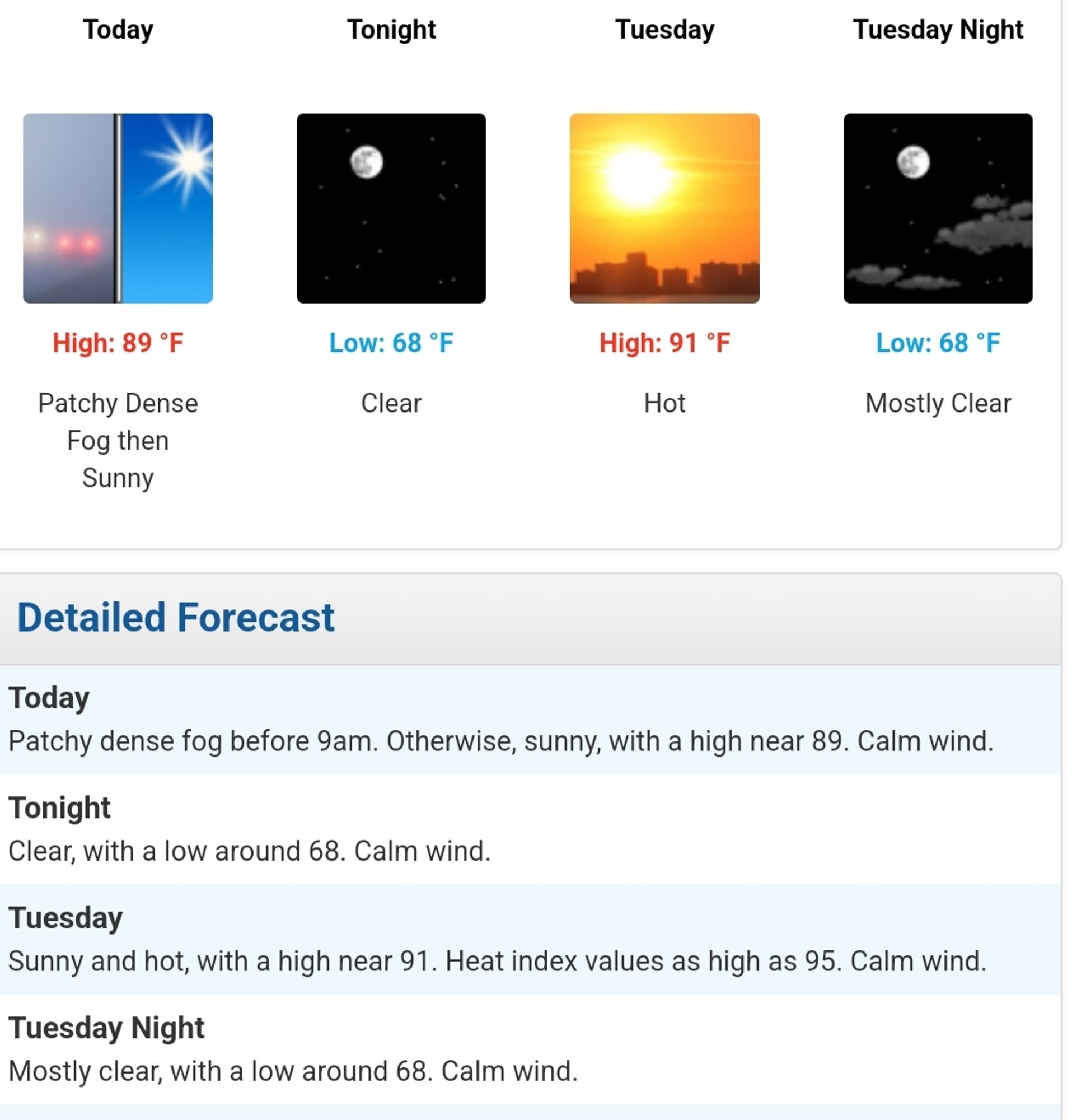
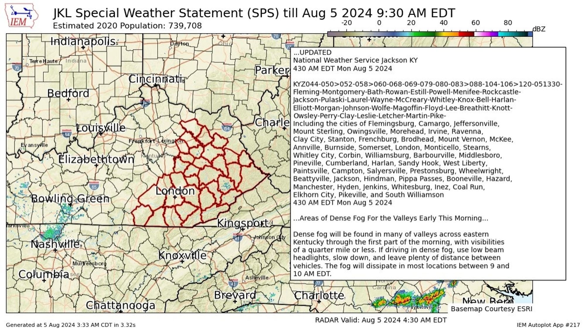
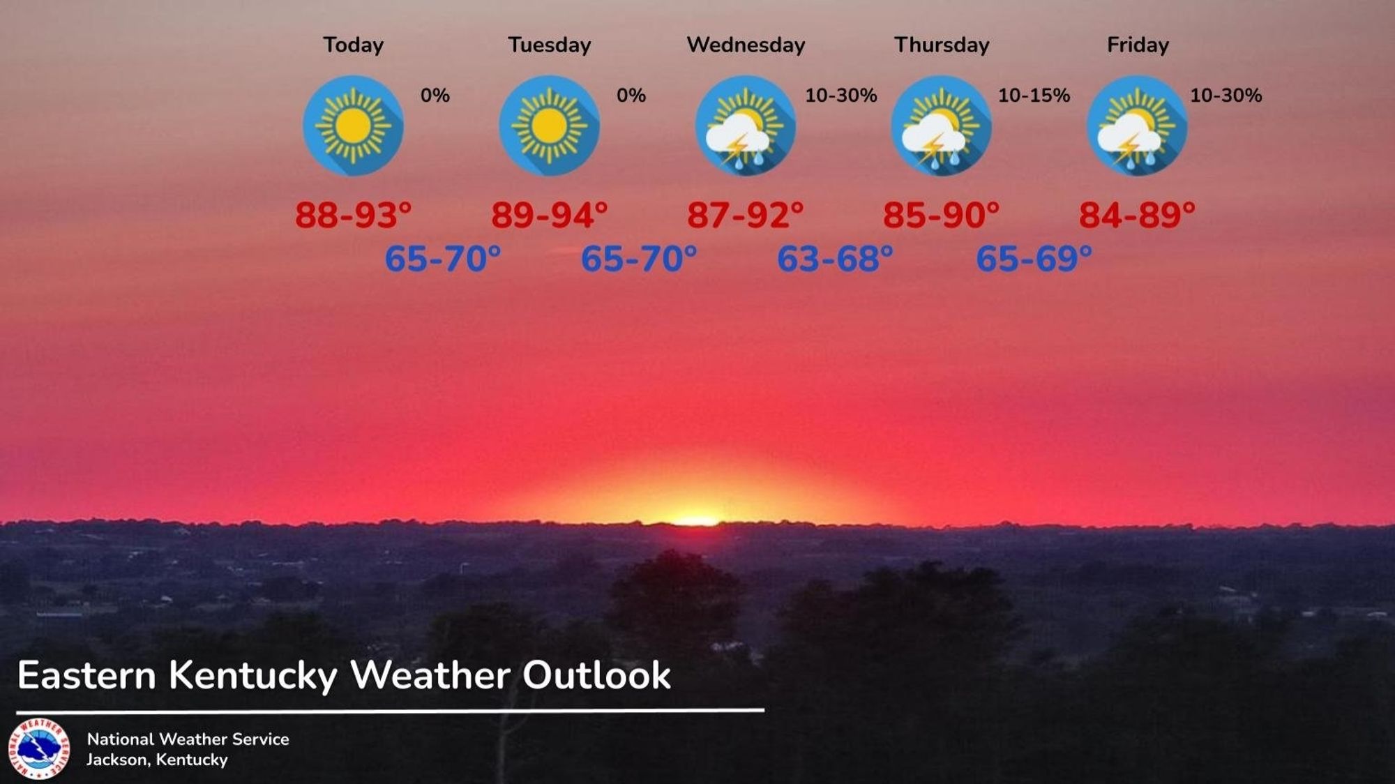
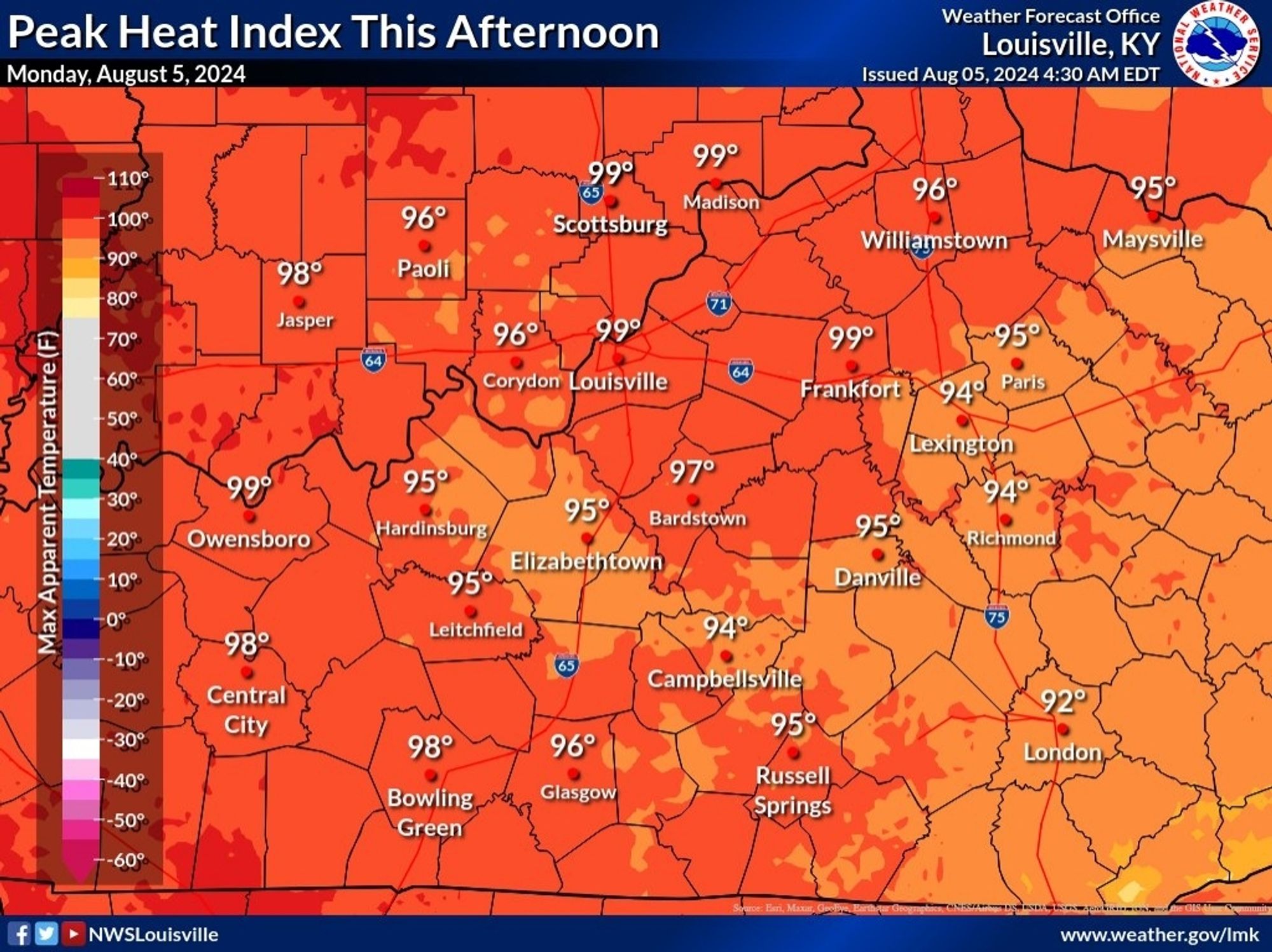
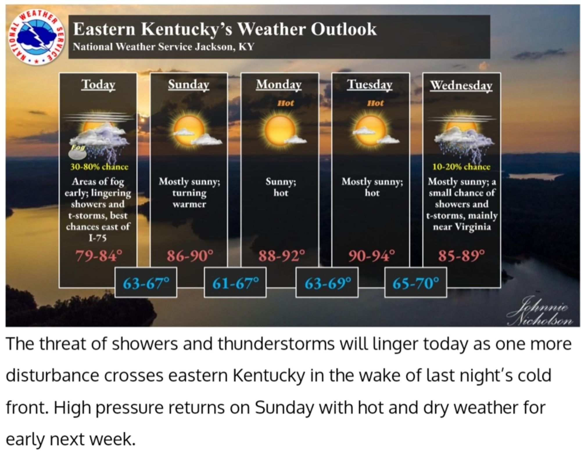
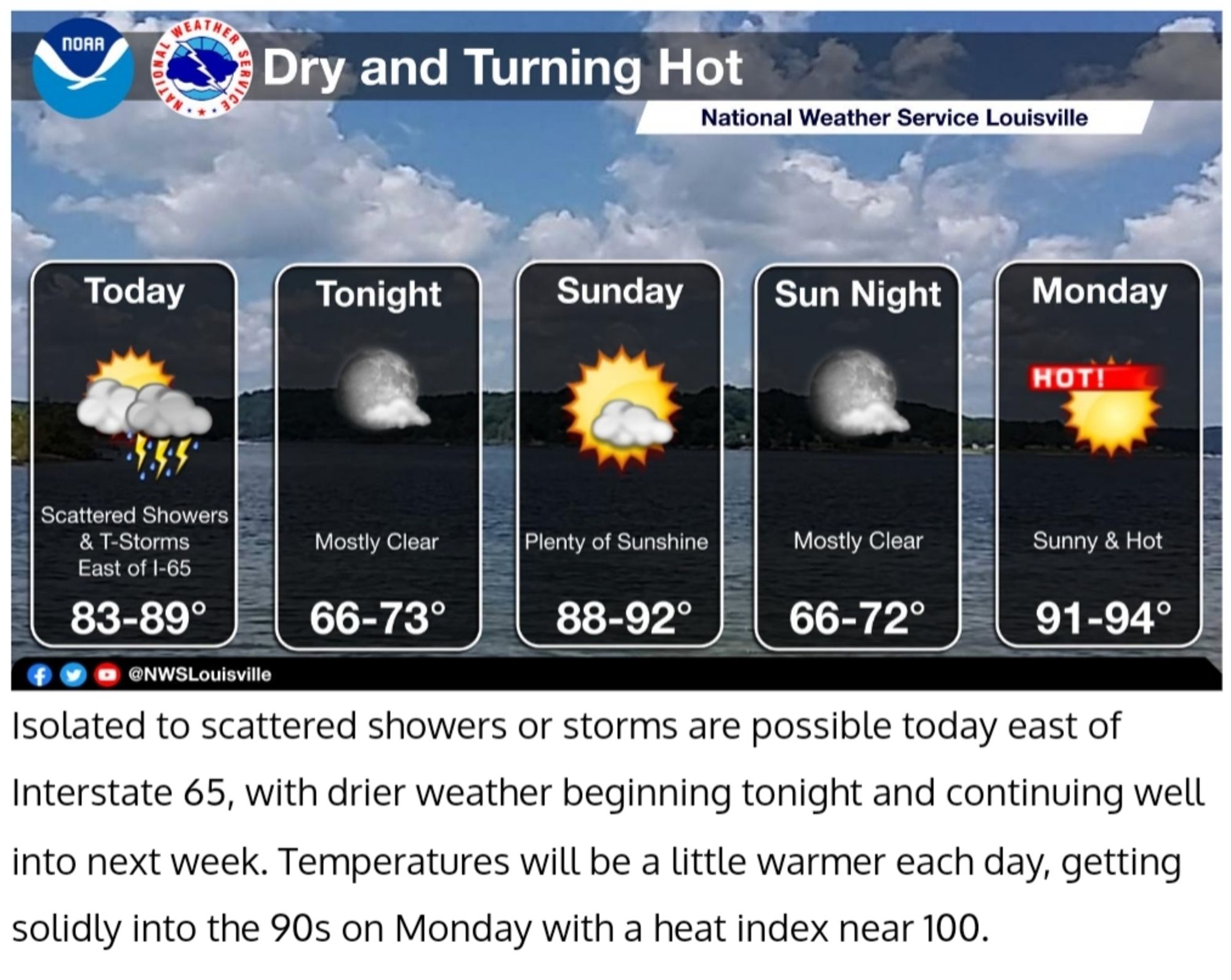
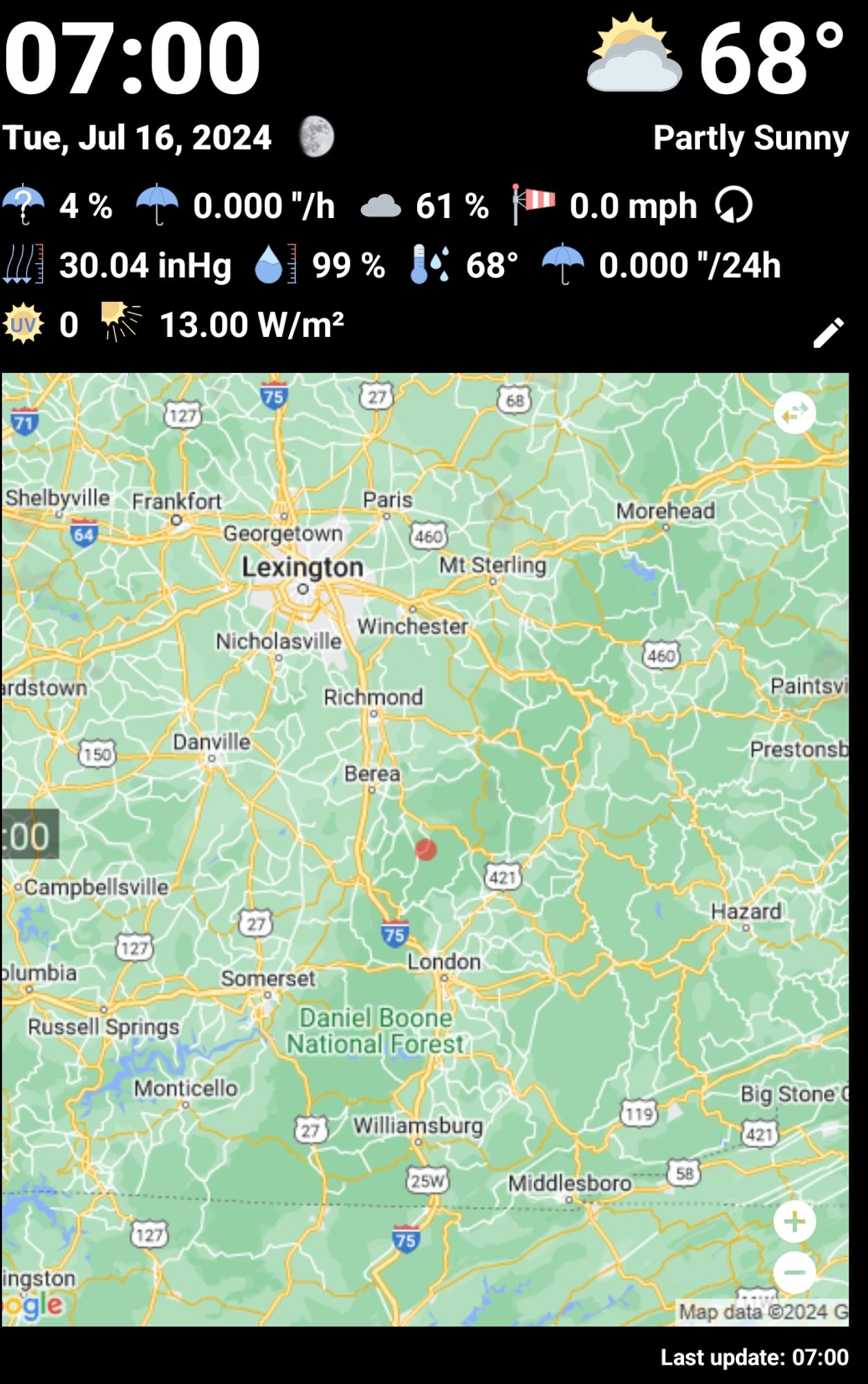
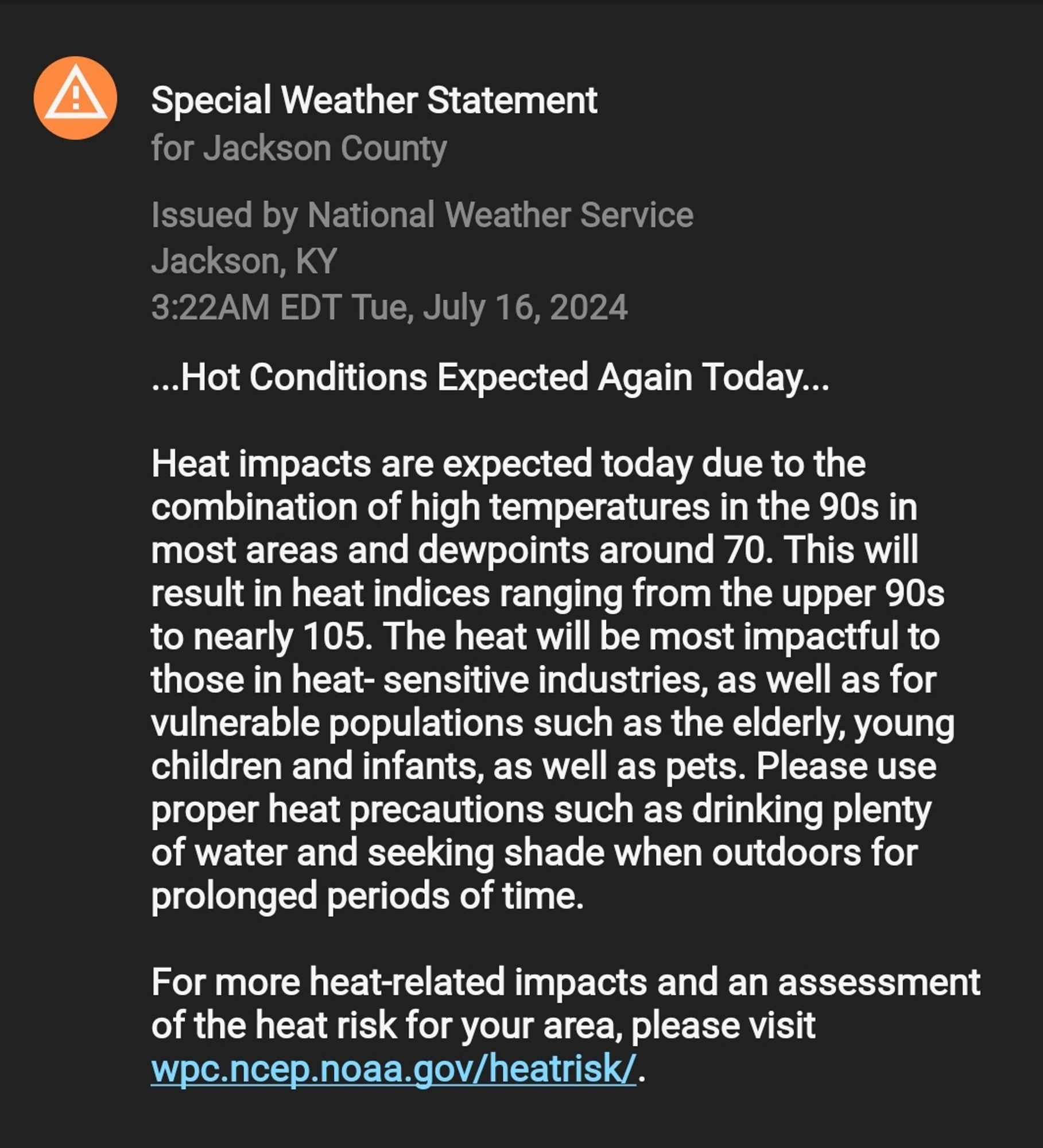
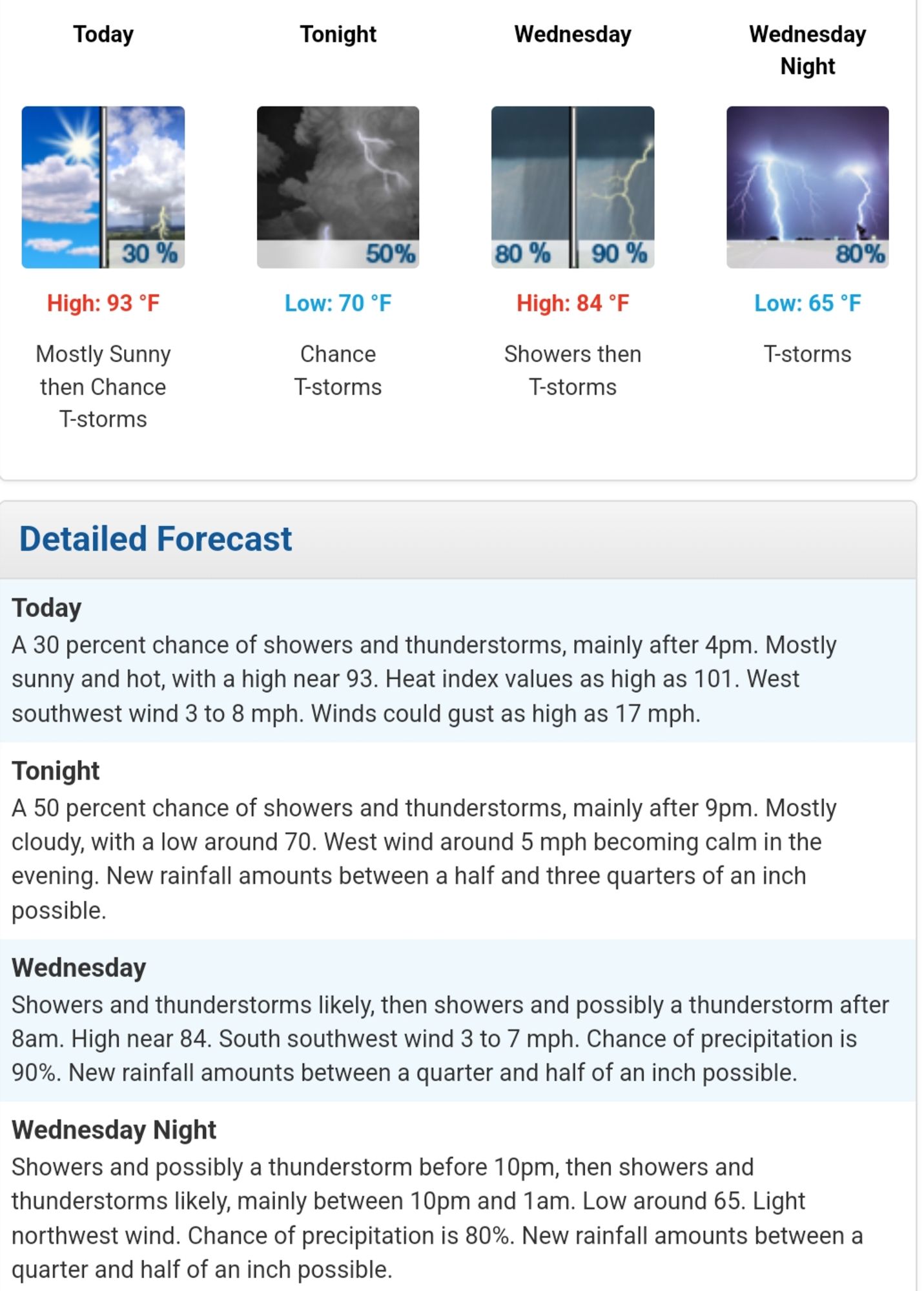
Current CoCoRaHS station conditions at the 7h on 5 August 2024, with a Special Weather Statement for dense valley fog until 10 AM plus the two day hyperlocal forecast for 5-6 August 2024, from @nwsjacksonky are given ⬇️ #ekywx#kywx

0
Reposted by CoCoRaHS Station KY-JC-6

🌫️ Dense fog will impact valleys of Eastern Kentucky this morning. ☀️ Dry weather to start the week, but daily rain chances return from Wednesday through the weekend 🌡️ Hot temps and humidity peak Tues/Wed with heat indices near 100°F. #ekywx#kywx

0
Reposted by CoCoRaHS Station KY-JC-6

Early morning fog in Central Kentucky (to include the Lake Cumberland area), and Southern Indiana will mix out by mid-morning. This afternoon will be hot and humid with temperatures climbing into the low to mid 90s with the heat index reaching in the mid to upper 90s. #KYwx#INwx

0
Reposted by CoCoRaHS Station KY-JC-6

Here's the latest weather forecast for the Upper Cumberland River Valley in Kentucky (including Lake Cumberland and other area lakes) plus the Middle Cumberland River Valley in Tennessee. Data courtesy of nwsjacksonky, NWSLouisville, NWSMorristown, and NWSNashville #kywx#tnwx

0
CScocorahskyjc6.bsky.social

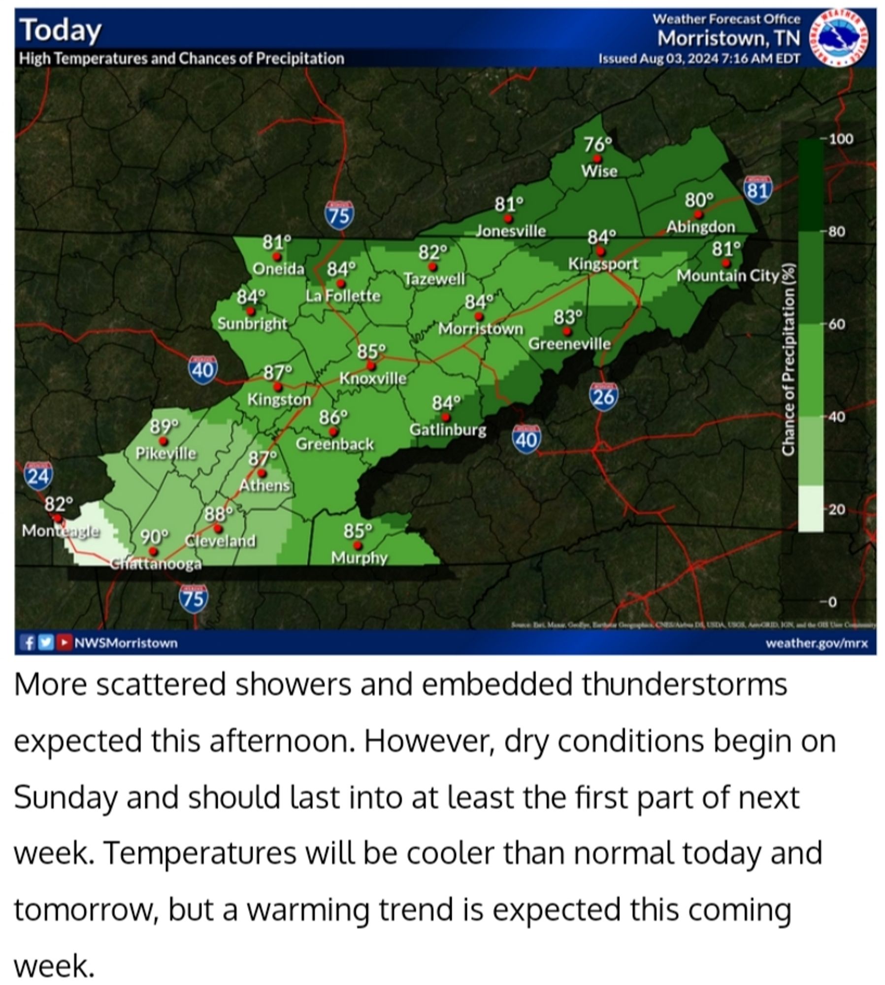
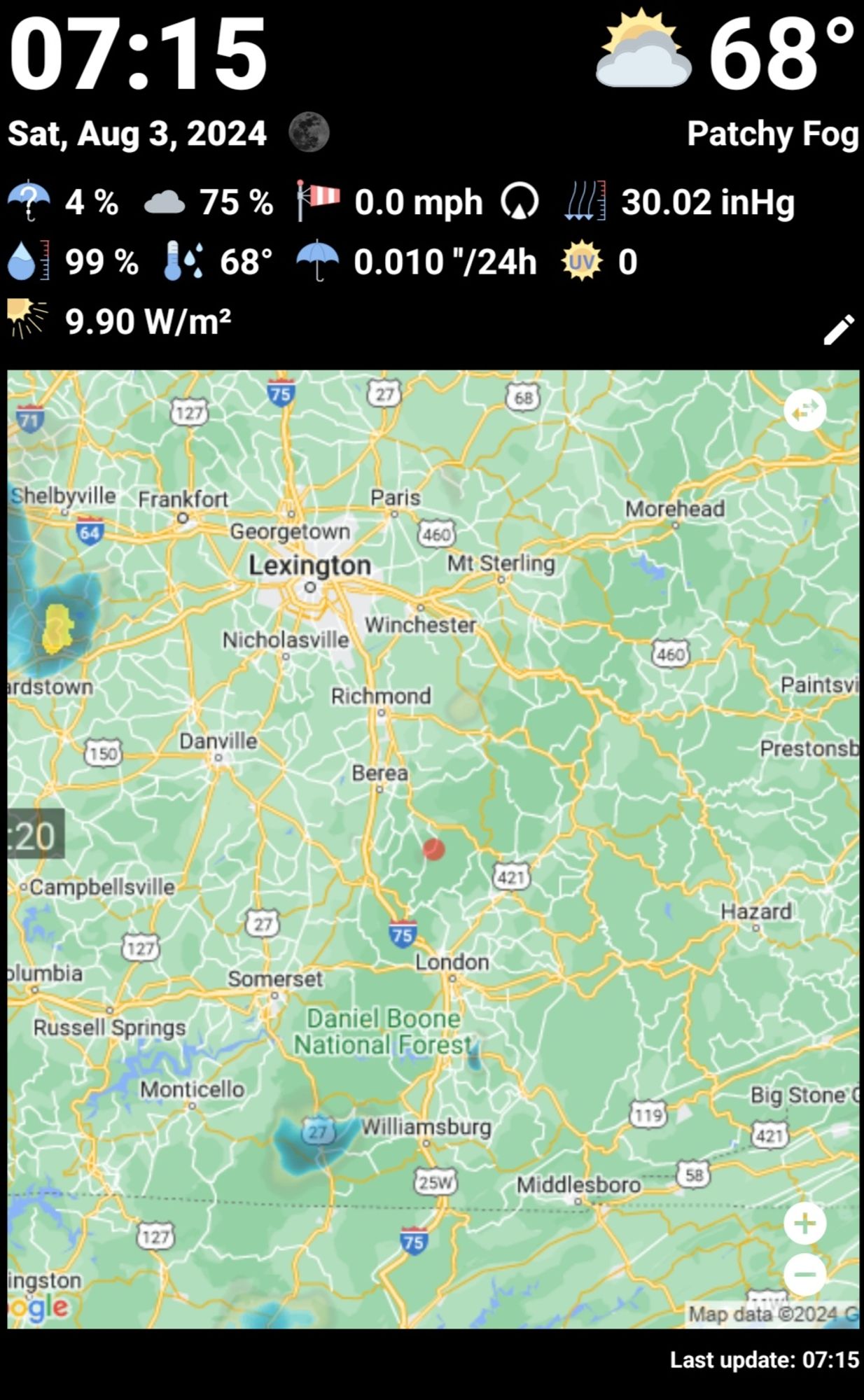
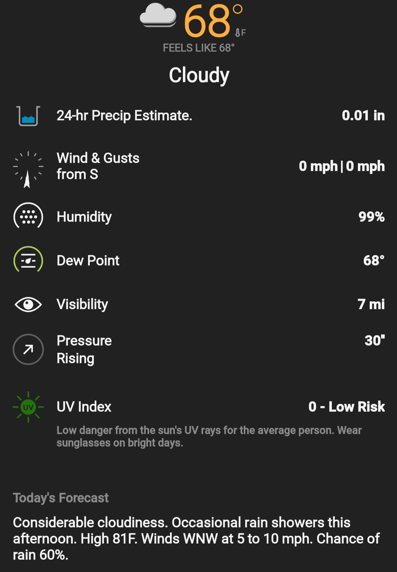
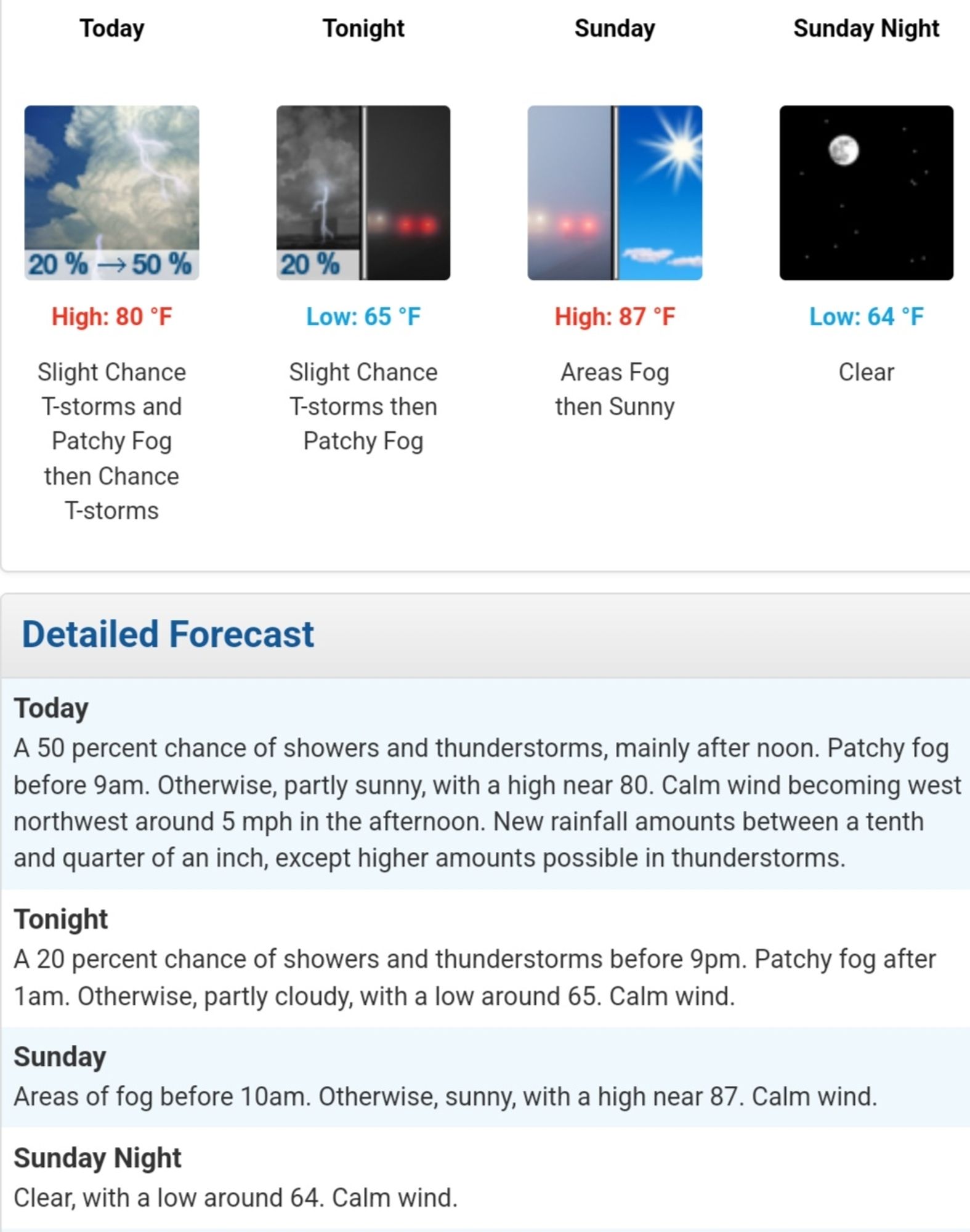
Current CoCoRaHS station conditions at the 7h on 3 August 2024, plus the two day hyperlocal forecast for 3-4 August 2024, from @nwsjacksonky are given ⬇️ #ekywx#kywx

0
CScocorahskyjc6.bsky.social

An unsettled weather pattern will remain in place early in the week, with multiple opportunities for showers and storms across Central Kentucky and Southern Indiana. Conditions trend a bit drier and hotter midweek. Heat index values over 100 are likely. #KYwx#INwx

0
CScocorahskyjc6.bsky.social

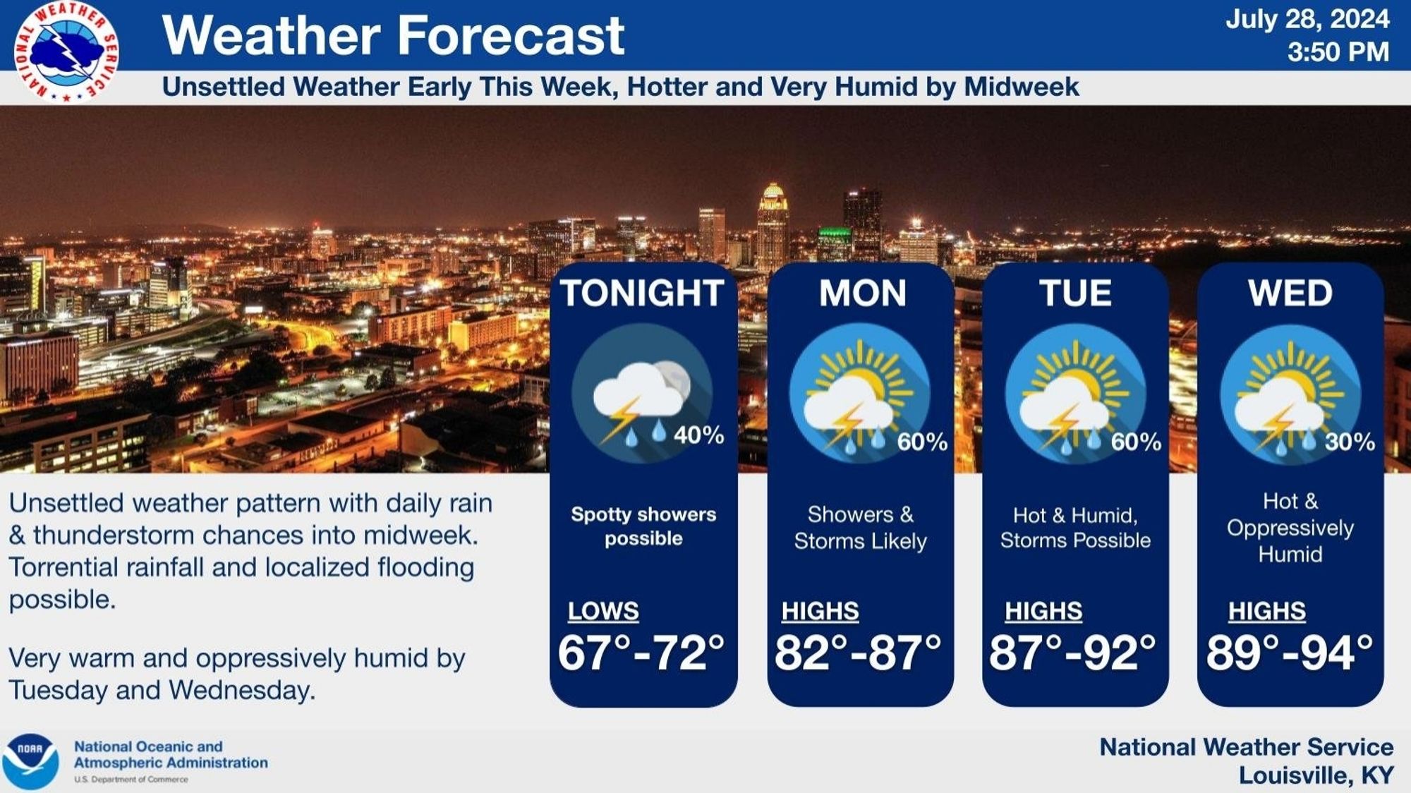
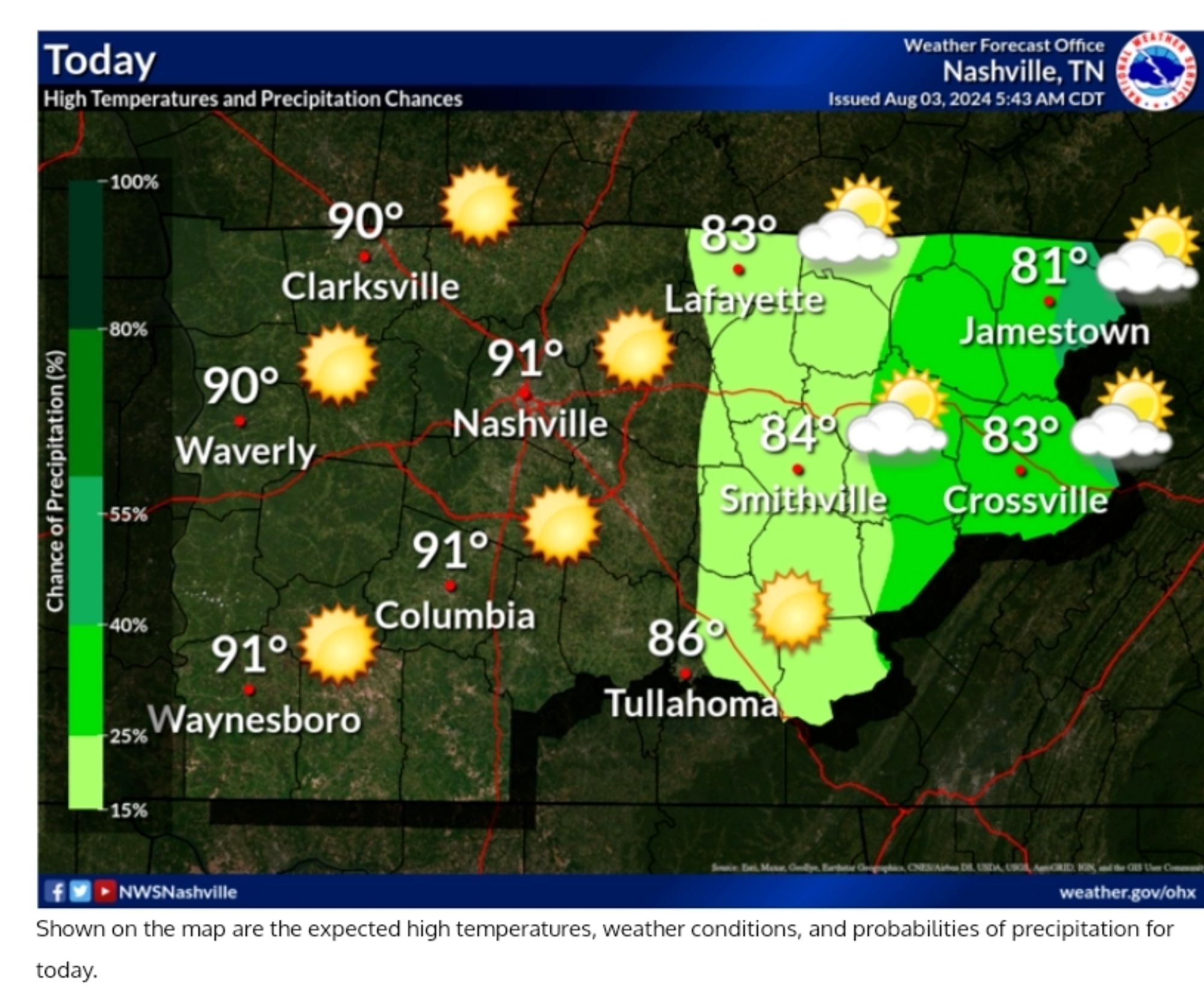
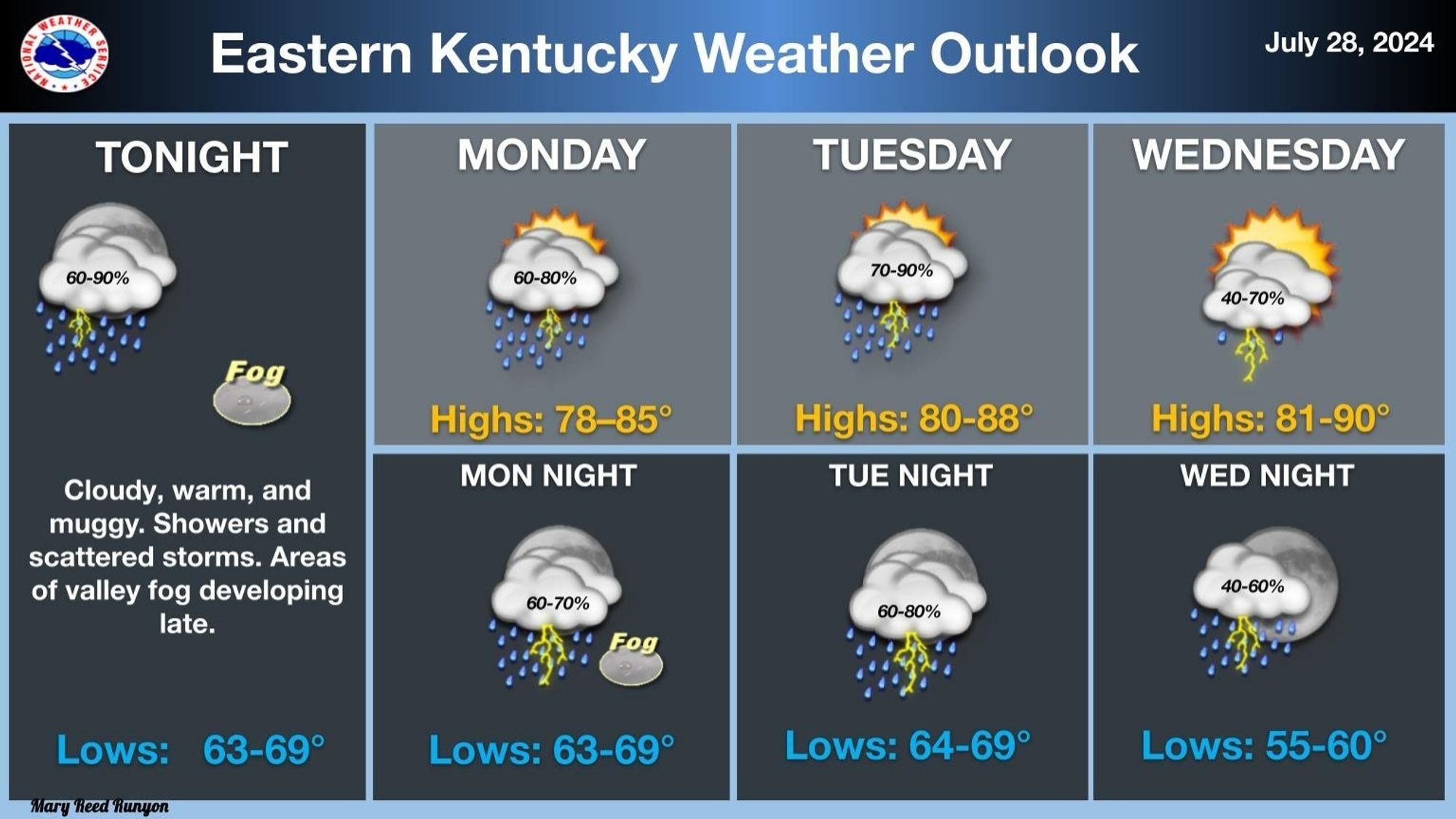
Warm and muggy conditions, along with repeated rounds of showers and storms, will plague eastern Kentucky through mid-week, as a series of disturbances aloft move through the area. Rain could be locally heavy at times, with isolated instances of flooding possible. #kywx#ekywx#turnarounddontdrown

0
CScocorahskyjc6.bsky.social

Current CoCoRaHS station conditions at the 7h on 16 July 2024, with a Special Weather Statement until 6 PM EDT/22 UTC, plus the two day hyperlocal forecast from the NWS Jackson, Kentucky office for 16-17 July 2024, are ⬇️ #ekywx#kywx

0
CScocorahskyjc6.bsky.social

CoCoRaHS_KYJC6 conditions at 7h on Friday 28 June 2024: Mostly sunny | T: 59°F | Td: 58°F | H: 99% | W: WNW @ 0.0 MPH | B: 30.05 inHg | Visibility: 10 mi. | Pcpn.: 0.00 in. | AQI: 31 PM2.5 (Good) | UV: 0 | SR: 12.40 w/m2 #ekywx#kywx

0
Profile banner
CS
CoCoRaHS Station KY-JC-6
@cocorahskyjc6.bsky.social
I'm a Community Collaborative Rain, Hail, and Snow volunteer and severe storm spotter/#wx watcher inside the Daniel Boone N.F. for NWS Jackson KY as well as operating Weather Underground PWS KKYMCKEE31 wunderground.com/dashboard/pws/KKYMCKEE31
53 followers169 following1.2k posts