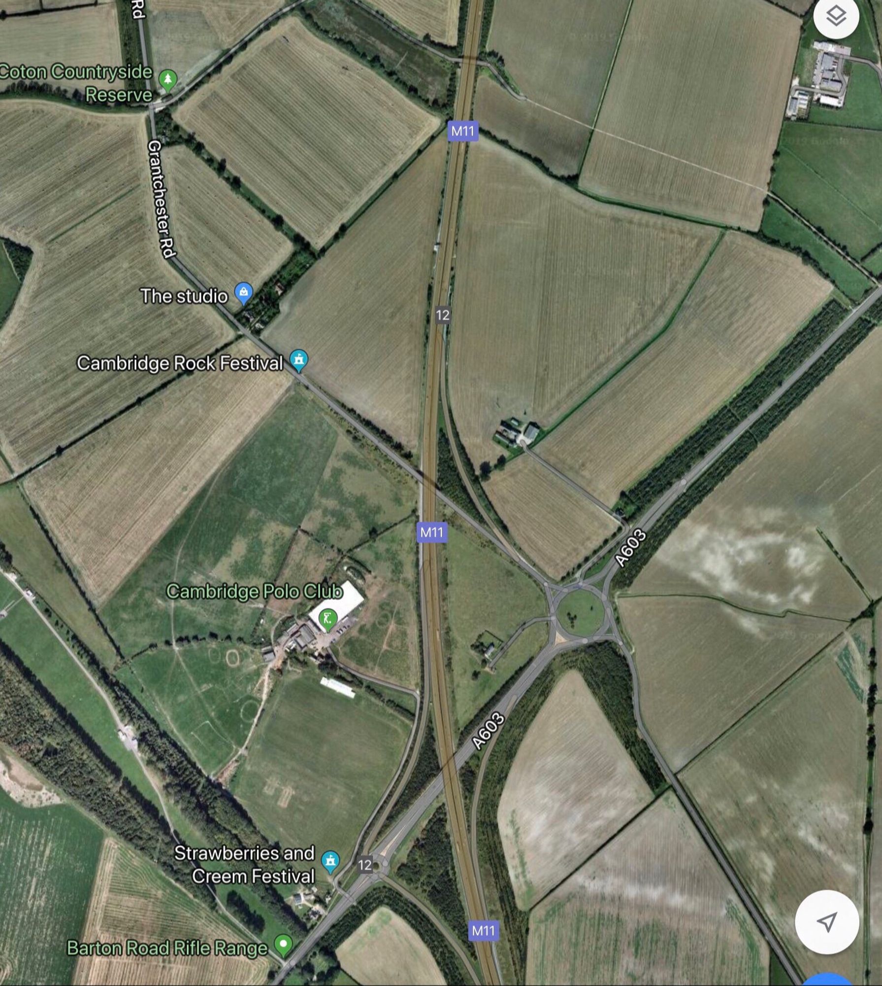
THREAD. Here’s a fun game for a rainy day based on the proposition: where 1 line in the landscape is crossed by another, then the one being crossed is the older of the 2. Eg the M11 in Cambs. built 1975-80 cuts rectangular fields of Parliamentary enclosure c1803 into triangles+
Very interesting, thank you. I confess to doing some of this landscape study on long motorway journeys.
Great thread. Very interesting, thanks!
16. The best of this is that the evidence is all there, ready to be picked at. Landscape history is the best fun because it's available to us all 🎺
15. For a more detailed & less breathless look at Caxton have a look at archaeologydataservice.ac.uk/archiveDS/ar....
14. I can’t promise you that this conclusion is ‘true’. Few of us can be certain about what happened in the past. All I can say is that it’s the best-fit explanation for the currently-available evidence.
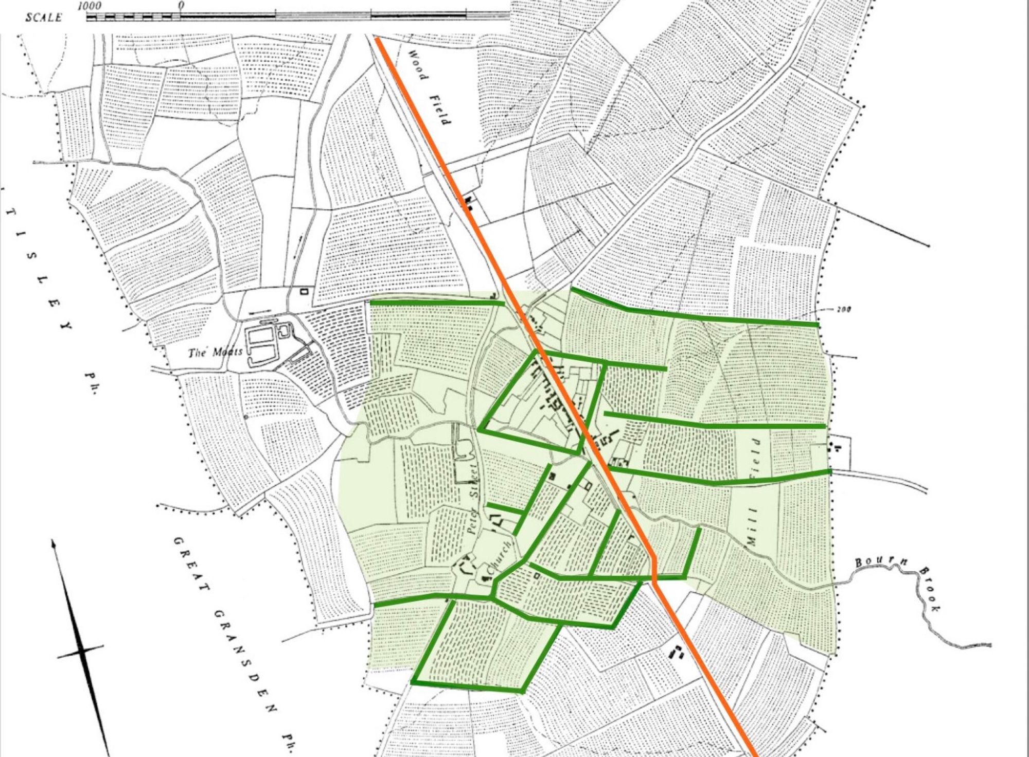
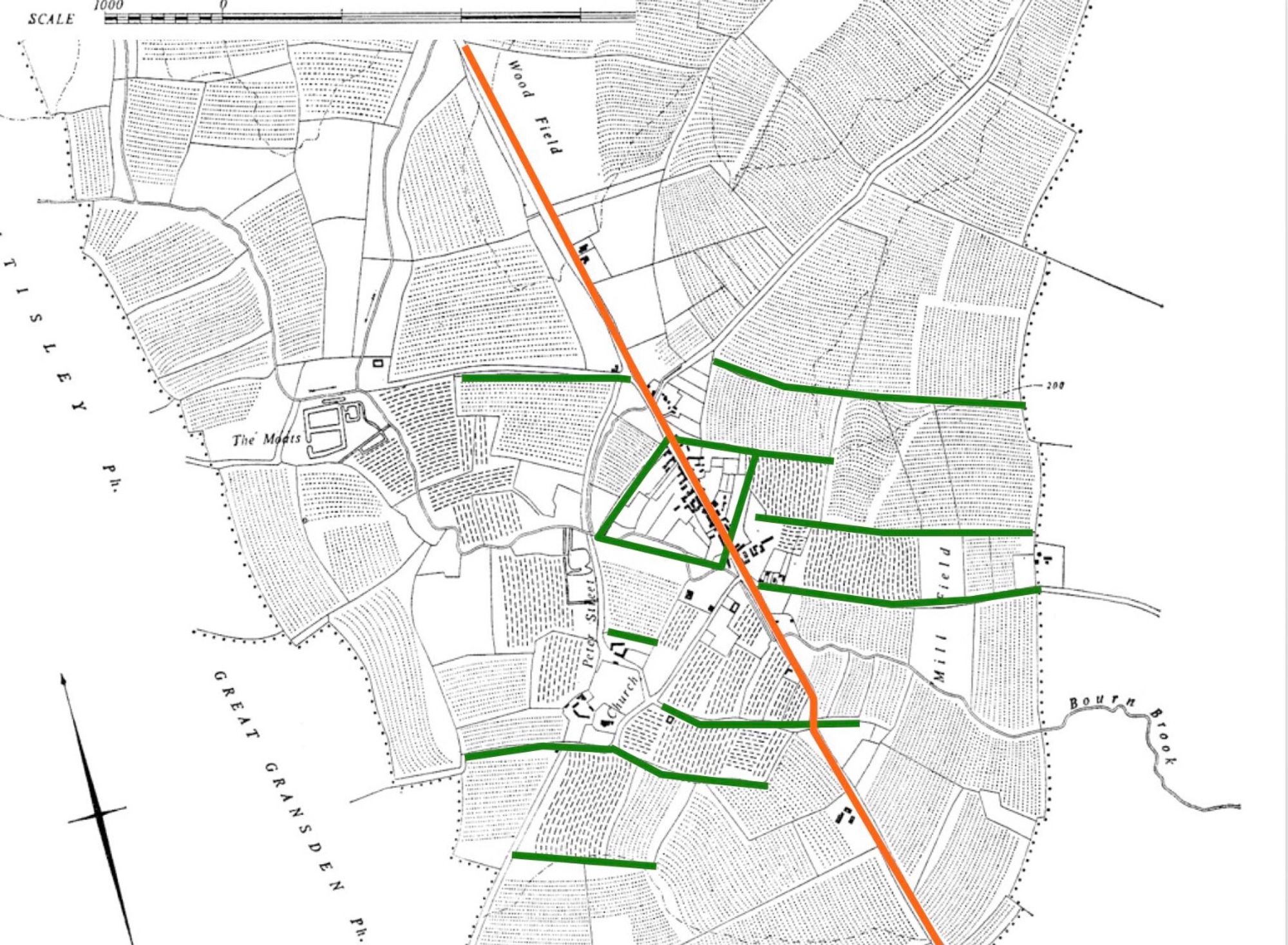
13. That possibility is supported by the odd angles between the ridge and furrow inside the green-shaded area and that beyond, eg on either side of the green line in the red circle. They’re on quite different alignments, suggesting quite different periods of origin.
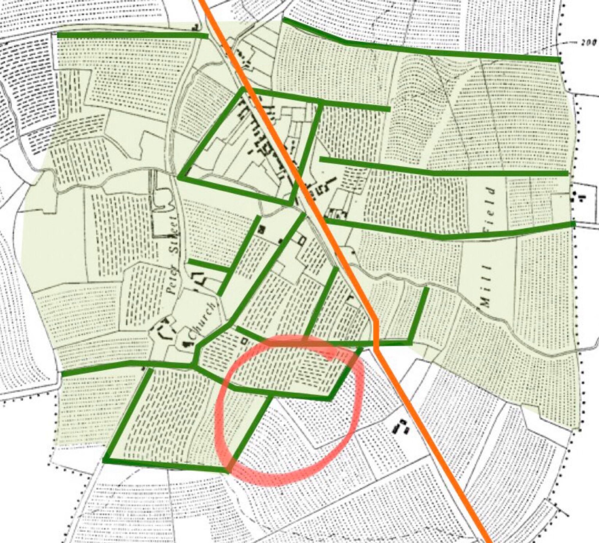
12. .. prehistoric land divisions (green), the Roman road (orange), the medieval extension of arable beyond the prehistoric fields (the blue arrows); all suggesting the possibility that the green-shaded area has been continuously exploited since the Iron Age at least.

11. ... parallel to th e Roman road, so it’s feasible that their alignment (blue arrows) may have been influenced by the road. In their case, that is, the road was their first. So far, the evidence suggests a 3-phase overall development:
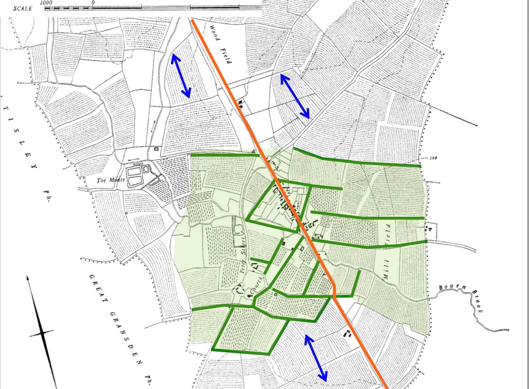
10. The possibility that the field pattern around the village (coloured green) predates the Roman occupation of a Britain gets some support from the orientation of the b/w medieval open field strips on the slopes beyond the village - they lie ...