BLUE
AF
Alerts from NWS Key West FL (UNOFFICIAL)
@eyw.nws-bot.us
Unofficial bot sharing alerts from NWS Key West FL. This account is not monitored. Contact @wandrme.paxex.aero if needed.
89 followers1 following39 posts
AFeyw.nws-bot.us

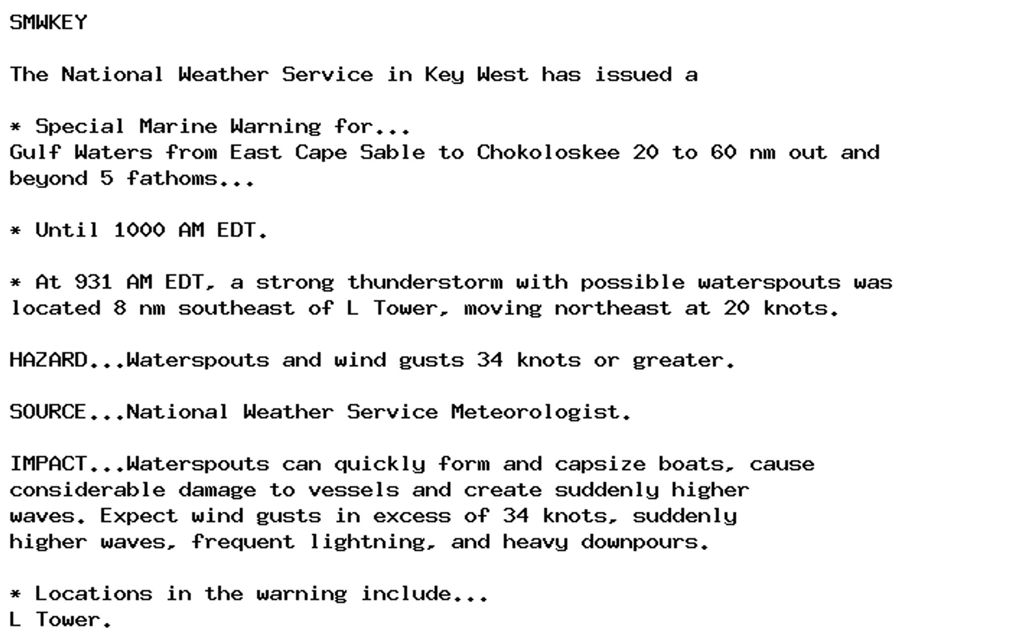
🚨 Special Marine Warning issued October 6 at 9:32AM EDT until October 6 at 10:00AM EDT by NWS Key West FL 🚨 Additional Details Here.

SMWKEY

The National Weather Service in Key West has issued a

* Special Marine Warning for...
Gulf Waters from East Cape Sable to Chokoloskee 20 to 60 nm out and
beyond 5 fathoms...

* Until 1000 AM EDT.

* At 931 AM EDT, a strong thunderstorm with possible waterspouts was
located 8 nm southeast of L Tower, moving northeast at 20 knots.

HAZARD...Waterspouts and wind gusts 34 knots or greater.

SOURCE...National Weather Service Meteorologist.

IMPACT...Waterspouts can quickly form and capsize boats, cause
considerable damage to vessels and create suddenly higher
waves. Expect wind gusts in excess of 34 knots, suddenly
higher waves, frequent lightning, and heavy downpours.

* Locations in the warning include...
L Tower.
0

AF
Alerts from NWS Key West FL (UNOFFICIAL)
@eyw.nws-bot.us
Unofficial bot sharing alerts from NWS Key West FL. This account is not monitored. Contact @wandrme.paxex.aero if needed.
89 followers1 following39 posts