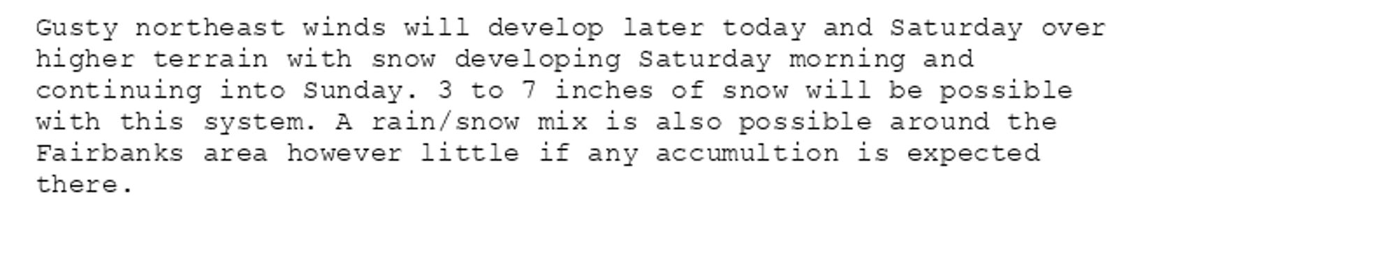
Special Weather Statement issued October 11 at 4:08AM AKDT by NWS Fairbanks AK Additional Details Here.
Special Weather Statement issued October 11 at 4:07AM AKDT by NWS Fairbanks AK Additional Details Here.
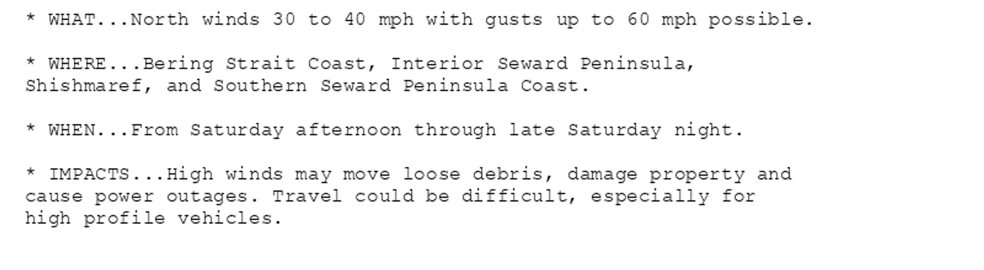
🚨 High Wind Watch issued October 11 at 4:01AM AKDT until October 13 at 4:00AM AKDT by NWS Fairbanks AK 🚨 Additional Details Here.
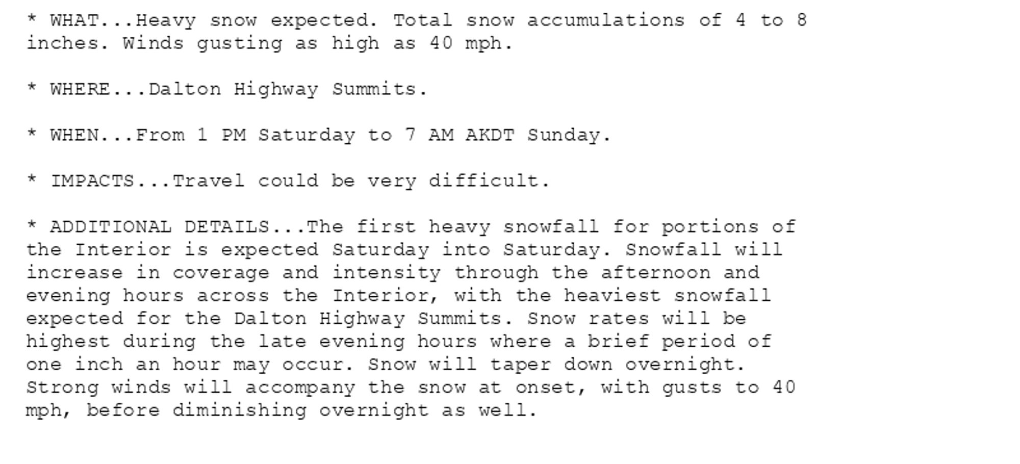
🚨 Winter Storm Warning issued October 11 at 3:48AM AKDT until October 13 at 7:00AM AKDT by NWS Fairbanks AK 🚨 Additional Details Here.
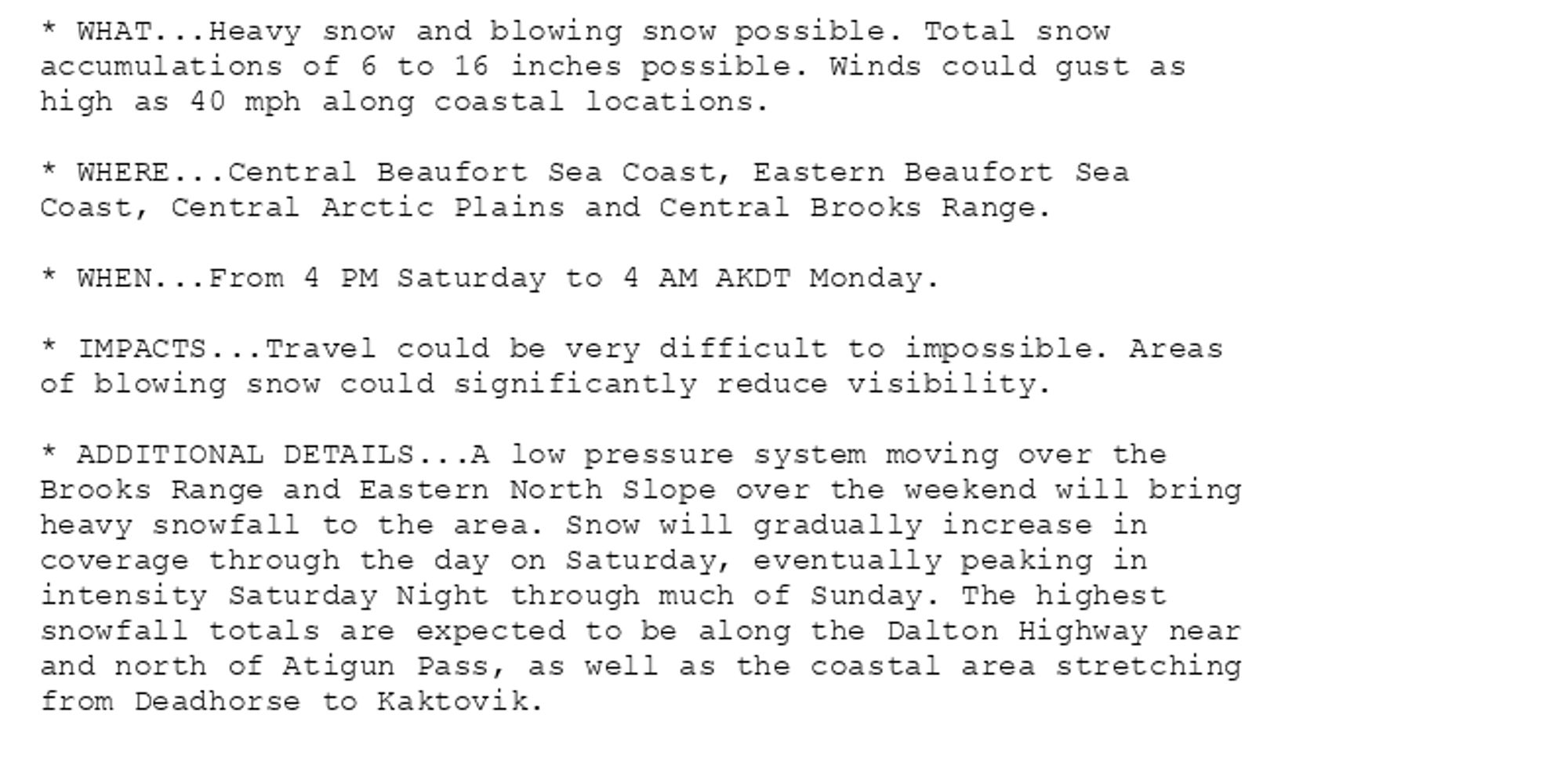
🚨 Winter Storm Warning issued October 11 at 3:55AM AKDT until October 14 at 4:00AM AKDT by NWS Fairbanks AK 🚨 Additional Details Here.
Small Craft Advisory issued October 11 at 3:04AM AKDT until October 12 at 5:00PM AKDT by NWS Fairbanks AK Additional Details Here.
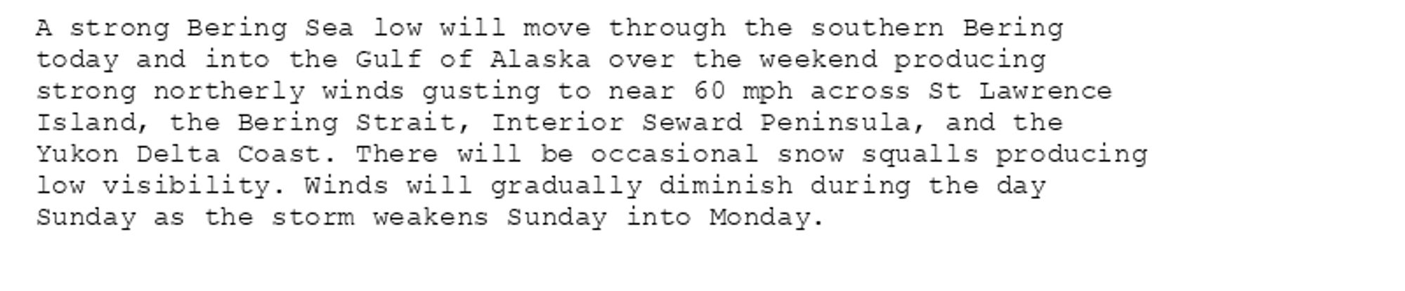
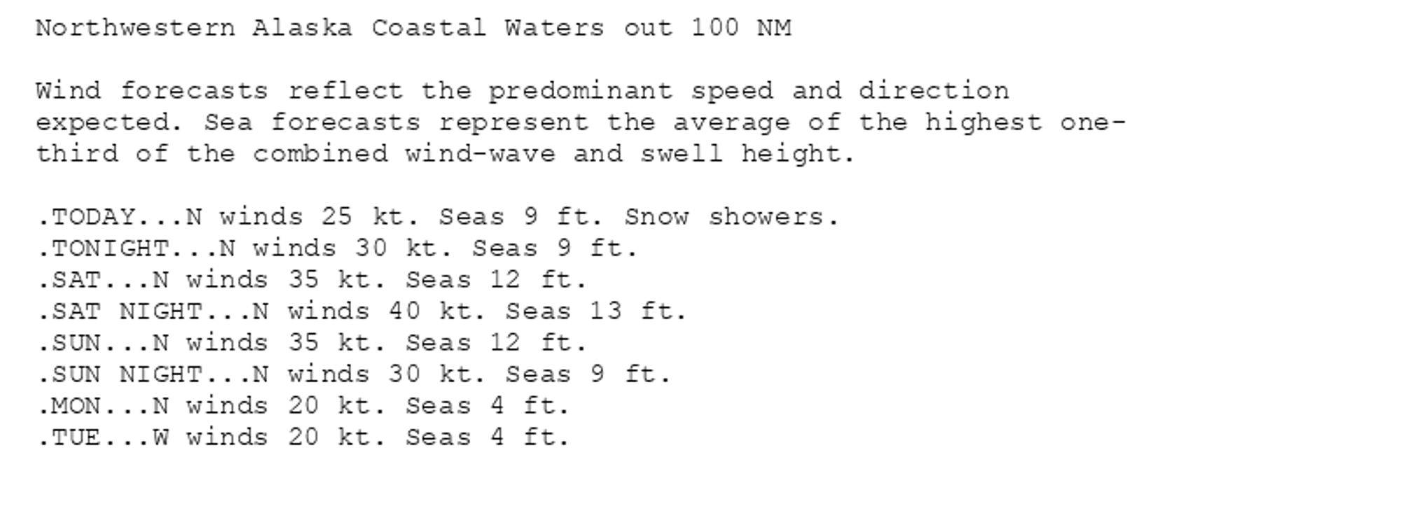
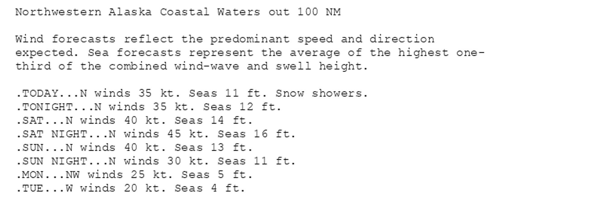
Gale Warning issued October 11 at 3:08AM AKDT until October 12 at 5:00PM AKDT by NWS Fairbanks AK Additional Details Here.(4/4)
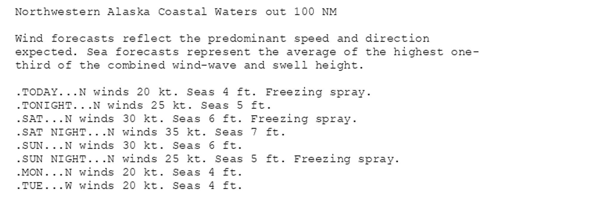
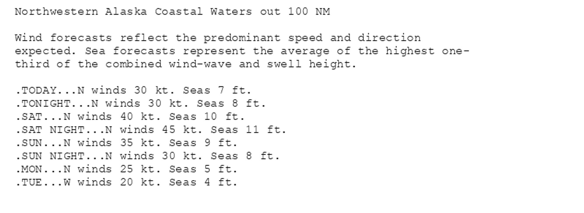
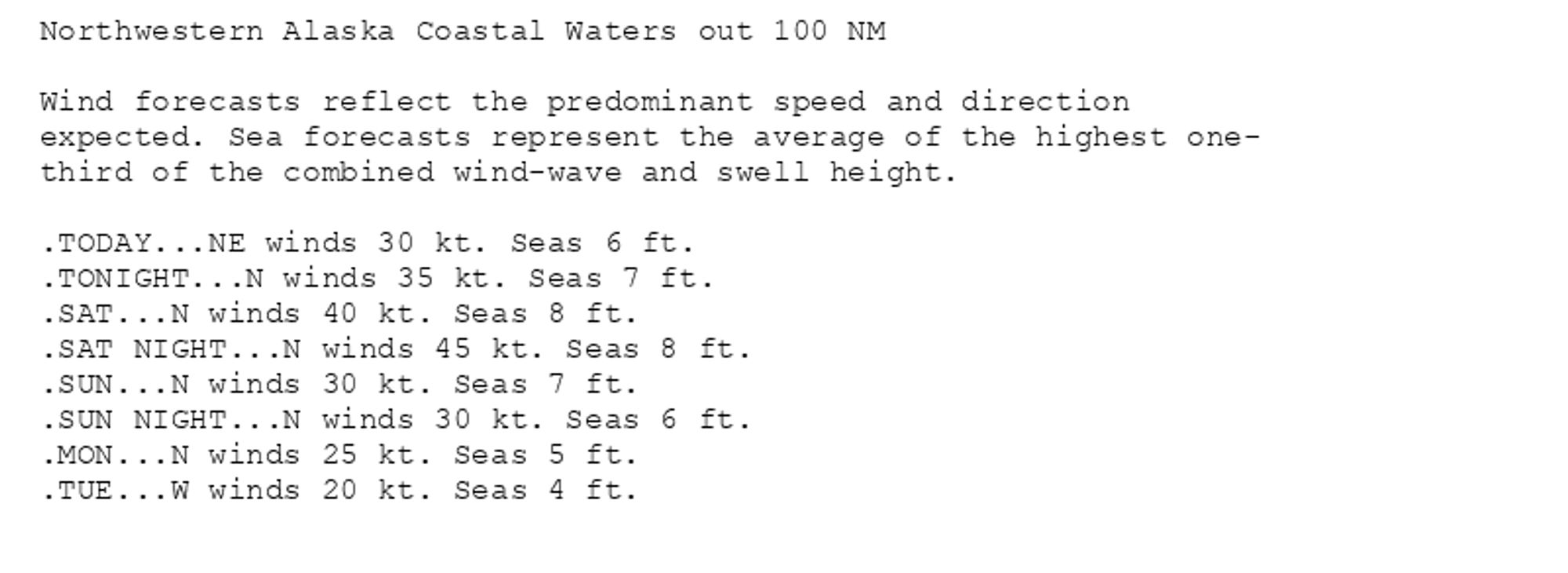
Gale Warning issued October 11 at 3:08AM AKDT until October 12 at 5:00PM AKDT by NWS Fairbanks AK Additional Details Here. (3/4)
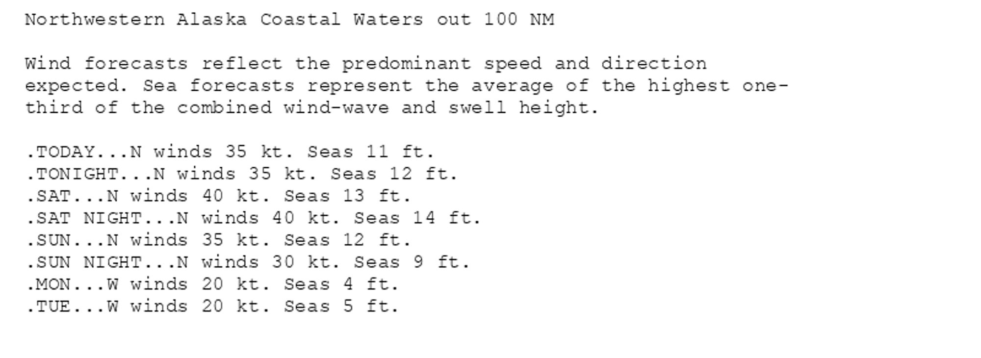
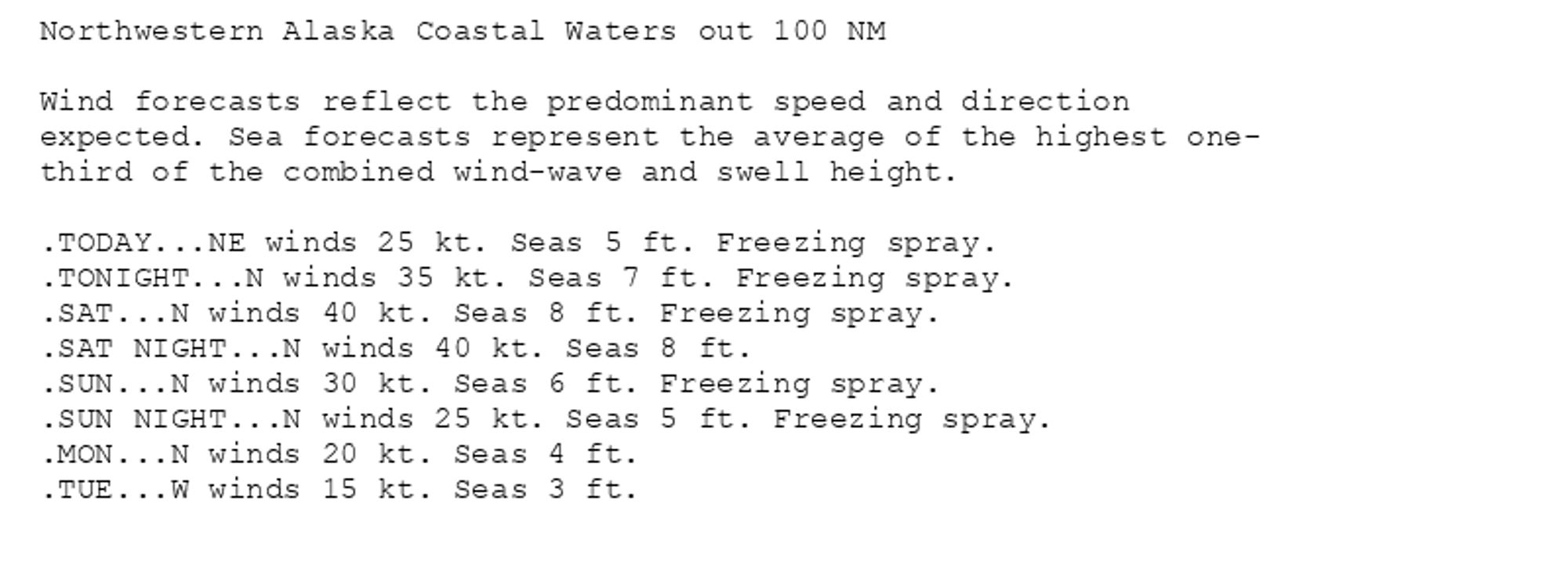
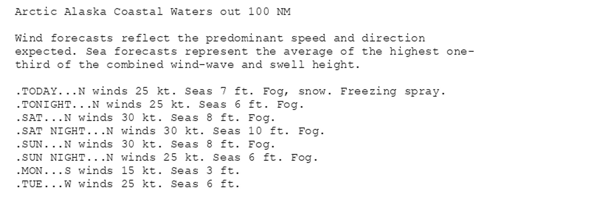
Gale Warning issued October 11 at 3:08AM AKDT until October 12 at 5:00PM AKDT by NWS Fairbanks AK Additional Details Here. (2/4)
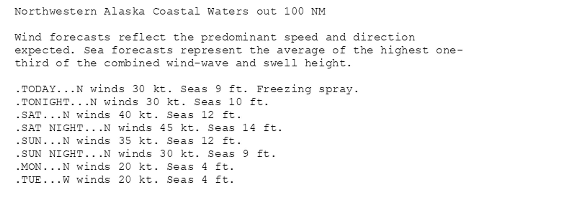
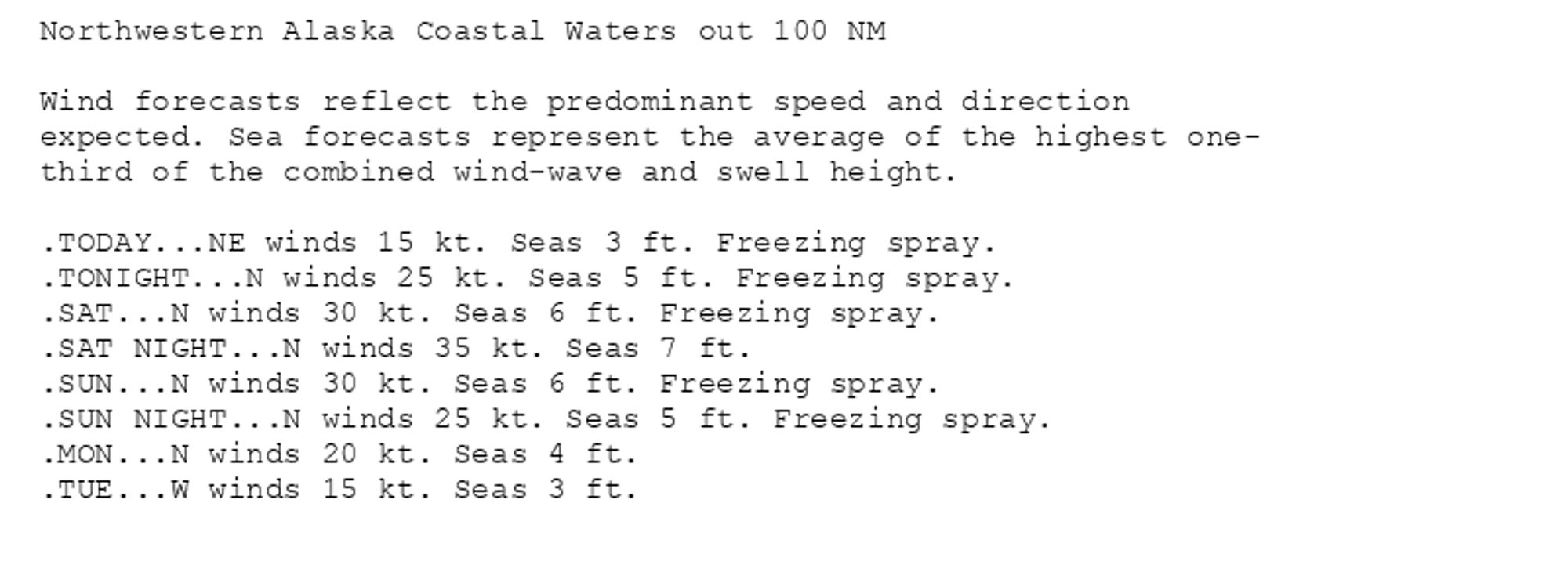
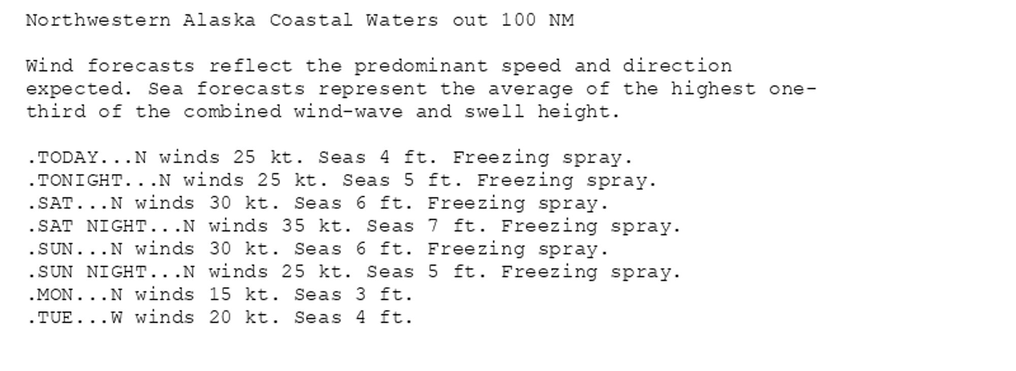

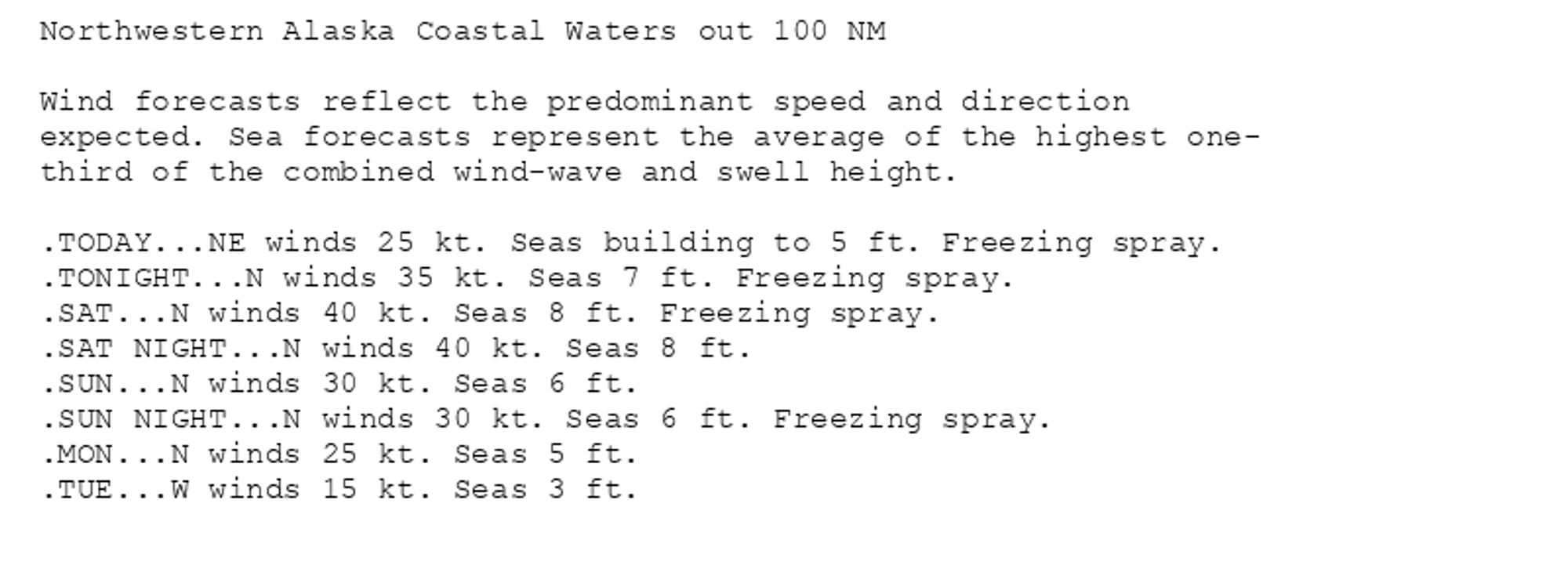
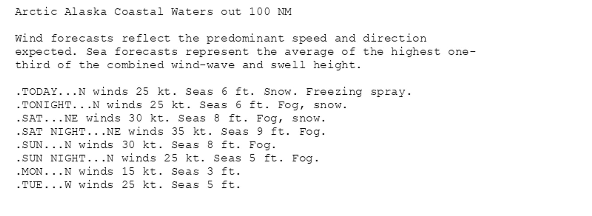
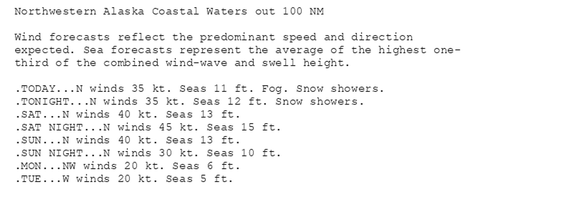
Gale Warning issued October 11 at 3:08AM AKDT until October 12 at 5:00PM AKDT by NWS Fairbanks AK Additional Details Here. (1/4)