
H
Henning
@geohenning.bsky.social
Geosciences MSc • Earthquakes • Soil protection and contaminated sites • 📷 Fujifilm X100V • Ruhrgebiet • S04
Maintainer of @geofon.bsky.social
Creator of Bluesky's FujiFeed
1.4k followers432 following2k posts
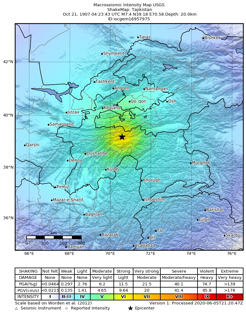
The 1907 Qaratog #earthquake struck on October 21 near Qaratog, in the border area between Uzbekistan and Tajikistan. It had a magnitude of 7.4 and a maximum intensity of IX. The disaster resulted in 12,000 to 15,000 deaths, one of the deadliest earthquakes ever. ⚒
H
Henning
@geohenning.bsky.social
Geosciences MSc • Earthquakes • Soil protection and contaminated sites • 📷 Fujifilm X100V • Ruhrgebiet • S04
Maintainer of @geofon.bsky.social
Creator of Bluesky's FujiFeed
1.4k followers432 following2k posts