SR
Scott Robeson
@indianaclimate.bsky.social
Climatologist, environmental scientist, statistician, and geographer (in the USA) | FirstGen | UDel and UBC grad | Grower of food and lover of plants and birds | Partner of bsky.app/profile/teresarobeson.bsky.social
1.2k followers564 following642 posts
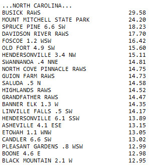
Any red dot on this map is ~12+ inches of rain over the last two days and it's likely there was much more at higher elevations. The gap in coverage northeast of Asheville is where Mt. Mitchell, highest point east of the Mississippi, is. It and nearby Busick got over 2 feet. 🌊🧪
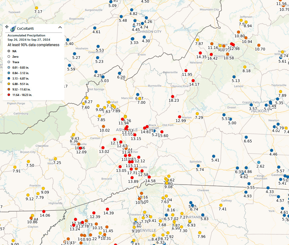
To be clear, these are two-day summaries of the observations from two different networks of volunteer ("cooperative") networks: left is CoCoRaHS and right is the NOAA Cooperative Observer Program (COOP).
In addition the myriad of people there is the NCDC operational and safe?!
Shoutout to CoCoRaHS, volunteer powered!
SR
Scott Robeson
@indianaclimate.bsky.social
Climatologist, environmental scientist, statistician, and geographer (in the USA) | FirstGen | UDel and UBC grad | Grower of food and lover of plants and birds | Partner of bsky.app/profile/teresarobeson.bsky.social
1.2k followers564 following642 posts