DJ
Dr Joanne Williams
@jowilliams.bsky.social
Sea-level and tidal scientist. Liverpool, UK.
Opinions own!
1.1k followers488 following3.6k posts
GNSS (GPS and the like) can be used to measure water level, using reflectometry. The direct signal from the satellite also arrives late at the receiver due to reflection off the sea, and signal-to-noise levels change with the angle as the satellite passes overhead. 🌊
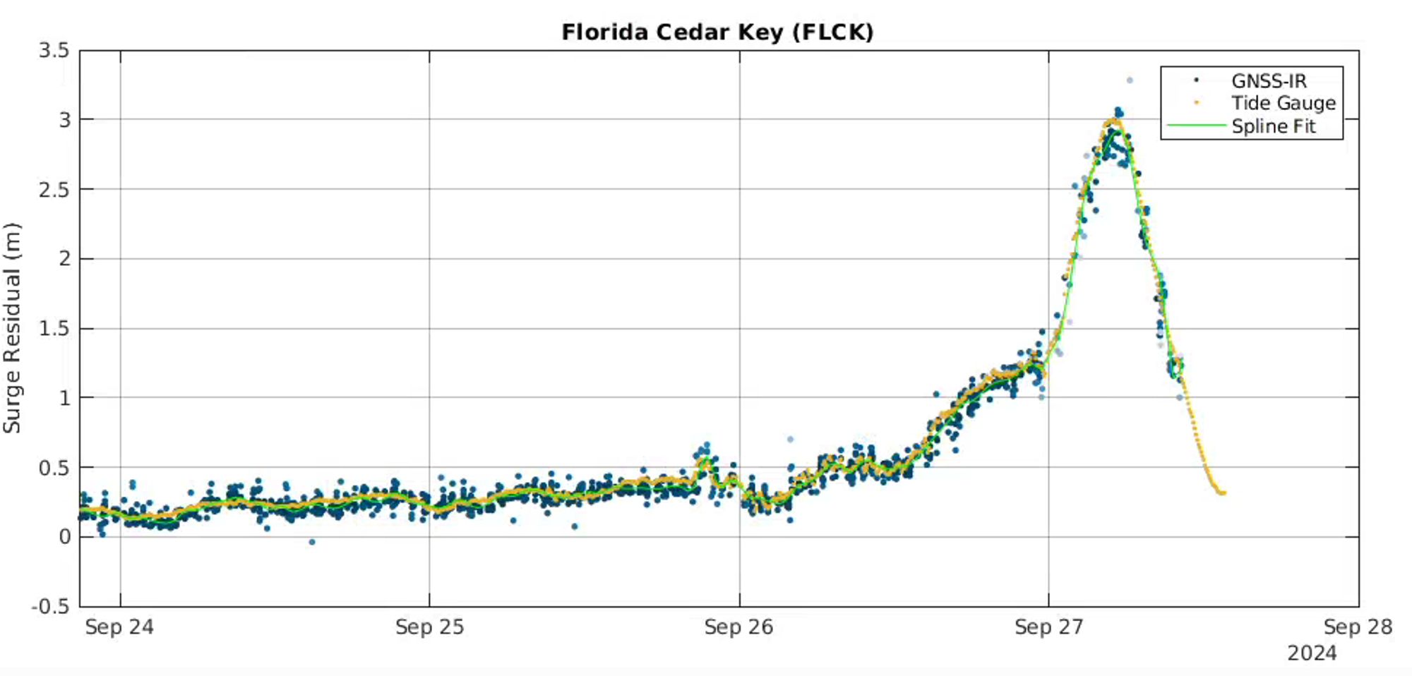
It's not as regular a signal as a tide gauge (hence the spline fit in that plot), but it has certain advantages. The receiver can be raised up safely on land, so long as it has a good view of the water.
DJ
Dr Joanne Williams
@jowilliams.bsky.social
Sea-level and tidal scientist. Liverpool, UK.
Opinions own!
1.1k followers488 following3.6k posts