M
Michael
@ksuhistorian.bsky.social
Environmental historian of coyotes and other toothy critters. Cheerleader for grasslands big and small. Kansas State University alumni.
My YouTube channel is youtube.com/@wildlifehistory?si=xX6Glh9u
Website is wildlifehistory.com
838 followers408 following1.6k posts
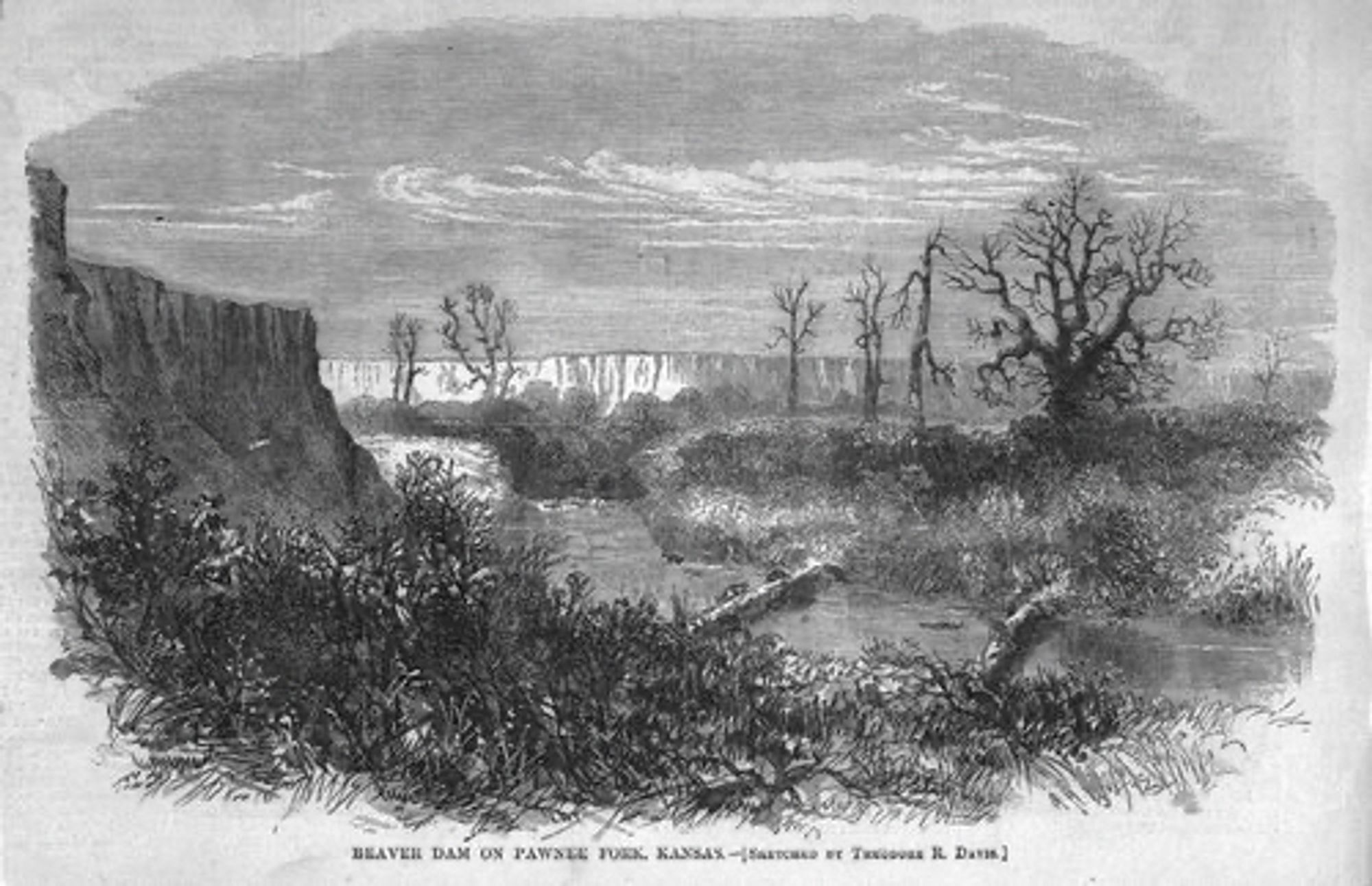
Beavers transformed the creeks and rivers of the Great Plains into relatively lush riparian zones. This photo is from Harper’s Weekly in 1867. It shows a section of the Pawnee River about 30 miles west of Ft. Larned. You can see all trees and other plants. 2/?
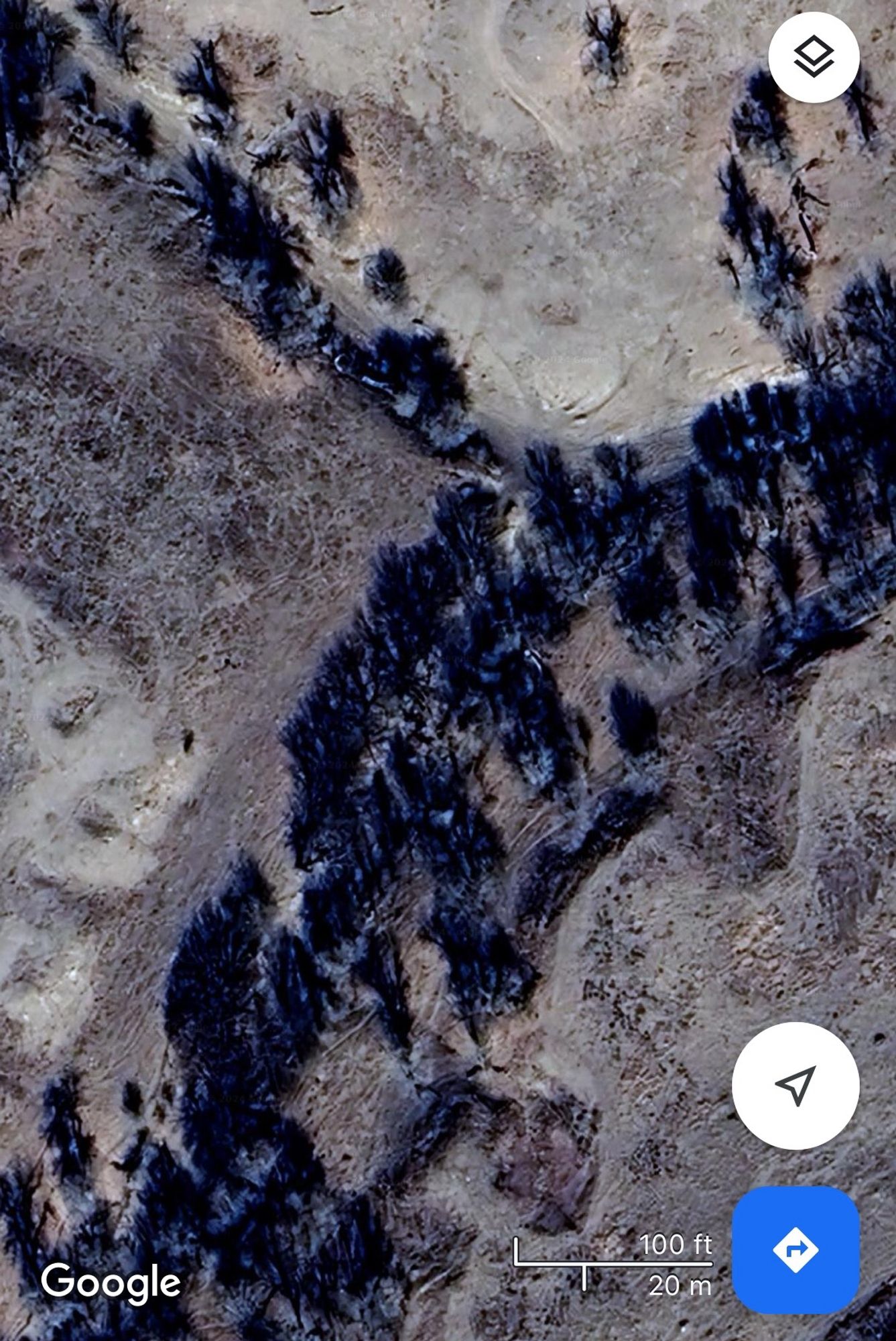
Compare that image to this screen shot from Google Maps in the same approximate location and you can see the changes. Even accounting for a different perspective and season the modern river is drier. I’m betting erosion toke a toll on the banks also. 3/?
M
Michael
@ksuhistorian.bsky.social
Environmental historian of coyotes and other toothy critters. Cheerleader for grasslands big and small. Kansas State University alumni.
My YouTube channel is youtube.com/@wildlifehistory?si=xX6Glh9u
Website is wildlifehistory.com
838 followers408 following1.6k posts