BLUE
AF
Alerts from NWS Newport/Morehead City NC (UNOFFICIAL)
@mhx.nws-bot.us
Unofficial bot sharing alerts from NWS Newport/Morehead City NC. This account is not monitored. Contact @wandrme.paxex.aero if needed.
94 followers1 following185 posts
AFmhx.nws-bot.us

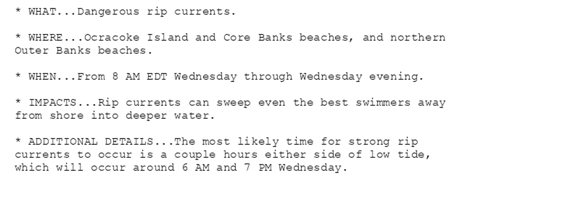
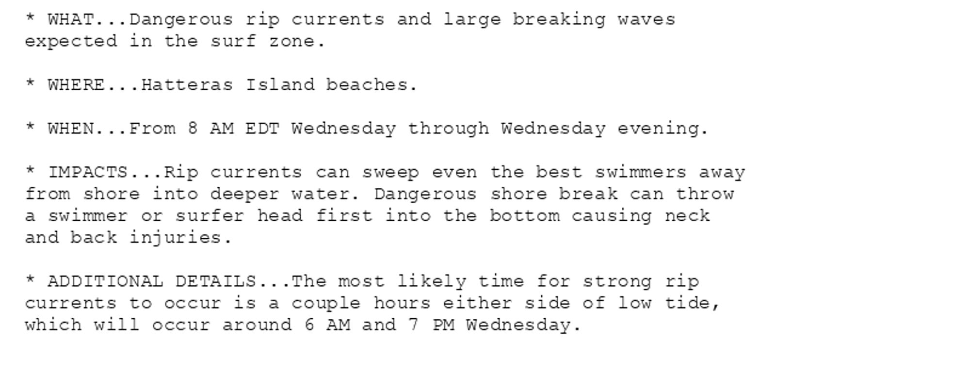
Beach Hazards Statement issued October 8 at 8:18PM EDT until October 9 at 8:00PM EDT by NWS Newport/Morehead City NC Additional Details Here.

* WHAT...Dangerous rip currents.

* WHERE...Ocracoke Island and Core Banks beaches, and northern
Outer Banks beaches.

* WHEN...From 8 AM EDT Wednesday through Wednesday evening.

* IMPACTS...Rip currents can sweep even the best swimmers away
from shore into deeper water.

* ADDITIONAL DETAILS...The most likely time for strong rip
currents to occur is a couple hours either side of low tide,
which will occur around 6 AM and 7 PM Wednesday.
* WHAT...Dangerous rip currents and large breaking waves
expected in the surf zone.

* WHERE...Hatteras Island beaches.

* WHEN...From 8 AM EDT Wednesday through Wednesday evening.

* IMPACTS...Rip currents can sweep even the best swimmers away
from shore into deeper water. Dangerous shore break can throw
a swimmer or surfer head first into the bottom causing neck
and back injuries.

* ADDITIONAL DETAILS...The most likely time for strong rip
currents to occur is a couple hours either side of low tide,
which will occur around 6 AM and 7 PM Wednesday.
0

AF
Alerts from NWS Newport/Morehead City NC (UNOFFICIAL)
@mhx.nws-bot.us
Unofficial bot sharing alerts from NWS Newport/Morehead City NC. This account is not monitored. Contact @wandrme.paxex.aero if needed.
94 followers1 following185 posts