BLUE
NH
National Hurricane Center - Atlantic Alerts (UNOFFICIAL)
@nhc-atlc.nws-bot.us
Unofficial bot sharing alerts from National Hurricane Center - Atlantic. This account is not monitored. Contact @wandrme.paxex.aero if needed.
1.1k followers1 following250 posts
NHnhc-atlc.nws-bot.us

NHC Atlantic Outlook update for Fri, 18 Oct 2024 05:05:19 GMT Additional Details Here.


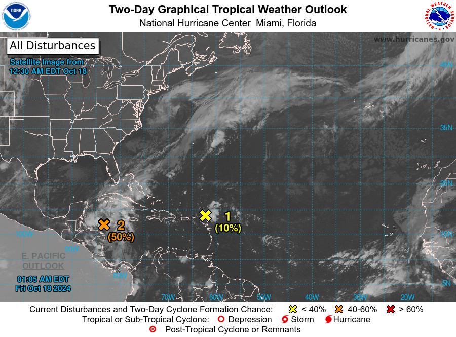
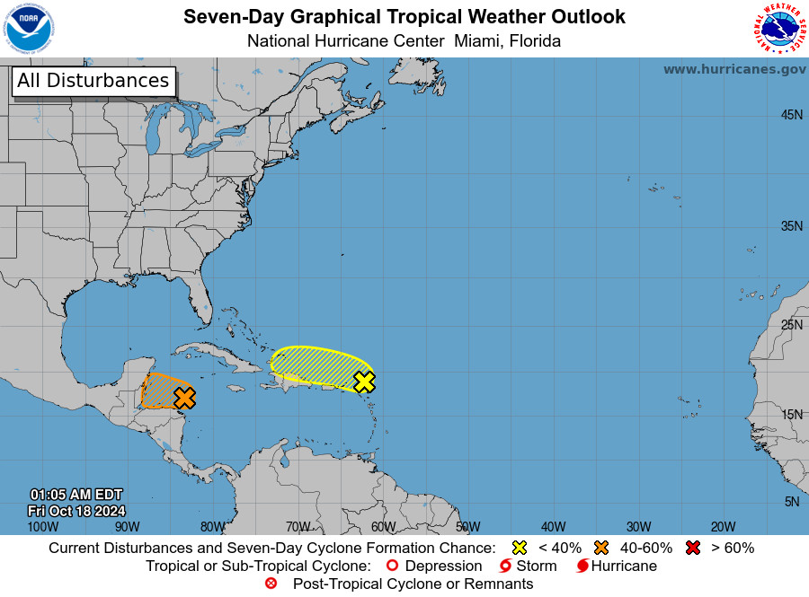
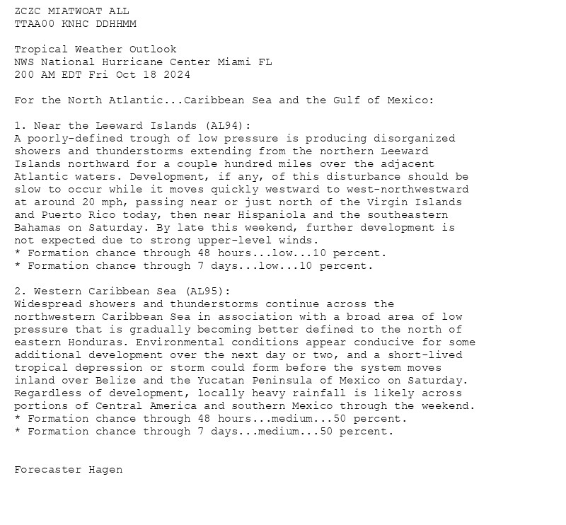
ZCZC MIATWOAT ALL<br>TTAA00 KNHC DDHHMM<br><br>Tropical Weather Outlook<br>NWS National Hurricane Center Miami FL<br>200 AM EDT Fri Oct 18 2024<br><br>For the North Atlantic...Caribbean Sea and the Gulf of Mexico:<br><br>1. Near the Leeward Islands (AL94):<br>A poorly-defined trough of low pressure is producing disorganized <br>showers and thunderstorms extending from the northern Leeward <br>Islands northward for a couple hundred miles over the adjacent <br>Atlantic waters. Development, if any, of this disturbance should be <br>slow to occur while it moves quickly westward to west-northwestward <br>at around 20 mph, passing near or just north of the Virgin Islands <br>and Puerto Rico today, then near Hispaniola and the southeastern <br>Bahamas on Saturday. By late this weekend, further development is <br>not expected due to strong upper-level winds.<br>* Formation chance through 48 hours...low...10 percent.<br>* Formation chance through 7 days...low...10 percent.<br><br>
2. Western Caribbean Sea (AL95):<br>Widespread showers and thunderstorms continue across the <br>northwestern Caribbean Sea in association with a broad area of low <br>pressure that is gradually becoming better defined to the north of <br>eastern Honduras. Environmental conditions appear conducive for some <br>additional development over the next day or two, and a short-lived <br>tropical depression or storm could form before the system moves <br>inland over Belize and the Yucatan Peninsula of Mexico on Saturday. <br>Regardless of development, locally heavy rainfall is likely across <br>portions of Central America and southern Mexico through the weekend.<br>* Formation chance through 48 hours...medium...50 percent.<br>* Formation chance through 7 days...medium...50 percent.<br><br>
<br>Forecaster Hagen<br><br>
Atlantic 2-Day Graphical Outlook Image
Atlantic 7-Day Graphical Outlook Image
0

NH
National Hurricane Center - Atlantic Alerts (UNOFFICIAL)
@nhc-atlc.nws-bot.us
Unofficial bot sharing alerts from National Hurricane Center - Atlantic. This account is not monitored. Contact @wandrme.paxex.aero if needed.
1.1k followers1 following250 posts