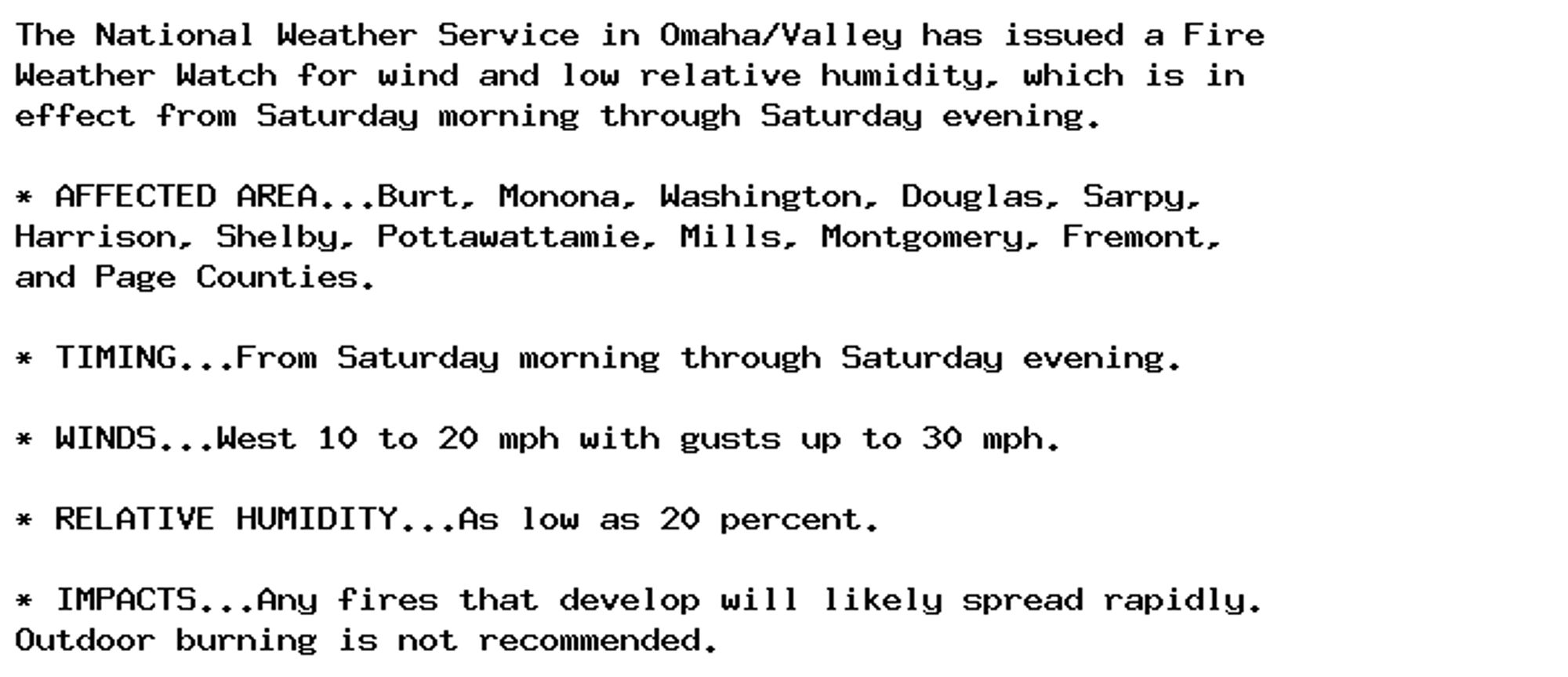
🚨 Fire Weather Watch issued October 4 at 2:13PM CDT until October 5 at 8:00PM CDT by NWS Omaha/Valley NE 🚨 Additional Details Here.
🚨 The Fire Weather Watch has been replaced. Please see the latest information from NWS Omaha/Valley NE on this developing situation. 🚨 Additional Details Here.

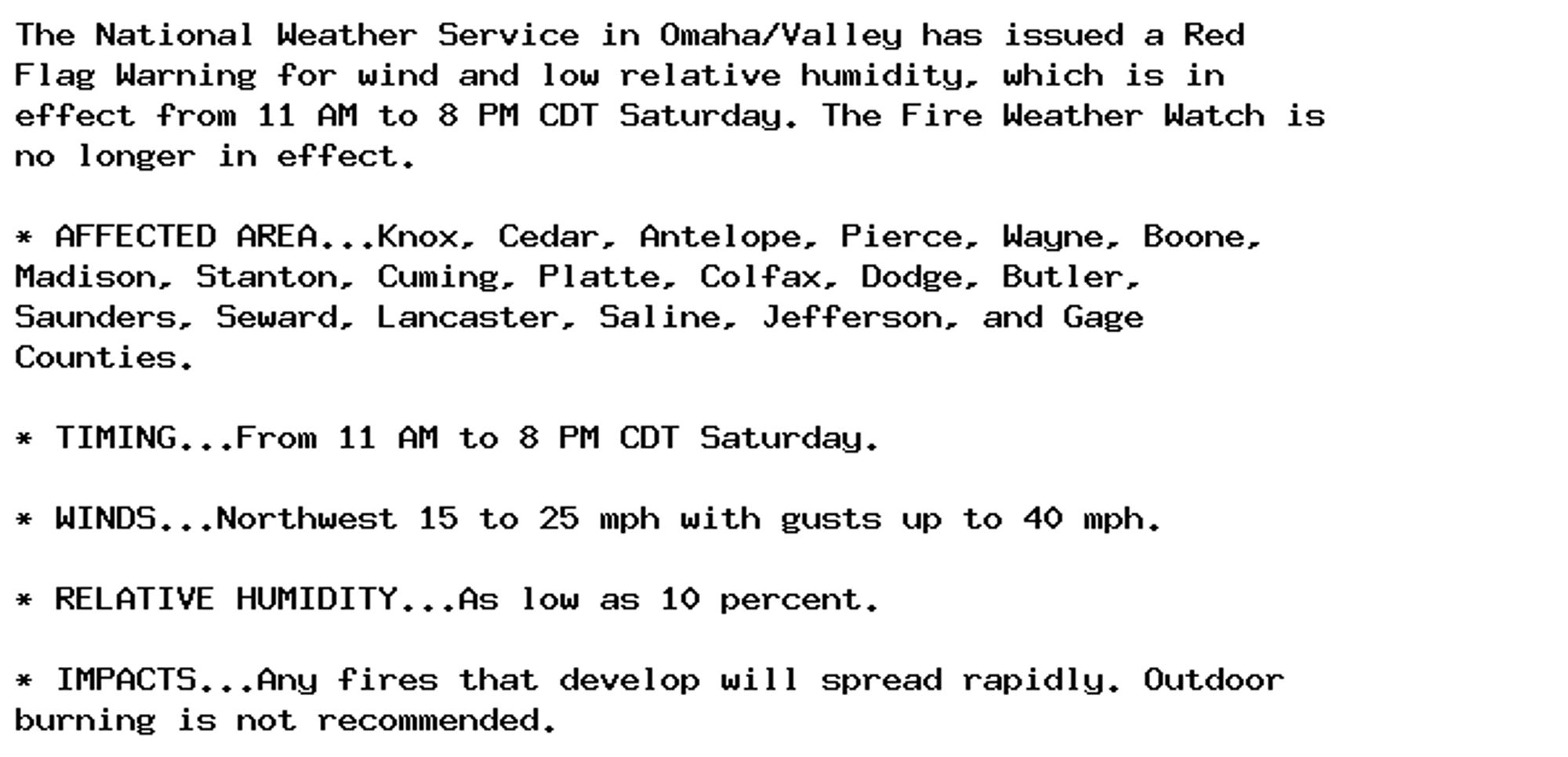
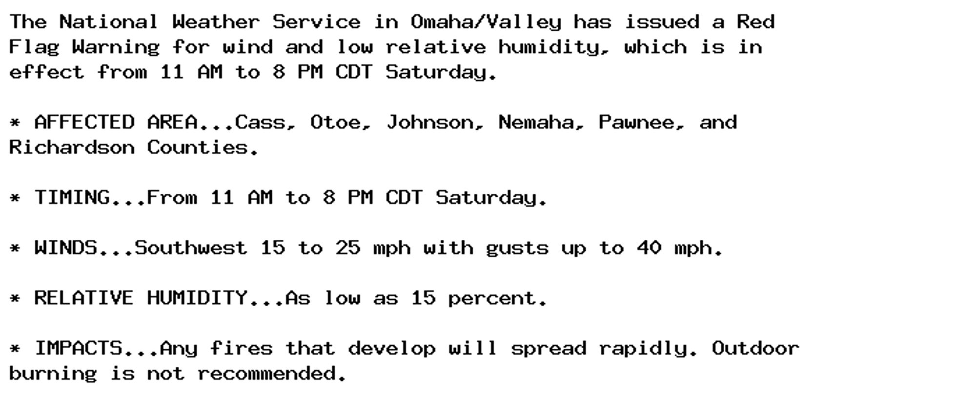
🚨 Red Flag Warning issued October 4 at 2:13PM CDT until October 5 at 8:00PM CDT by NWS Omaha/Valley NE 🚨 Additional Details Here.
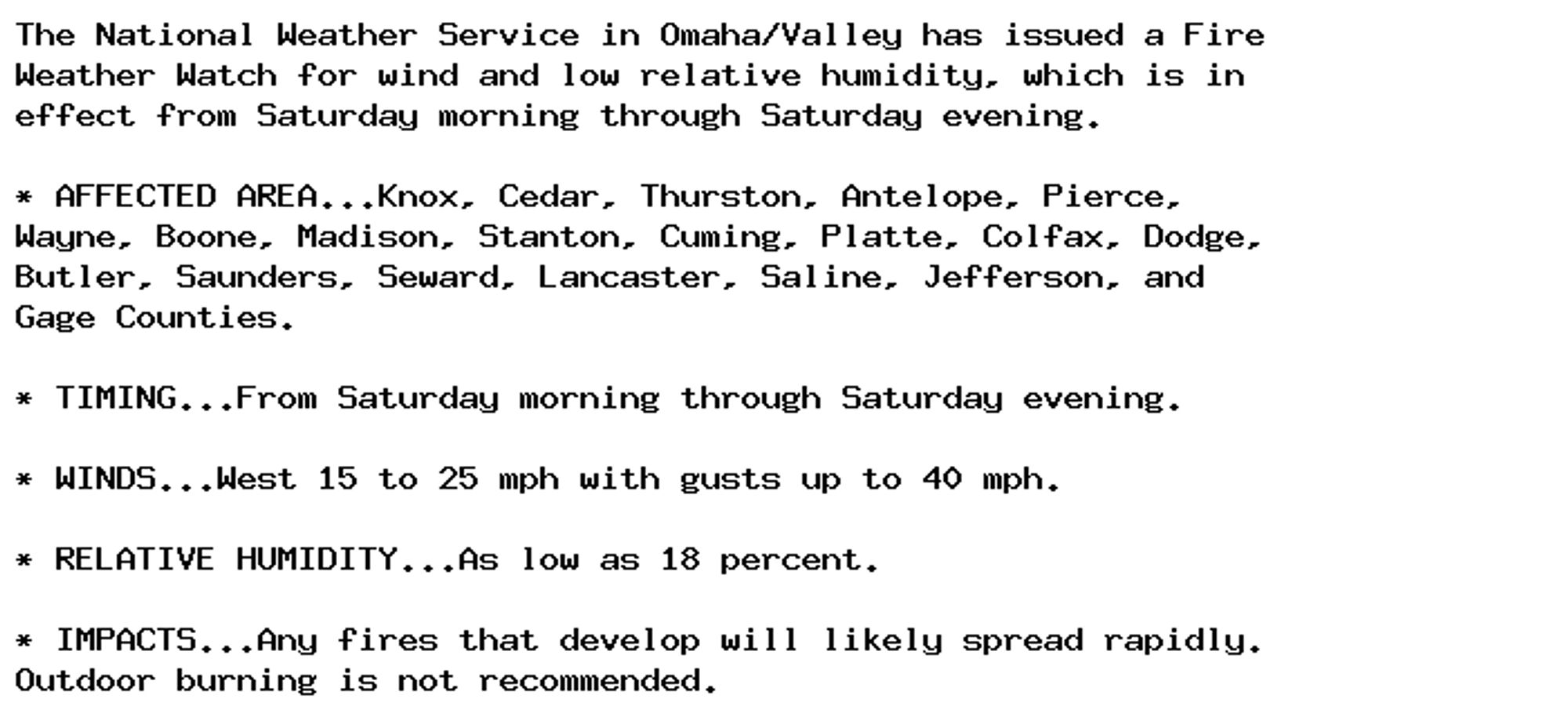
🚨 Fire Weather Watch issued October 4 at 2:13PM CDT until October 5 at 8:00PM CDT by NWS Omaha/Valley NE 🚨 Additional Details Here.
🚨 Red Flag Warning issued October 4 at 2:13PM CDT until October 5 at 8:00PM CDT by NWS Omaha/Valley NE 🚨 Additional Details Here.
🚨 Fire Weather Watch issued October 4 at 1:11AM CDT until October 5 at 9:00PM CDT by NWS Omaha/Valley NE 🚨 Additional Details Here.
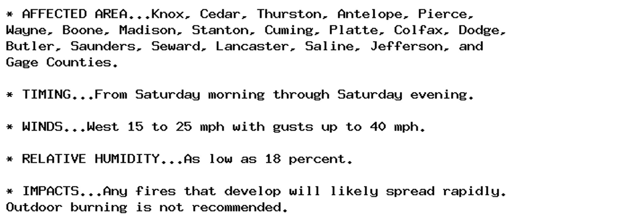
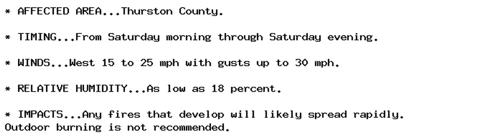
🚨 Fire Weather Watch issued October 3 at 2:17PM CDT until October 5 at 9:00PM CDT by NWS Omaha/Valley NE 🚨 Additional Details Here.
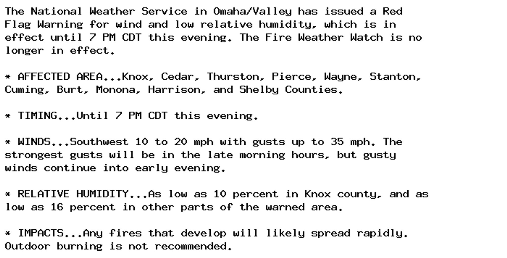
🚨 Red Flag Warning issued October 2 at 6:34PM CDT until October 2 at 7:00PM CDT by NWS Omaha/Valley NE 🚨 Additional Details Here.

🚨 Red Flag Warning issued October 2 at 11:56AM CDT until October 2 at 7:00PM CDT by NWS Omaha/Valley NE 🚨 Additional Details Here.
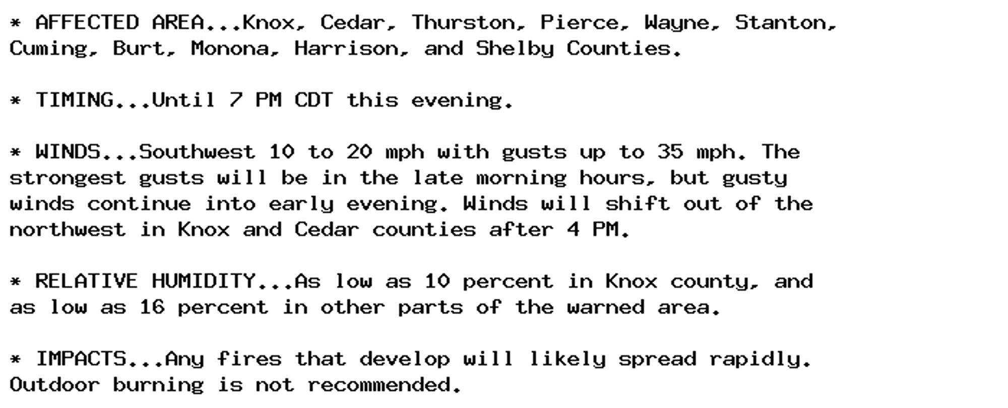
🚨 Red Flag Warning issued October 2 at 9:37AM CDT until October 2 at 7:00PM CDT by NWS Omaha/Valley NE 🚨 Additional Details Here.