OV
Ottawa Valley Wx
@ottvalleywx.bsky.social
CANWARN trained spotter, Ottawa-area weather events
6 followers5 following25 posts
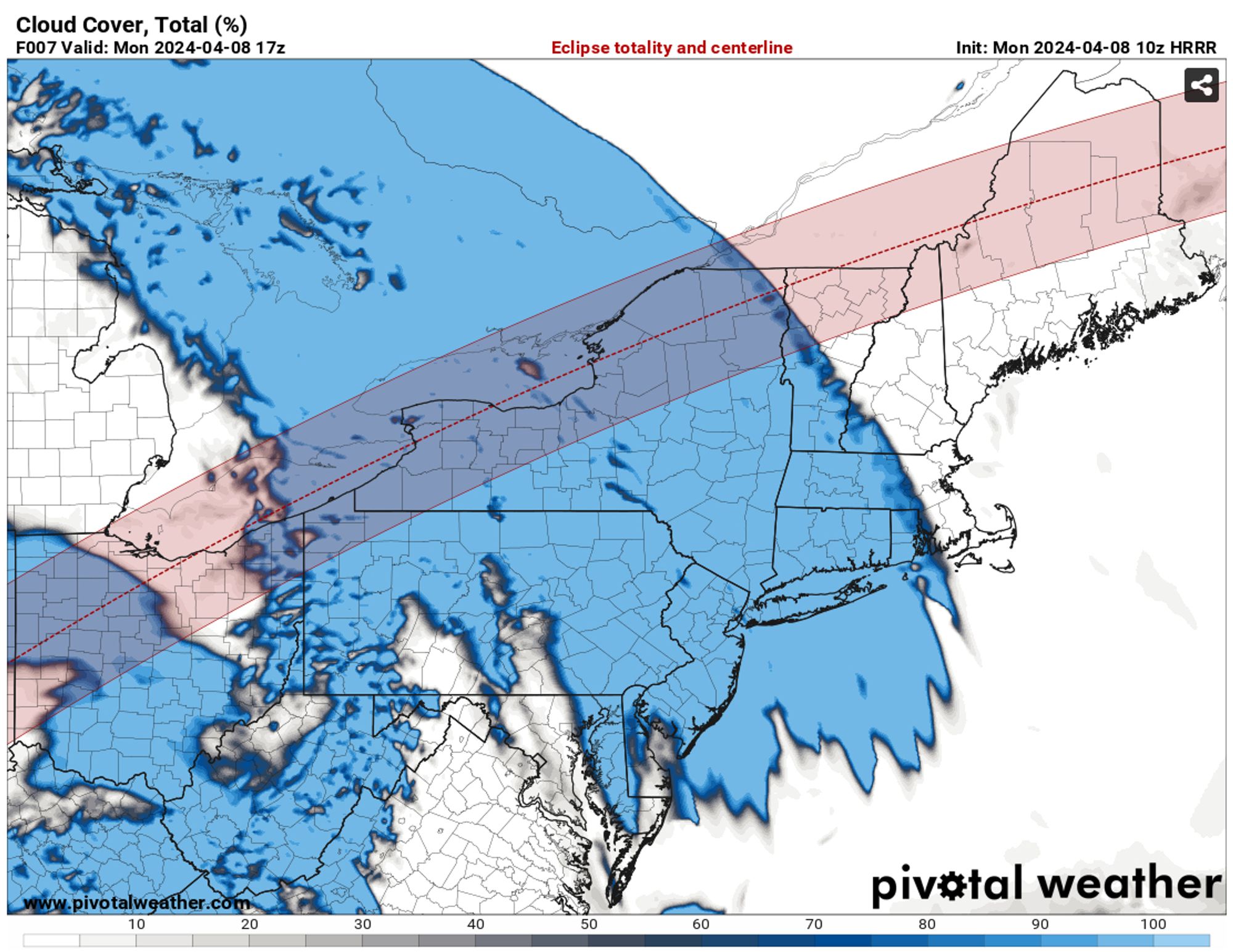
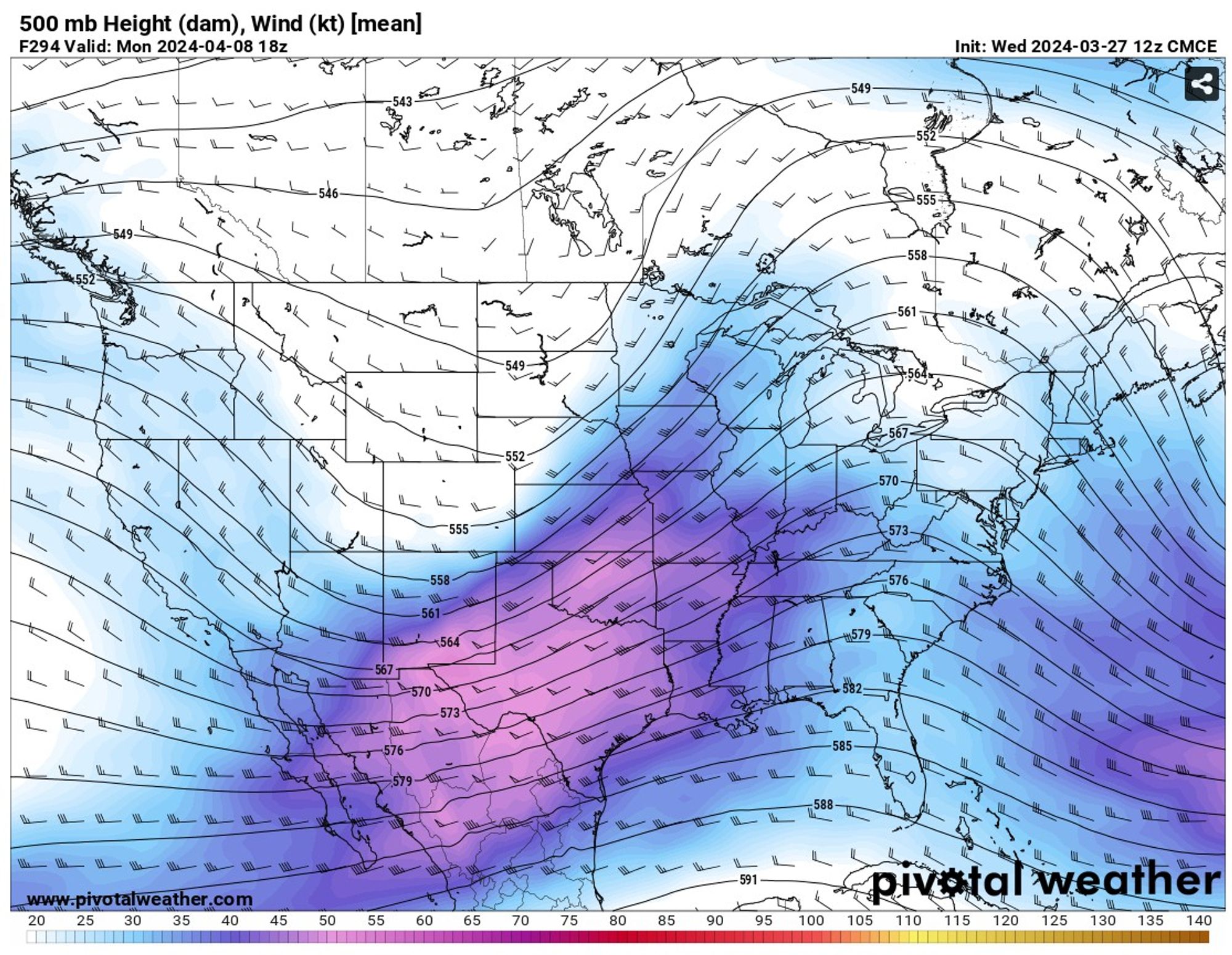
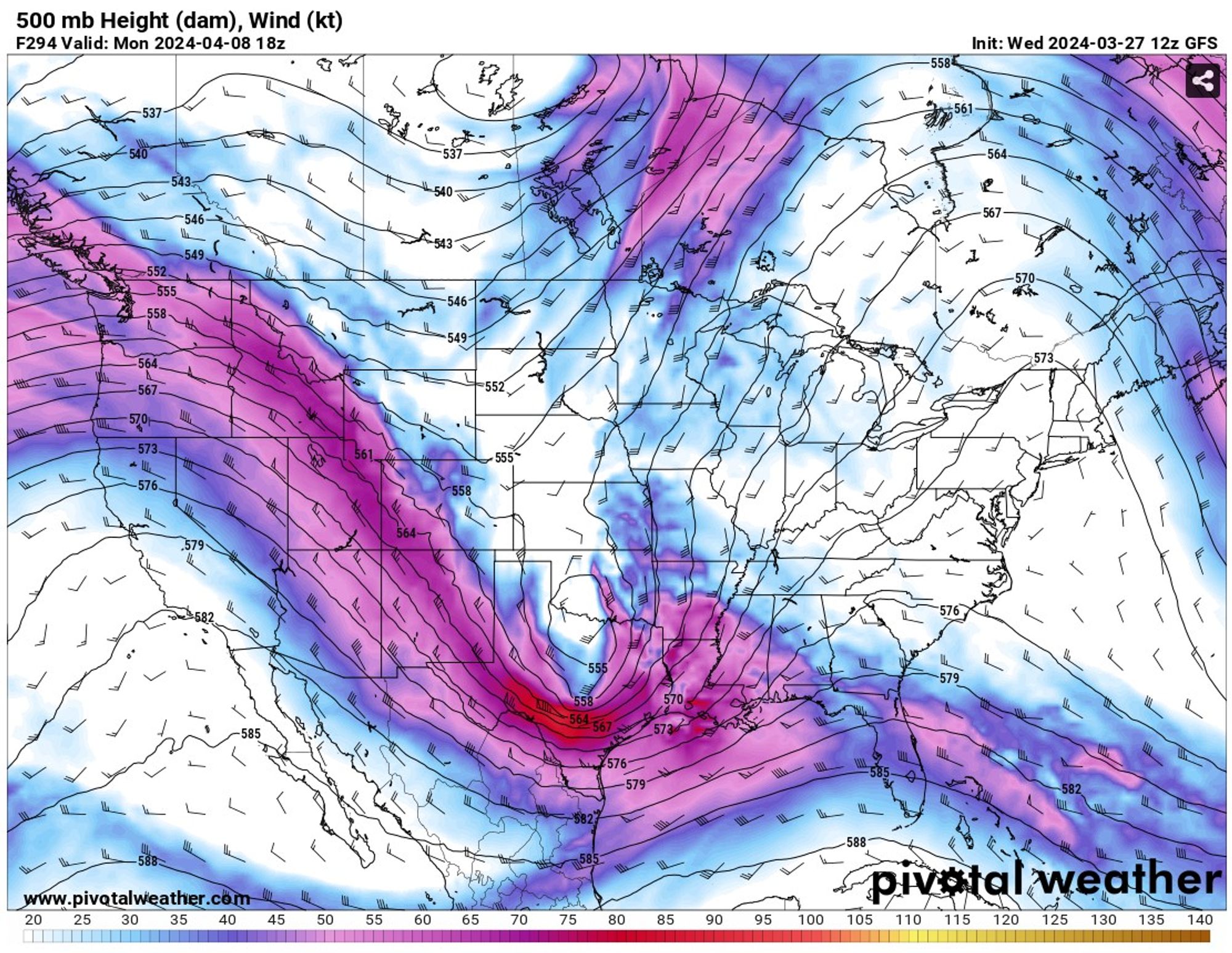
I would expect low-topped storms to develop, with the main threat of high winds if the upper winds mix down to the surface. Let's see what happens. (2/2)
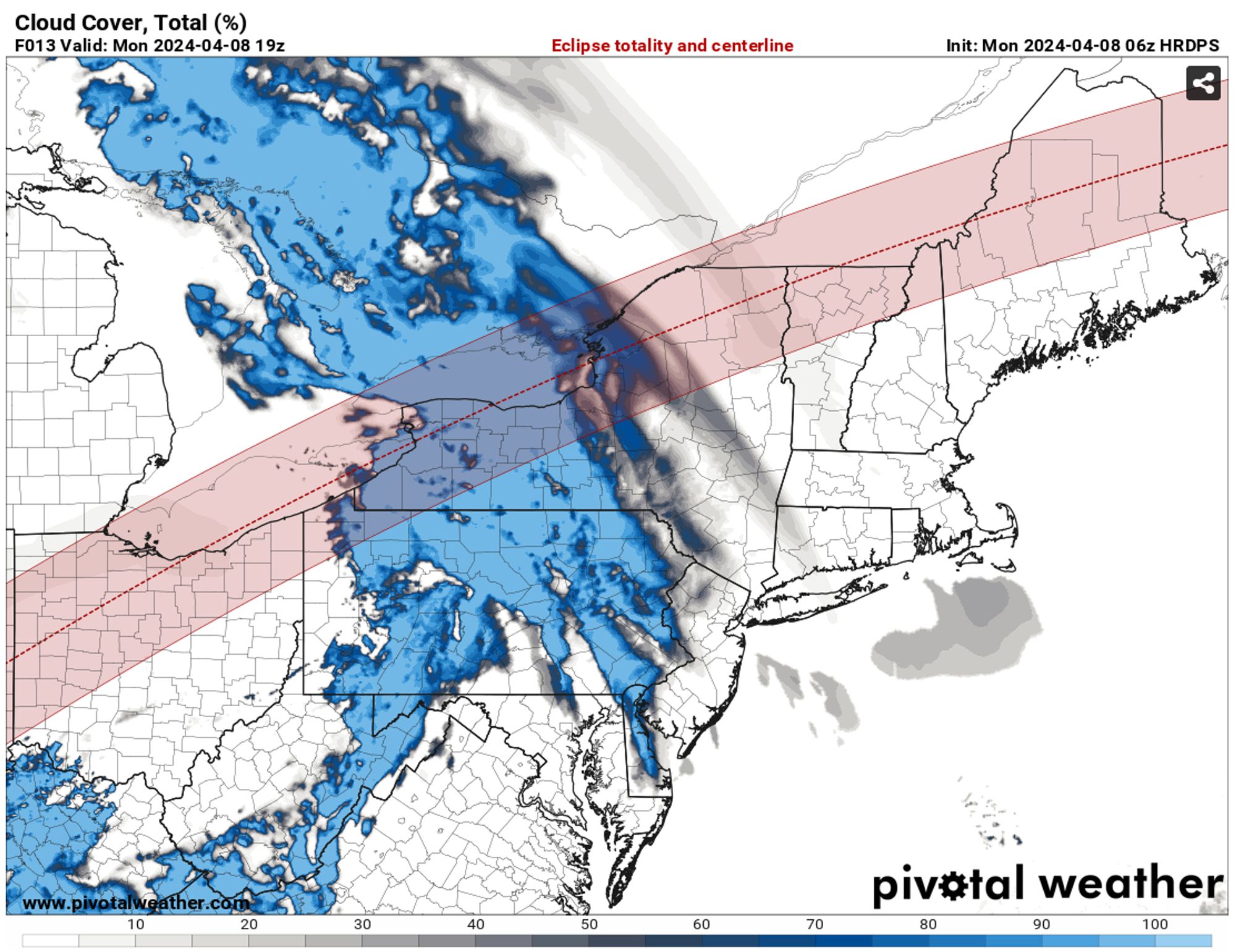
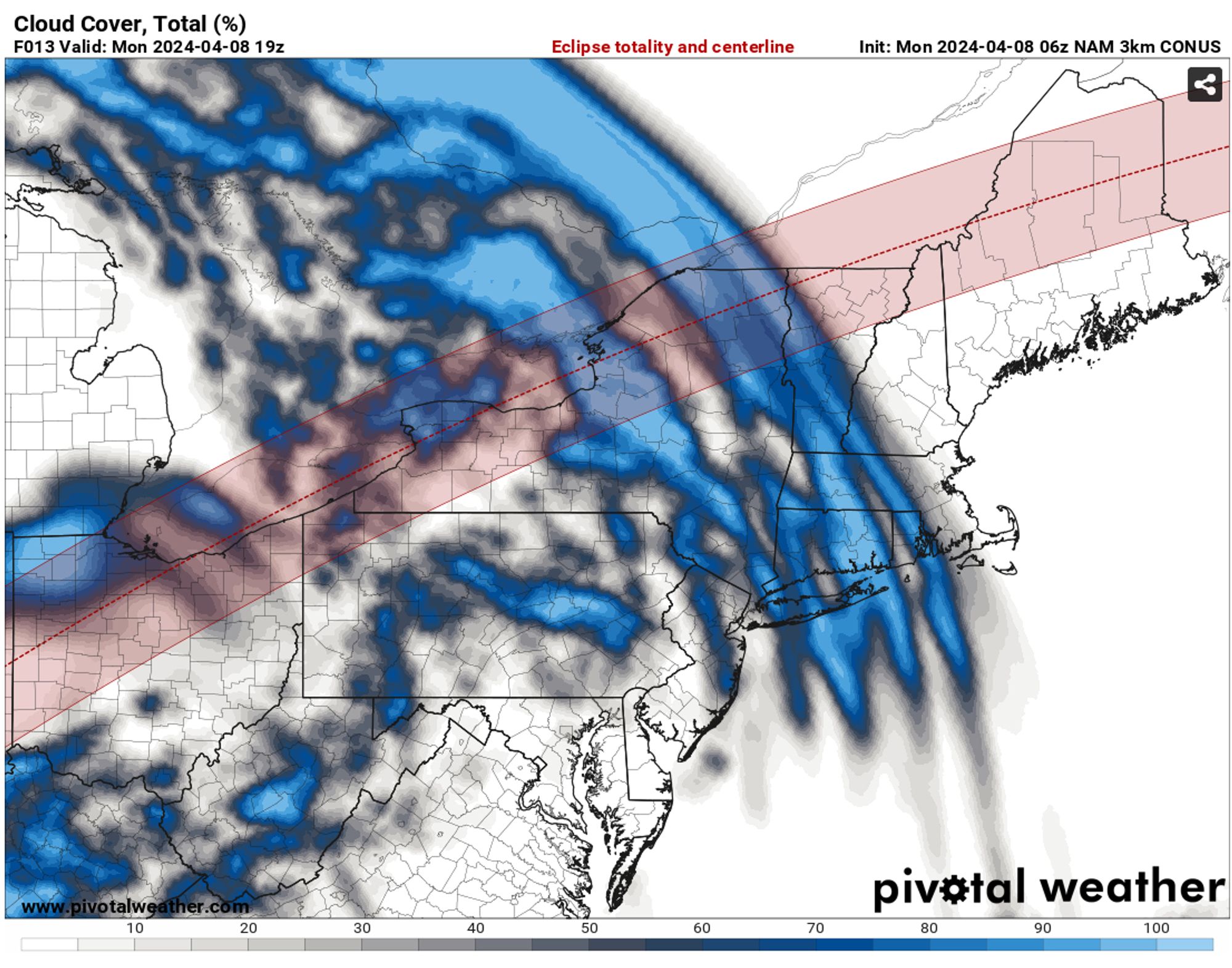
CMCE ensemble is calculating about a quarter to one third cloud cover in the general area, and GEFS ensemble is about 60% cloud cover.
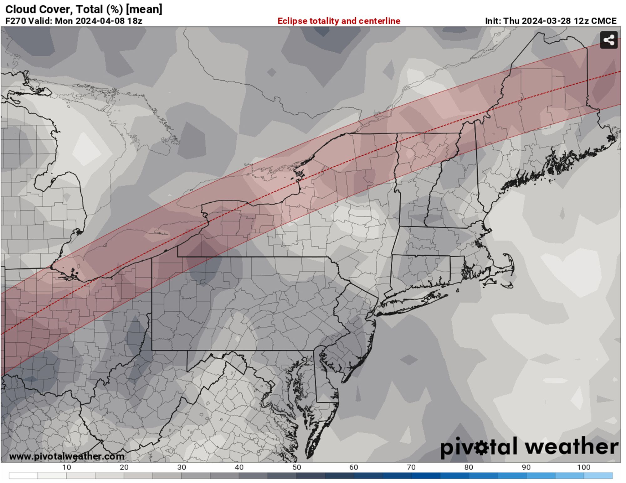
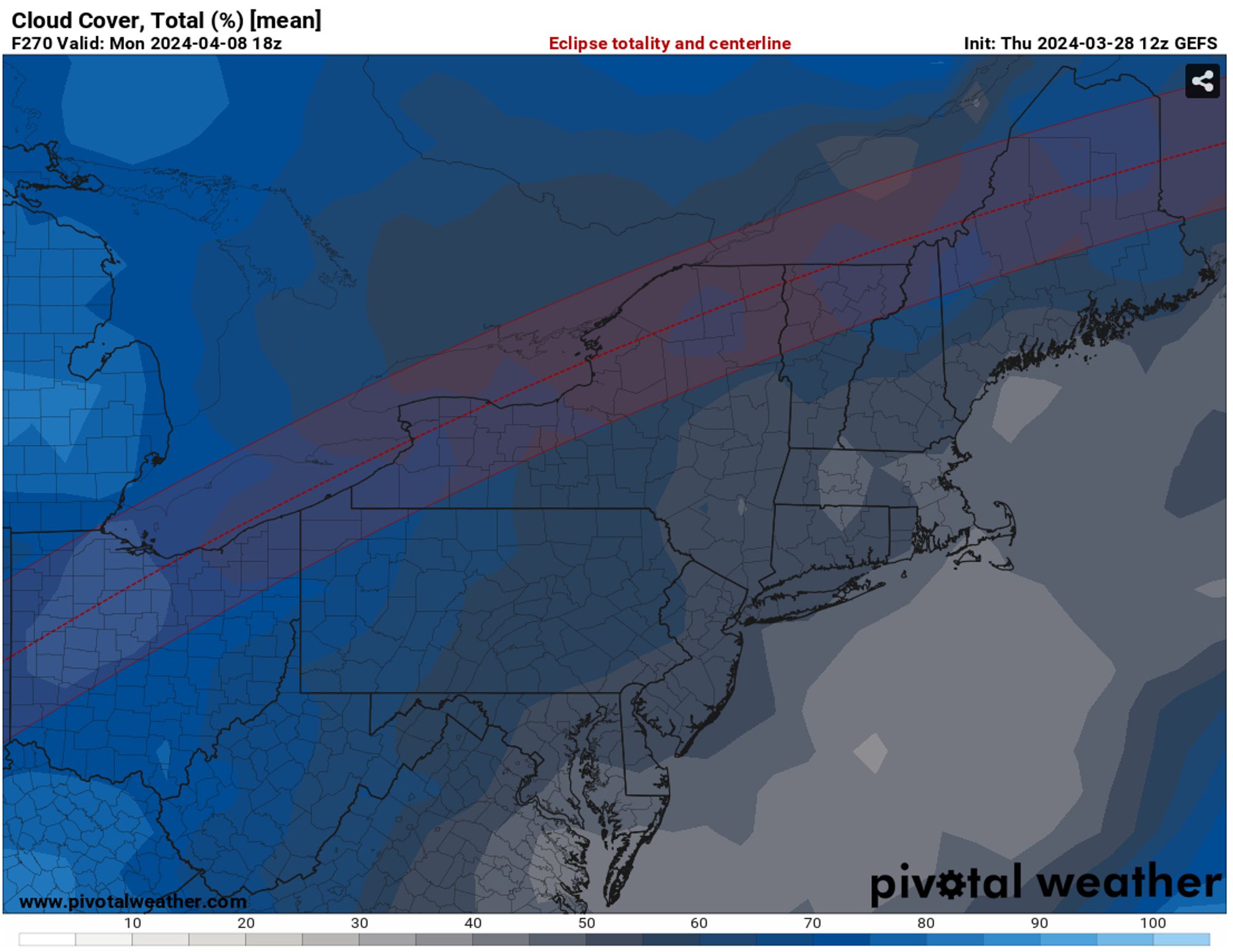
CMCE has a later timing on the ridge moving out, and thus why it's more bullish on less cloud cover. Compare to GFS, which has the trough starting to move in at the time. Given how close it is, I'd expect the models to see-saw still for a few days.
OV
Ottawa Valley Wx
@ottvalleywx.bsky.social
CANWARN trained spotter, Ottawa-area weather events
6 followers5 following25 posts