If you have point data on maps and need to retrieve coordinates, check out the updated #speciesdigitizergithub.com/ptarroso/spe...#GIS#Mapping#DataAnalysis
🚀 Spatial data with Go! 🌍 I wanted to explore a new language with spatial data and created a tool using Go + Godal (GDAL interface) to generate true color images from Sentinel-2 data. Get the tool here: github.com/ptarroso/gos...#golang#spatialdata#GIS Example result
Centenas de km disponíveis para painéis solares? Porque é que os espaços entre as faixas da autoestrada não são aproveitados para painéis solares? Deve ter pouco impacto, não é necessário inutilizar grandes áreas, nem destruir zonas naturais 🌞💡 #EnergiaSolar#Sustentabilidade

How does the environment shape contact zones? We analyzed the meeting areas between 🐍Vipera latastei and V. aspis 🐍 to uncover the ecological interactions. Check it out! #Vipers#Ecology#Biogeographydoi.org/10.1038/s415...
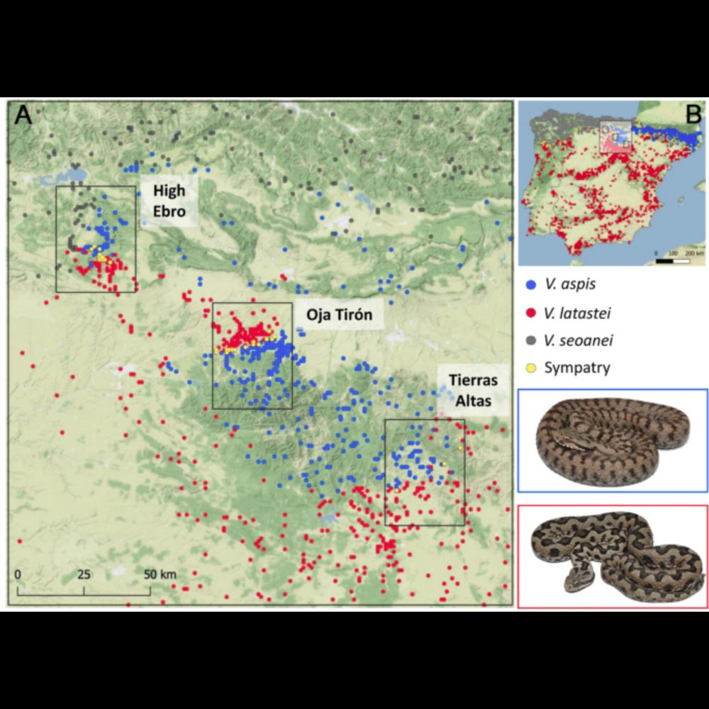
Scientific Reports - Local niches explain coexistence in environmentally-distinct contact zones between Western Mediterranean vipers