
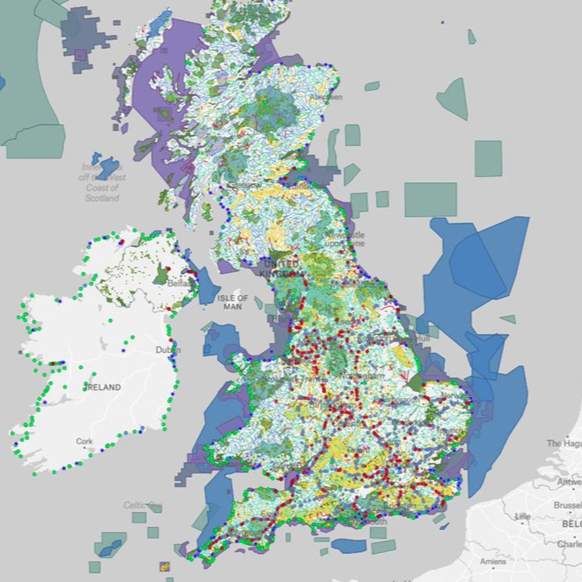
Excited to announce the launch of THE WATERSHED POLLUTION MAP! River health, landfills, sewage, road run-off, intensive farming, big industry, forever chemicals, abandoned mines, bathing waters, flood risk, protected areas and so much more... bit.ly/45GBMRQ#GreenSky#ClimateSky#EnergySky
Excellent work, this will be a really useful resource.
Wow, what a resource. An incredible amount of work must have gone into this
Am I right in thinking you launched this on Twitter a little while ago? Found it fascinating. My question is How are best to use this valuable information?
This is ‘excellent’. 🙏 However I’ll have to delve on a computer as it’s not happy on iOS.
This is fantastic Rachel, do you happen to know of anything similar for the US?
This looks amazing. Going to be investigating Norfolk rivers in the morning.
It’s a fabulous resource but it’s regularly crashing on my phone.
So it includes Ireland – which presumably has a different body in charge of water quality than the UK – but not the Isle of Man. Why?