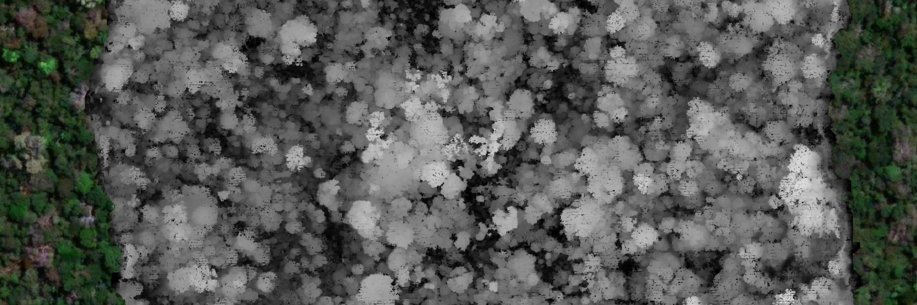
hey Ryan, it was a test to see if it could work for satellite images, as it was not designed with that in mind. Now for applications, i dont know, maybe to clean up some image with clouds for printing purposes, or to create some simulated images for analysis - the sky (& imagination) is the limit !
🛰️🔥This diffusion model app is crazy - it edited the Planet NICFI satellite image changing some areas affected by deforestation, fire & logging to something else - mostly "reforested" them - and it actually looks good 📷 app: huggingface.co/spaces/OzzyG...
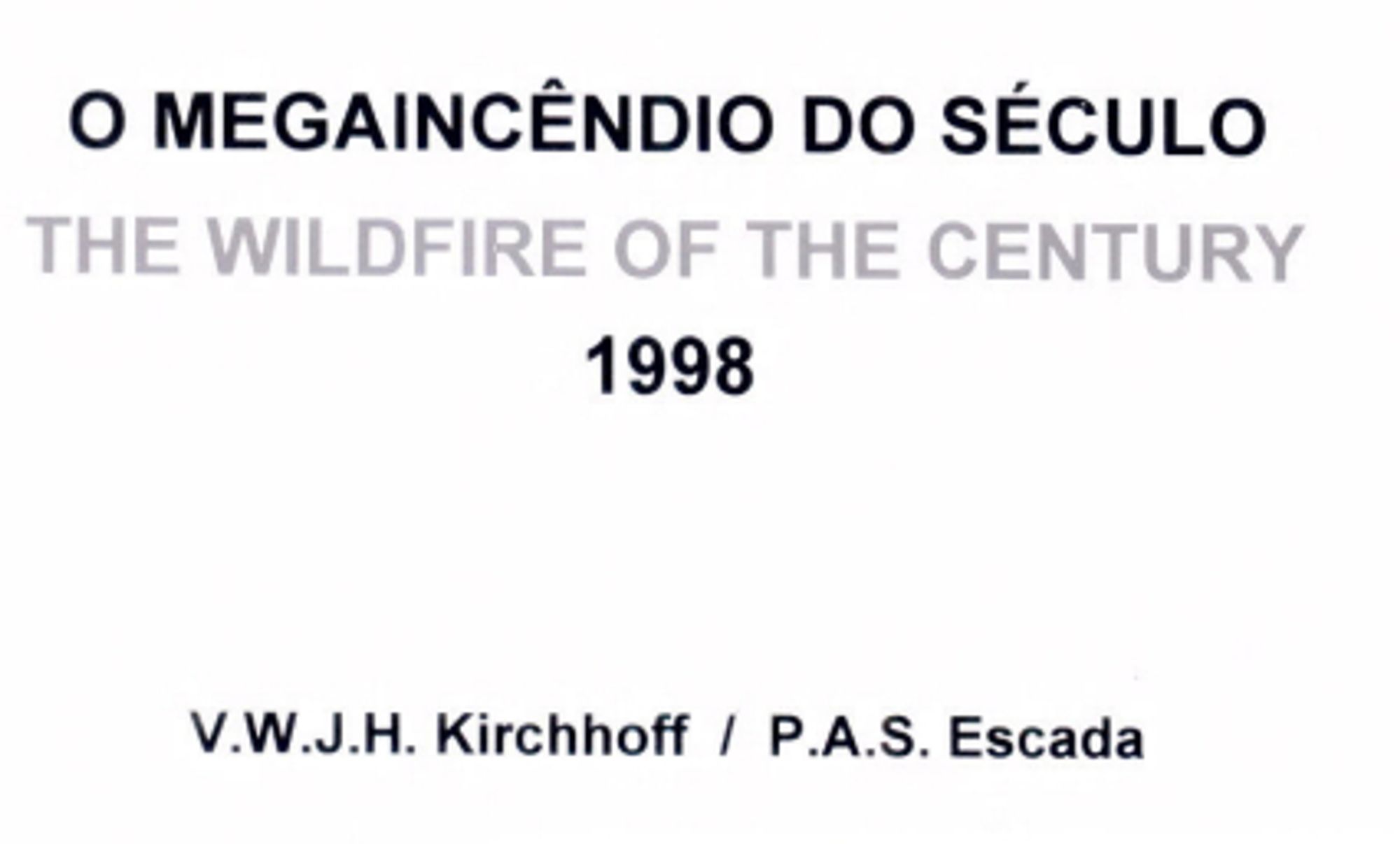
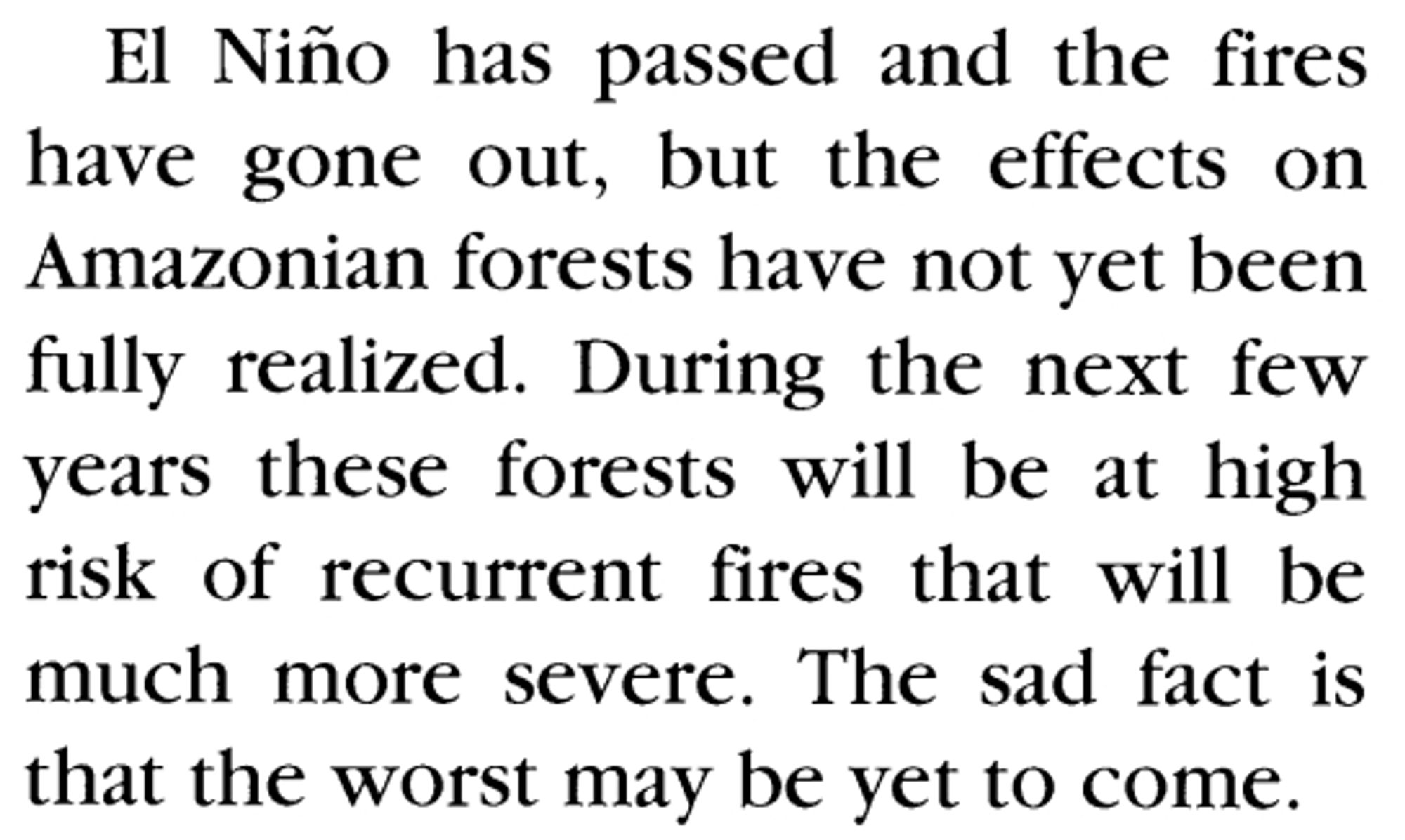
Trecho de Cochrane & Schulze (1998) sobre os incêndios na Amazônia durante o El Niño de 1997! 🌍🔥 Mais de 20 anos depois, o tema segue atual. As lições desses eventos ecoam até hoje - só não sei se são ouvidas. #Amazonia#MudançasClimáticas#Ciênciawww.jstor.org/stable/2387566
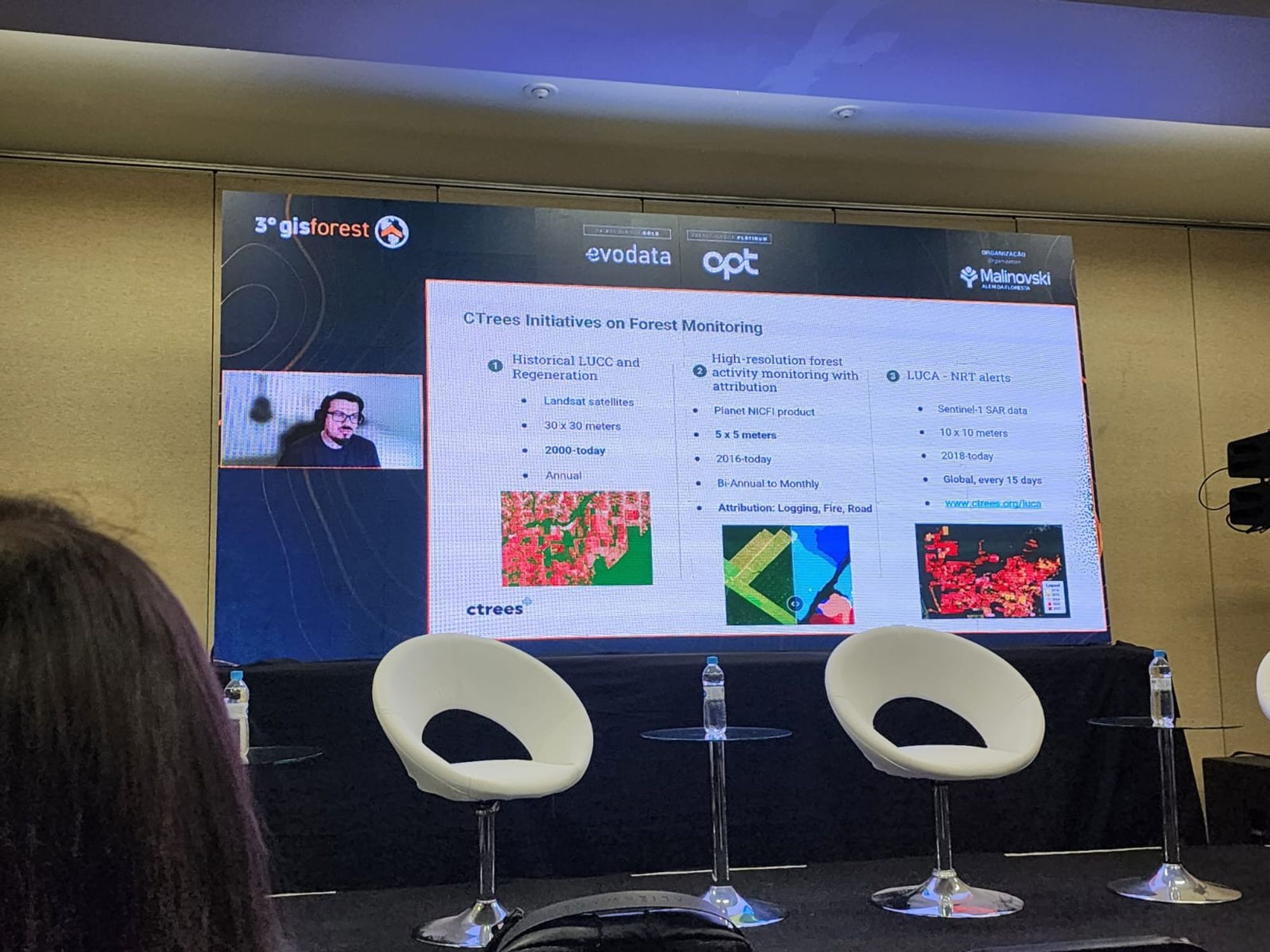
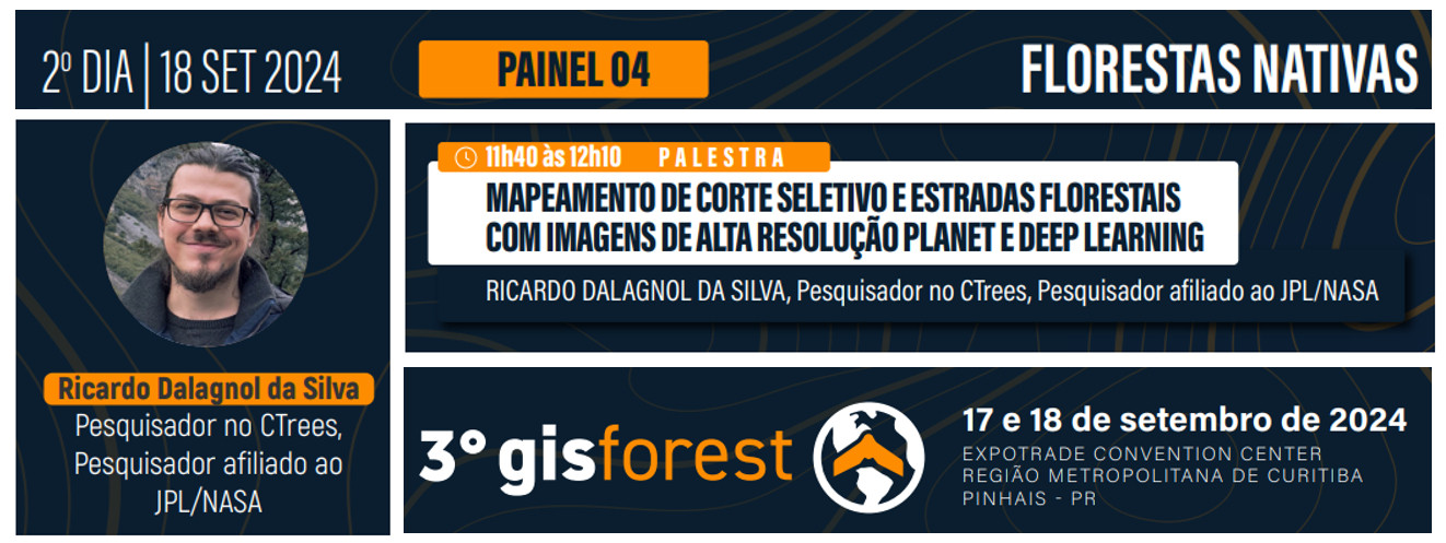
Os dados e tecnologias que estamos gerando com CTrees.org#GISFORESTlignumlatinamerica.com/gis-forest/