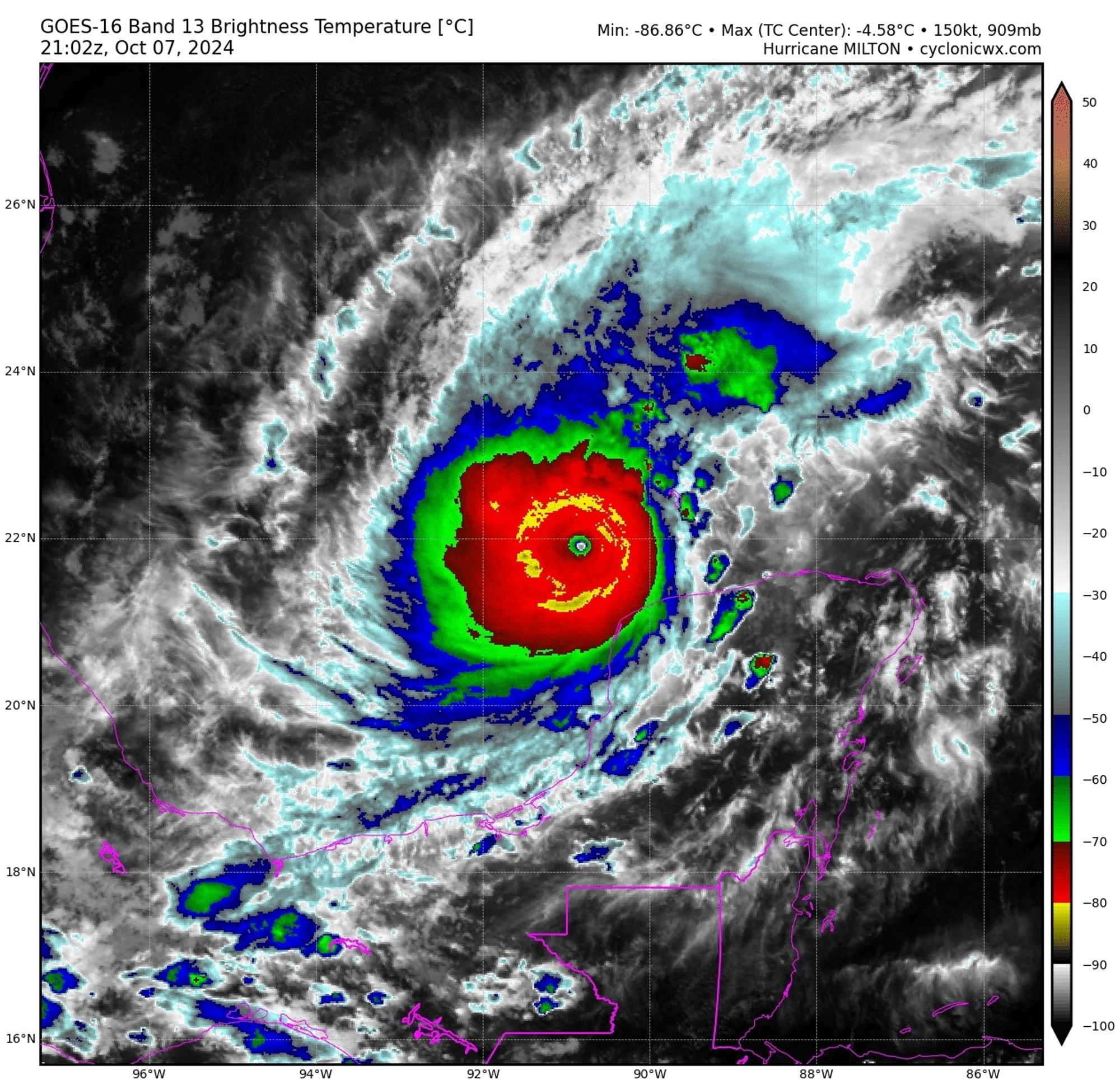
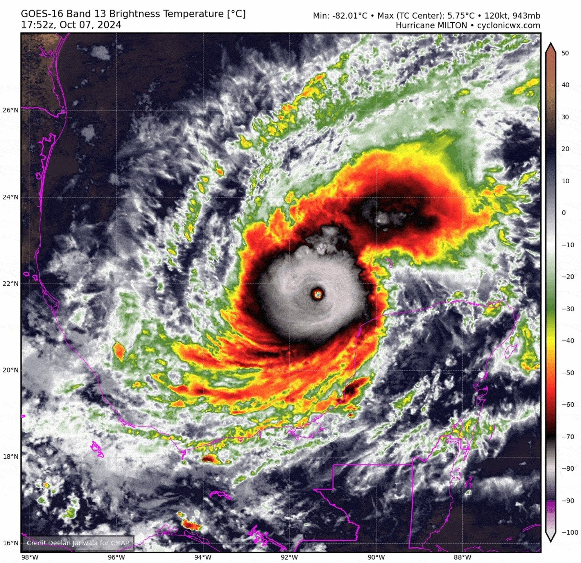
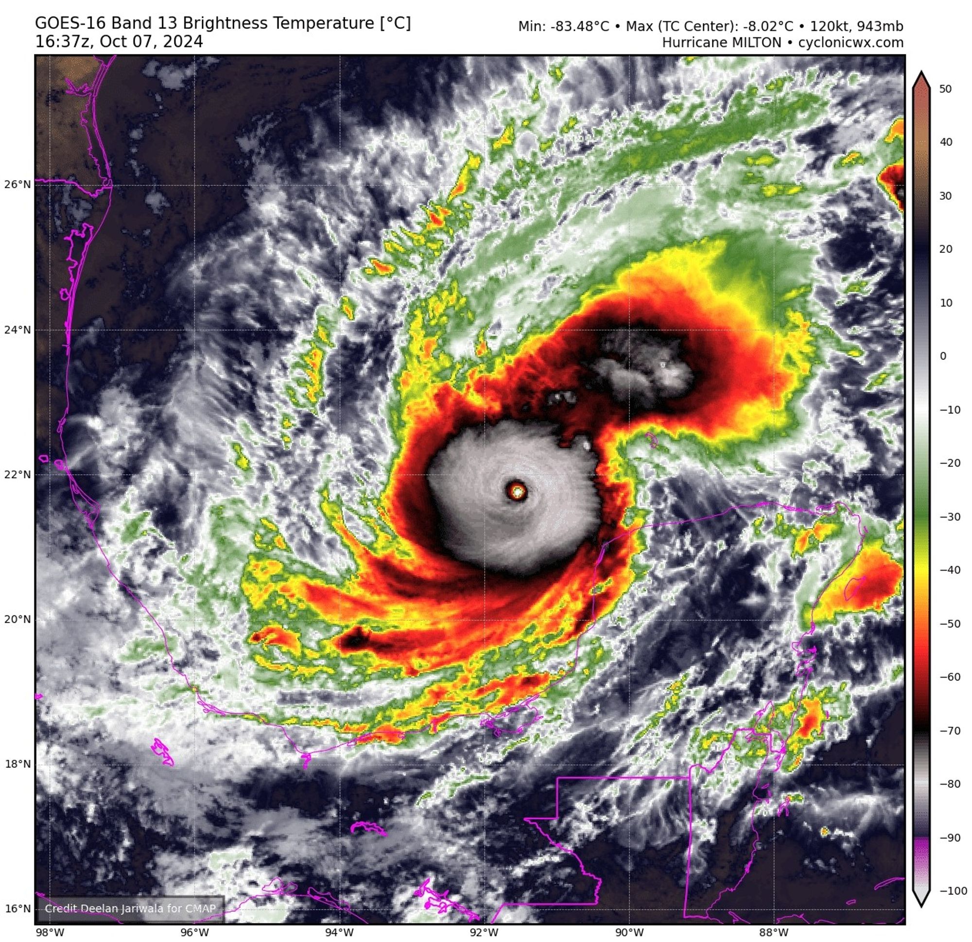
Over the last hours #Hurricane#Milton has been consistently growing a ring of -80°C cloud tops around the eye. Now however it truly is almost complete. This is very rare and only usually seen in the most intense (Atlantic) tropical cyclones. Absolutely insane storm!
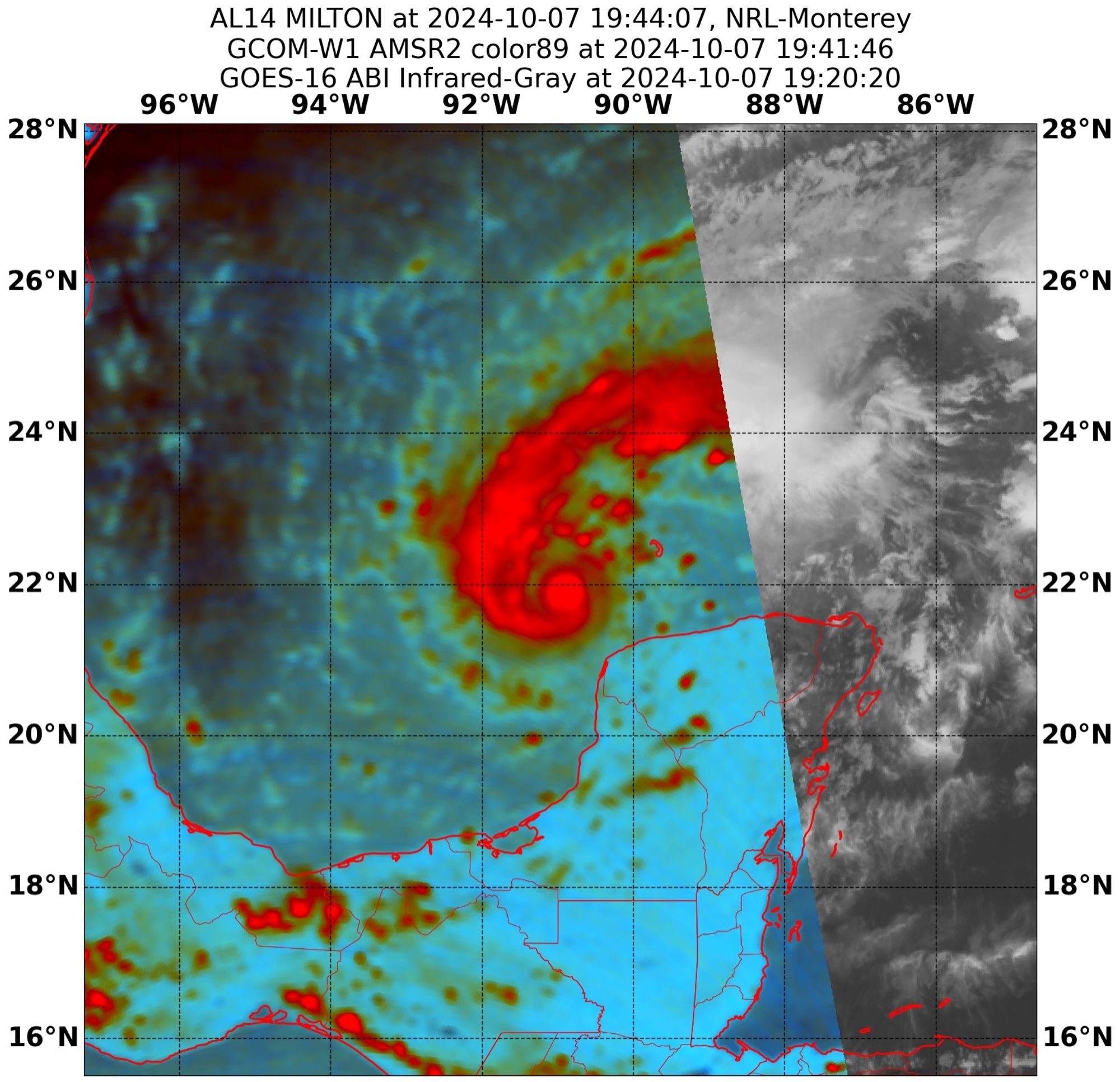
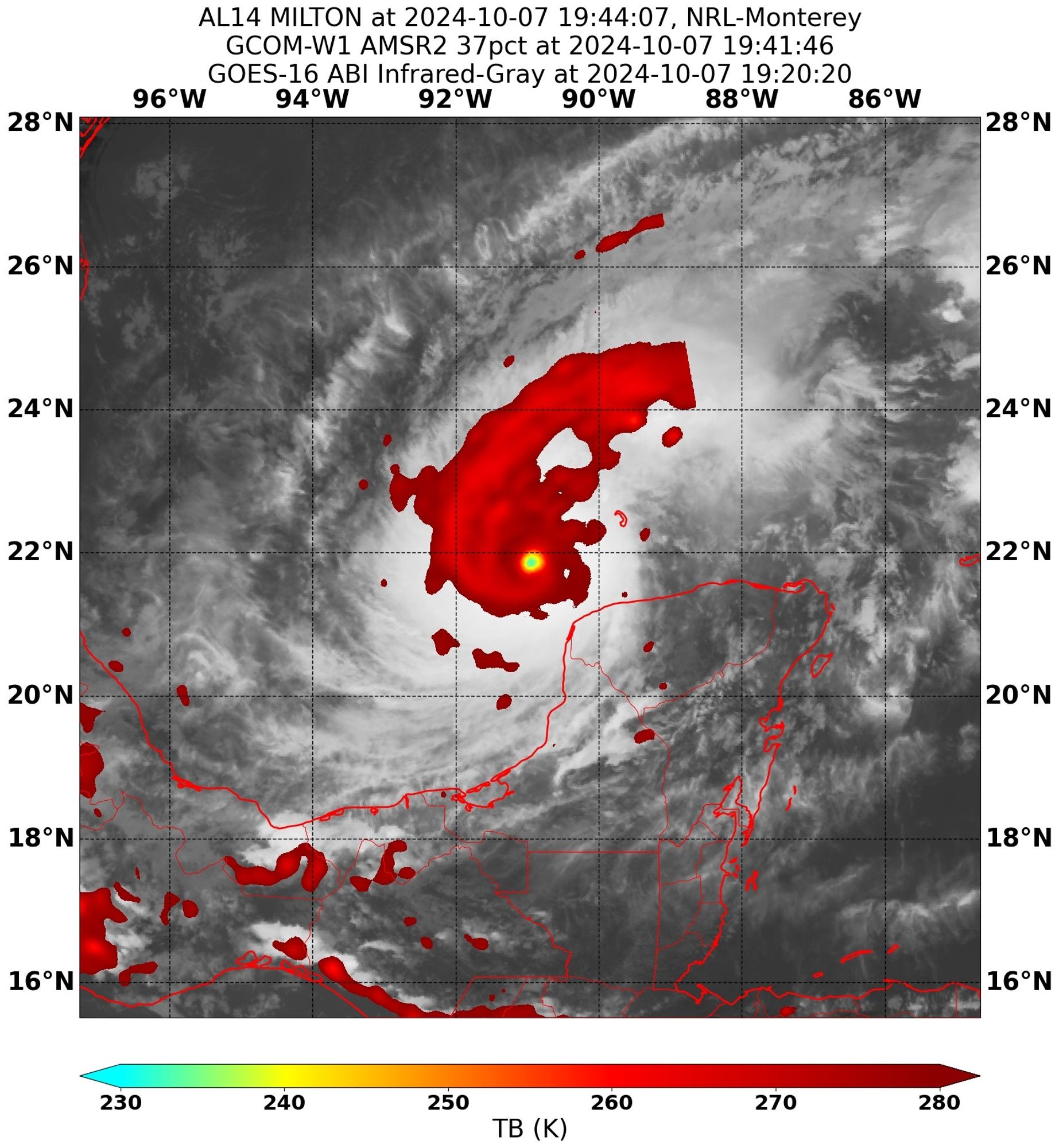
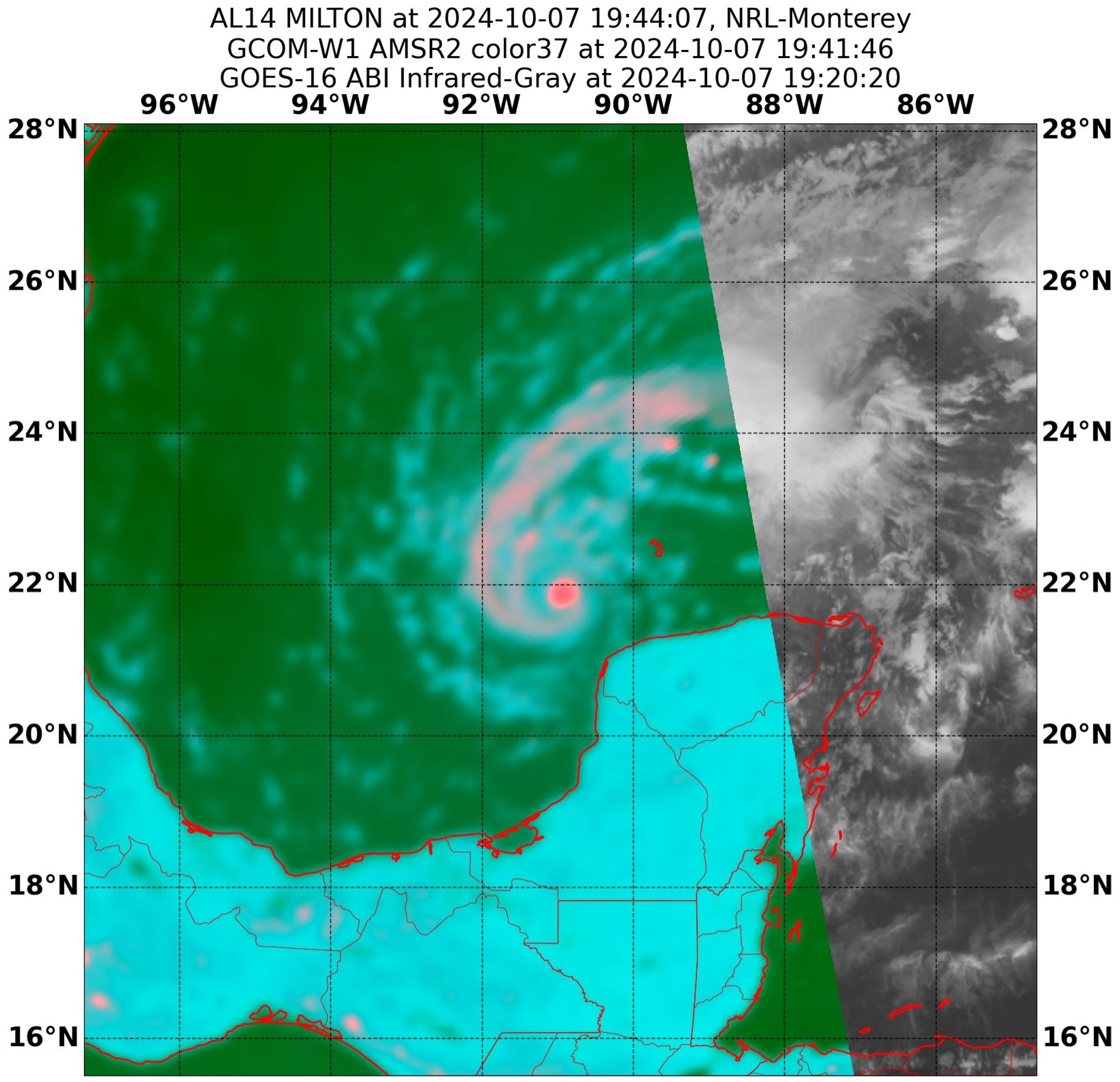
Incredible Microwave images of Major Hurricane Milton coming out right now. The eyewall is so intense, so robust and that core so tight and compact. This is some of the most incredible microwave imagery I have ever seen. Also the eye is almost too small to resolve.

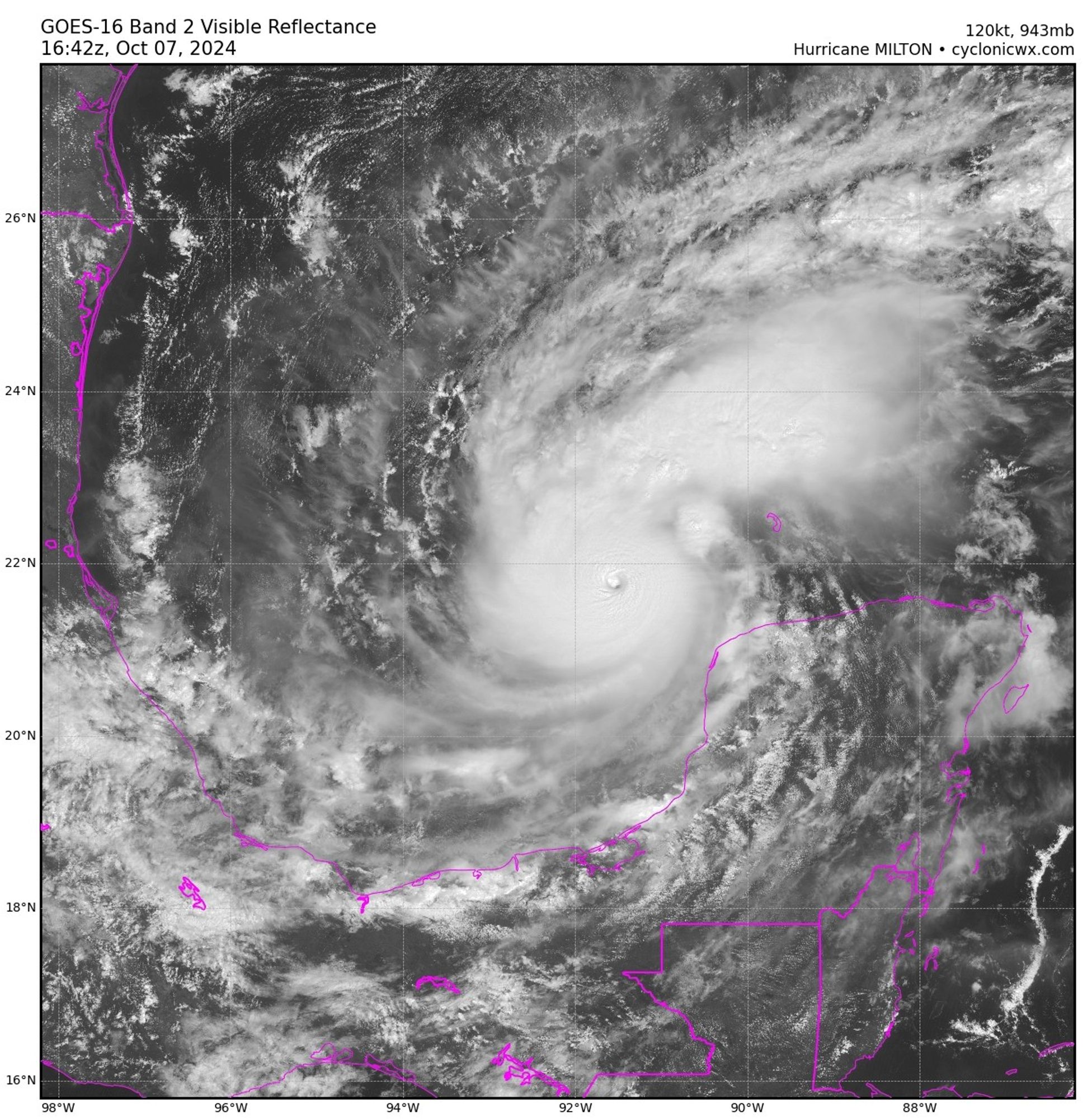
Despite the parallax and despite the eye shrinking even further, the eye temperature of Hurricane Milton has just reached 11°C. This is the highest temperature I can recall yet. The CDO CDO continues to become even more impressive as well. Really (not) looking forward to recon
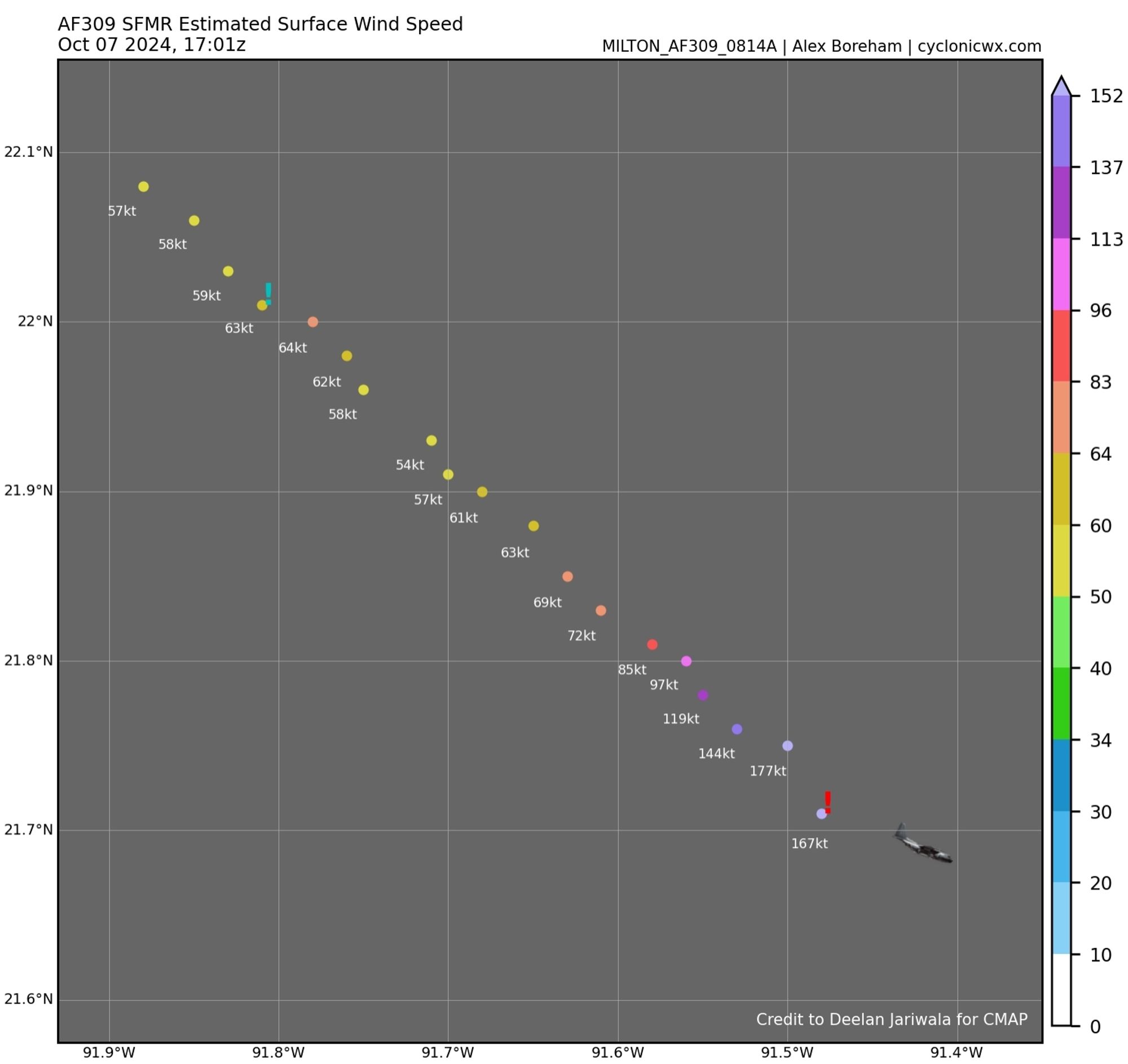
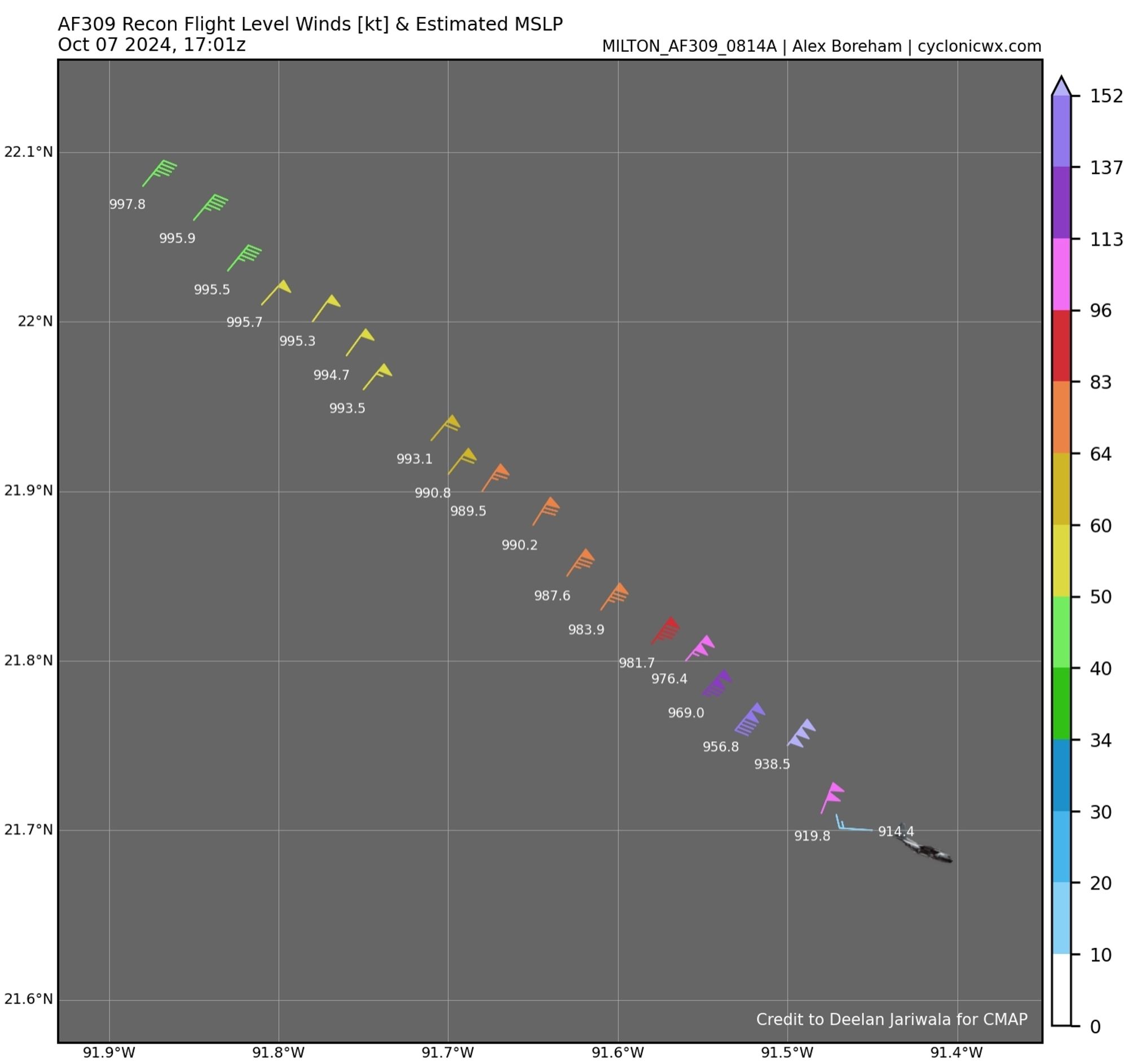
For once dropsonde even confirmed a lower pressure then was extrapolated at 911 mbar. NHC compromised the available wind data and came up with an intensity of 280 km/h (175 mph, 150 kts) for Milton on the latest advisory. Now the strongest Atlantic Hurricane Since Dorian (2019).
Recon investigating #Hurricane#Milton indicates yet further rapid intensification. The XTRAP pressure has dropped another ~10 mbar to 914.4. They also found unflagged SFMRs of 177 knots but FL winds "only" support around 140 knots at the moment. The truth may lie somewhere in between
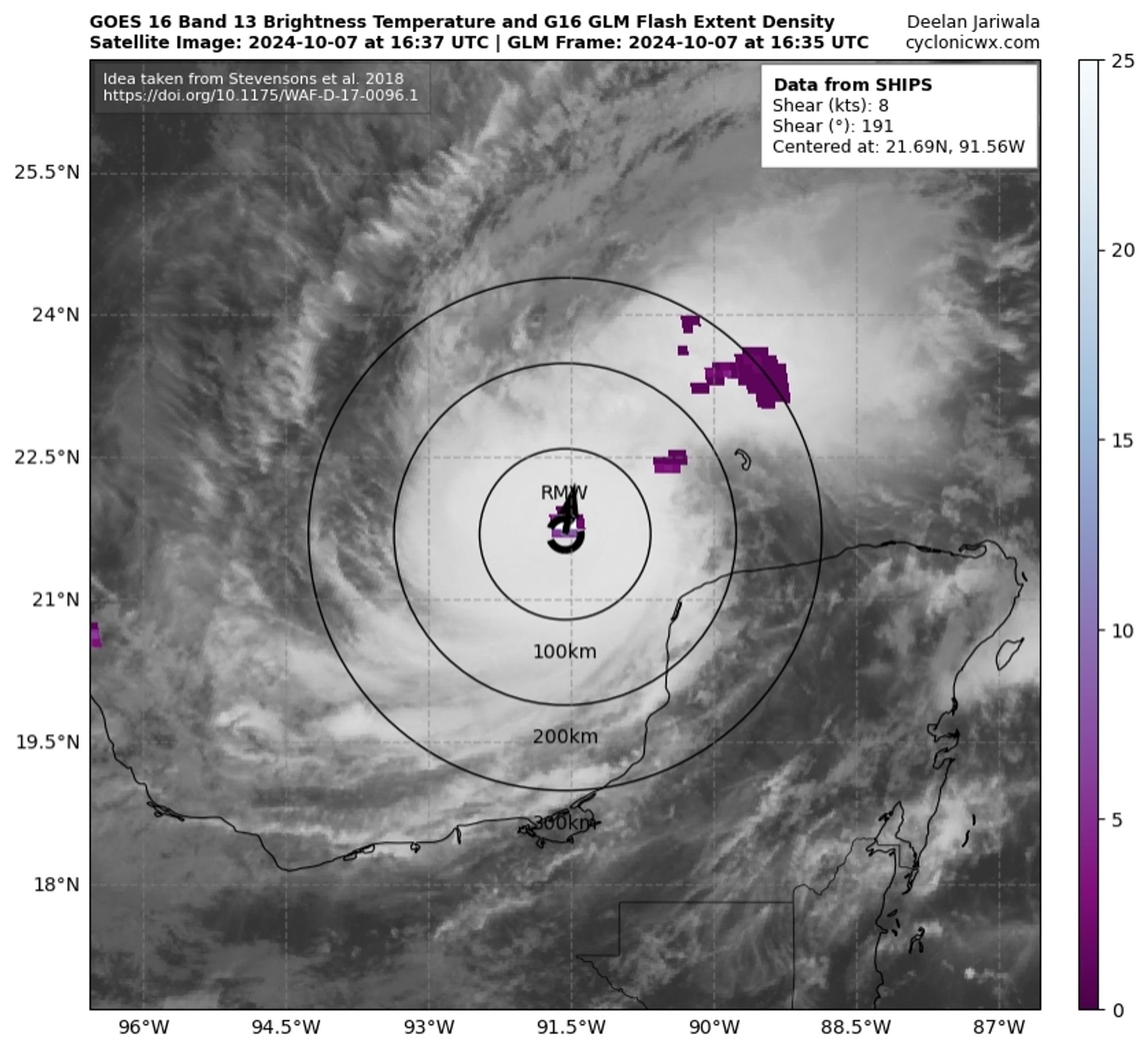
Milton is approaching hurricane perfection rn. Waves are reverberating through the intense highly symmetrical CDO, while the pinhole eye contained within quickly approaches positive values. All the while intense eyewall lightning continues. A true Category 5 beast.
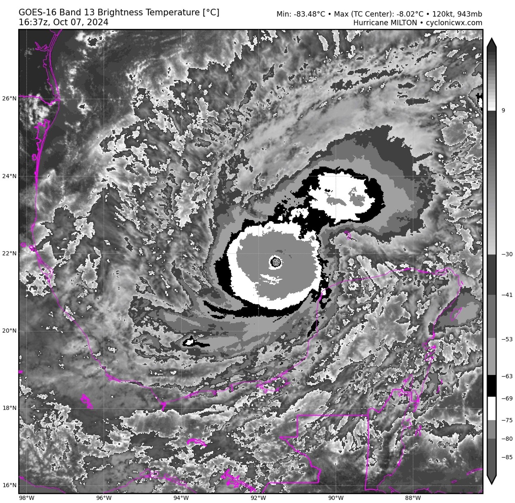
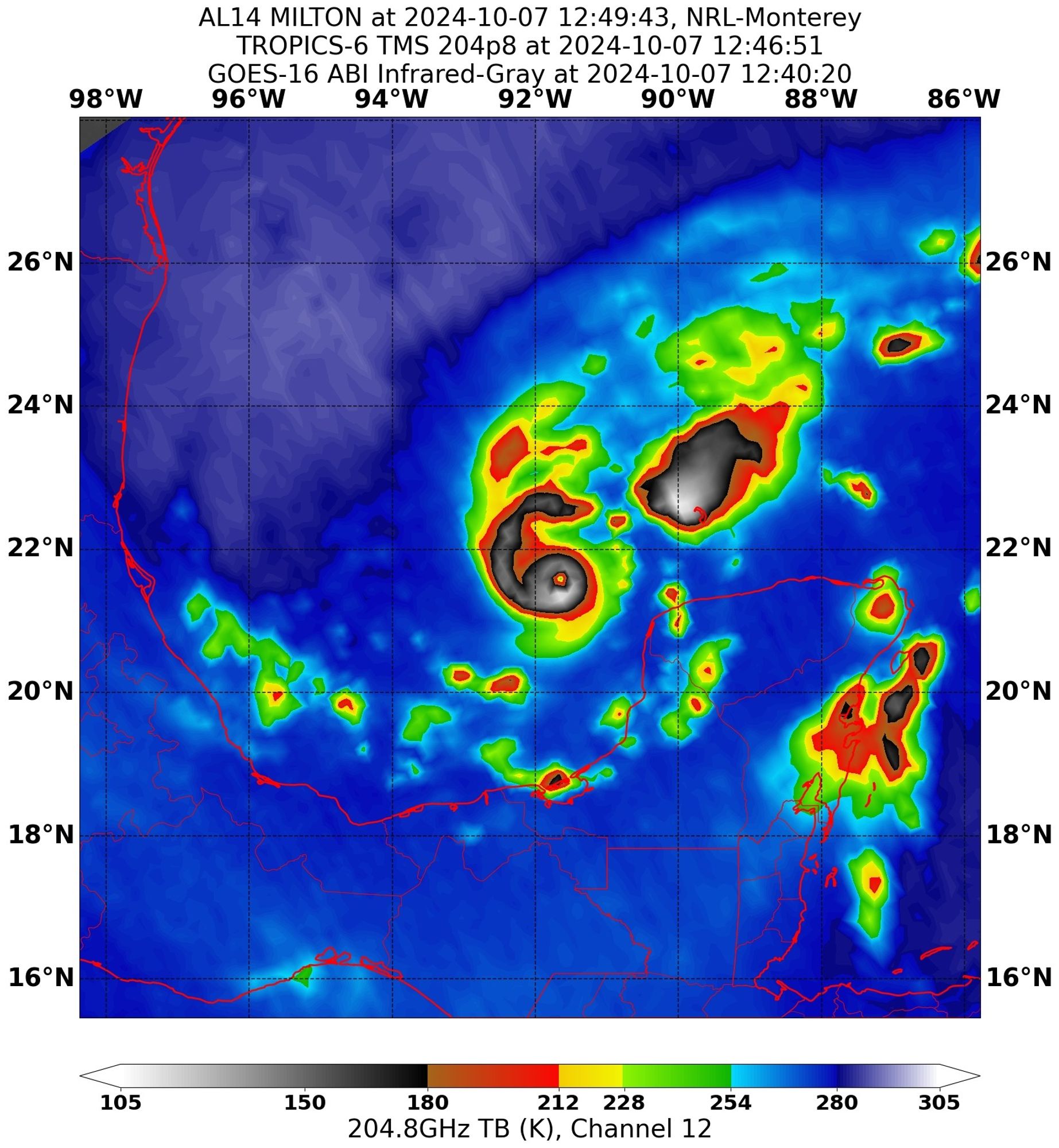
A recent TMS microwave image of Major Hurricane Milton shows once again a pibhole eye surrounded by a compact, well-developed and intense eyewall. Got a nice rainband going as well.
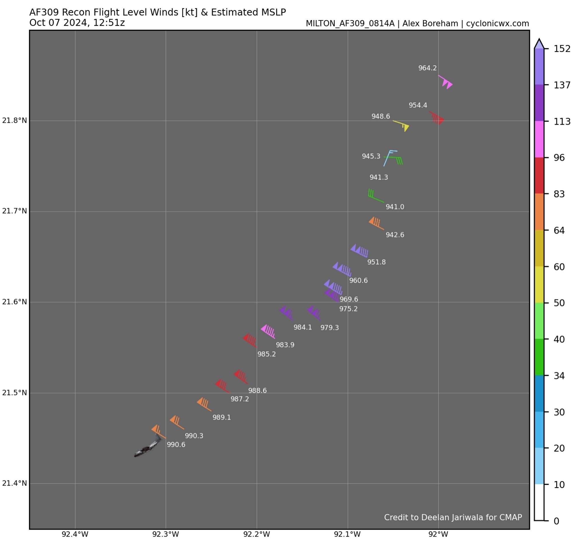
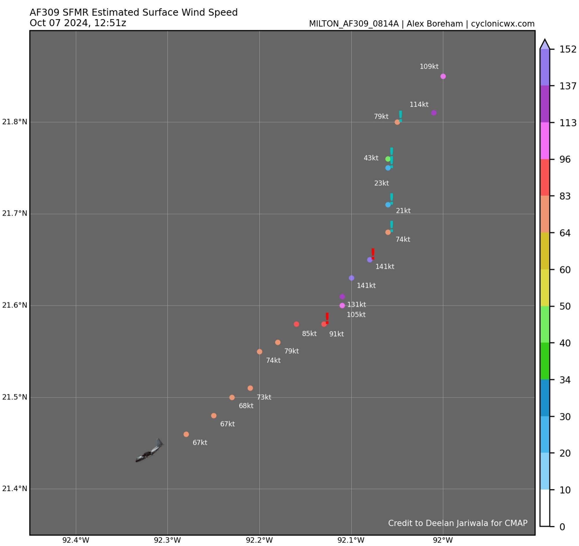
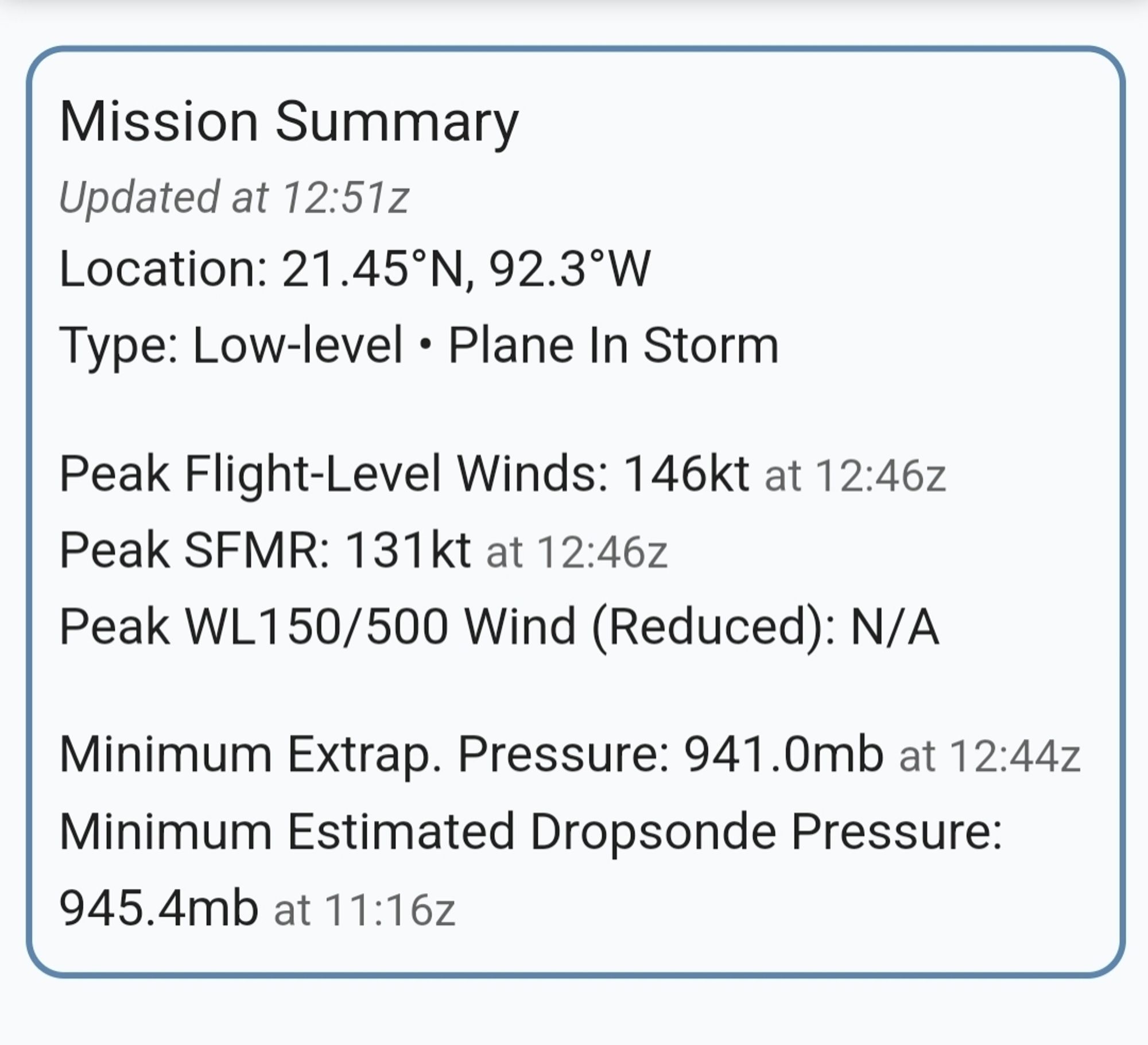
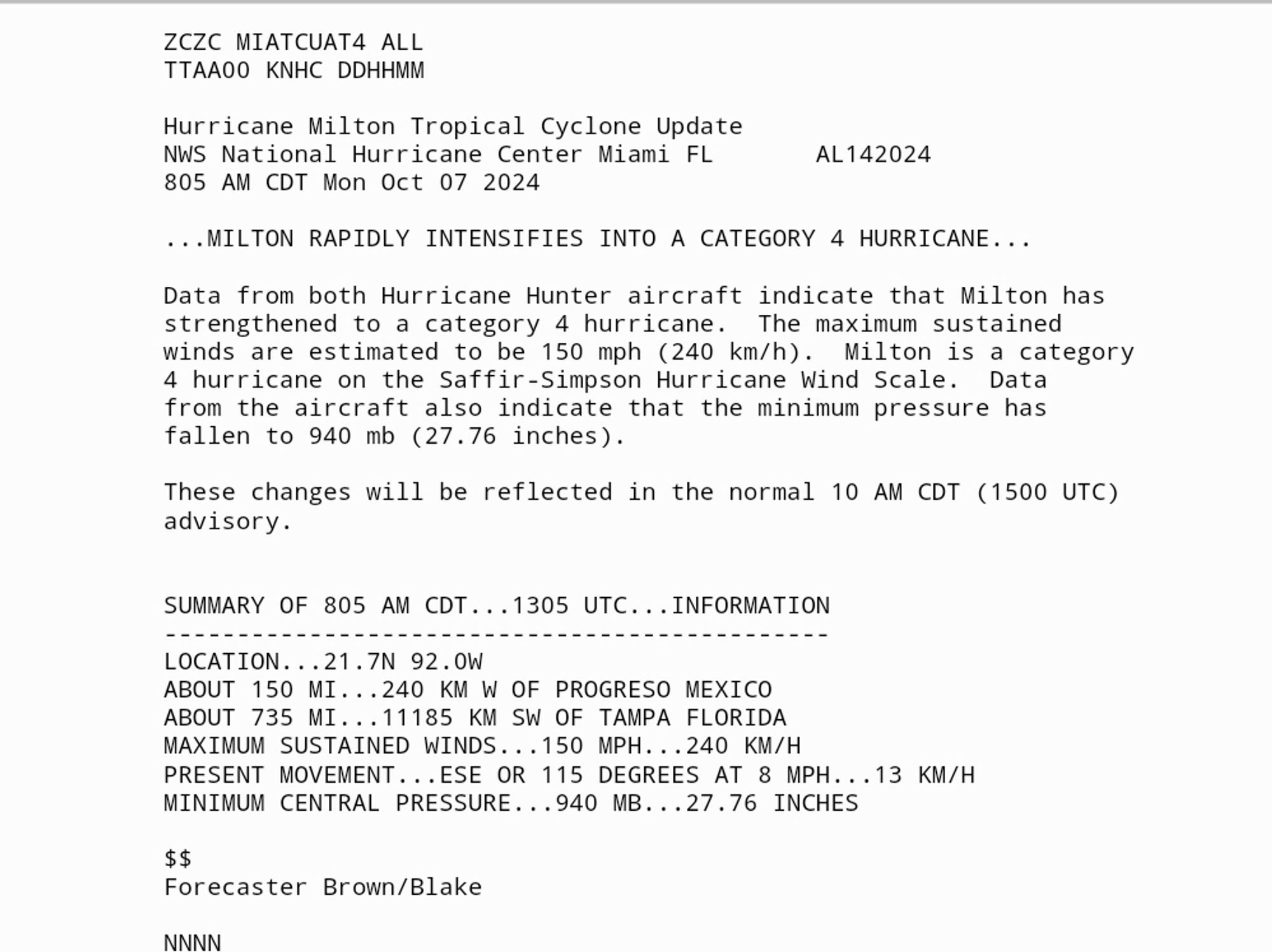
Air Force Hurricane Hunters investigating Major Hurricane Milton just found FL winds of 146 kts (131 kts SFC) and non-suspect SFMRs of 131 knots. XTRAP pressure down to 941.7 mbar. NOAA data is a bit less impressive but overall this data easily supports C4 intensity. This has now been made official.
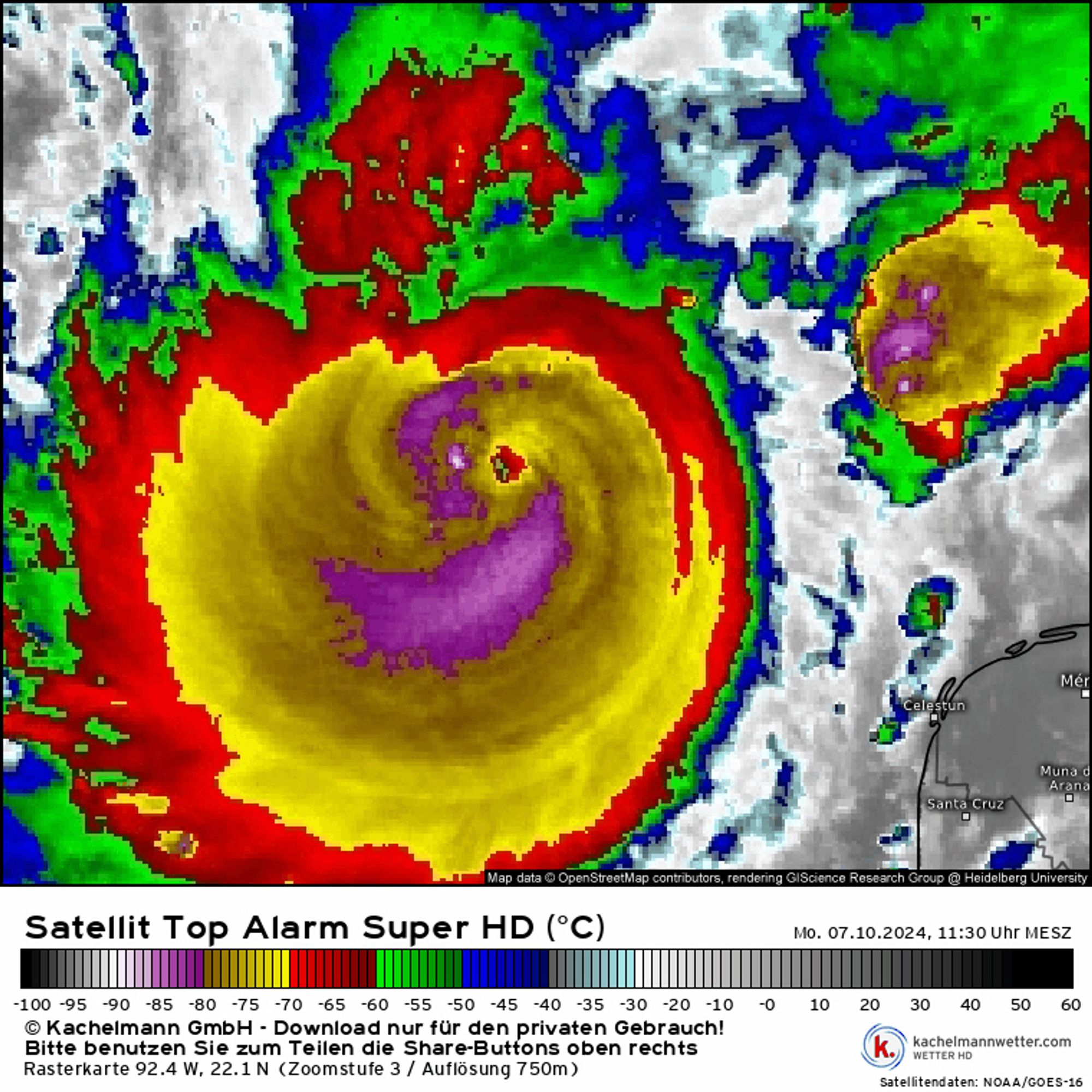
M-PERC has reacted very strongly to this image and now predicts an approximately 75% chance that Milton will soon undergo an eyewall replacement cycle. If it had one now while conditions are still favourable, that could be bad news for folks in W Florida.