How is marine geoscience conducted at the Geological Survey of Canada? Here are some of the tools we use to characterize the seafloor and monitor seabed processes, in collaboration with our partners from academia and other government departments.
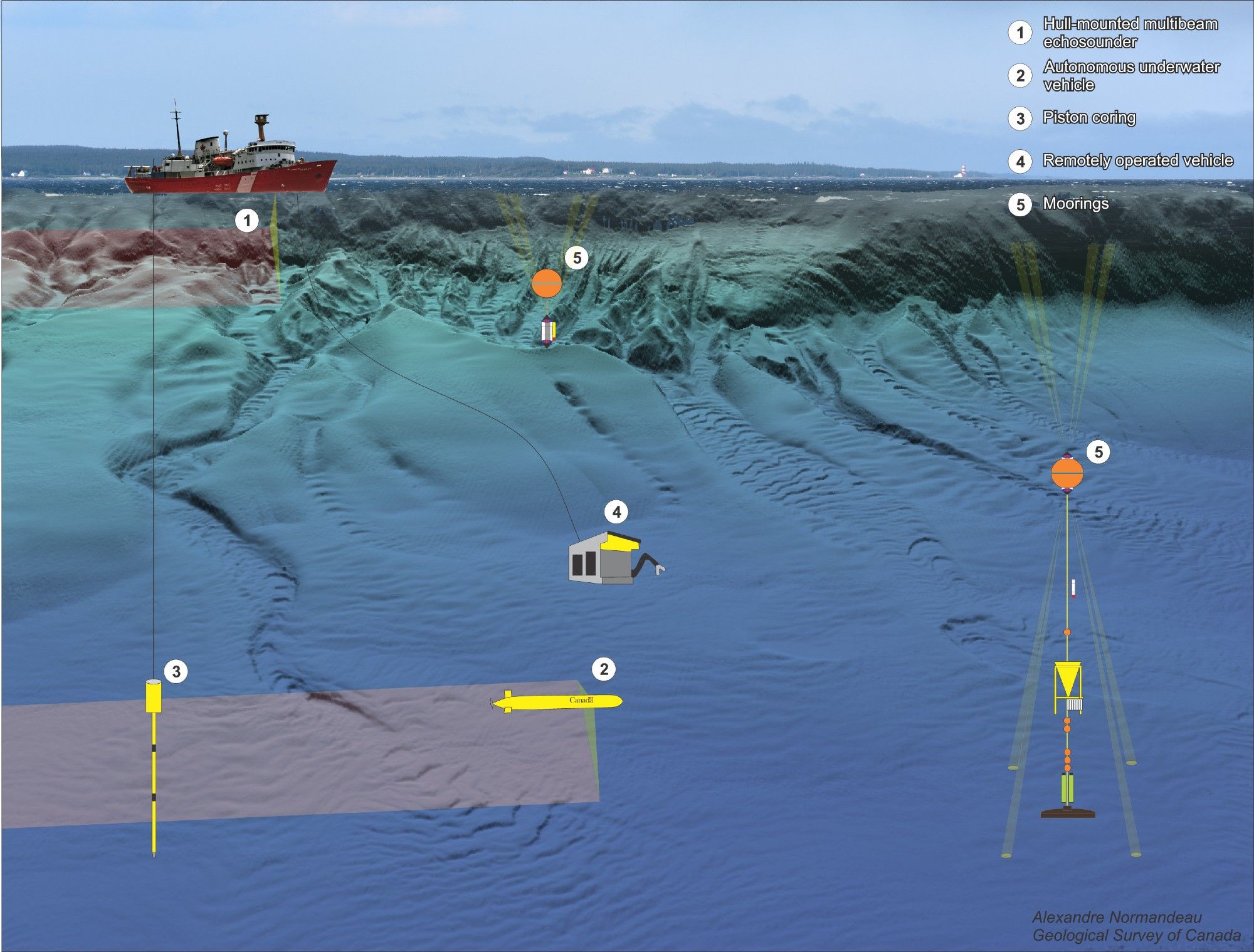
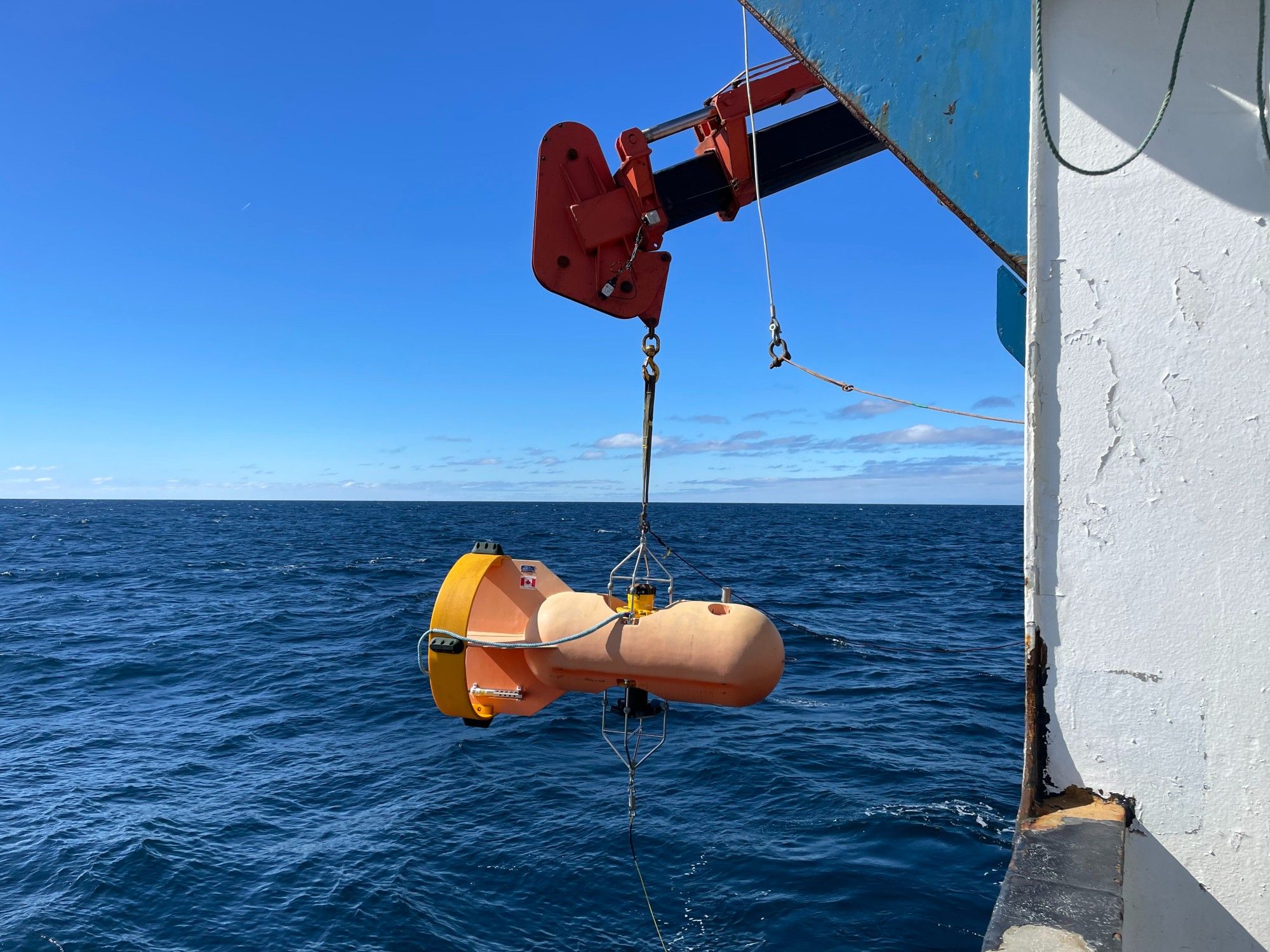
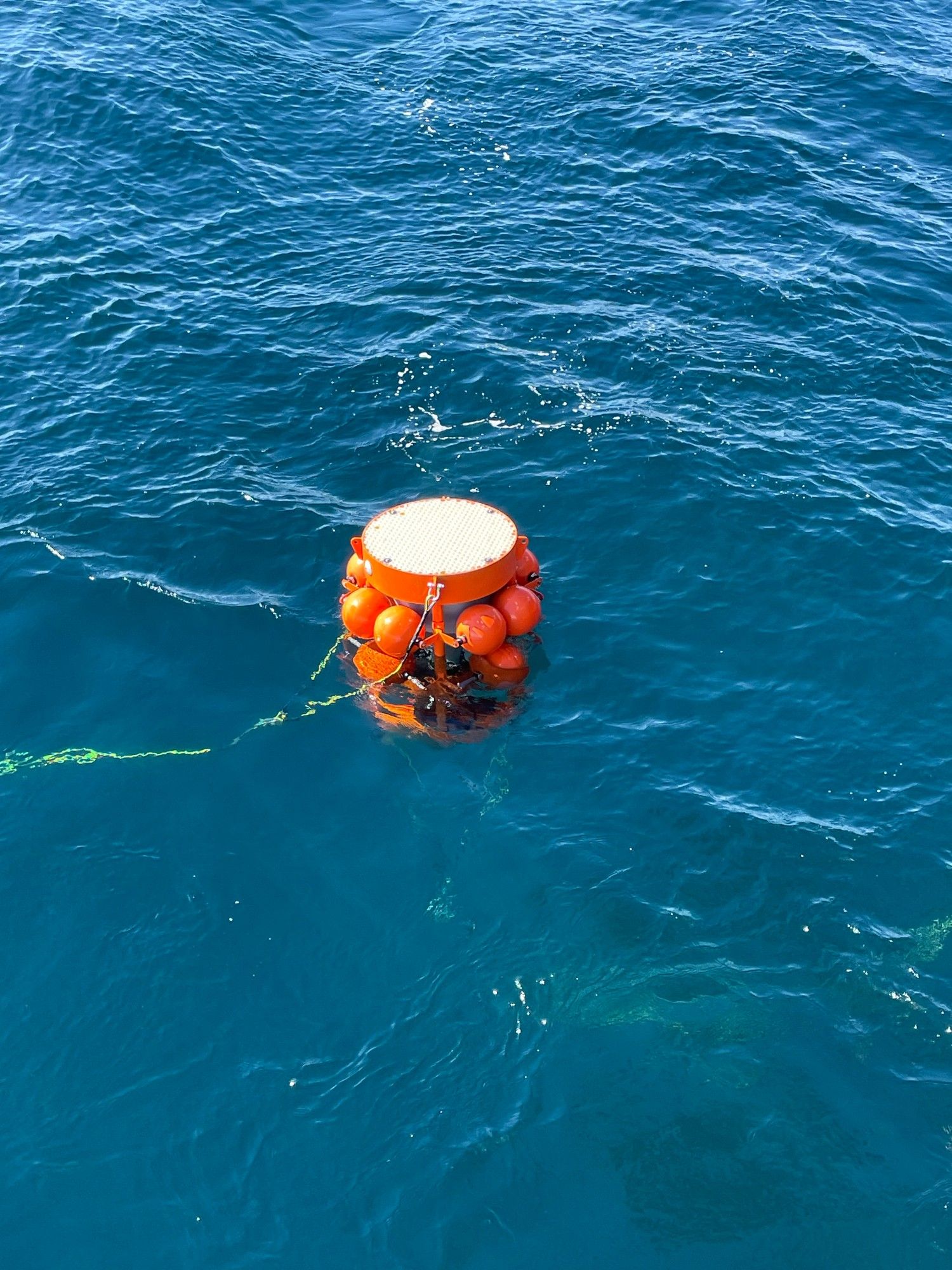
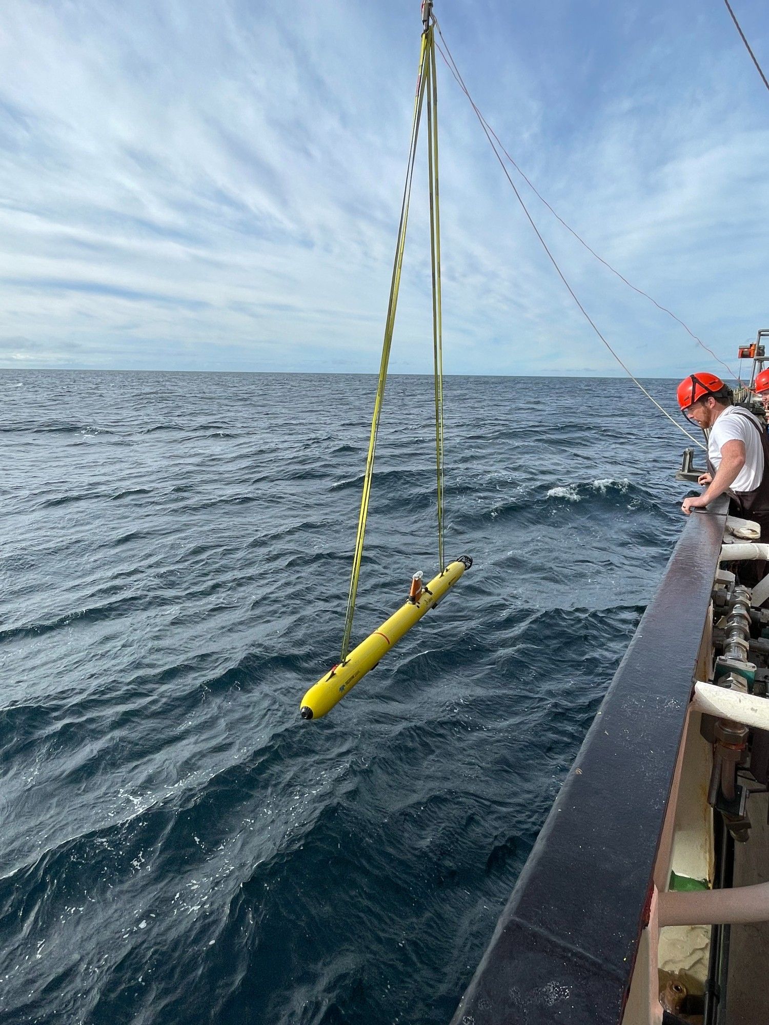
We deployed an autonomous underwater vehicle and 3 moorings in Shortland Canyon, eastern Canada, from the RRS Discovery. Sediment cores were also recovered from the canyon bottom. These data will allow us to understand the physical oceanography and seabed processes in eastern Canadian canyons.
Thanks! I find them very useful for outreach presentations
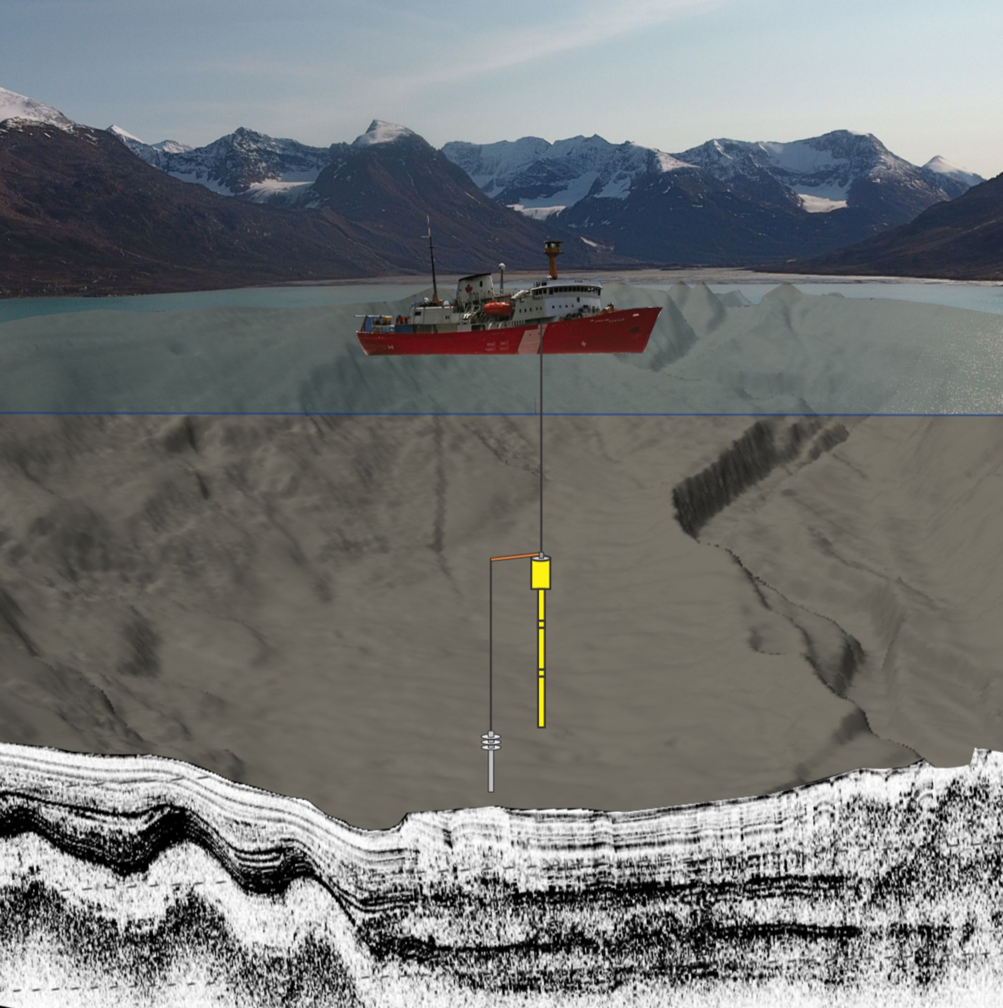
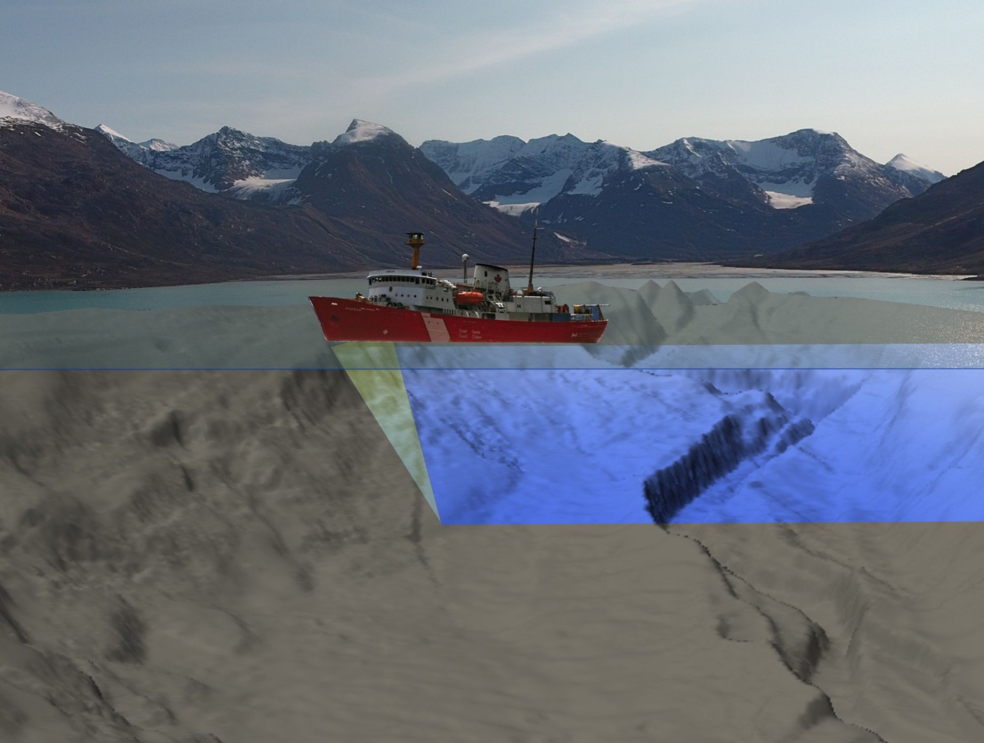
A few years ago, I created animations to illustrate how geological sampling and surveys are conducted at sea. Here are two examples: 1) piston coring to collect long sediment cores 2) multibeam surveys to create maps of the seafloor. Animations are available here: sites.google.com/view/normand...