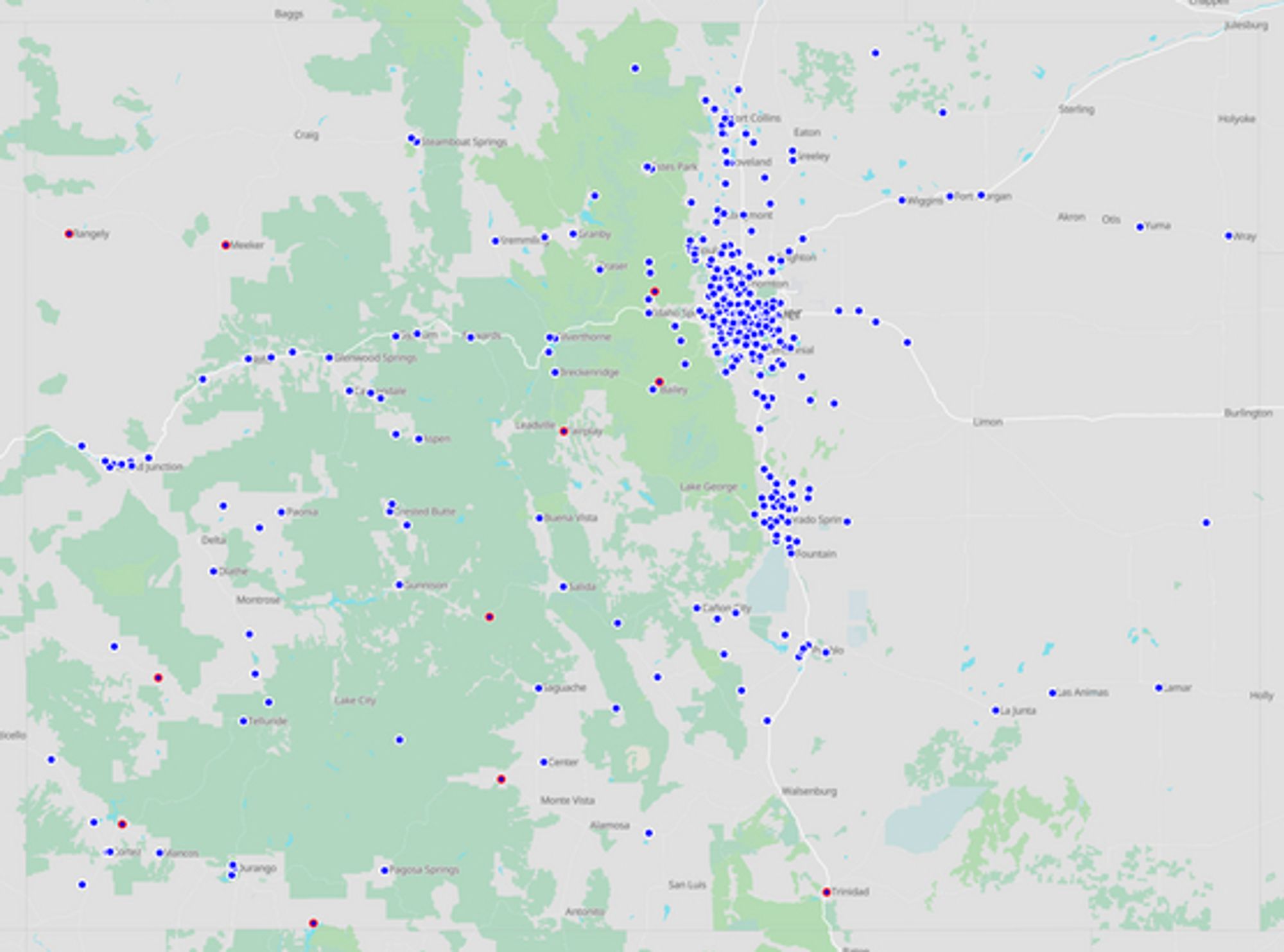
As you can imagine, an address for Mesa County Fairgrounds will only get you so far. My experience doing this in WA is that many counties can have data that puts boxes 10, 30, or 1000+ meters away from their true location... So I'm trying to keep things pretty tight for now.
I looked at their info and unfortunately, it's only roughly geocoded, their entry for the library earlier in the thread points you at the building center and not the east side. Maybe not an issue for this specific box but many will end up difficult to find without more precise hassling.
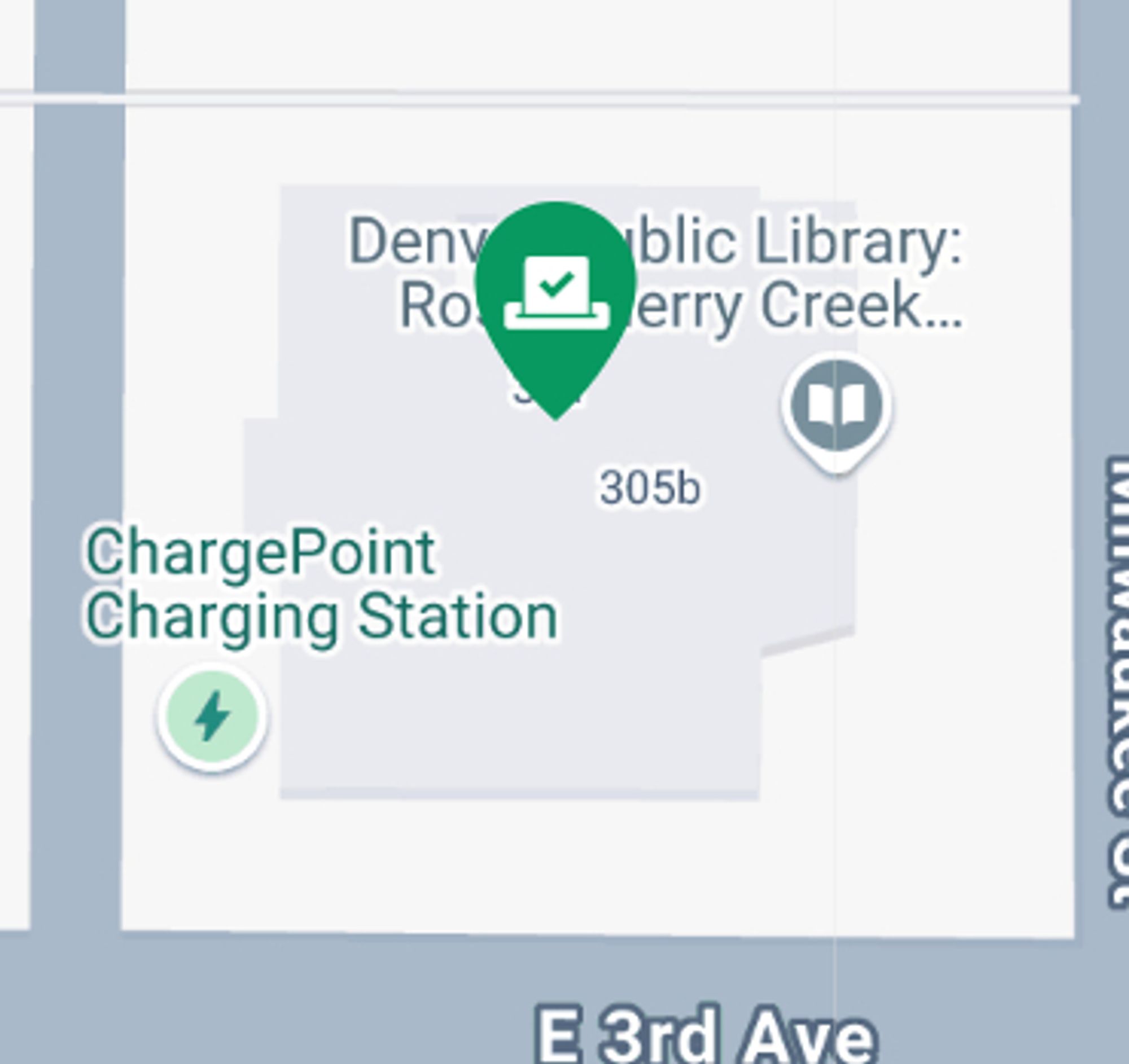
Ah! That is a Voter Service Polling Center (VSPC) with an inventive drop off system. I'll have to figure out how to best encode that into OpenStreetMap lingo and get the hours added etc. I had been focusing on physical drop boxes as they are easier to "confirm".
I think this should be the location of the Ross drop box and should show up on the map: www.openstreetmap.org/node/1218328... The streetside and aerial imagery I have doesn't show a box at that church. If there is one, can you send me a picture and/or description? Happy to get it added!
OpenStreetMap is a map of the world, created by people like you and free to use under an open license.
... you get the idea. Let me know if you find one or discover one on the map that is in error.
Boulder county is missing... Southeast County Community Hub 1755 S. Public Road Boulder County Fairgrounds 9595 Nelson Road (Fairground Lane near south parking lot) bouldercounty.gov/elections/in...
Adams county is missing... Reunion Recreation Center Larkridge shopping center 16434 Washington St. trail winds recreation center Adams County Human Services Center Front Range Community College (College Hill Library) www.adamscountycoelections.gov/ballot-drop-...
Supposedly there is 1 more in Arapahoe County with these addresses: 4810 E. County Line Rd. Littleton, CO 80126
Denver county elections has 7 boxes that need to be found and added: 5090 Broadway Recreation Center Denver Botanic Gardens Harvard Gulch Recreation Center RTD - Light Rail at Union Station Regis University Bookstore Rude Recreation Center University of Denver The Ritchie Center
I have a project to get all of the Colorado ballot drop boxes into an accessible map. I've managed to chase down ~350 across most counties would love to work with folks in CO to get the rest mapped. Details in the thread. Live map: overpass-ultra.us#run&query=gi...#opendata#elections