
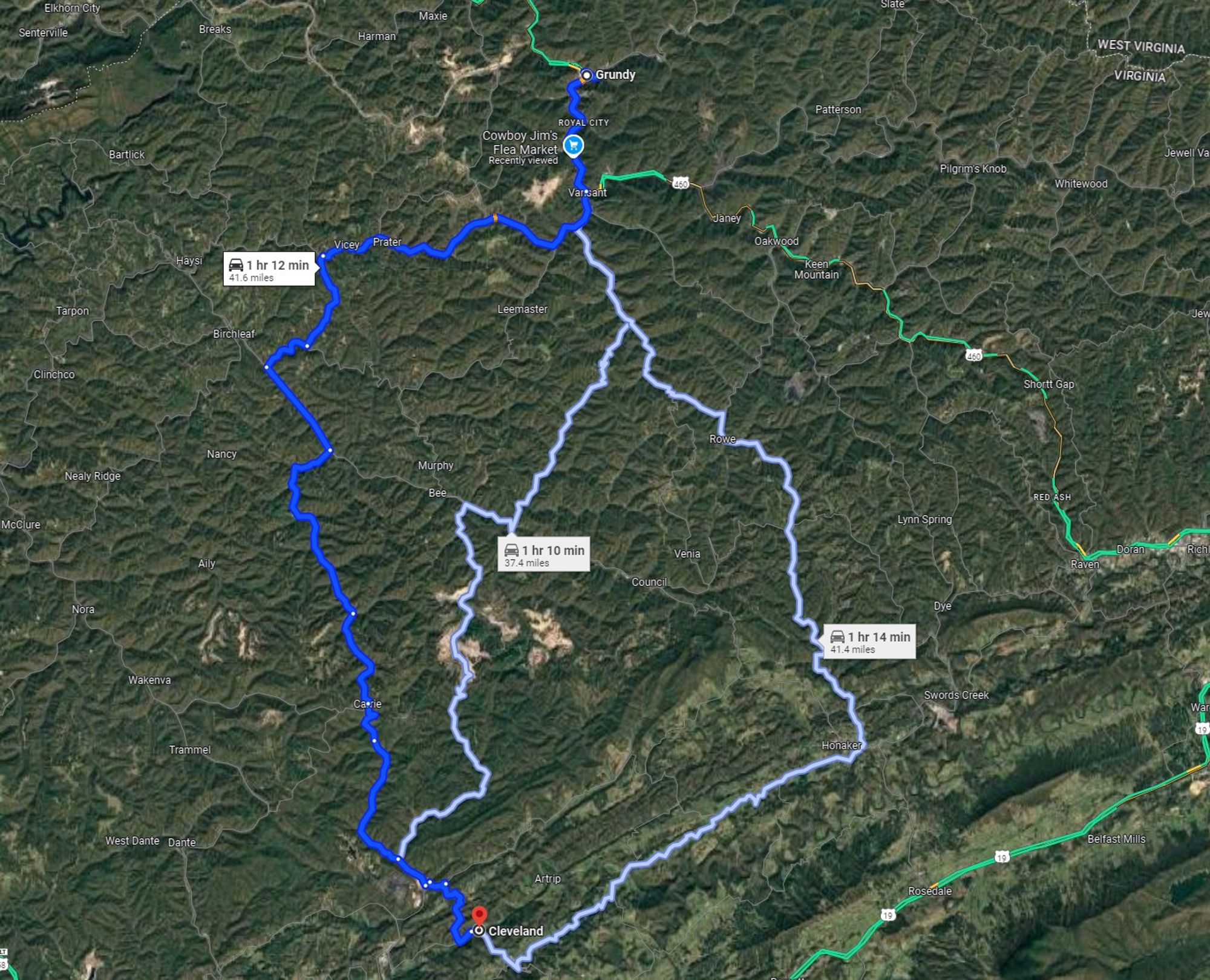
As a part of a summer road trip, I drove from Grundy, VA, to Cleveland, VA. Much of this drive was every bit as remote as the big sky country of Montana, only with mountainous terrain. Although this is north of the area affected by Helene, it is likely quite similar. 6/6
This means that some areas, especially more populated areas for obvious reasons, have received more aid than others, like a family living in an isolated house in a mountain valley with their nearest neighbor a mile away. 5/
In western North Carolina and surrounding areas, however, rescuers must either hike miles along destroyed roads or else helicopter in to residences to reach survivors, some of which are hidden beneath a dense tree canopy and scattered over a *much* larger area. 4/
It's obvious from these images that the population density of western North Carolina is far less than that of New Orleans. After Katrina, it was possible to go door-to-door to evacuate survivors to a central location and identify the deceased given the relatively small geographic area affected. 3/
Here is a Google satellite image of the Lower Ninth Ward in New Orleans and a satellite image at the same zoom level centered on Chimney Rock, NC, one of the most devastated towns. 2/
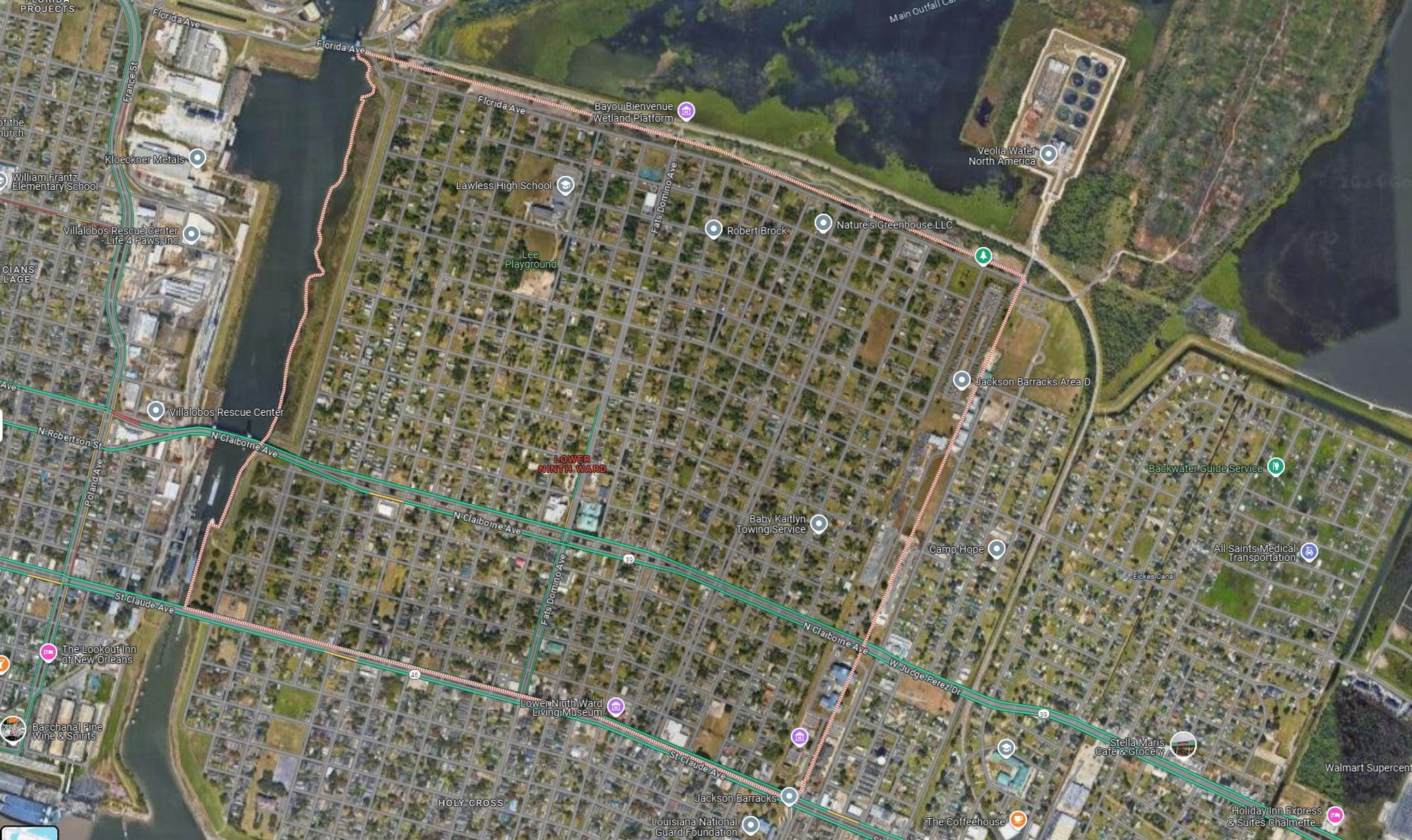
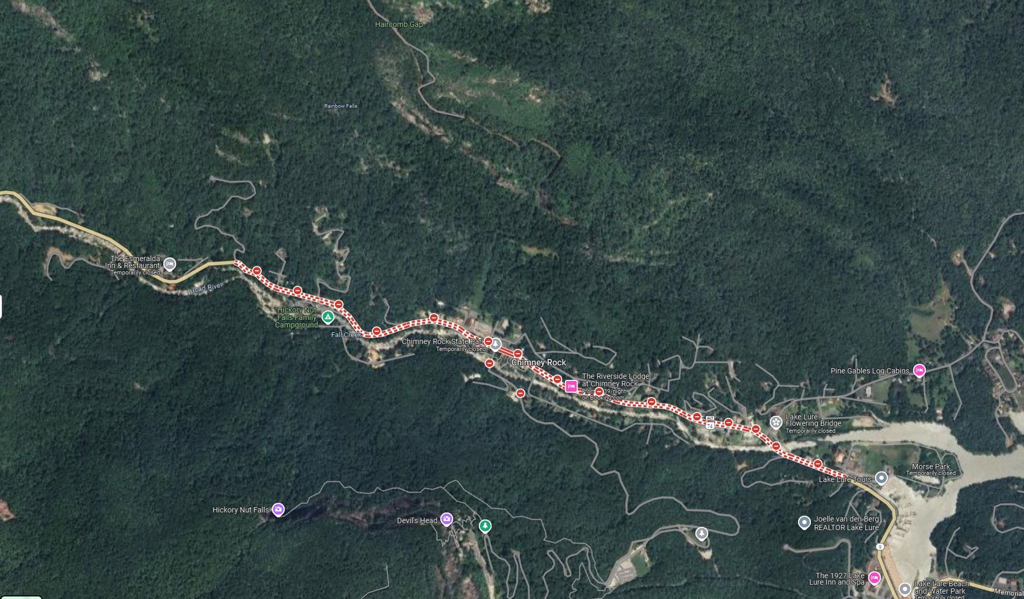
Some folks are trying to compare the response to Helene to that to Katrina, and that comparison is not valid because of the shear difference in geographical scale in the areas devastated by the storms. 1/
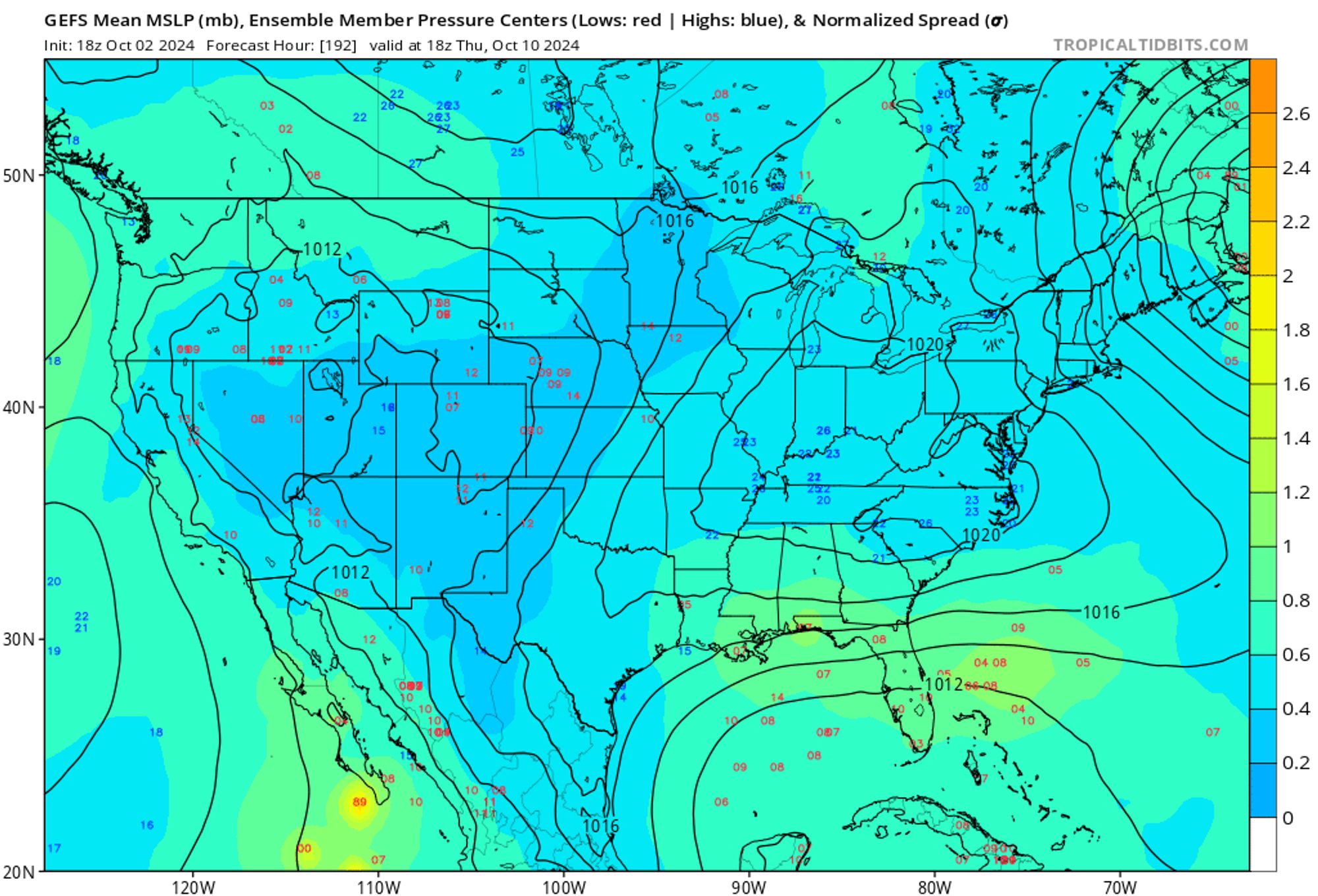
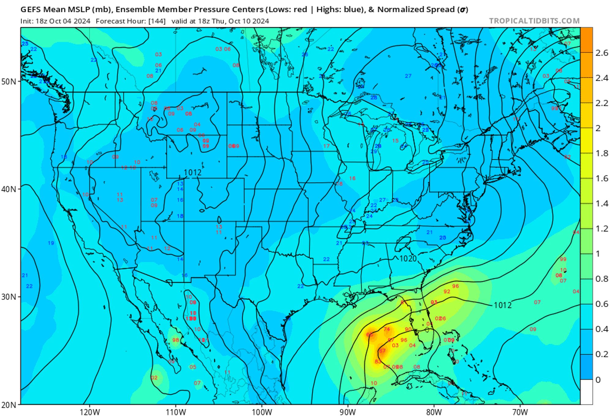
This remnant circulation may provide a enough of a low-level vortex from which tropical cyclogenesis can progress in the Gulf. 3/3

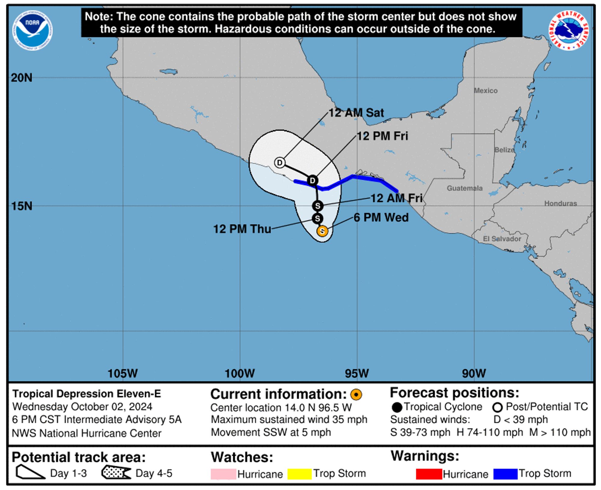
Meanwhile, TD 11 in the Eastern Pacific, which was once forecast to move westward parallel to the Mexican coast, instead moved northward across the isthmus of Tehuantepec into the Bay of Campeche 2/3

There's been a significant shift in the ensemble guidance toward tropical development next week in the Gulf of Mexico in ensemble guidance in the last couple of days 1/