BLUE
SH
Steve Hilberg
@wxclisteve.bsky.social
Meteorologist & climatologist. SLU. Former dir. MRCC. CoCoRaHS blogger, IL CoCoRaHS coord., winter weather fan, diehard Cubs fan. Opinions my own.
11 followers17 following2 posts
SHwxclisteve.bsky.social

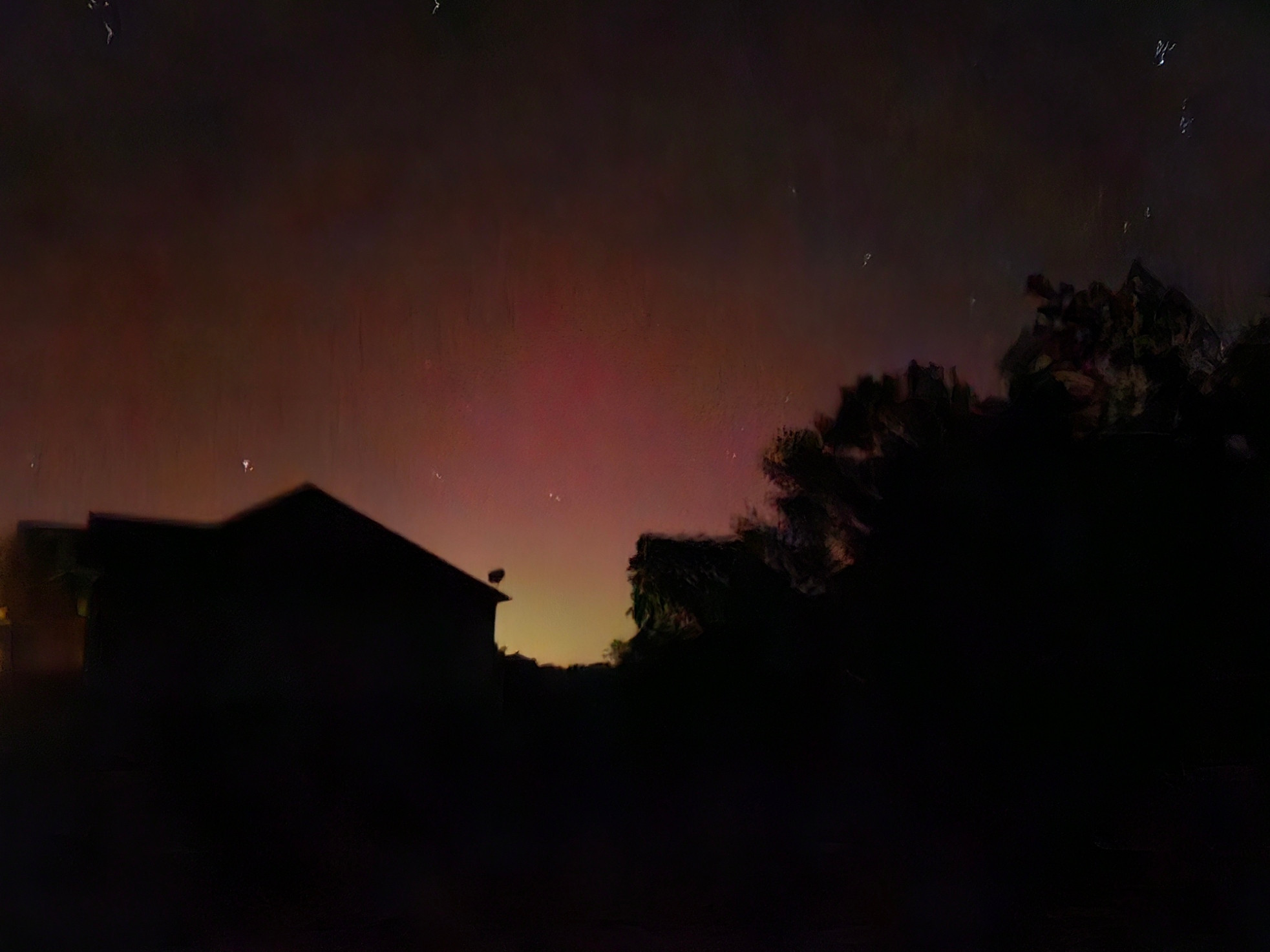
The Northern Lights are visible in east-central Illinois tonight (with a camera). Photos taken at 9:40 p.m. CDT.

0
SHwxclisteve.bsky.social

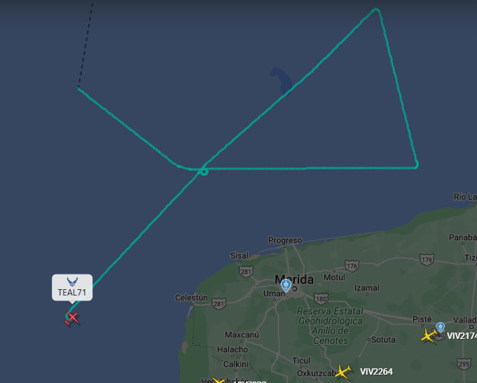
I spy, with my little eye, what might be the location of the eye. USAF Hurricane Hunter tonight. #hurricanemilton#Milton

USAF Hurricane Hunter flight track Monday, 10/7/2024 9:00 EDT
1
Reposted by Steve Hilberg
CVcoweatherman.bsky.social

Absolutely incredible intensification by Milton - 90 mph in 25 hours!

000
WTNT64 KNHC 071305
TCUAT4
Hurricane Milton Tropical Cyclone Update
NWS National Hurricane Center Miami FL
805 AM CDT Mon Oct 07 2024
AL142024
...MILTON RAPIDLY INTENSIFIES INTO A CATEGORY 4 HURRICANE...
Data from both Hurricane Hunter aircraft indicate that Milton has strengthened to a category 4 hurricane. The maximum sustained winds are estimated to be 150 mph (240 km/h). Milton is a category 4 hurricane on the Saffir-Simpson Hurricane Wind Scale. Data from the aircraft also indicate that the minimum pressure has fallen to 940 mb (27.76 inches).
These changes will be reflected in the normal 10 AM CDT (1500 UTC)
advisory.
SUMMARY OF 805 AM CDT... 1305 UTC... INFORMATION
--------------------------===
LOCATION...21.7N 92.0W
ABOUT 150 MI...240 KM W OF PROGRESO MEXICO ABOUT 735 MI...11185 KM SW OF TAMPA FLORIDA MAXIMUM SUSTAINED WINDS... 150 MPH...240 KM/H
PRESENT MOVEMENT...ESE OR 115 DEGREES AT 8 MPH...13 KM/H
MINIMUM CENTRAL PRESSURE...940 MB...27.76 INCHES
$$
Forecaster Brown/Blak
1
SH
Steve Hilberg
@wxclisteve.bsky.social
Meteorologist & climatologist. SLU. Former dir. MRCC. CoCoRaHS blogger, IL CoCoRaHS coord., winter weather fan, diehard Cubs fan. Opinions my own.
11 followers17 following2 posts