
Welcome to October! Here are the changes we typically see in hurricane season...
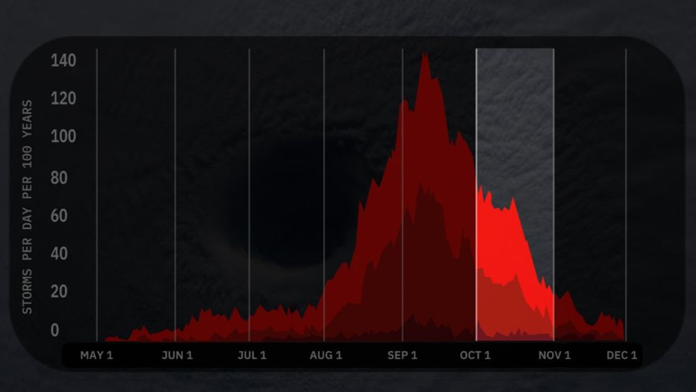
It can still be a busy and dangerous month. Here's what we usually look for in October. - Articles from The Weather Channel | weather.com
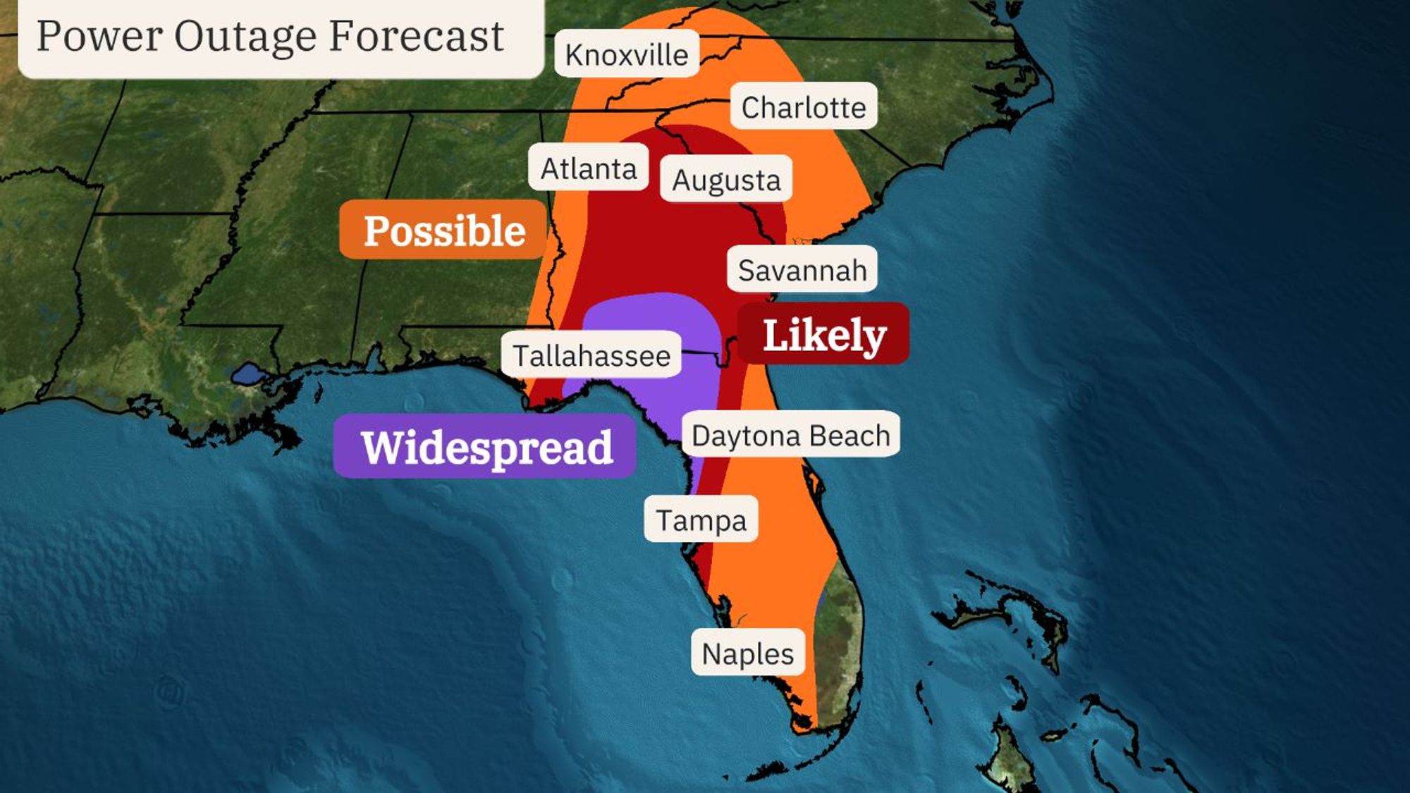
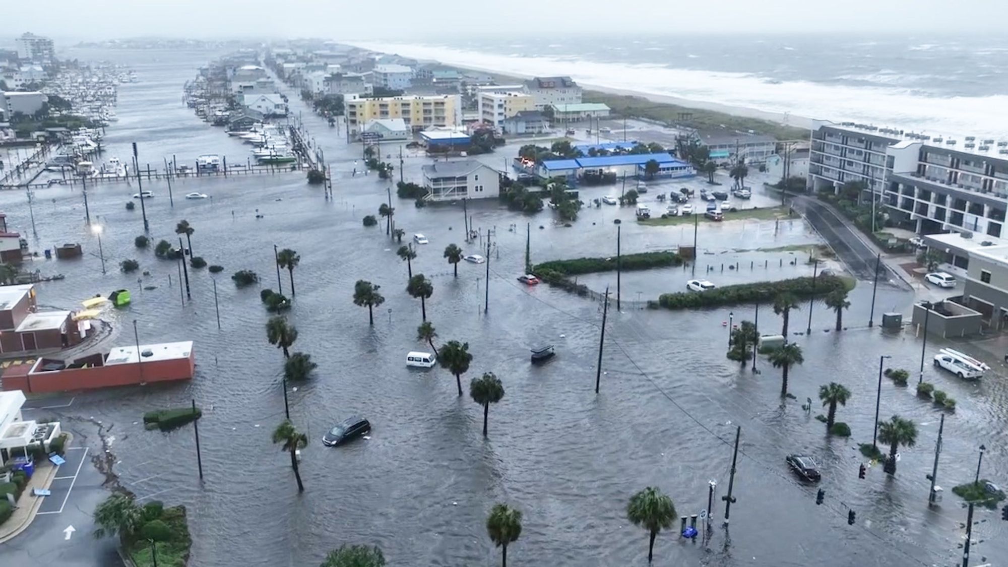
While Helene will be damaging at the coast , it will also have significant inland impacts, including high winds, dangerous rainfall flooding and the threat of tornadoes. Prepare for power outages in Georgia, parts of the Carolinas, in addition to Florida. Don't drive on flooded roads.

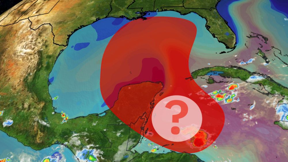
Here is our latest thinking regarding a likely Gulf tropical storm (possible hurricane) this week. Folks along the northern Gulf Coast and Florida should monitor this forecast closely.
Yet another Gulf storm is ahead. Here's what you need to know about this latest threat. - Articles from The Weather Channel | weather.com
We've seen a consistent signal in forecast models for development in the W. Caribbean Sea by early next week, that could then move into the Gulf mid-late next week. For now, those along the Gulf Coast should monitor the forecast closely and, as always, have hurricane plans ready, just in case.

As we saw with the unnamed Louisiana/Mississippi flood in Aug. 2016, who needs a name? Peak totals: - Beryl: 16.88" (Hilshire Village TX) - Debby: 22.02" (Moncks Corner, SC) - Francine: 12.75" (Apalachicola, FL) - "Unnamed" PTC Eight: 20.81" (Carolina Beach, NC)
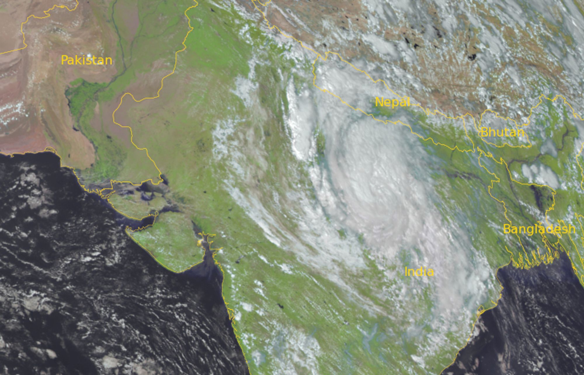
Per James Reynolds and Jonathan Belles, 10 days after its Vietnam landfall, the "remnant" of former Typhoon Yagi is a "depression" over northern India, per the India Meteorological Department.
Interesting that Louisiana's hurricane history includes active periods with rashes of landfalls within 1-2 seasons, as well as multi-year lulls.

The Pelican State has an interesting hurricane history with rashes of storms, then years without any. - Articles from The Weather Channel | weather.com

From ECMWF/C3S Aug. report: "The average anomaly for the remaining months of this year would need to drop by at least 0.30°C for 2024 not to be warmer than 2023. This has never happened in the entire ERA5 dataset, making it increasingly likely that 2024 is going to be the warmest year on record."

First image: Tuesday (Tropical Storm Yagi) Second image: Wednesday (Cat. 4 Typhoon Yagi) Just another rapid intensifier.