ブルーイノベーション(5597) 東証G 始値808円 高値815円 安値792円 終値800円 前日比-11円(-1.36%) VWAP801.7192円 出来高17,100株 前日比9,500株増(+125.00%) O/U比率-35.78% OVER 14800株 UNDER 7000株 [2024/10/10 11:29]
ケイファーマ(4896) 東証G 始値815円 高値815円 安値788円 終値788円 前日比-24円(-2.96%) VWAP799.5428円 出来高3,500株 前日比15,900株減(-81.96%) O/U比率-9.52% OVER 13800株 UNDER 11400株 [2024/10/10 11:25]
ヴィッツ(4440) 東証S 始値815円 高値815円 安値802円 終値807円 前日比+7円(+0.88%) VWAP807.84円 出来高2,500株 前日比2,100株減(-45.65%) 信用倍率56倍 売残800株 買残44800株 貸借倍率0倍 貸株残0株 融資残400株 回転日数28日 O/U比率-68.42% OVER 19200株 UNDER 3600株 [2024/10/10 11:24]
エムビーエス(1401) 東証G 始値805円 高値822円 安値798円 終値815円 前日比+6円(+0.74%) VWAP809.4339円 出来高5,300株 前日比9,200株減(-63.45%) O/U比率-23.67% OVER 20900株 UNDER 12900株 [2024/10/10 11:16]
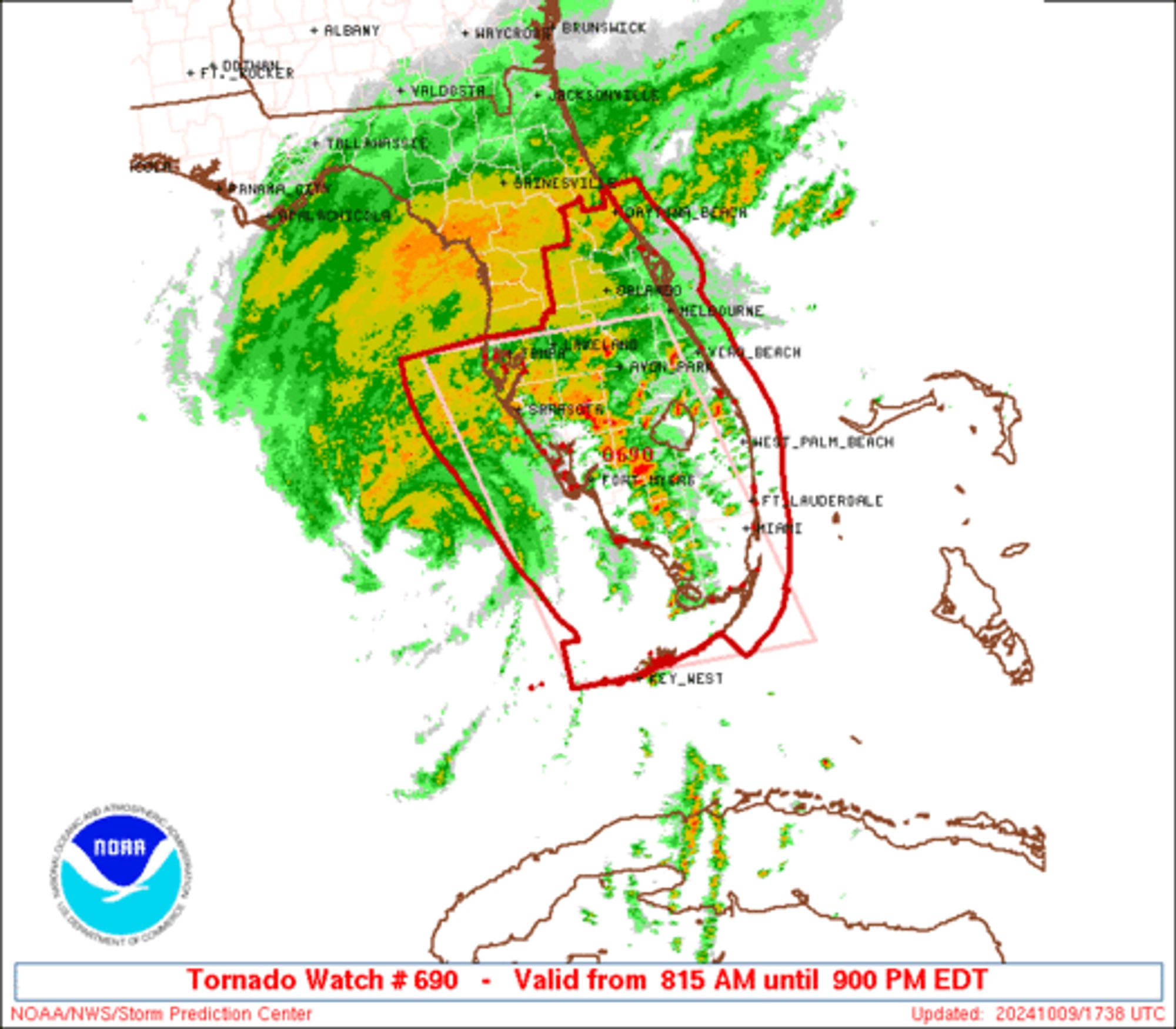
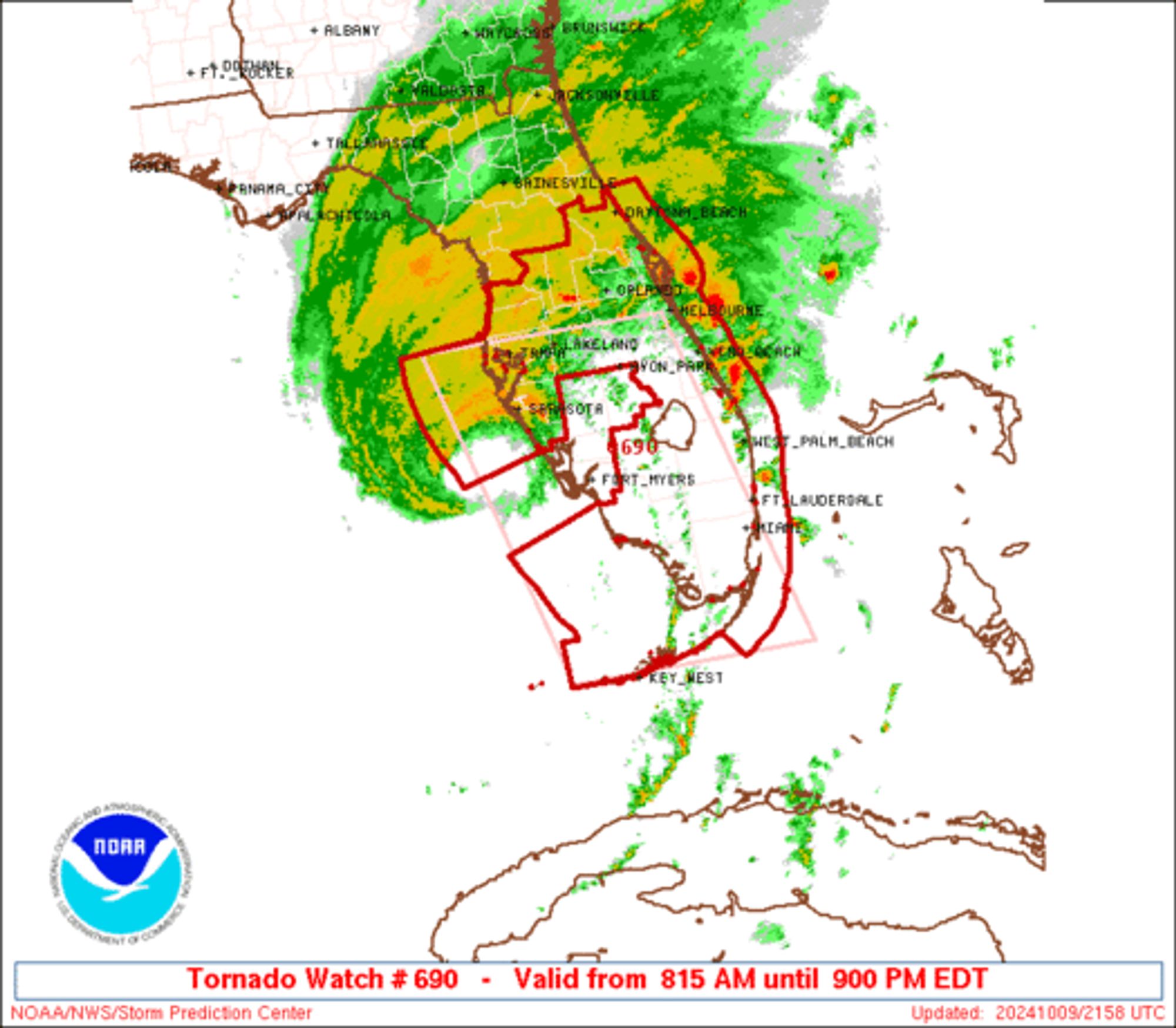
SPC Tornado Watch 690 ⛈️ Several tornadoes likely Isolated damaging wind gusts to 70 mph possible SUMMARY🌪️ Additional Details Here.
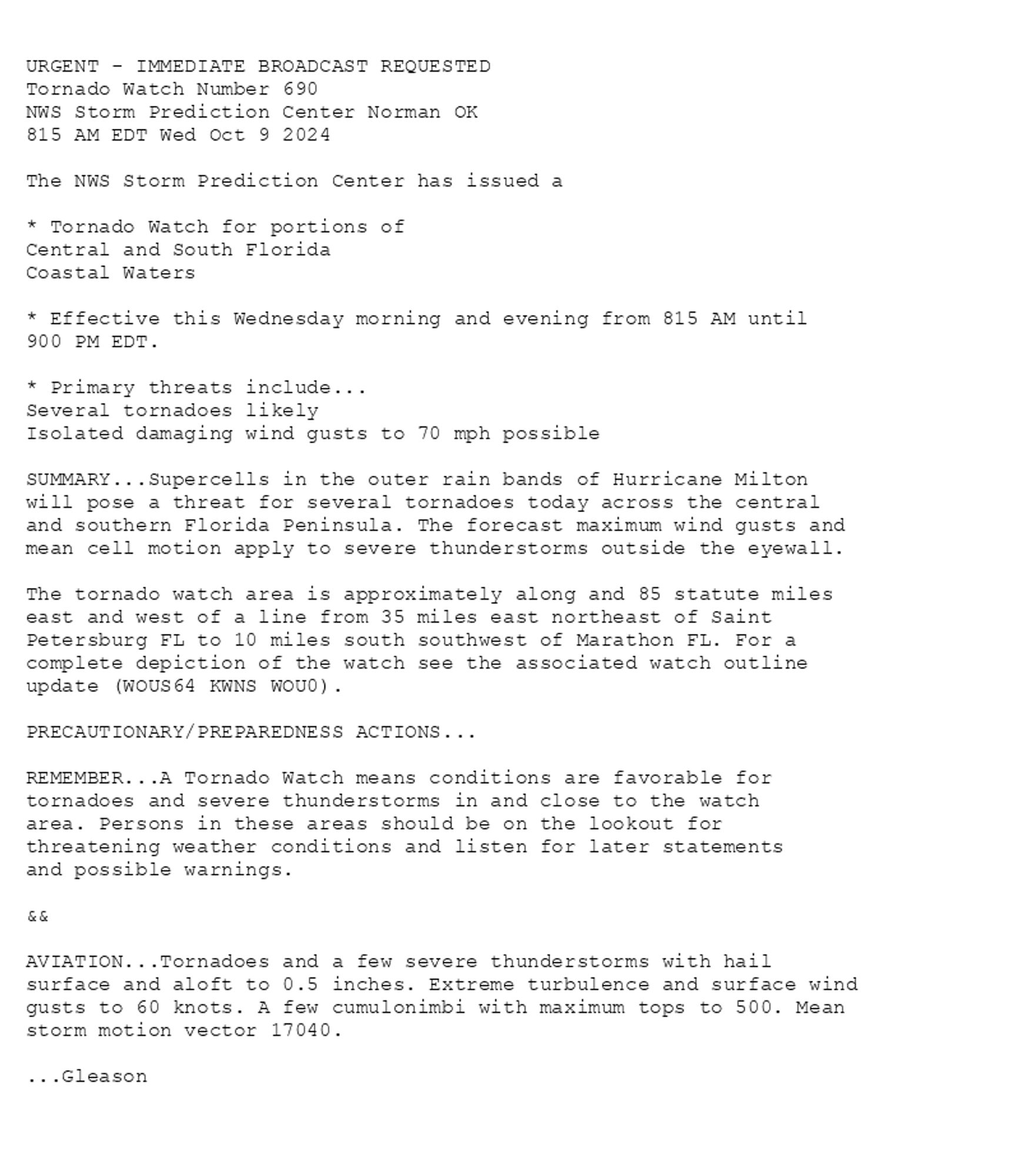
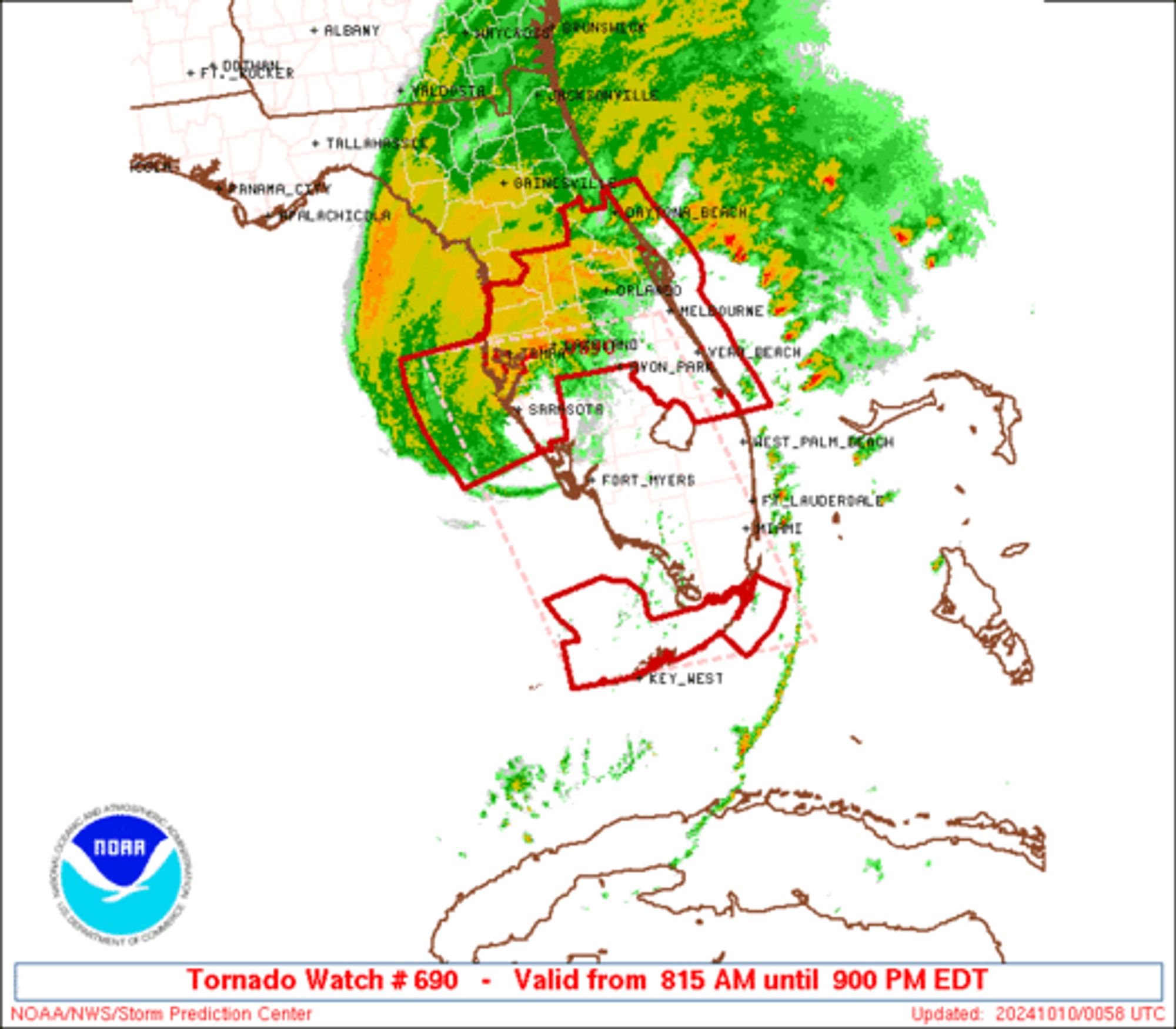
SPC Tornado Watch 690 ⛈️ Several tornadoes likely Isolated damaging wind gusts to 70 mph possible SUMMARY🌪️ Additional Details Here.
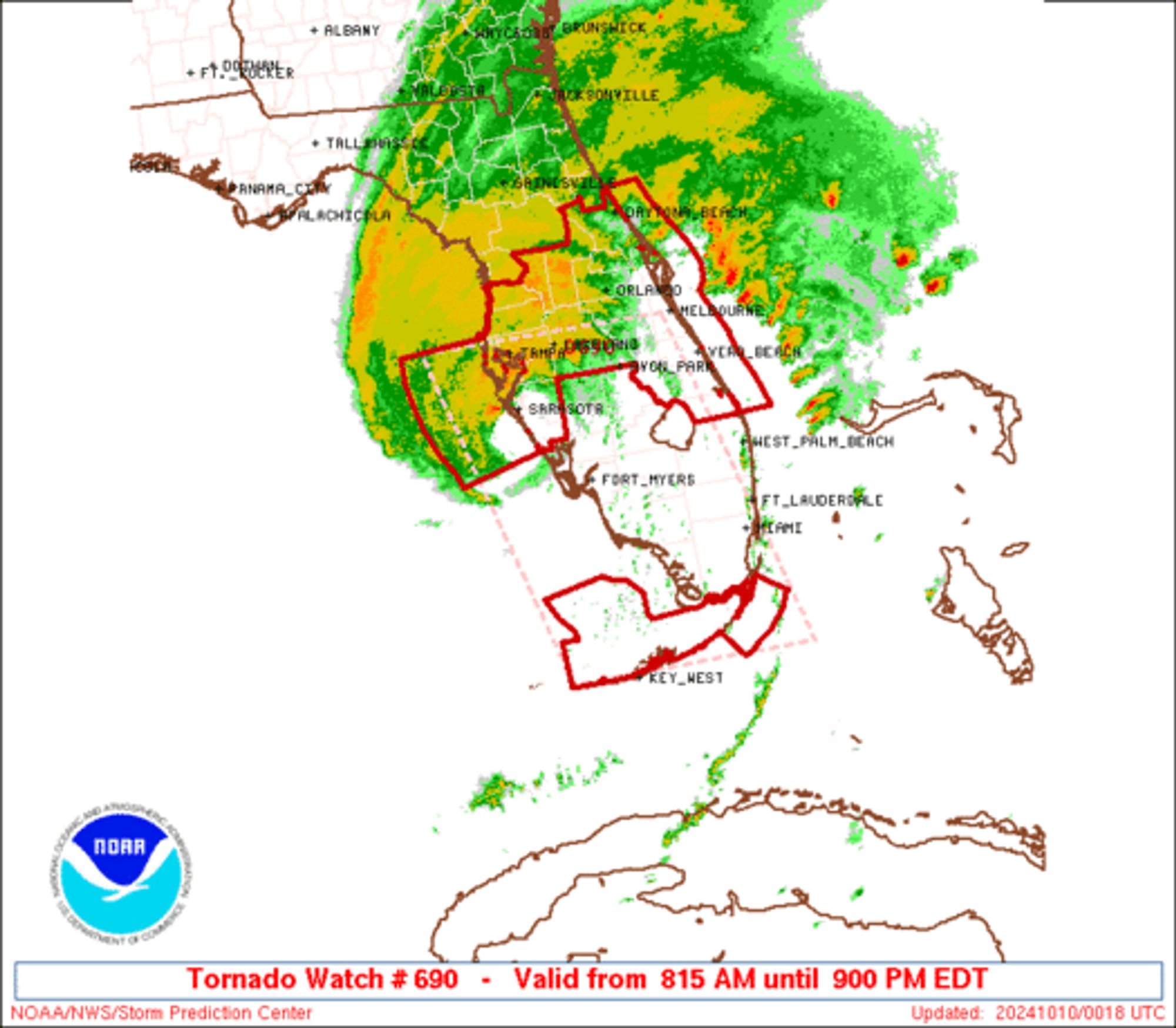
SPC Tornado Watch 690 ⛈️ Several tornadoes likely Isolated damaging wind gusts to 70 mph possible SUMMARY🌪️ Additional Details Here.
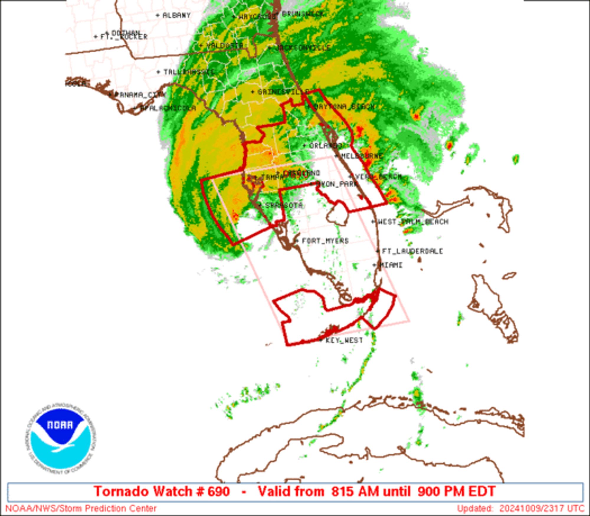
SPC Tornado Watch 690 ⛈️ Several tornadoes likely Isolated damaging wind gusts to 70 mph possible SUMMARY🌪️ Additional Details Here.
SWS train 815 scheduled to depart Chicago Union Station at 4:27 pm, will not operate due to a mechanical failure. Train 817 will be the next train making all stops to Manhattan.
SPC Tornado Watch 690 ⛈️ Several tornadoes likely Isolated damaging wind gusts to 70 mph possible SUMMARY🌪️ Additional Details Here.