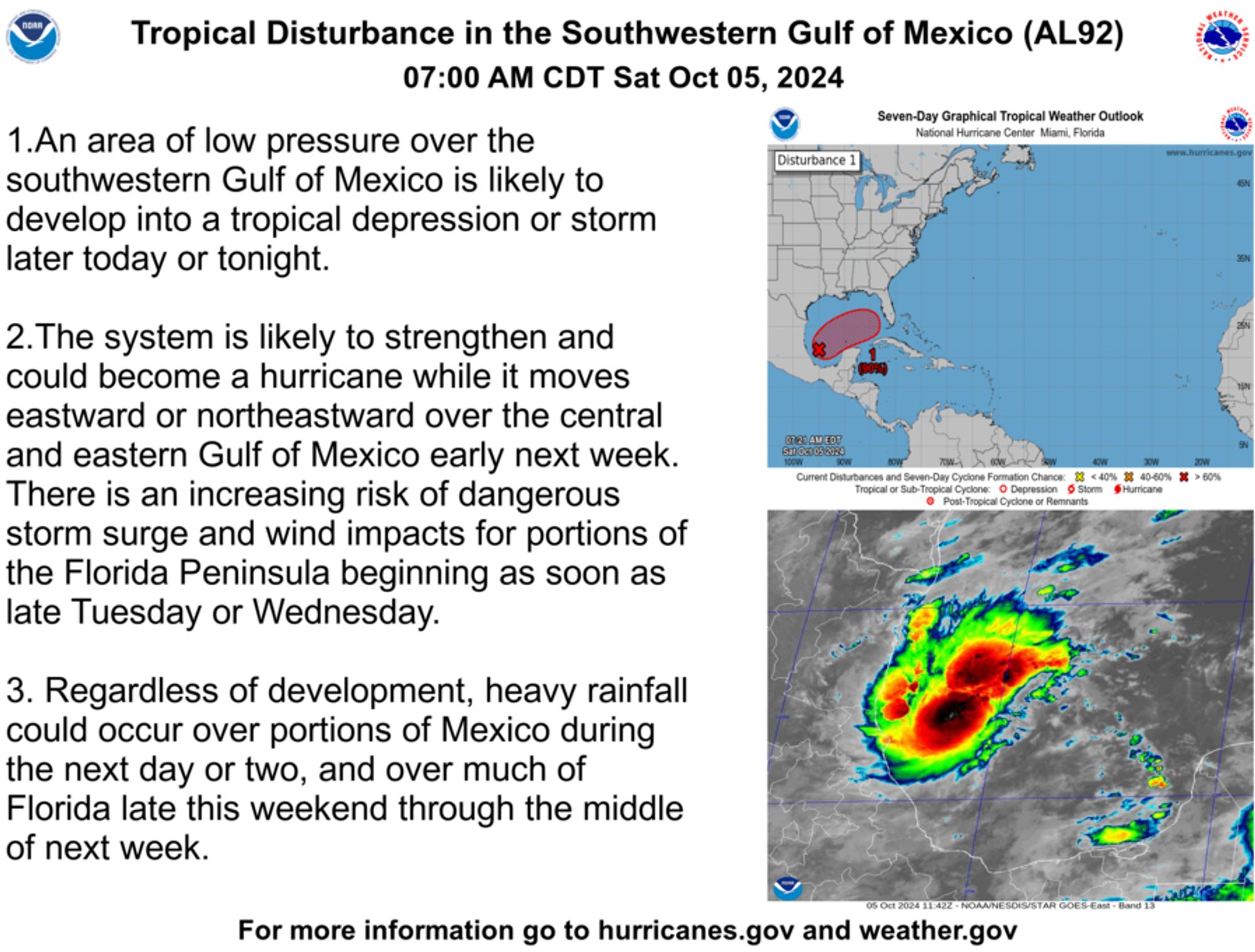
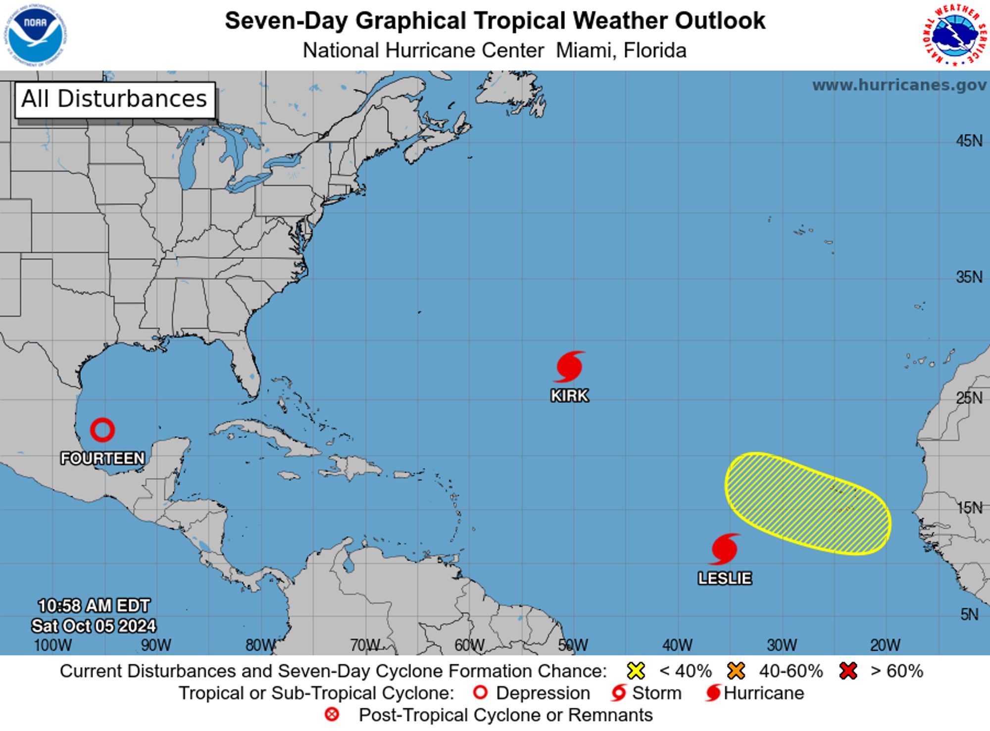
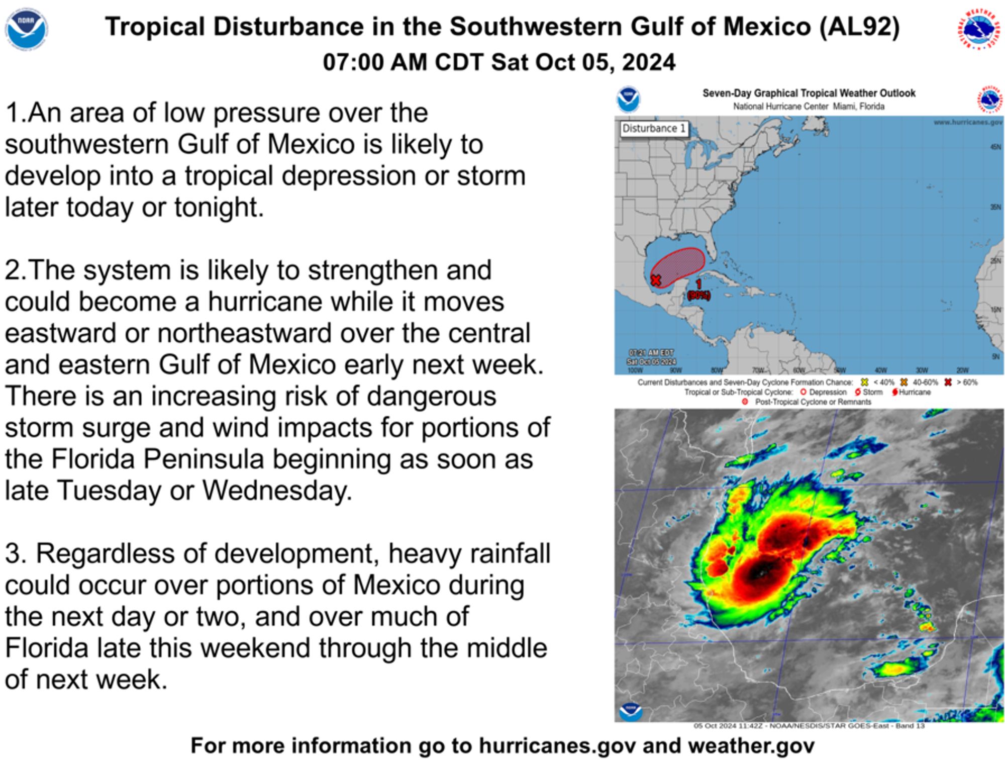
@NHC_Atlantic: 7AM CDT Oct 5: Here are the key messages for the tropical disturbance in the southwestern Gulf of Mexico (#AL92https://twitter.com/NHC_Atlantic/status/1842535886015332586
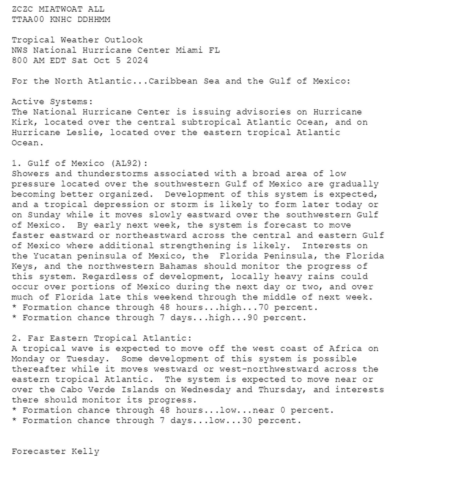
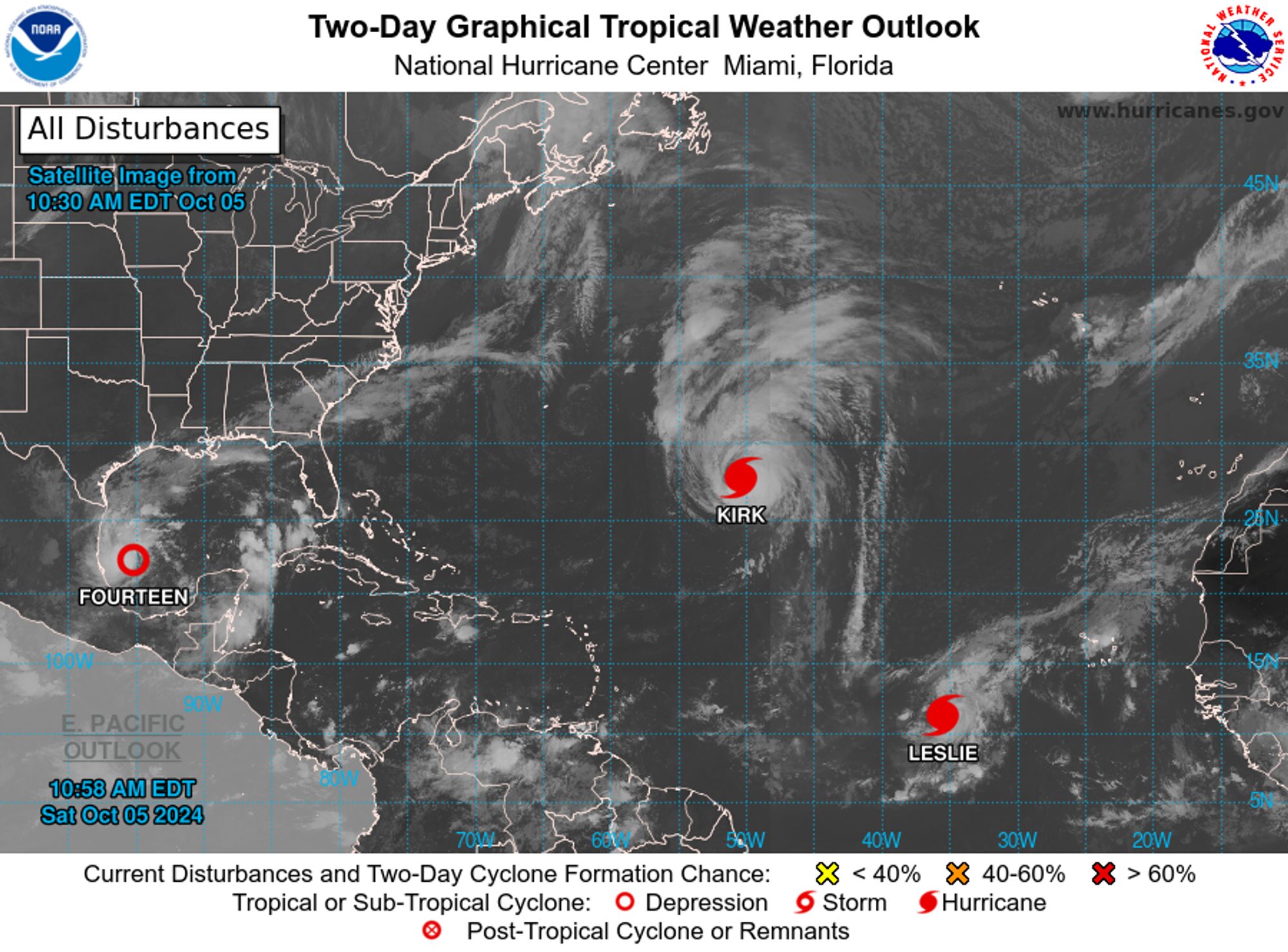
NWS National Hurricane Center Miami FL 800 AM EDT Sat Oct 5 2024 For the North Atlantic...Caribbean Sea and the Gulf of Mexico: Active Systems: The National Hurricane Center is issuing advisories on Hurricane Kirk, located over the central subtropical Atlantic Ocean, and on Hurricane Leslie, loc
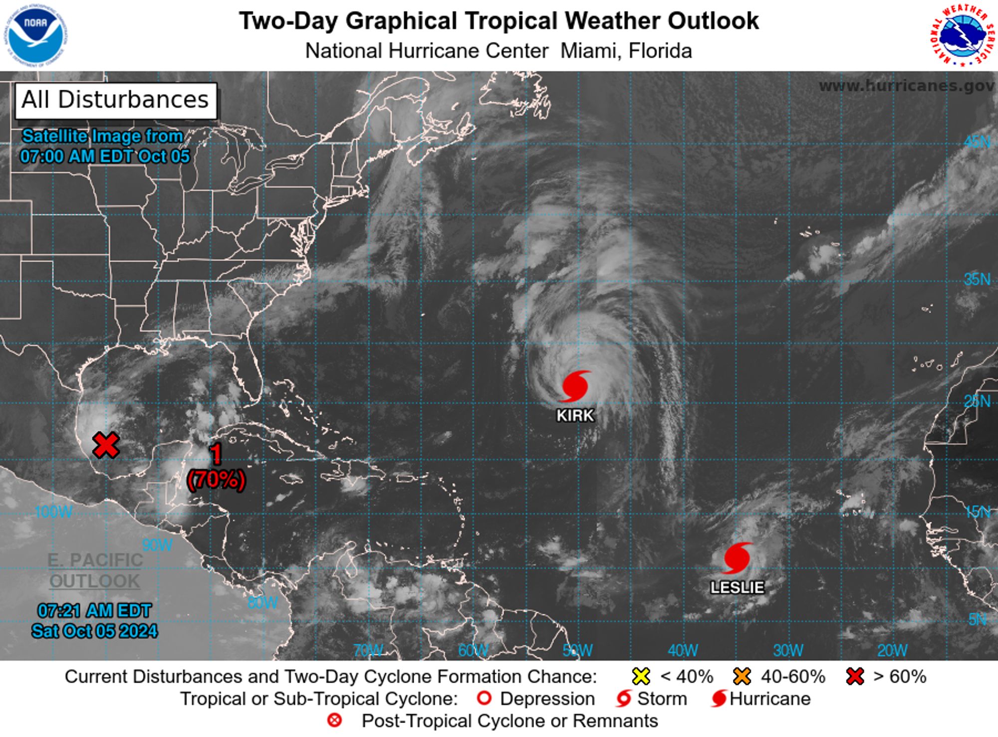

7AM CDT Oct 5: Here are the key messages for the tropical disturbance in the southwestern Gulf of Mexico (#AL92).https://t.co/tW4KeGe9uJhttps://t.co/6Tz67hbTzB


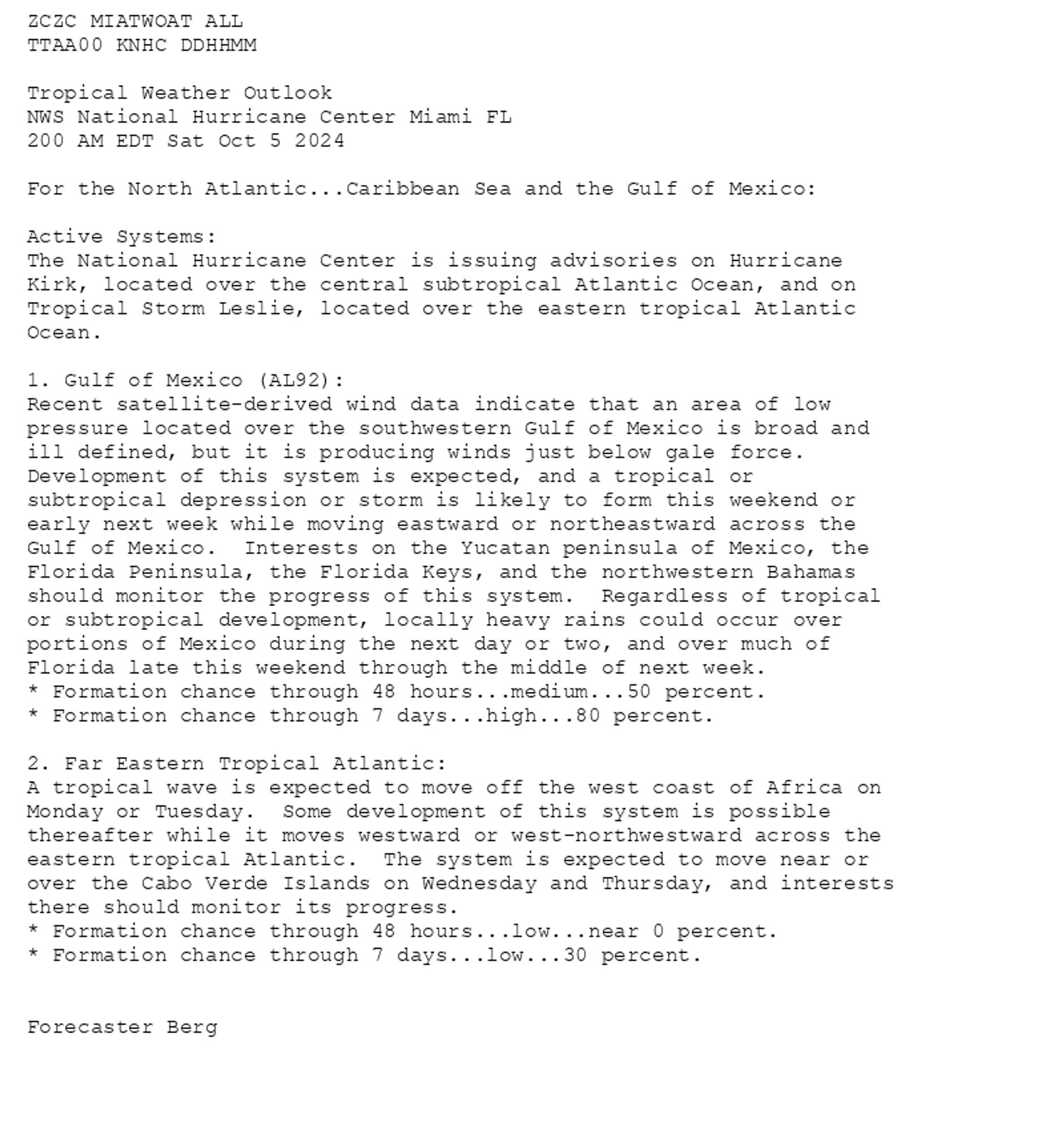
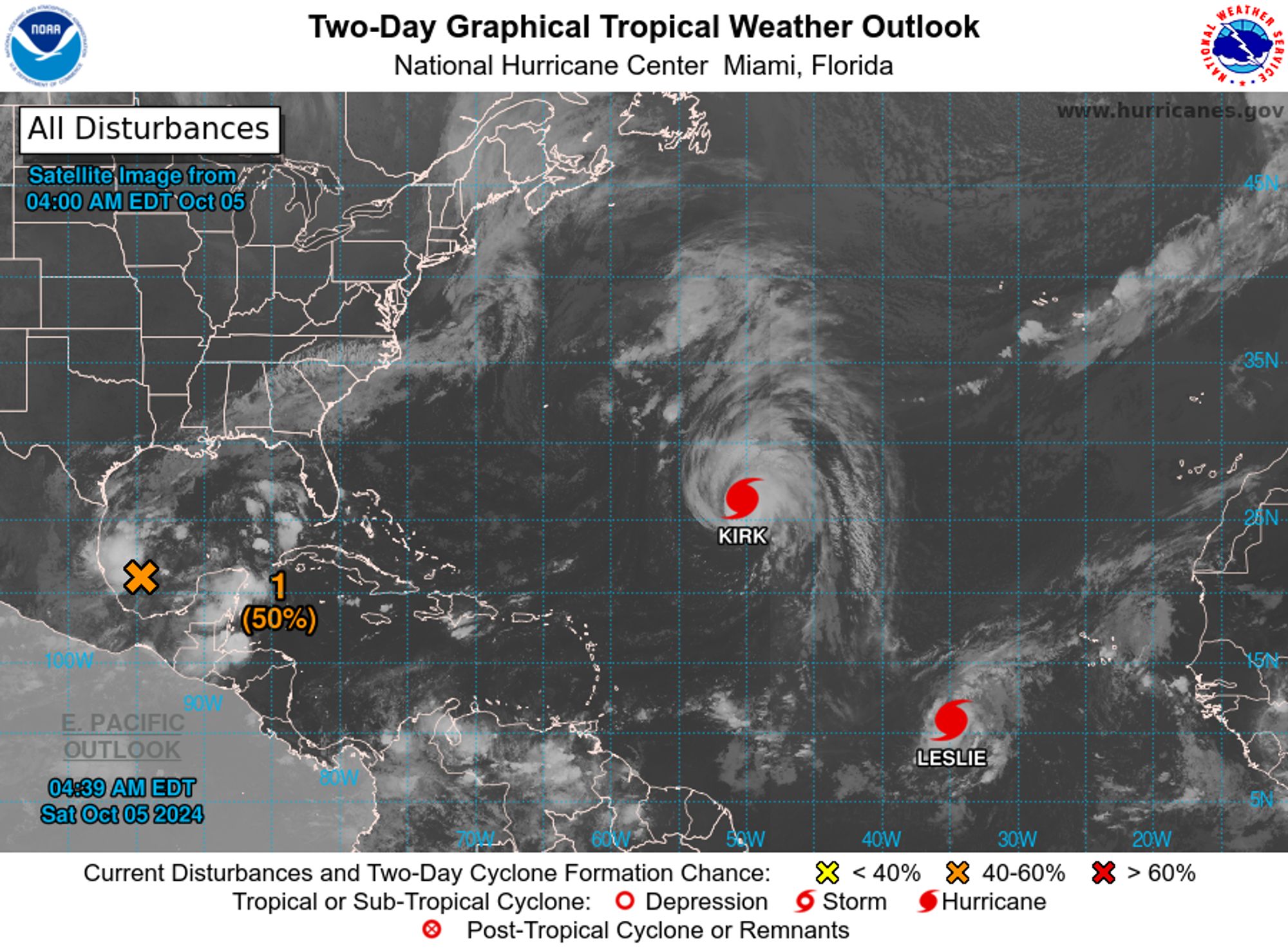


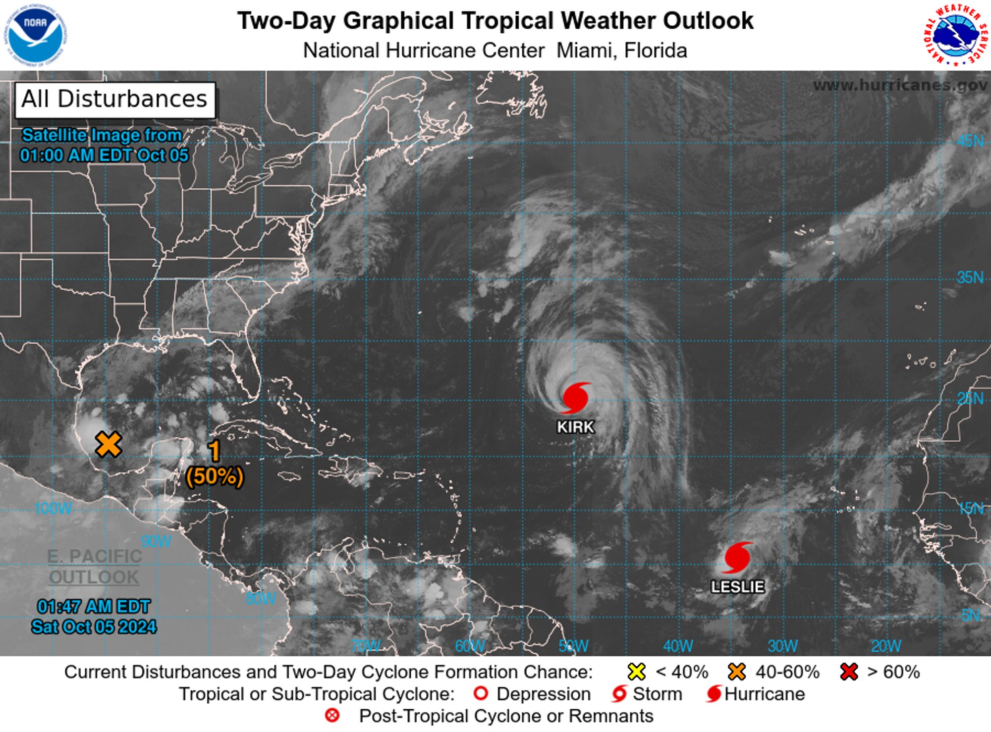
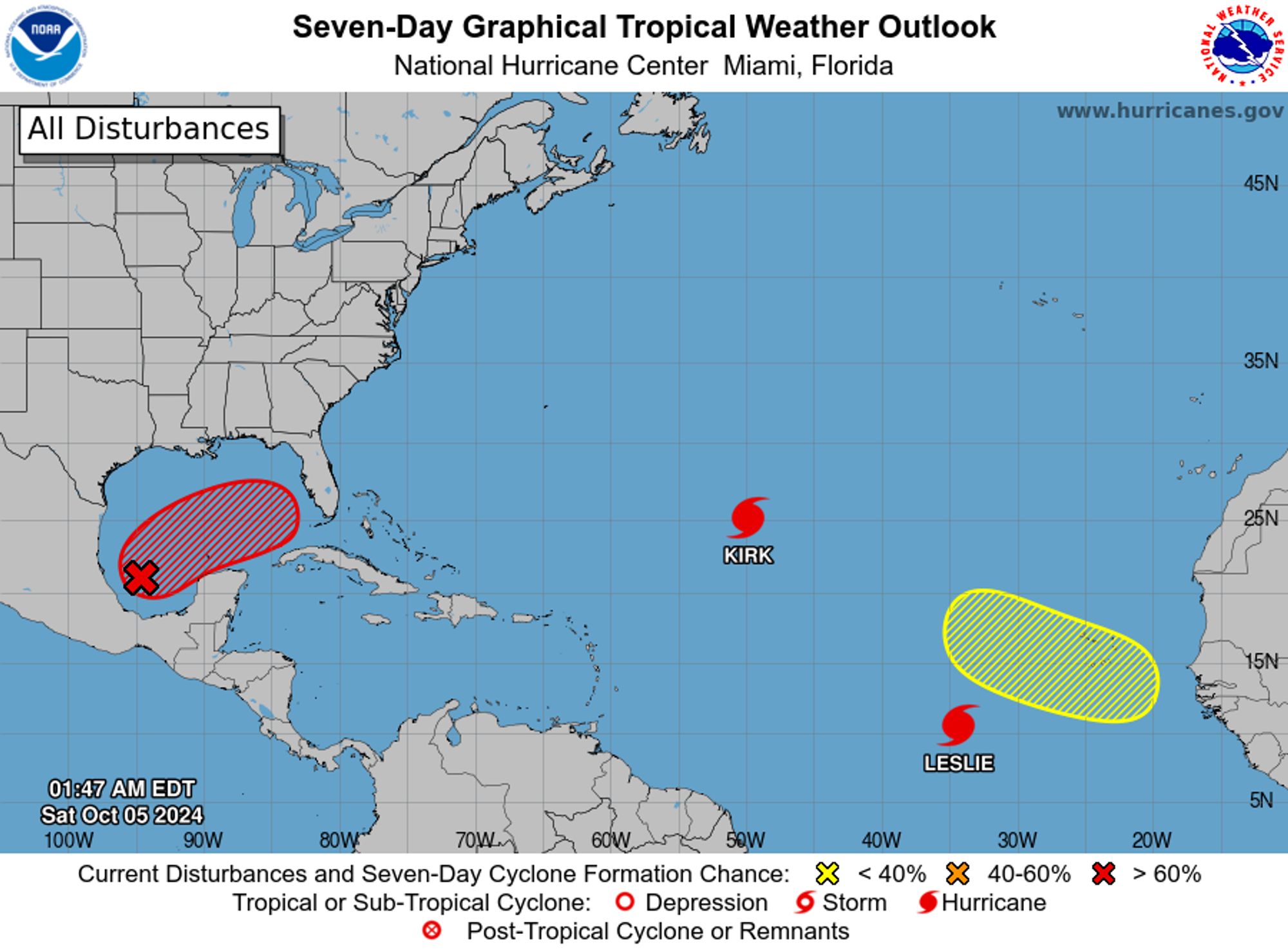
NWS National Hurricane Center Miami FL 200 AM EDT Sat Oct 5 2024 For the North Atlantic...Caribbean Sea and the Gulf of Mexico: Active Systems: The National Hurricane Center is issuing advisories on Hurricane Kirk, located over the central subtropical Atlantic Ocean, and on Tropical Storm Leslie