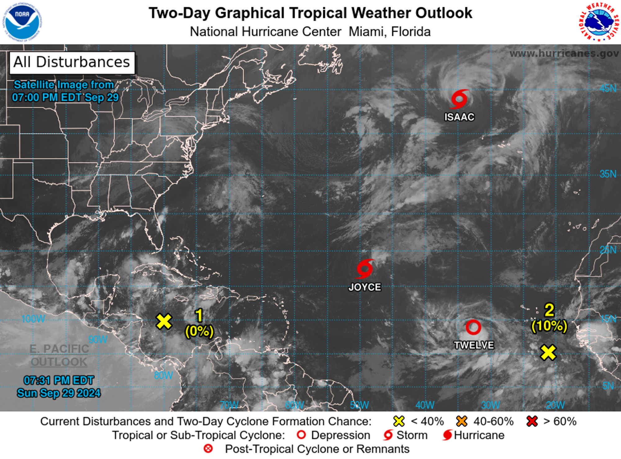
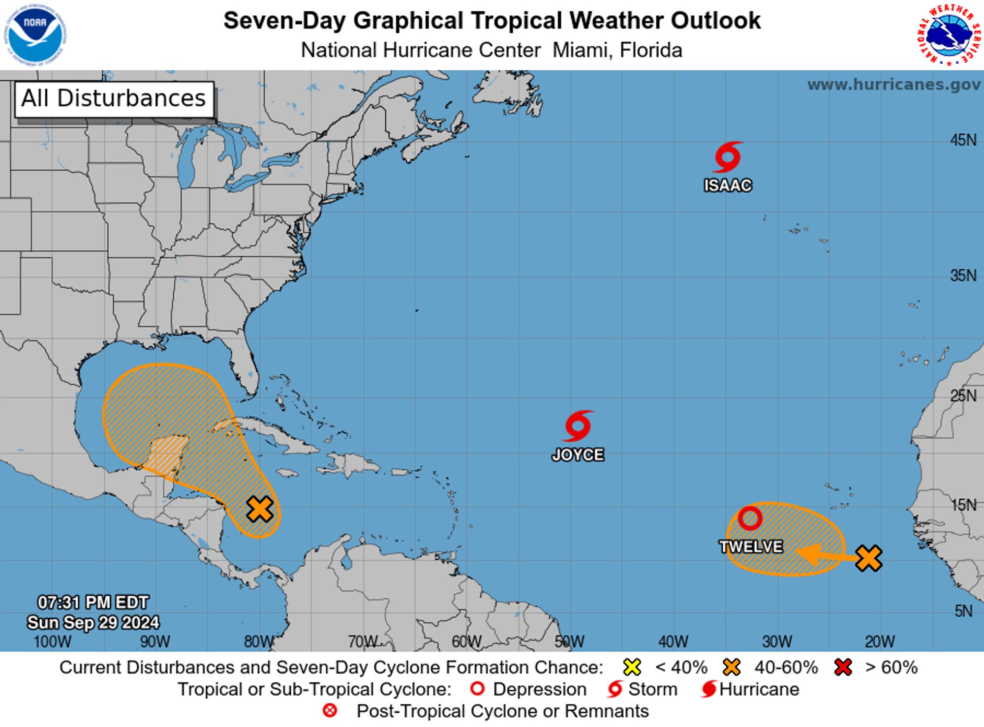
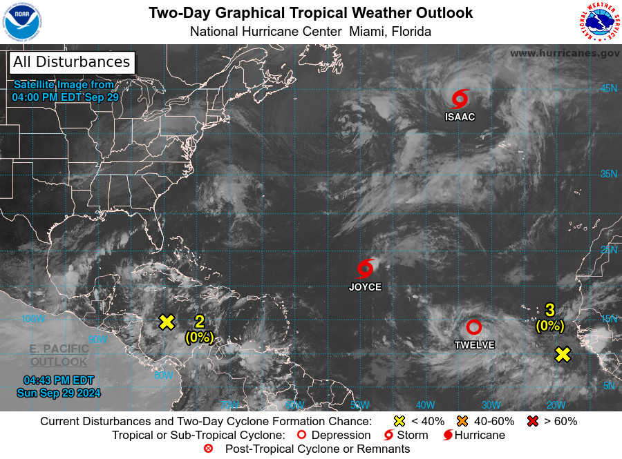
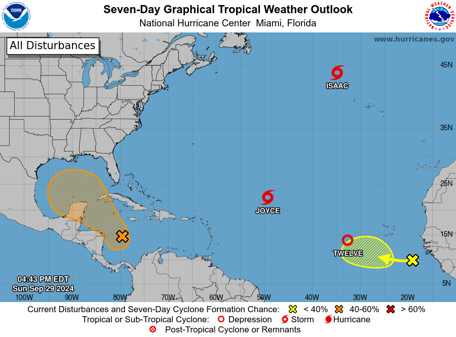
NWS National Hurricane Center Miami FL 800 PM EDT Sun Sep 29 2024 For the North Atlantic...Caribbean Sea and the Gulf of Mexico: Active Systems: The National Hurricane Center is issuing advisories on Tropical Storm Isaac, located several hundred miles northwest of the Azores, on Tropical Storm J
NWS National Hurricane Center Miami FL 200 PM EDT Sun Sep 29 2024 For the North Atlantic...Caribbean Sea and the Gulf of Mexico: Active Systems: The National Hurricane Center is issuing advisories on Hurricane Isaac, located several hundred miles northwest of the Azores, and on Tropical Storm Jo
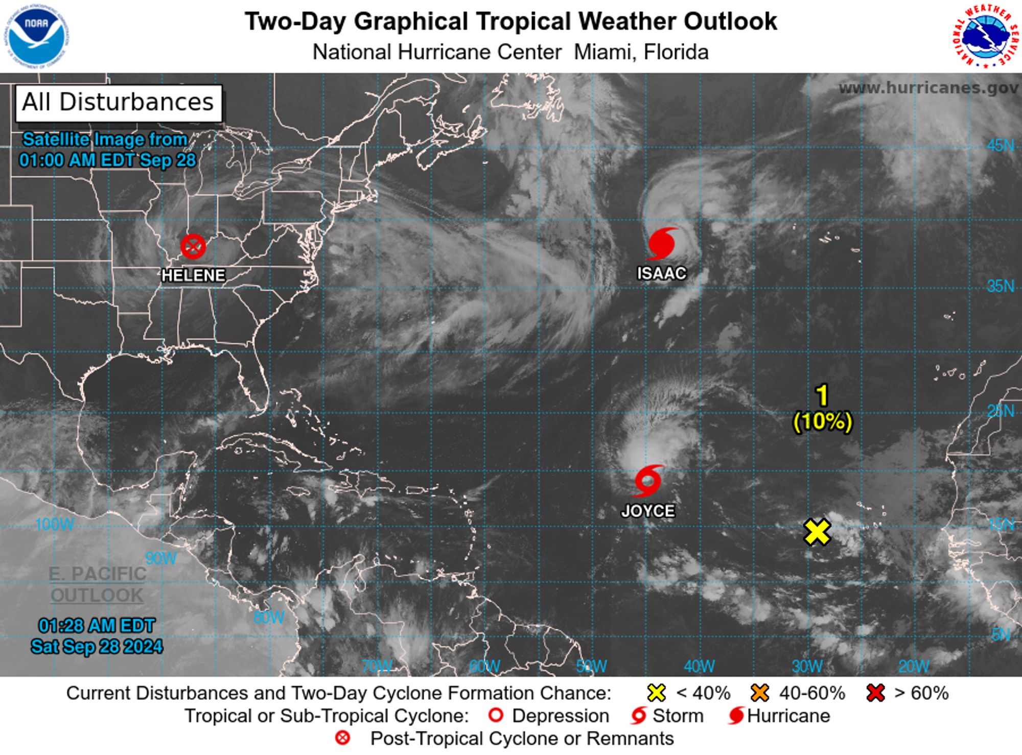
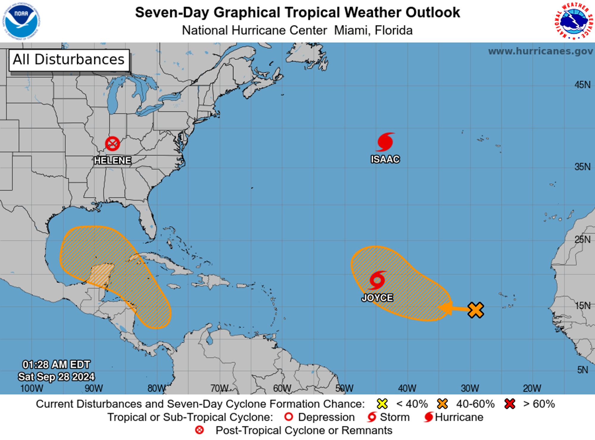
NWS National Hurricane Center Miami FL 200 AM EDT Sat Sep 28 2024 For the North Atlantic...Caribbean Sea and the Gulf of Mexico: Active Systems: The National Hurricane Center is issuing advisories on Hurricane Isaac, located over the central Subtropical Atlantic Ocean, and on Tropical Storm Joyc
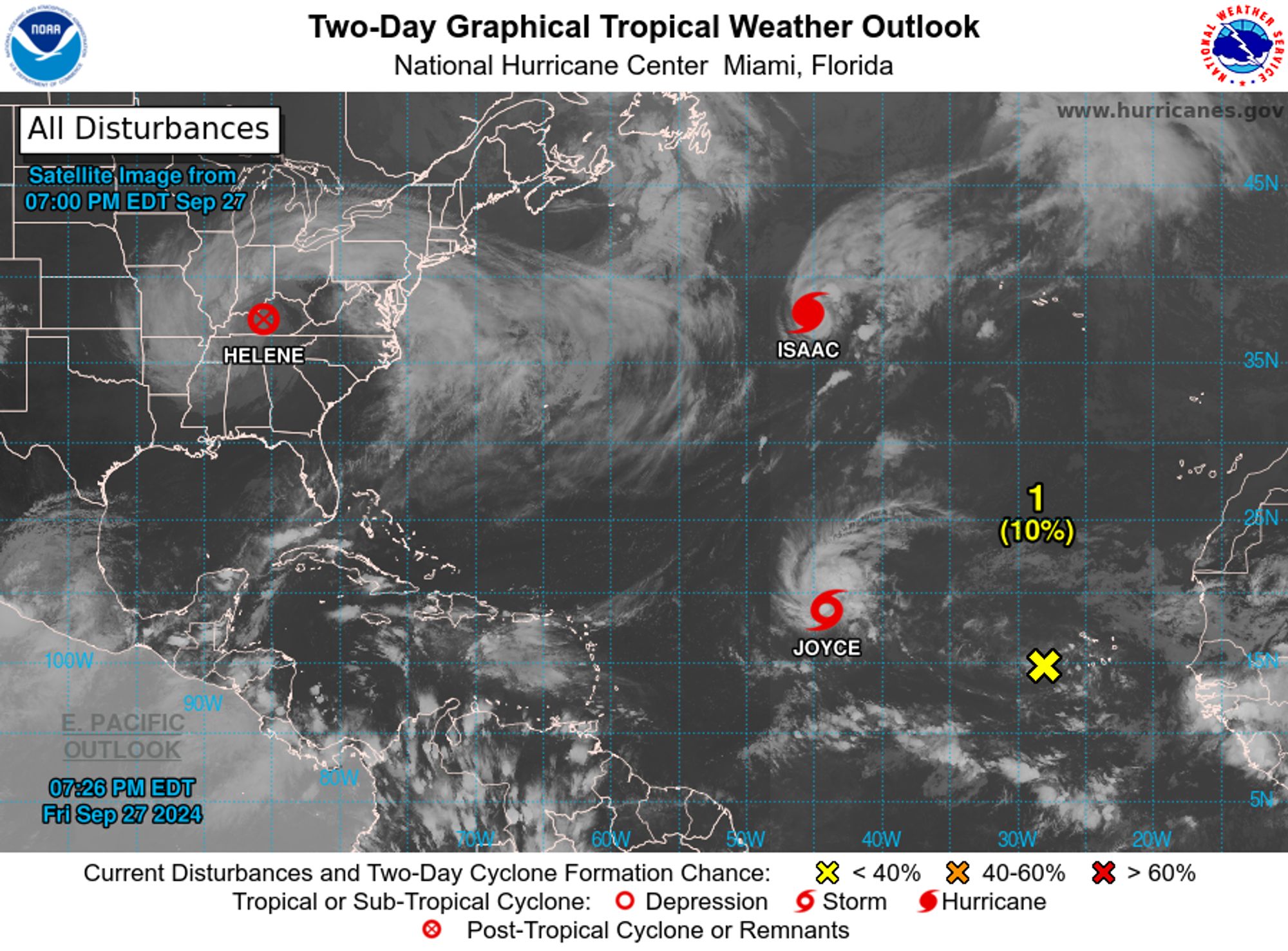
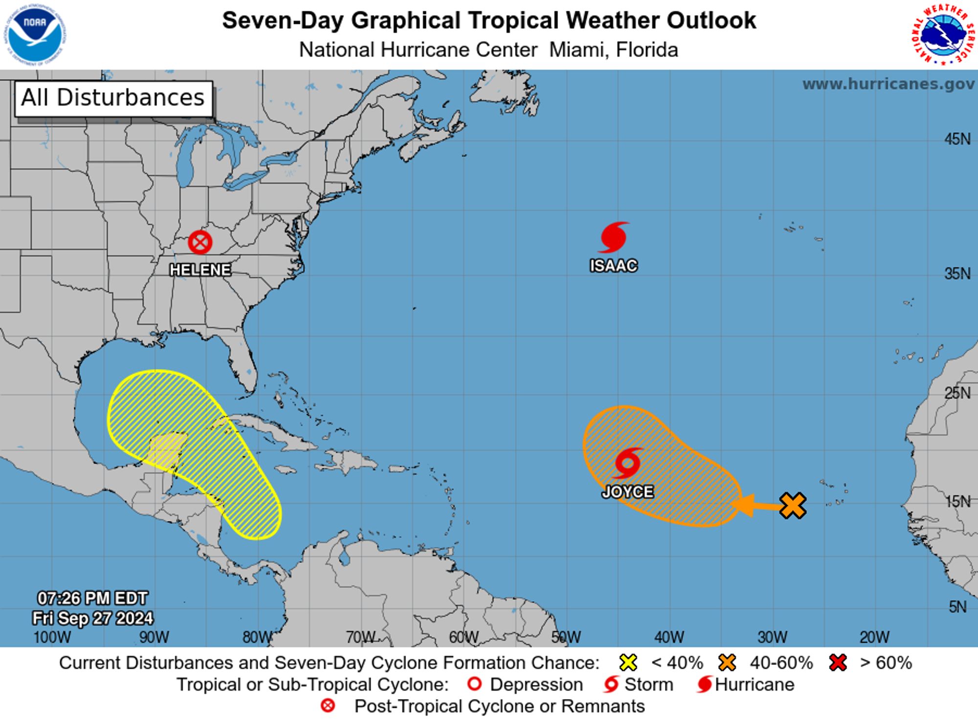
NWS National Hurricane Center Miami FL 800 PM EDT Fri Sep 27 2024 For the North Atlantic...Caribbean Sea and the Gulf of Mexico: Active Systems: The National Hurricane Center is issuing advisories on Hurricane Isaac, located over the central Subtropical Atlantic Ocean, and on Tropical Storm Joyc
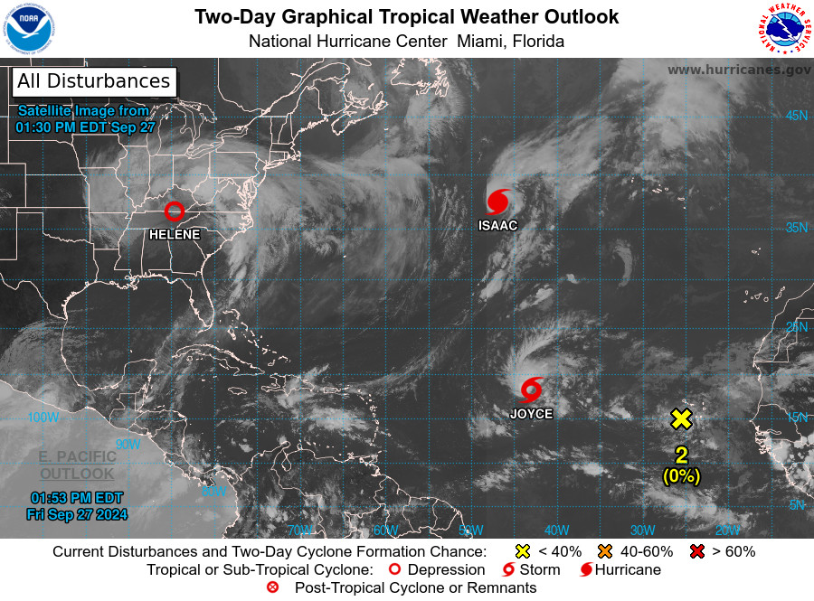
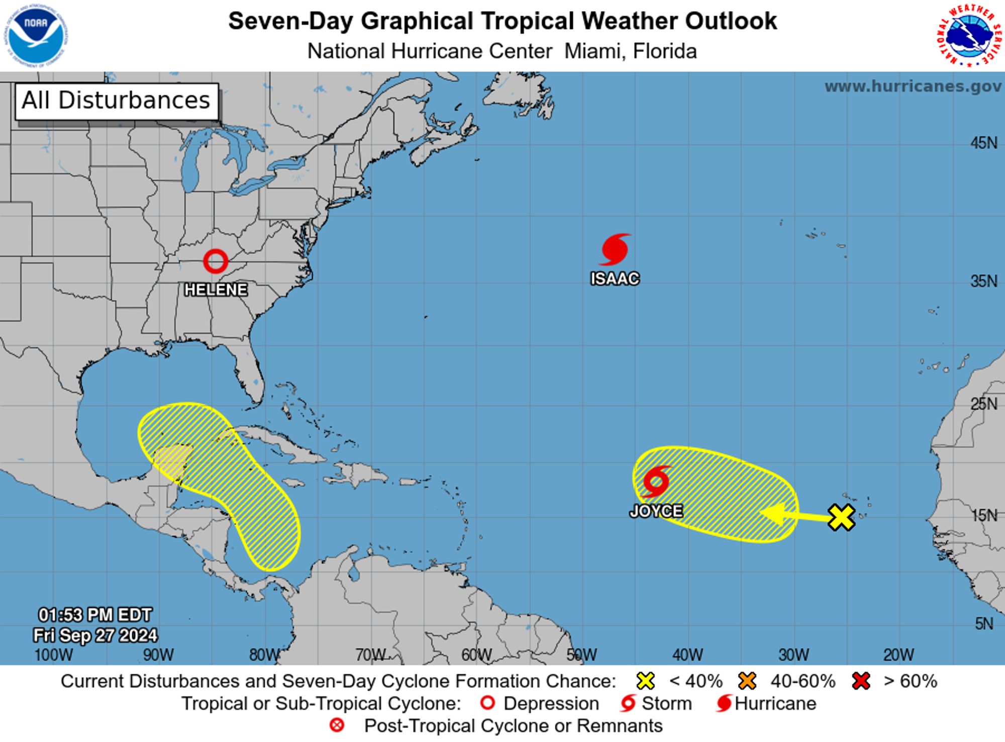
NWS National Hurricane Center Miami FL 200 PM EDT Fri Sep 27 2024 For the North Atlantic...Caribbean Sea and the Gulf of Mexico: Active Systems: The National Hurricane Center is issuing advisories on Tropical Depression Helene, located inland over the southern Appalachians, on Hurricane Isaac, l
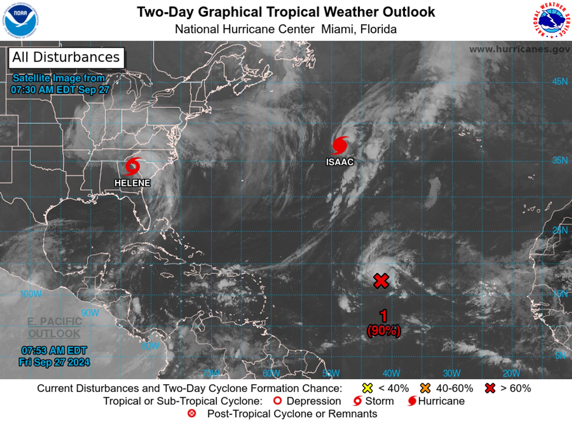
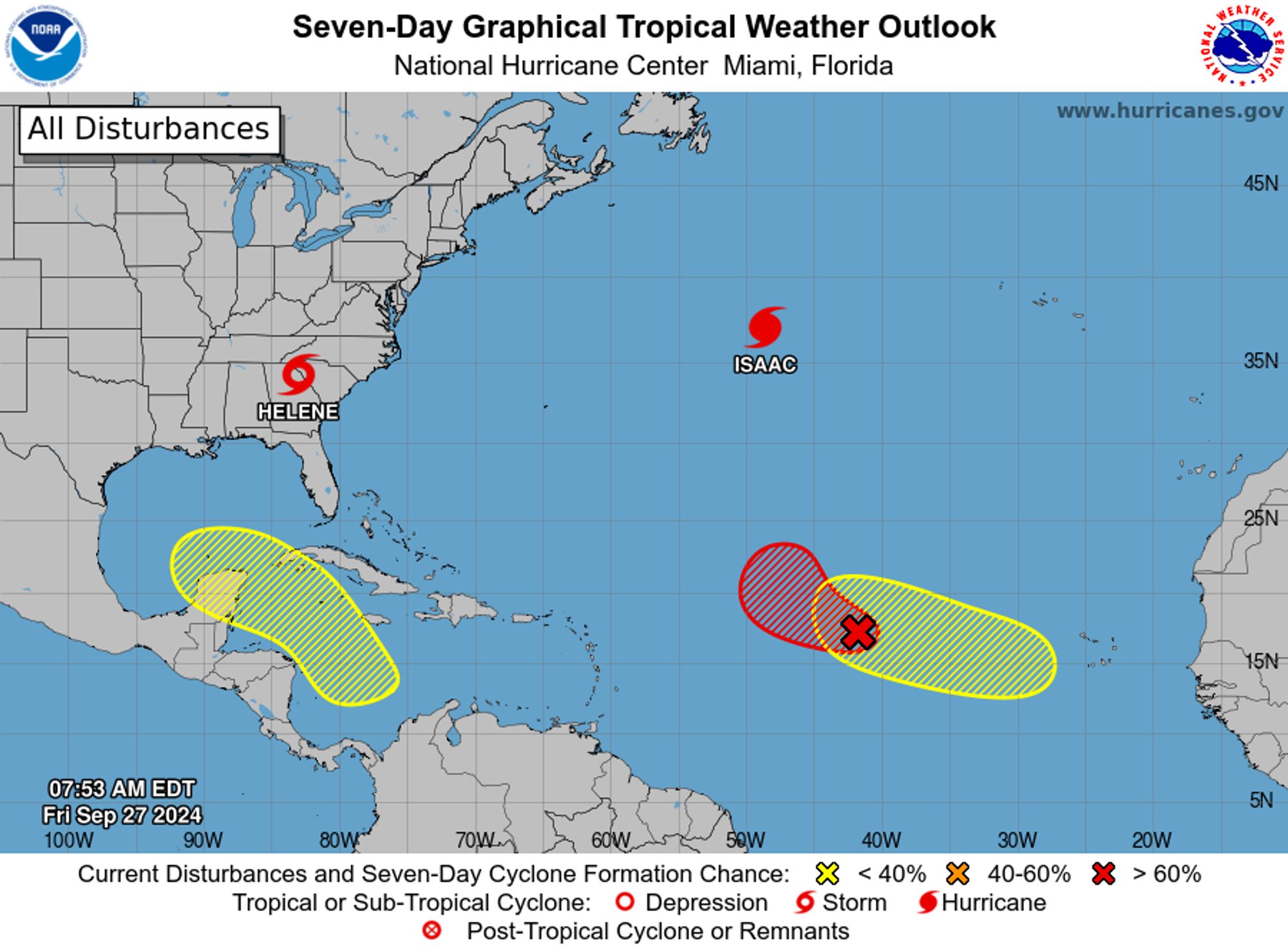
NWS National Hurricane Center Miami FL 800 AM EDT Fri Sep 27 2024 For the North Atlantic...Caribbean Sea and the Gulf of Mexico: Active Systems: The National Hurricane Center is issuing advisories on Tropical Storm Helene, located inland over northeast Georgia and on recently upgraded Hurricane
NWS National Hurricane Center Miami FL 200 AM EDT Fri Sep 27 2024 For the North Atlantic...Caribbean Sea and the Gulf of Mexico: Active Systems: The National Hurricane Center is issuing advisories on Hurricane Helene, located inland over southern Georgia and on Tropical Storm Isaac, located over
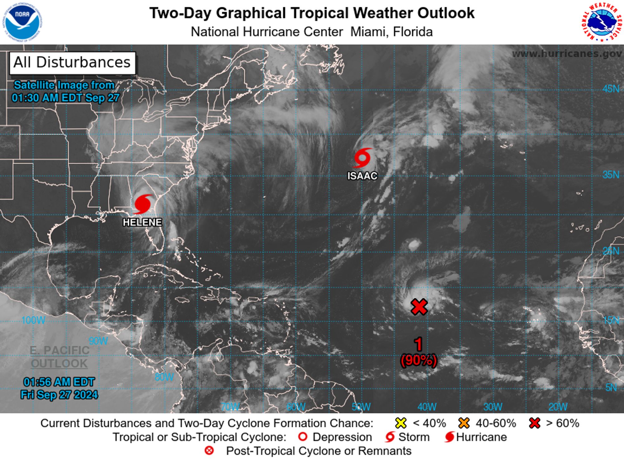
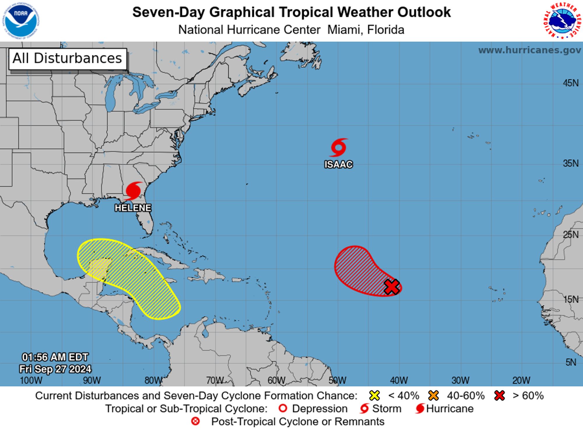
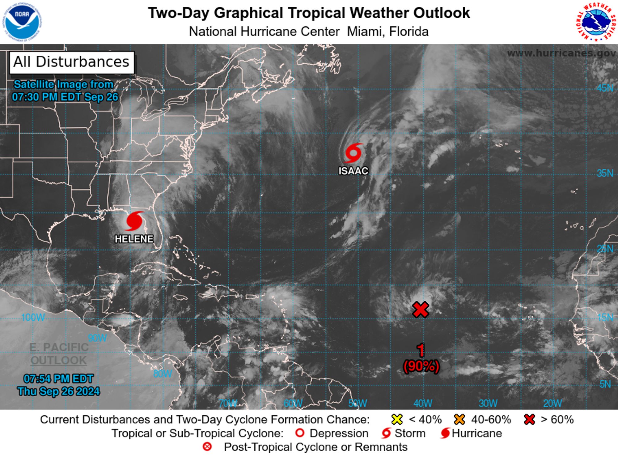
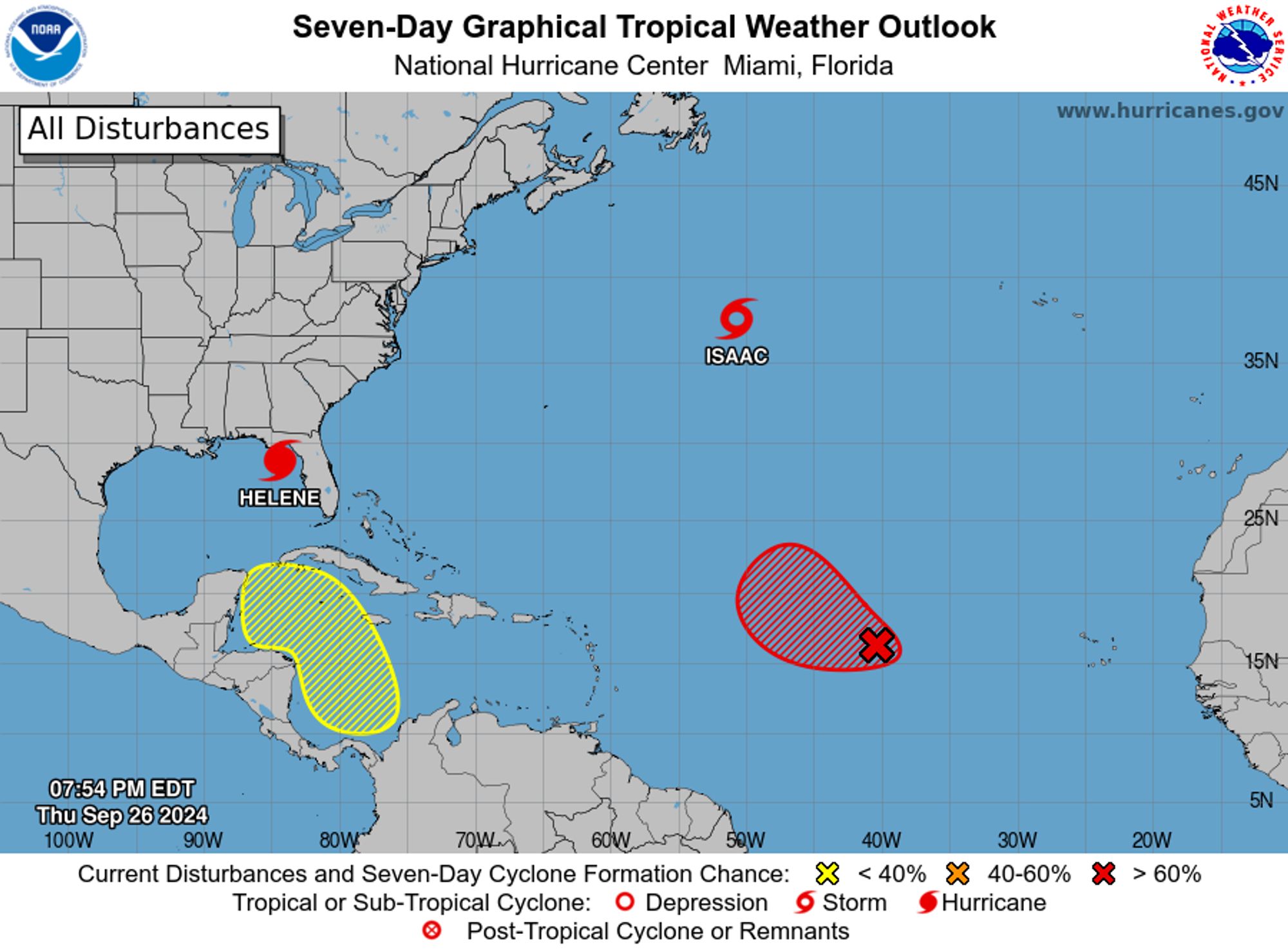
NWS National Hurricane Center Miami FL 800 PM EDT Thu Sep 26 2024 For the North Atlantic...Caribbean Sea and the Gulf of Mexico: Active Systems: The National Hurricane Center is issuing advisories on Hurricane Helene, located over the northeastern Gulf of Mexico and on Tropical Storm Isaac, loca
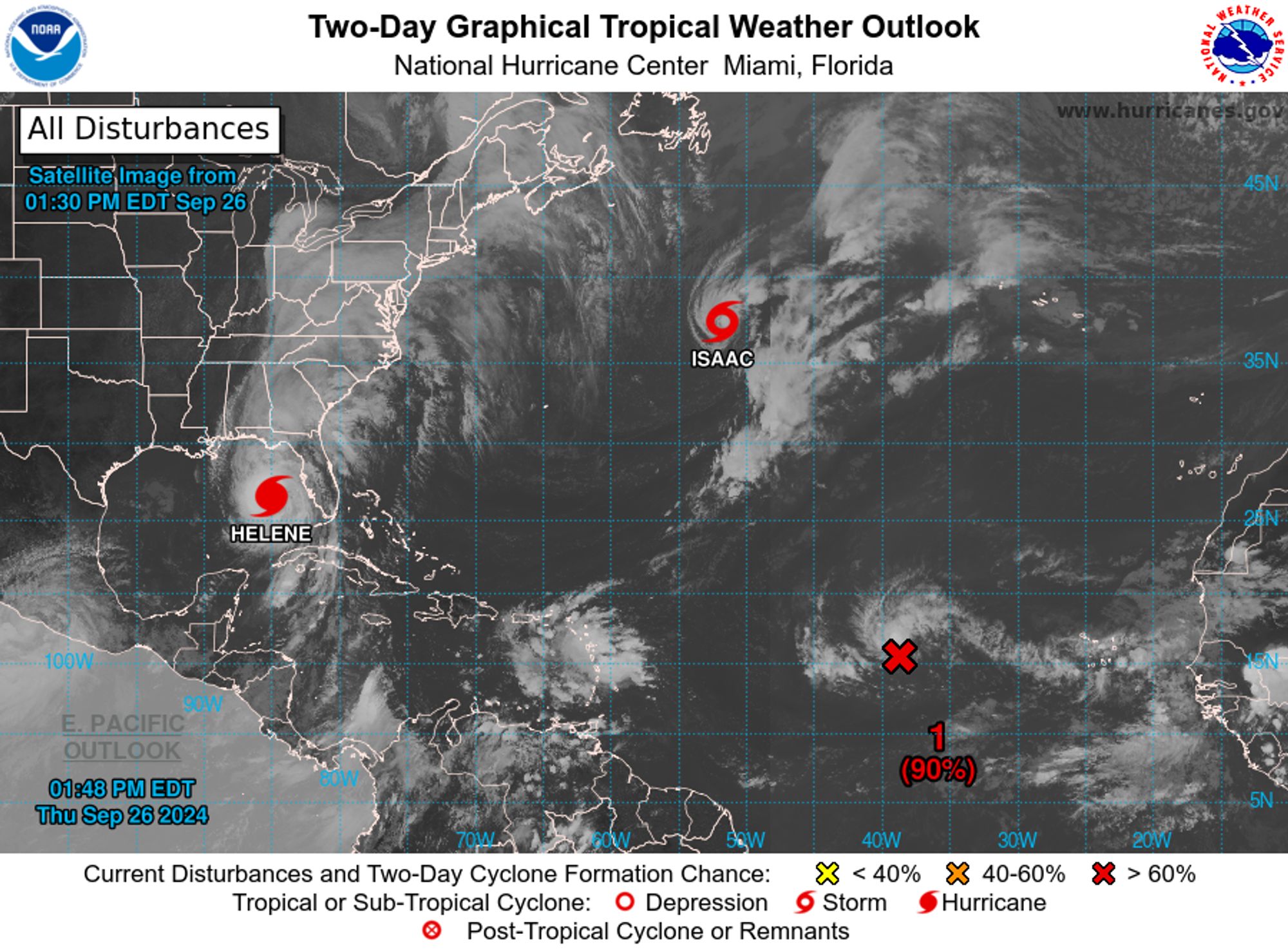
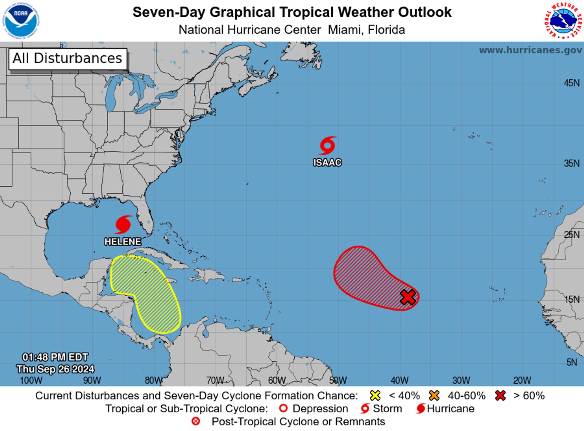
NWS National Hurricane Center Miami FL 200 PM EDT Thu Sep 26 2024 For the North Atlantic...Caribbean Sea and the Gulf of Mexico: Active Systems: The National Hurricane Center is issuing advisories on Hurricane Helene, located over the eastern Gulf of Mexico and on Tropical Storm Isaac, located o
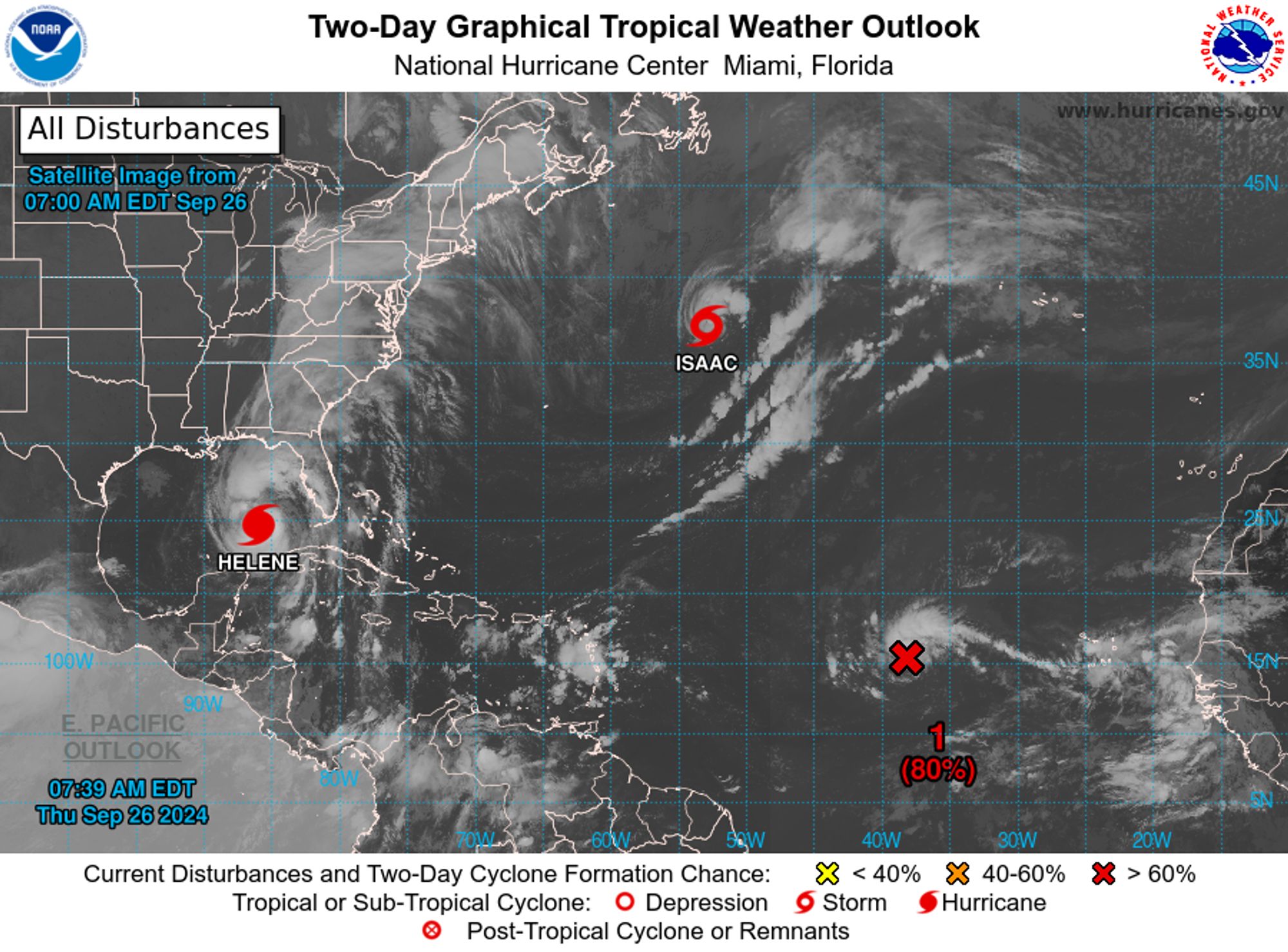
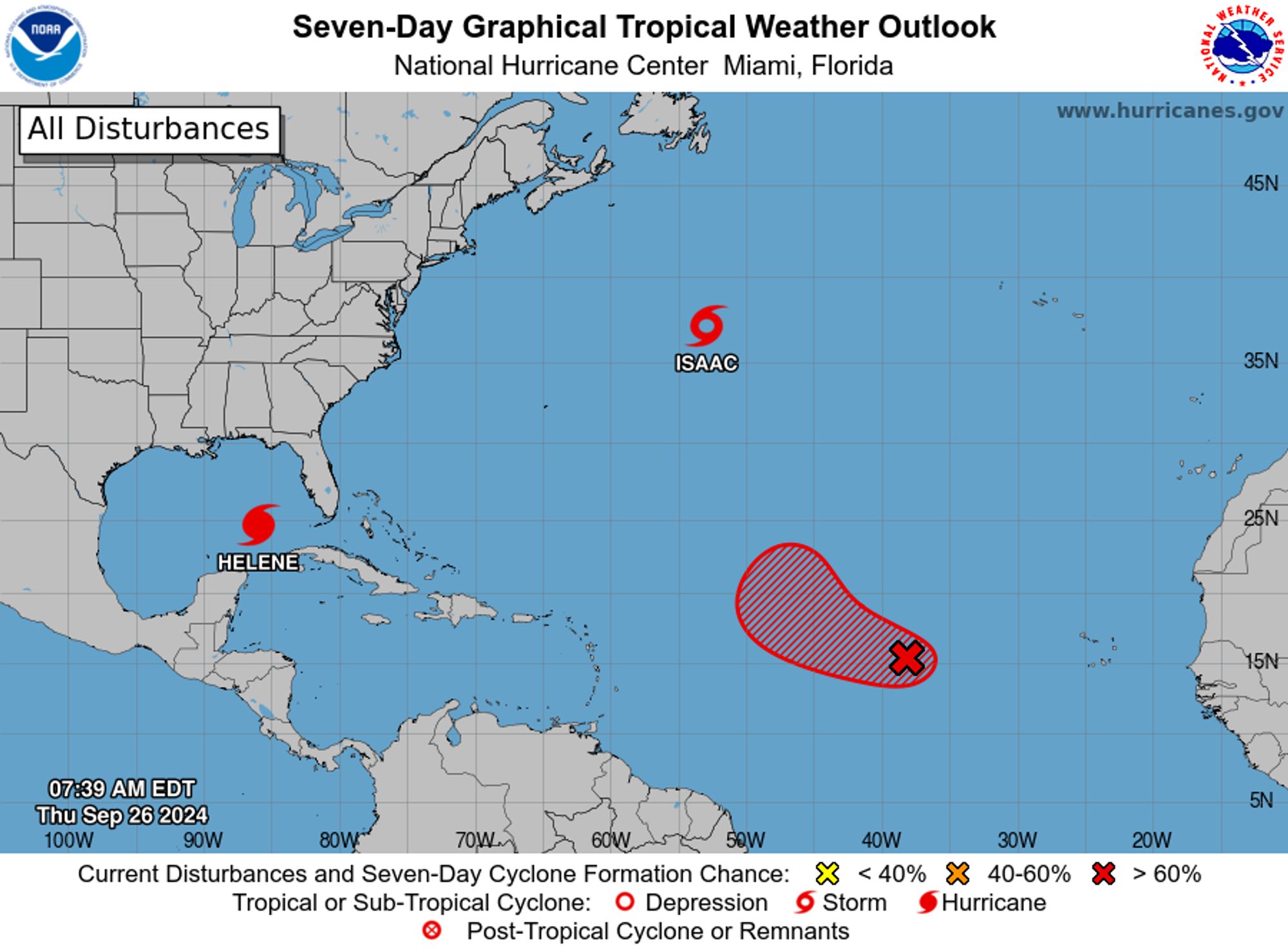
NWS National Hurricane Center Miami FL 800 AM EDT Thu Sep 26 2024 For the North Atlantic...Caribbean Sea and the Gulf of Mexico: Active Systems: The National Hurricane Center is issuing advisories on Hurricane Helene, located over the southeastern Gulf of Mexico and on Tropical Storm Isaac, loca