
RN
Rogue NHC Atlantic
@rogue-nhc-atlantic.bsky.social
Not official. Not going to sit idly by either though.
Please visit www.nhc.noaa.gov/mobile/ directly for more weather info.
@rogue-nhc-atlantic.bsky.social
@rogue-nhc-pacific.bsky.social
@rogue-hc-centpac.bsky.social
226 followers4 following1k posts
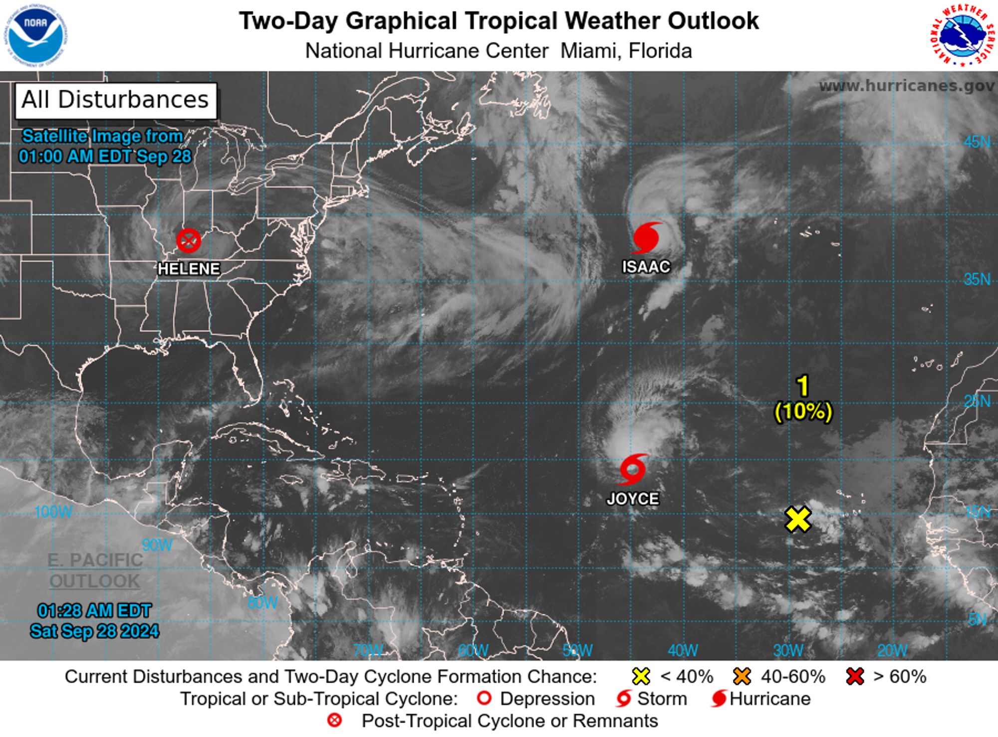
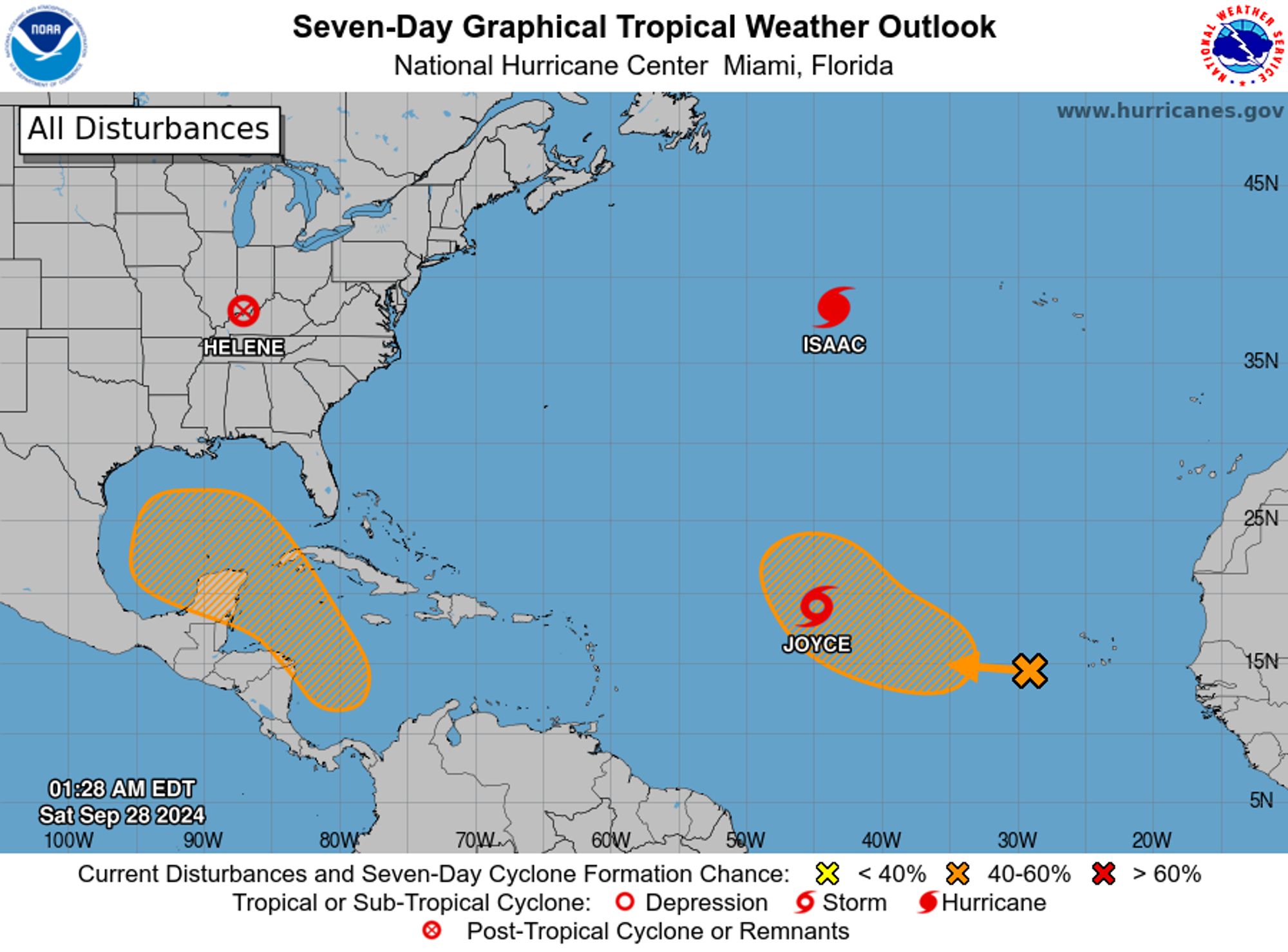
NWS National Hurricane Center Miami FL 200 AM EDT Sat Sep 28 2024 For the North Atlantic...Caribbean Sea and the Gulf of Mexico: Active Systems: The National Hurricane Center is issuing advisories on Hurricane Isaac, located over the central Subtropical Atlantic Ocean, and on Tropical Storm Joyc
RN
Rogue NHC Atlantic
@rogue-nhc-atlantic.bsky.social
Not official. Not going to sit idly by either though.
Please visit www.nhc.noaa.gov/mobile/ directly for more weather info.
@rogue-nhc-atlantic.bsky.social
@rogue-nhc-pacific.bsky.social
@rogue-hc-centpac.bsky.social
226 followers4 following1k posts