daytime sky further enhances the blue color. M78 is about five light-years across and visible through a small telescope. M78 appears above only as it was 1600 years ago, however, because that is how long it takes light to go from there to here. M78 belongs to the larger Orion Molecular Cloud Complex
i was thinking "you don't need to redact and reapply you can just remove the definition" but then: - labeler definitions ttl is 6 hours - only boolean states since it affects everyone (daytime or not daytime)i was thinking "you don't need to redact and reapply you can just remove the definition" but then: - labeler definitions ttl is 6 hours - only boolean states since it affects everyone (daytime or not daytime)
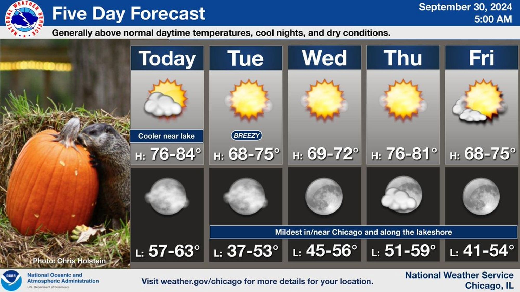
🚨 Red Flag Warning issued September 30 at 1:32AM PDT until October 1 at 11:00AM PDT by NWS Eureka CA 🚨 Additional Details Here.
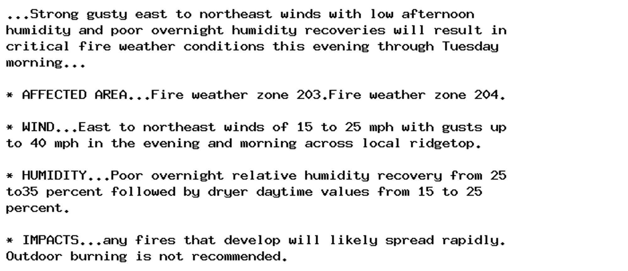
🚨 Red Flag Warning issued September 30 at 3:40AM CDT until September 30 at 9:00PM CDT by NWS Duluth MN 🚨 Additional Details Here.
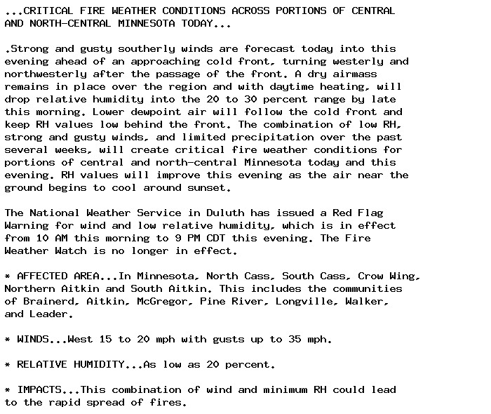
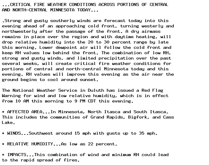
🚨 Red Flag Warning issued September 30 at 3:40AM CDT until September 30 at 9:00PM CDT by NWS Duluth MN 🚨 Additional Details Here.
oh hell yes, a daytime poster for me!
TBH I can’t recall the details and IIRC they’re not really that horrifying? I’m pretty sure it’s one of those “this is a fetish so esoteric you could show it on daytime TV and nobody would realise it’s a sex thing” situations.
time for nite patrol wiv tuk tuk luvs @lilyluwhot.bsky.social@spikecat.bsky.social@nyatsby.bsky.social an mundy makkruls for evrrywun an i luvs yoo orl lots
upstairs... the 'suite' was on the ground floor. He is a very handsome lad, and doing well in the evenings. He's reverted to hiding in the attic in the daytime though now he's out, so trying to convince him it's ok to cone out for his breakfast!