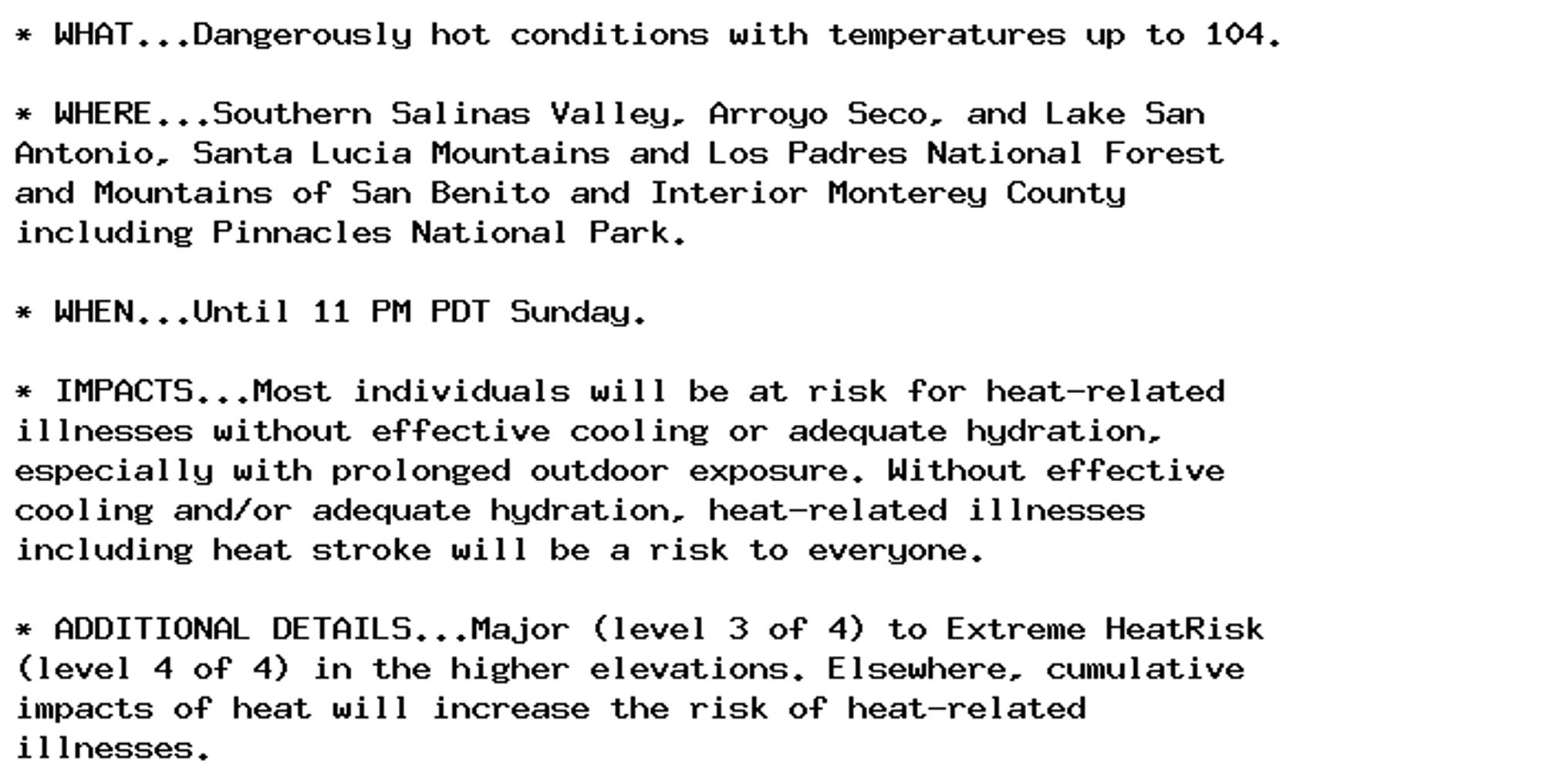
🚨 Excessive Heat Warning issued October 6 at 5:34AM PDT until October 6 at 11:00PM PDT by NWS San Francisco CA 🚨 Additional Details Here.
Yeah, the higher elevations are looking good right now 🍂🍁🍂!
🚨 Excessive Heat Warning issued October 6 at 1:42AM PDT until October 7 at 8:00PM PDT by NWS Las Vegas NV 🚨 Additional Details Here.
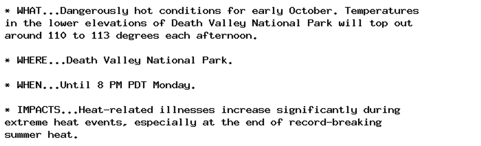
NEW WEATHER ADVISORY: Excessive Heat Warning * WHAT...Dangerously hot conditions for early October. Temperatures in the lower elevations of Death Valley National Park will top out around 110 to 113 degrees each afternoon. * WHERE...Death Valley... See more: watchedsky.social/app/alerts/...
🚨 Excessive Heat Warning issued October 5 at 8:35PM PDT until October 6 at 11:00PM PDT by NWS San Francisco CA 🚨 Additional Details Here.

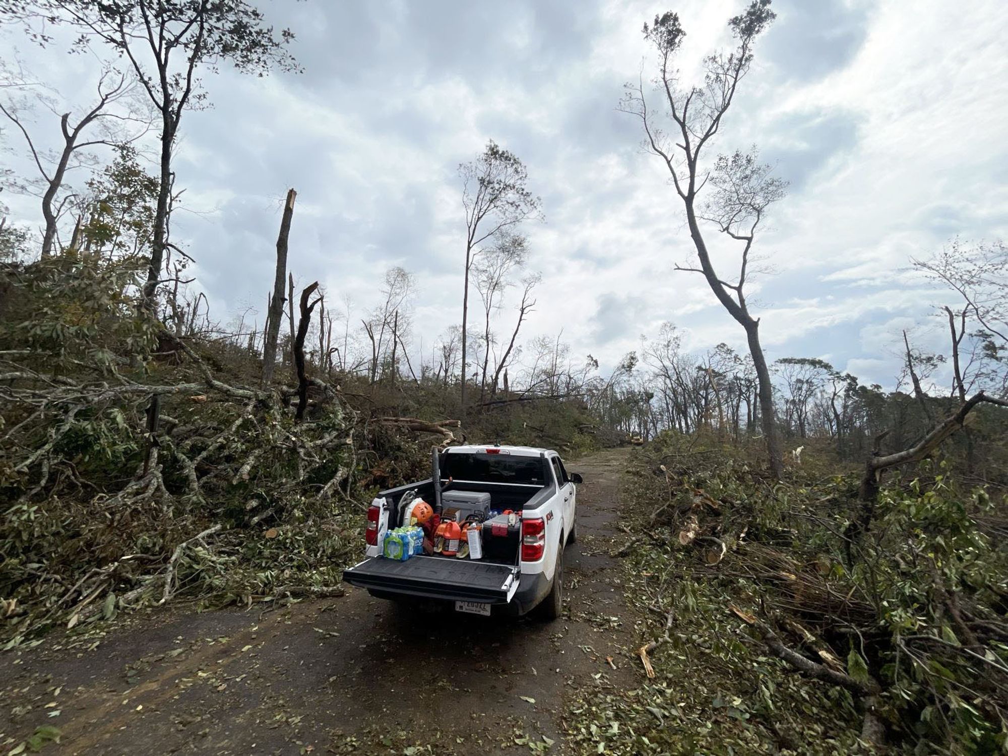
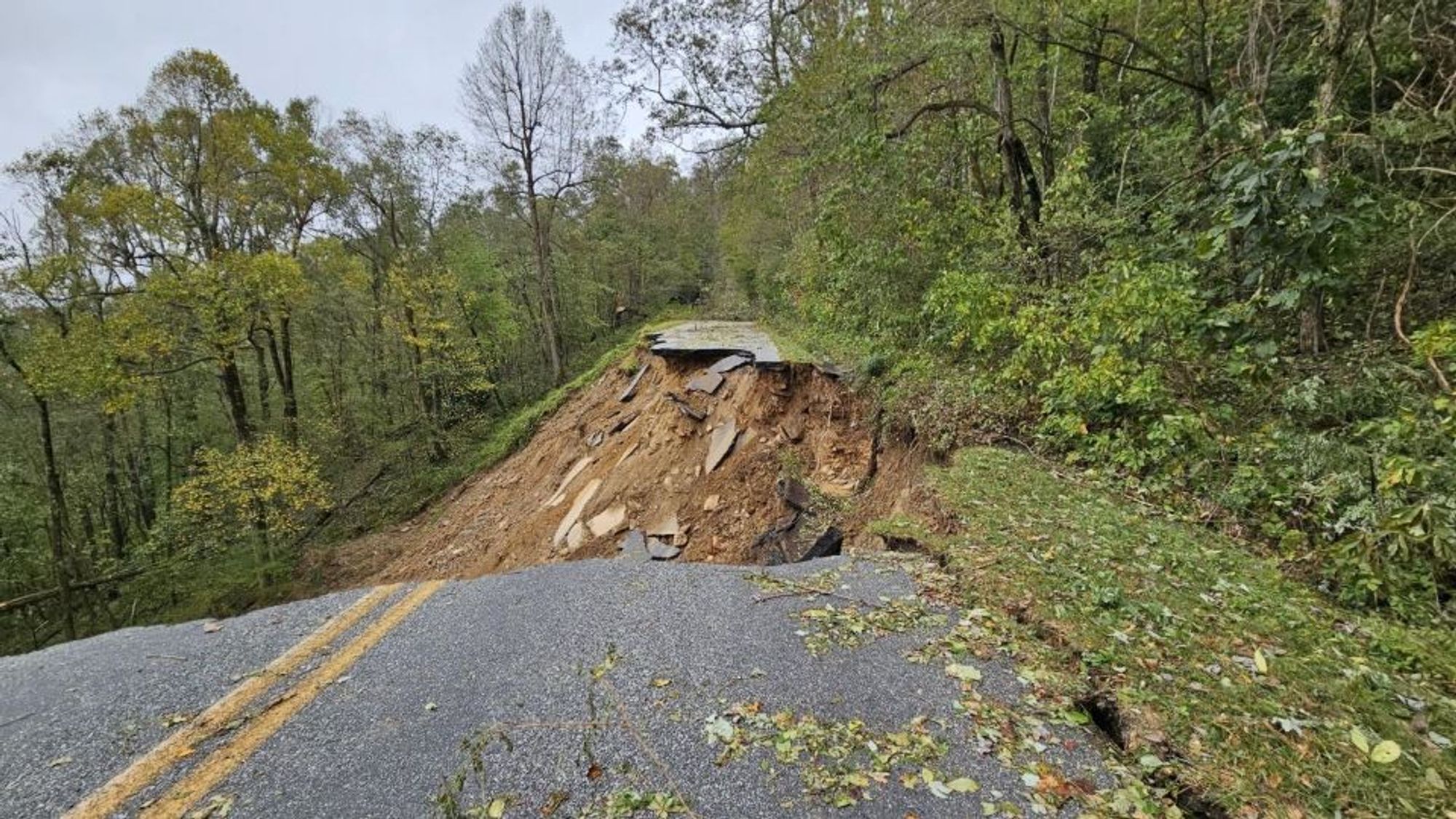
The Blue Ridge Parkway may be closed through the beginning of winter in some spots. Right now it's closed indefinitely from NC into VA. Massive tree damage at high elevations. www.facebook.com/BlueRidgeNPS...
Snowberry (Symphoricarpos albus) grows in open woods at low to mid elevations of the west & central Gorge. It makes a nice garden plant & is drought tolerant. While the berries are thought to be poisonous, there's no actual evidence & they don't taste good anyway. Native ...

Yeah, not ideal! But I’ve been through hurricanes in Florida, and thankfully, the friends I’m staying with are at one of Florida’s “higher” elevations and inland (Mt. Dora). At this point, staying through the storm seems preferable to taking off tropical storm+ winds, but we’ll see! 😅
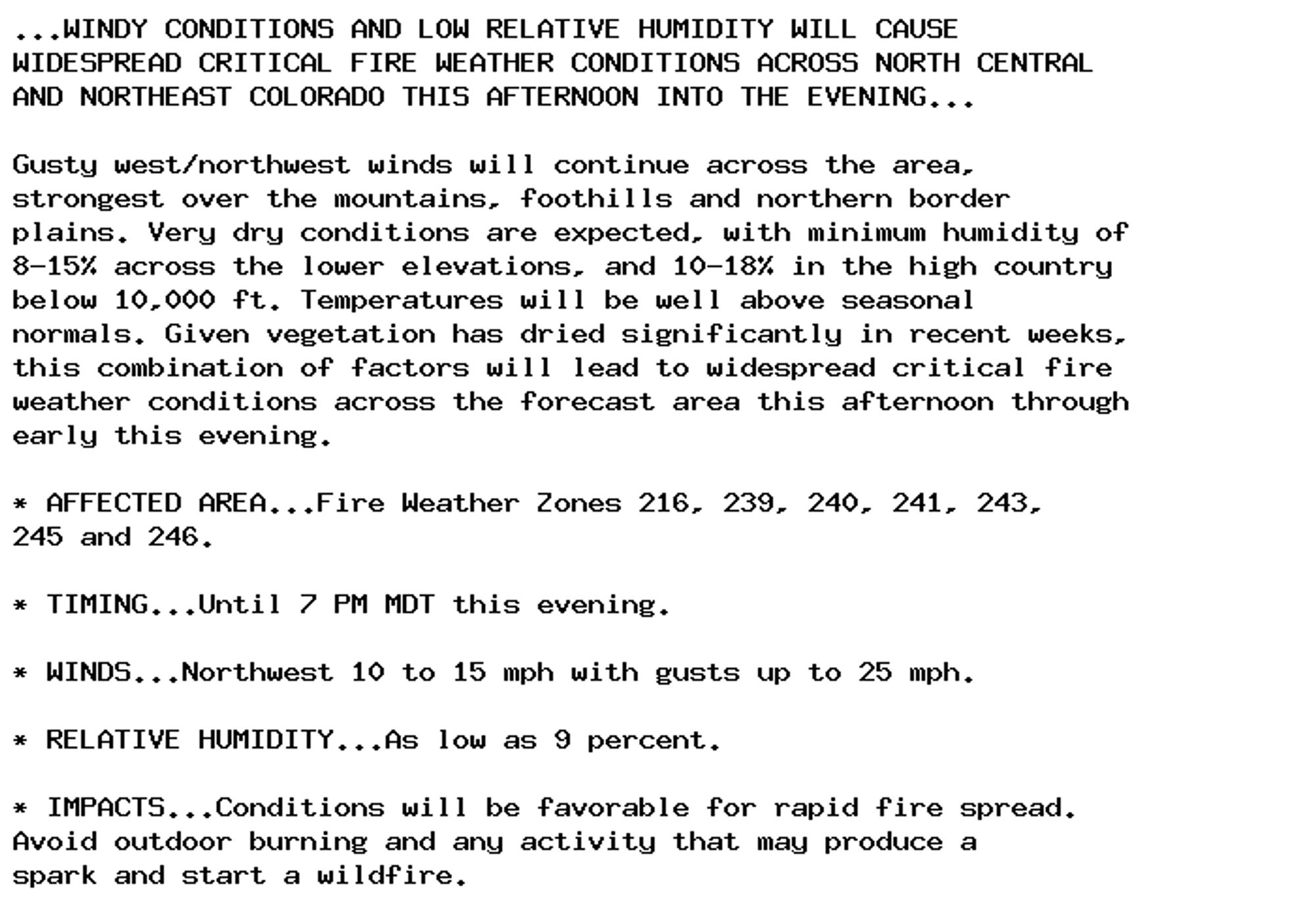
🚨 Red Flag Warning issued October 5 at 11:30AM MDT until October 5 at 7:00PM MDT by NWS Denver CO 🚨 Additional Details Here.
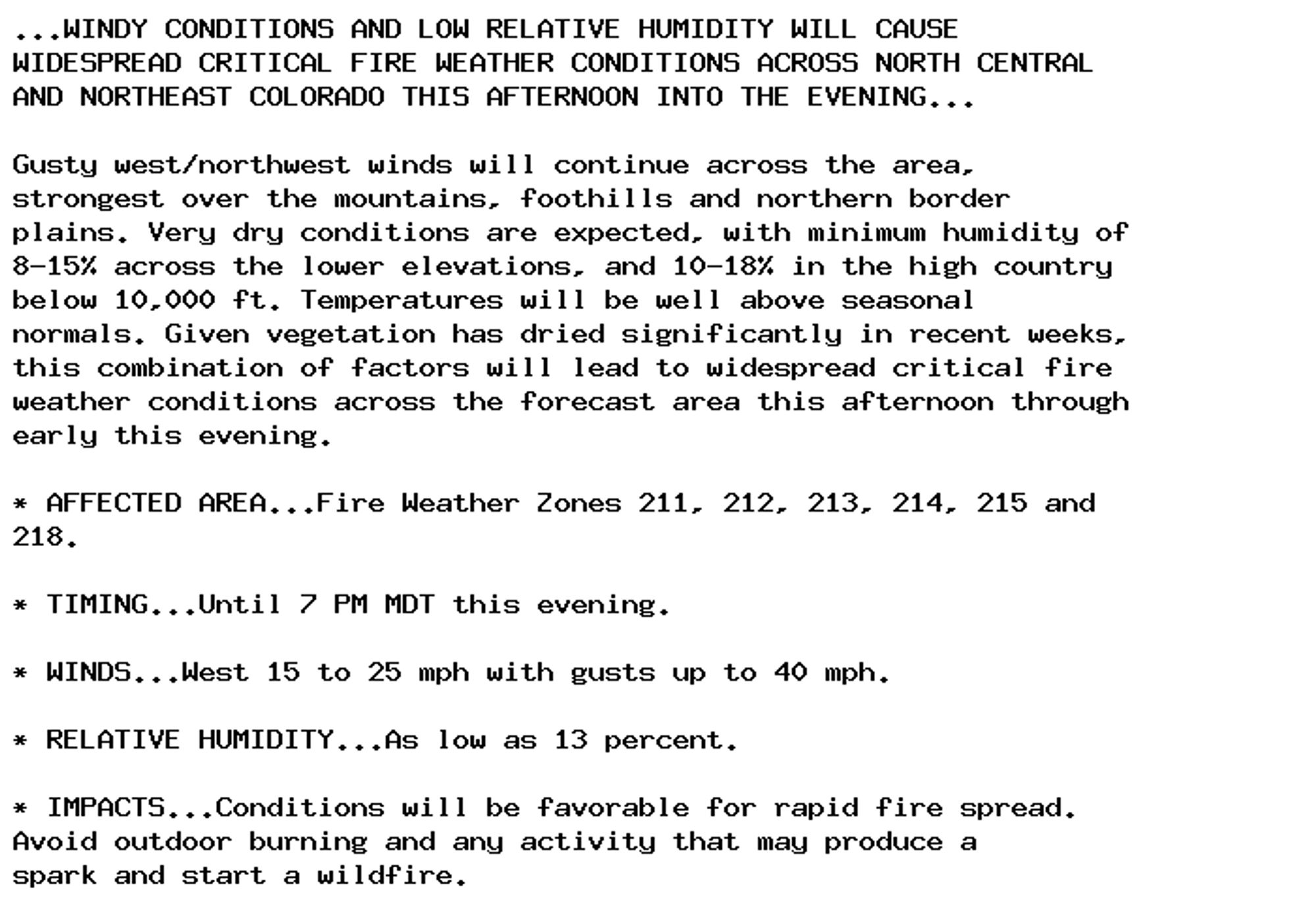
🚨 Red Flag Warning issued October 5 at 11:30AM MDT until October 5 at 7:00PM MDT by NWS Denver CO 🚨 Additional Details Here.