
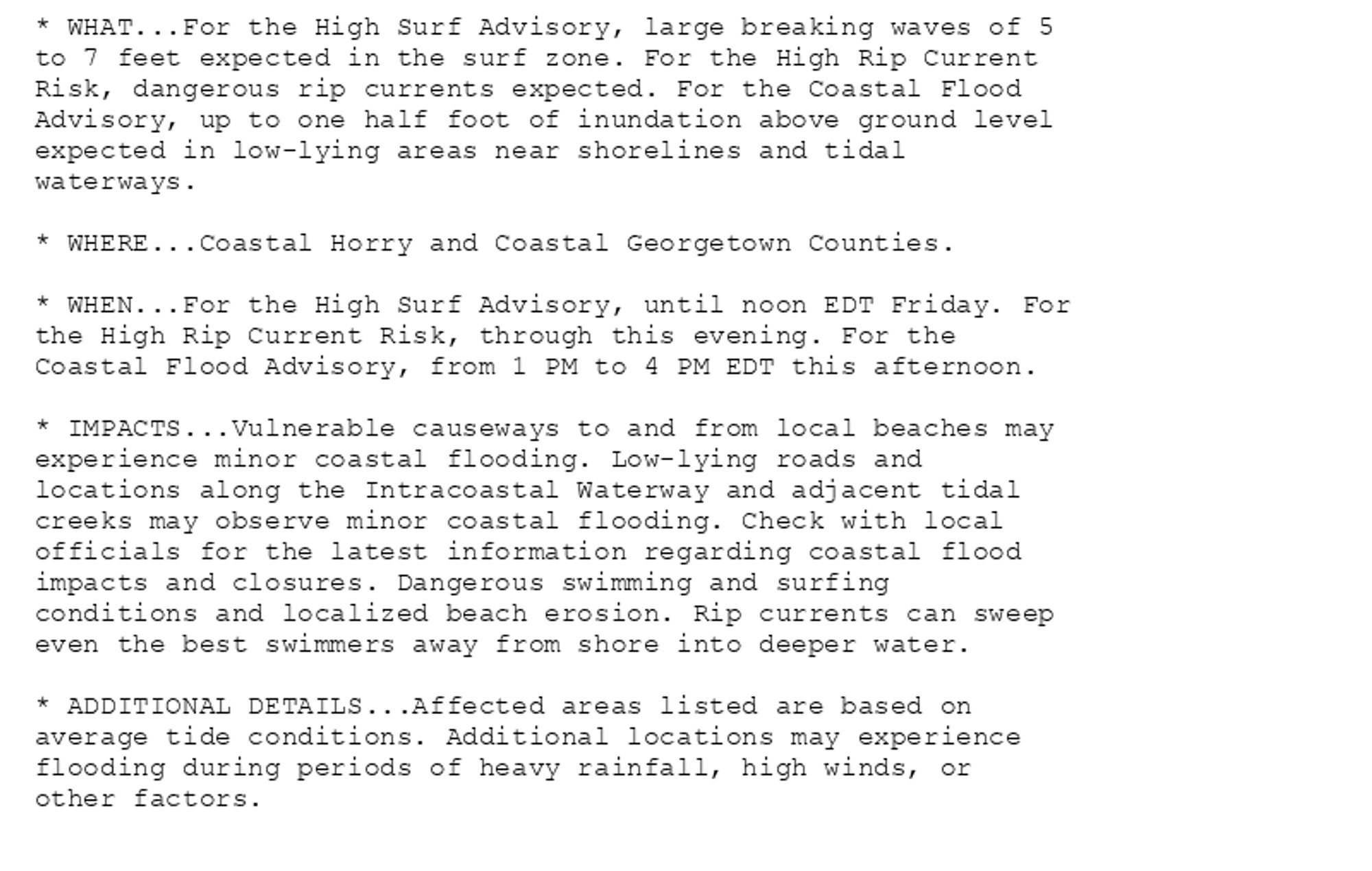
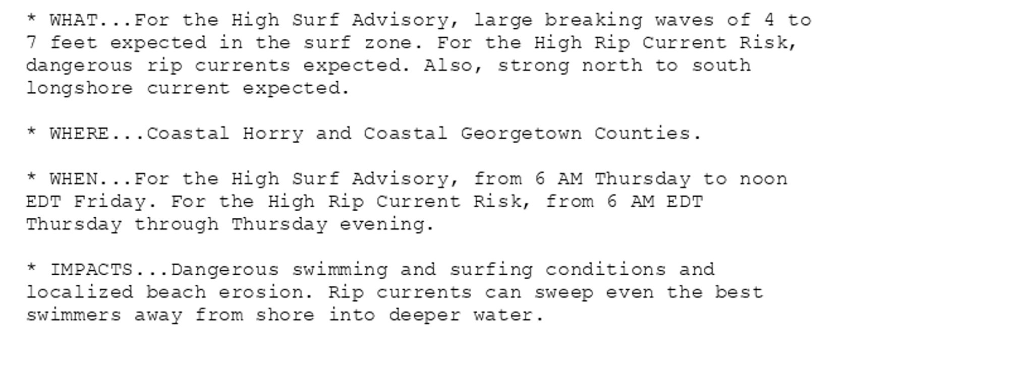
High Surf Advisory issued October 10 at 5:46AM EDT until October 11 at 12:00PM EDT by NWS Wilmington NC Additional Details Here. (1/2)
HUNGER GAMES: DHS head Mayorkas shops for luxury items in Georgetown while western North Carolinians suffer post-Helene
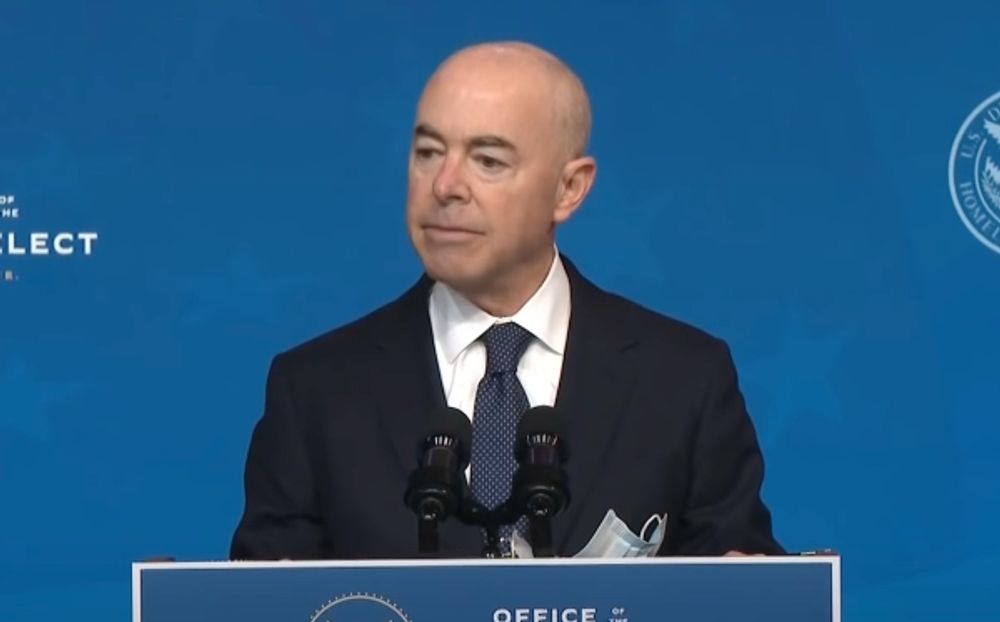
(NaturalNews) There is not enough money (or so they say) to help all the victims of Hurricane Helene, and yet there is more than enough cash in the till to support...
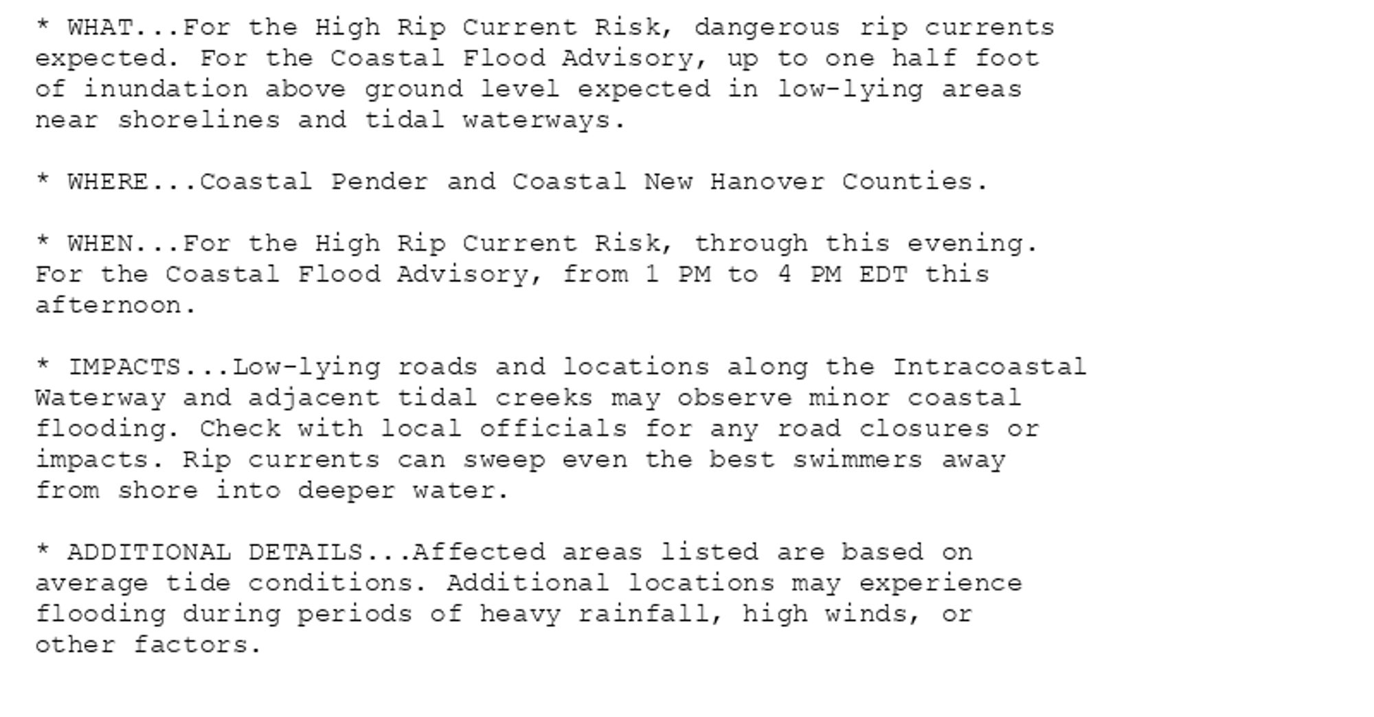
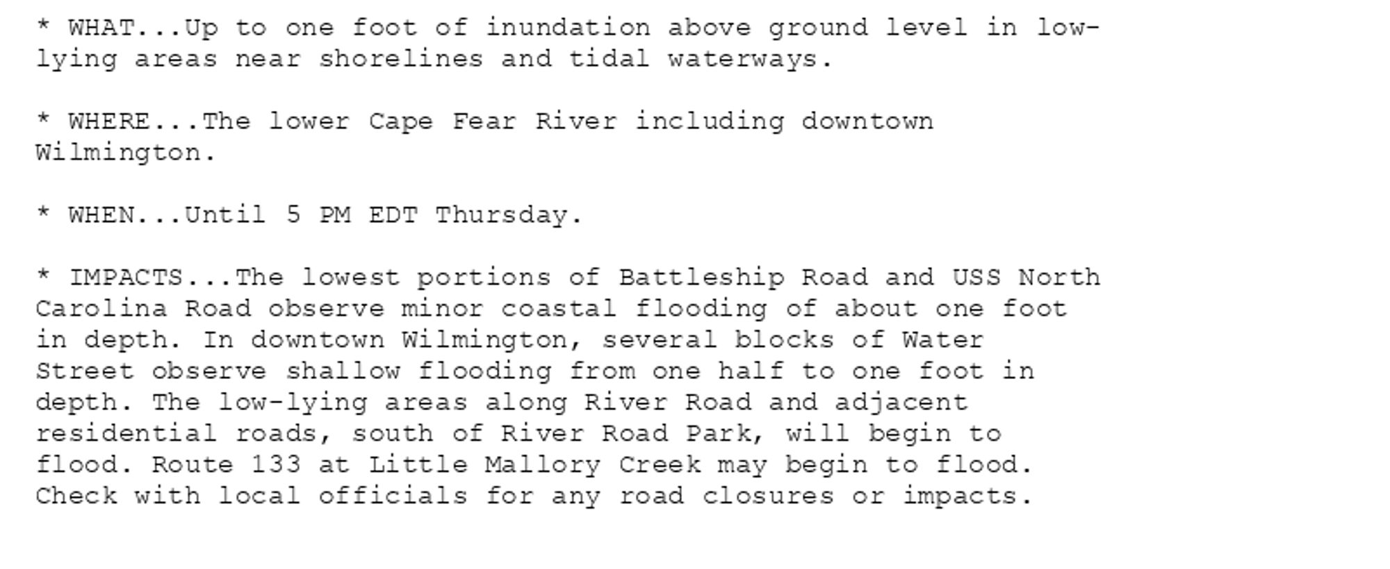
Coastal Flood Advisory issued October 10 at 3:30AM EDT until October 10 at 5:00PM EDT by NWS Wilmington NC Additional Details Here. (1/2)
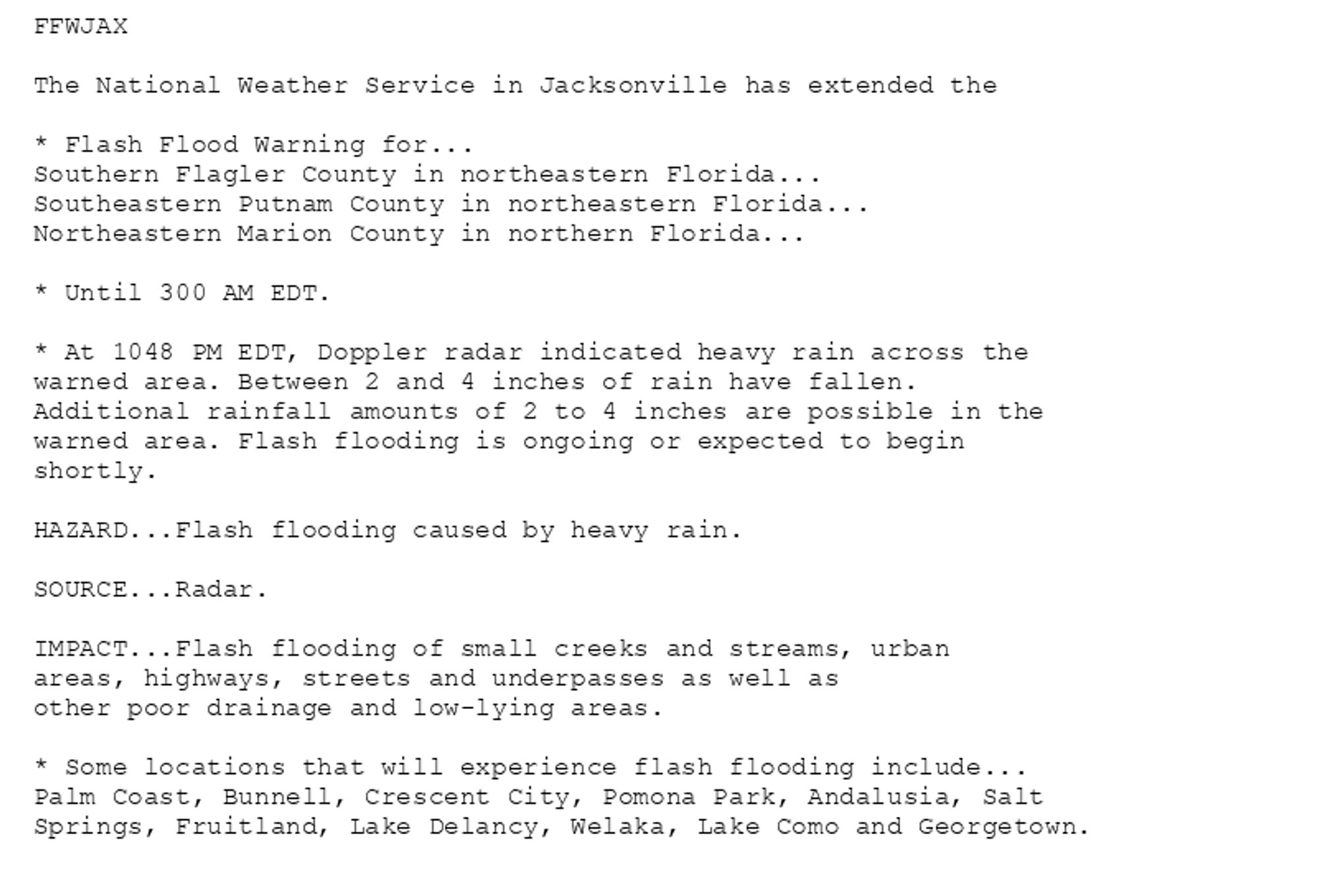
🚨 Flash Flood Warning issued October 9 at 10:48PM EDT until October 10 at 3:00AM EDT by NWS Jacksonville FL 🚨 Additional Details Here.


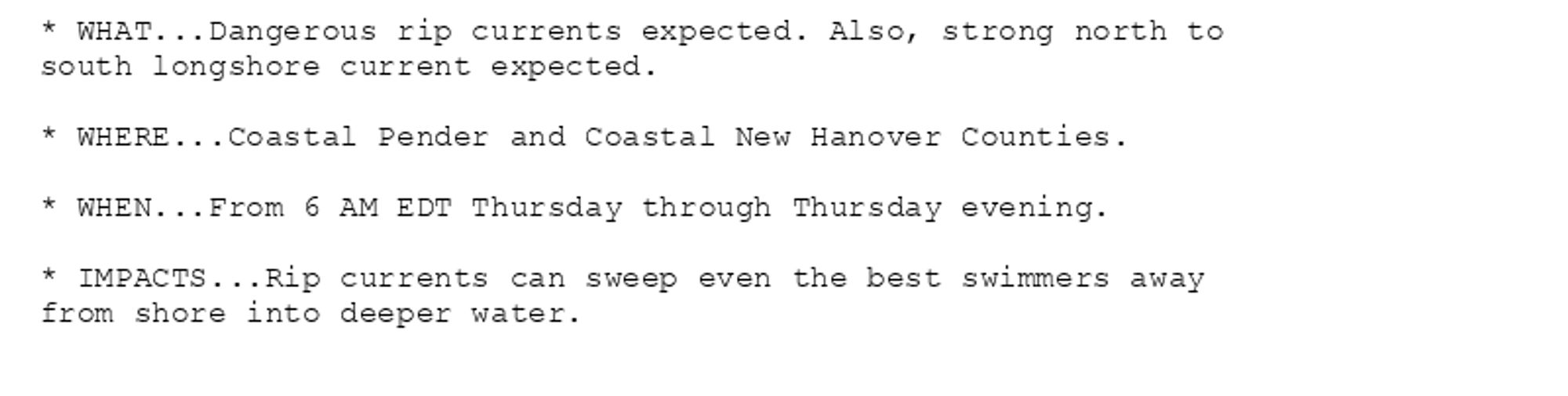
High Surf Advisory issued October 9 at 7:48PM EDT until October 11 at 12:00PM EDT by NWS Wilmington NC Additional Details Here.(1/2)
Bus incident reported for routes: J2. Alert: Expect eastbound delays on Route J2 at Old Georgetown Rd & Wisconsin Ave because of an incident. Check where you bus is by visiting https://buseta.wmata.com/#J2 Updated: 2024-10-09 18:34:36 (Eastern).
Clinton boosters would probably contrast his Georgetown/Yale education to her Howard/Hastings.