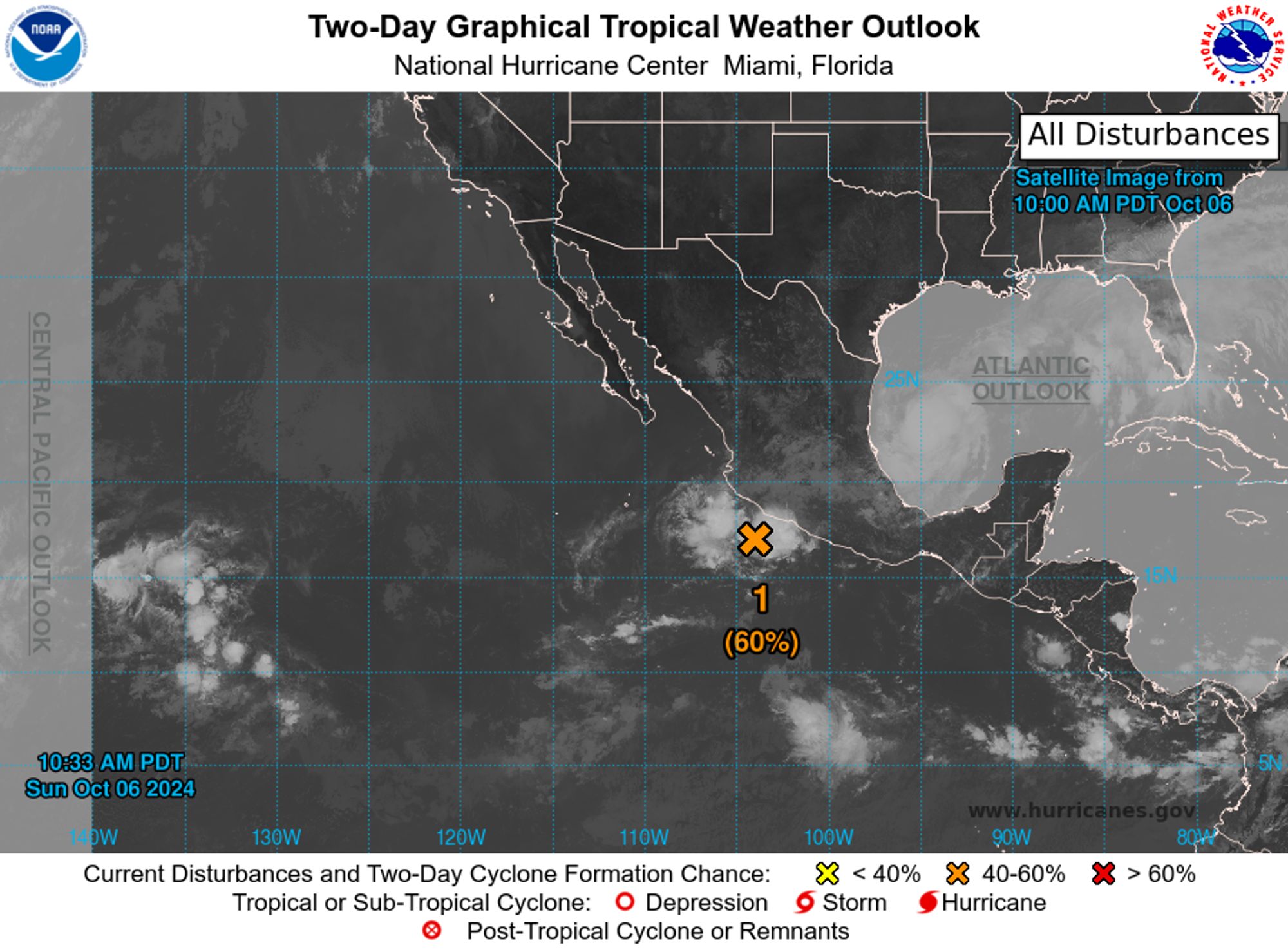
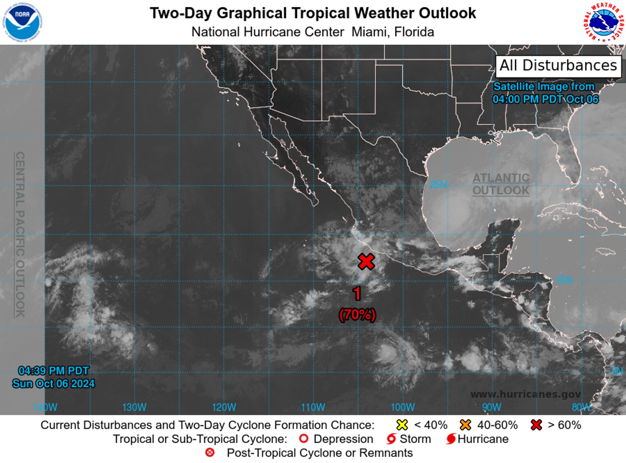
NWS National Hurricane Center Miami FL 500 PM PDT Sun Oct 6 2024 For the eastern North Pacific...east of 140 degrees west longitude:

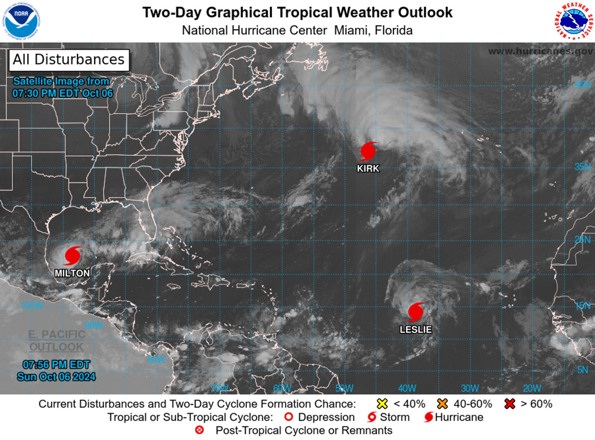
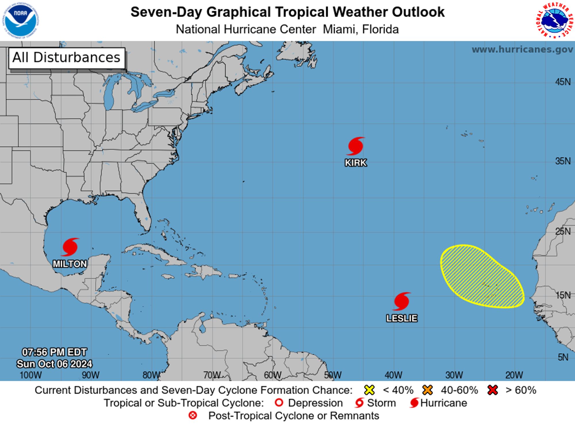
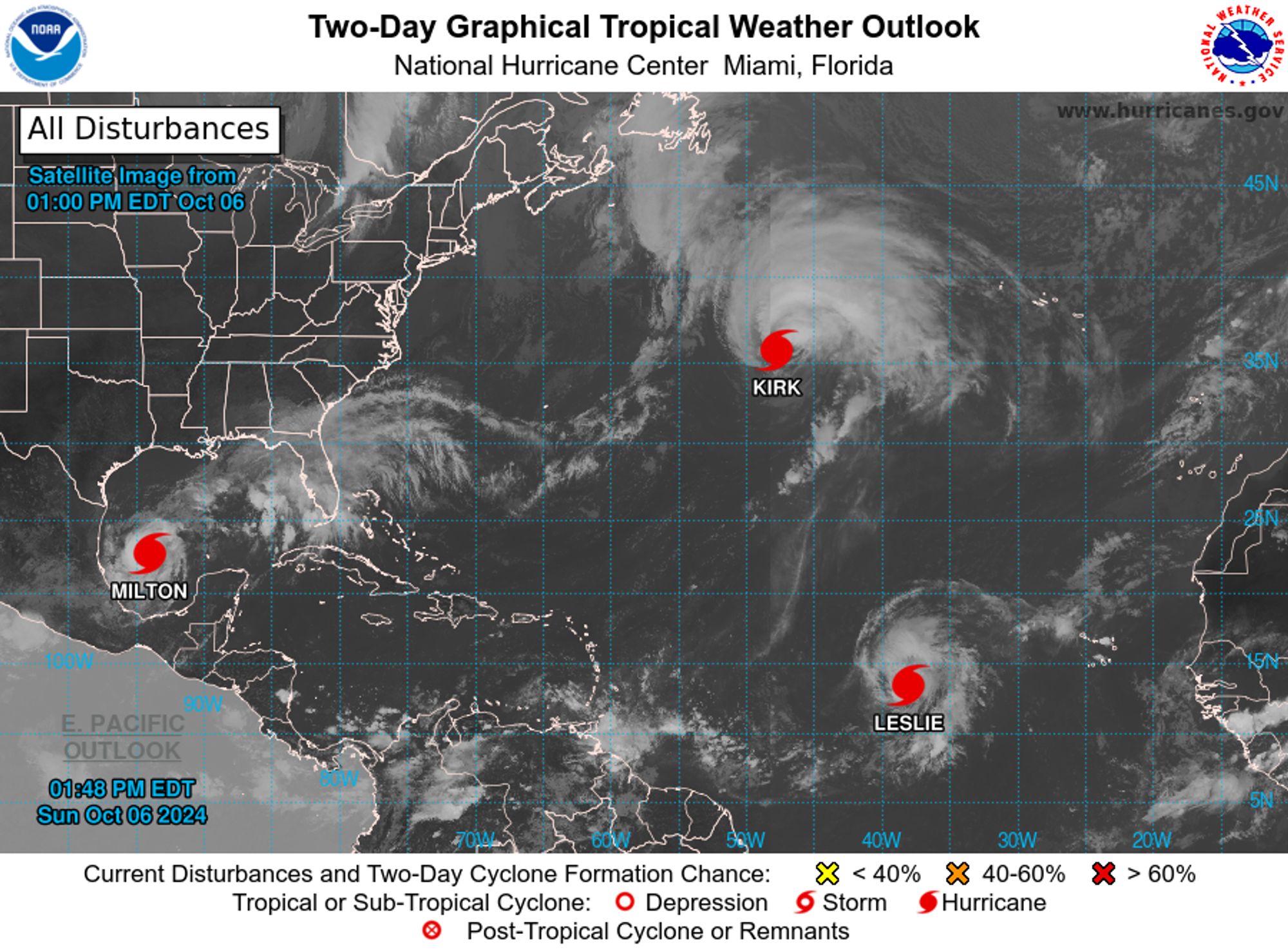
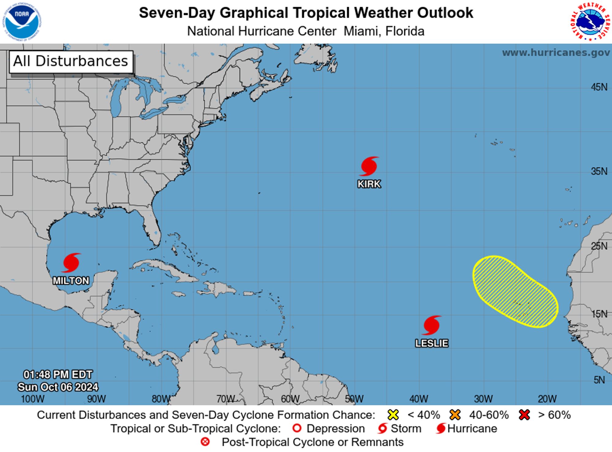
NWS National Hurricane Center Miami FL 800 PM EDT Sun Oct 6 2024 For the North Atlantic...Caribbean Sea and the Gulf of Mexico: Active Systems: The National Hurricane Center is issuing advisories on Hurricane Kirk, located over the central subtropical Atlantic Ocean, on Hurricane Leslie, located

6. Muscular (With Captain Carter) Tried some experiments with greyscale (which i have zero prior experience), didnt work out, but that's the magic of learning. We can always try again later. #lewdtober#lewdtober2024


I suppose the notable thing would be if the world went greyscale
NWS National Hurricane Center Miami FL 800 AM EDT Sun Oct 6 2024 For the North Atlantic...Caribbean Sea and the Gulf of Mexico: Active Systems: The National Hurricane Center is issuing advisories on Hurricane Kirk, located over the central subtropical Atlantic Ocean, on Hurricane Leslie, located
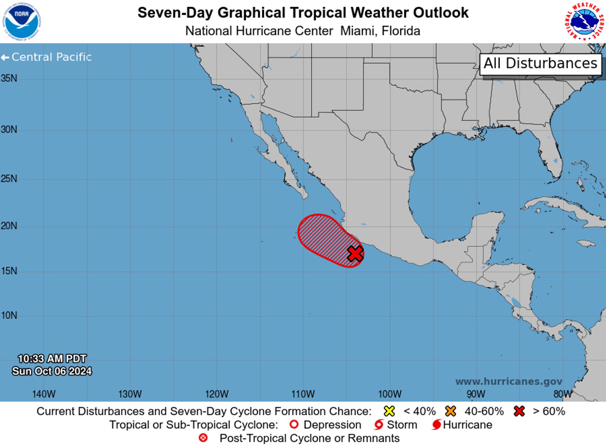
NWS National Hurricane Center Miami FL 1100 AM PDT Sun Oct 6 2024 For the eastern North Pacific...east of 140 degrees west longitude: