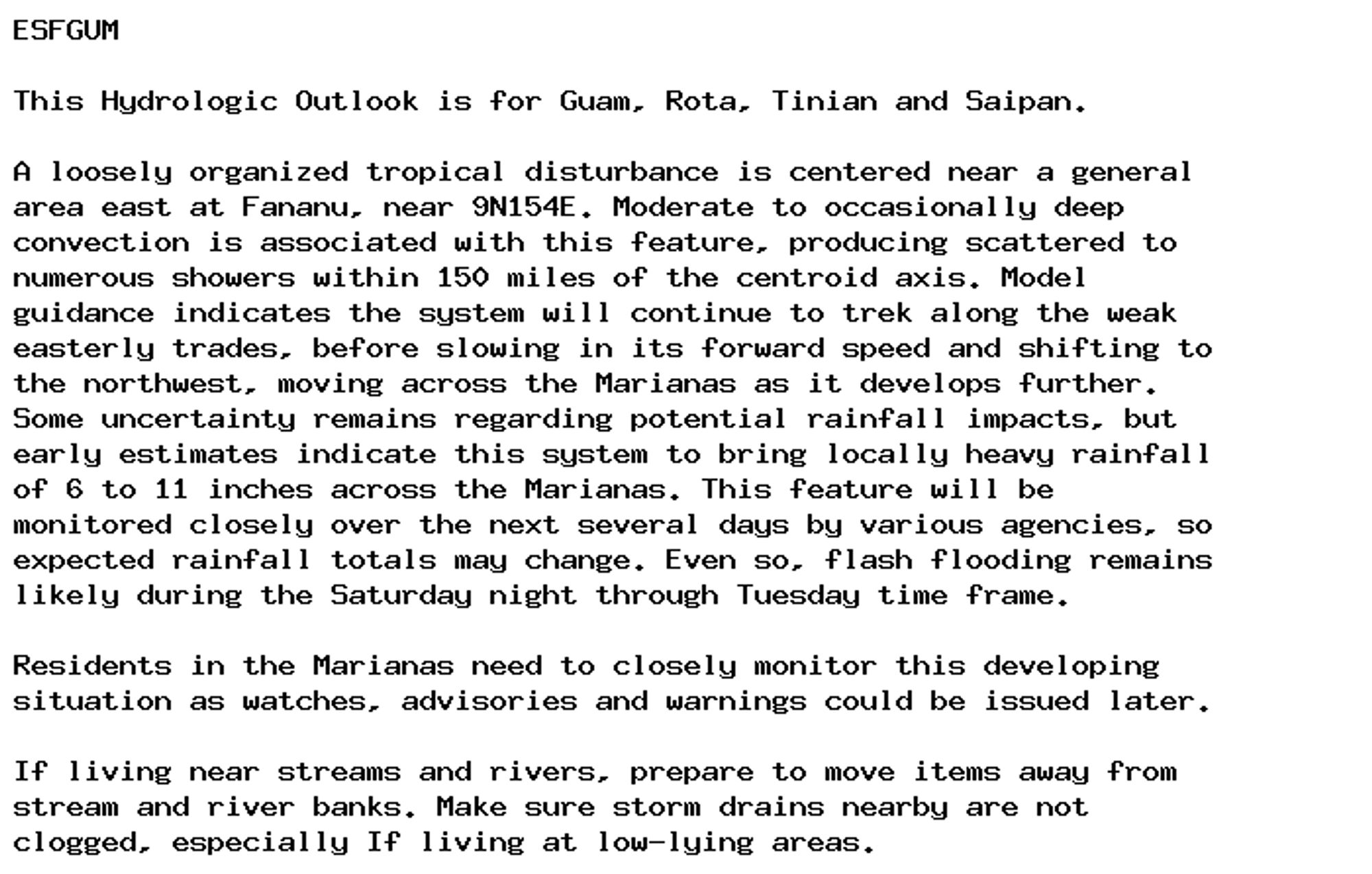
NEW WEATHER ADVISORY: Hydrologic Outlook ESFMFL The National Hurricane Center continues to monitor a broad area of low pressure over the western Gulf of Mexico this morning. At the time of writing, this area has been give a 40% chance (medium) of... See more: watchedsky.social/app/alerts/...
I'll add Toronto, Hamilton and Ottawa have greenbelts in place to help protect farmland / natural heritage / hydrologic features, whereas London does not. I can see the need to reshape London's boundaries given new pressures, but it should be done thoughtfully to protect the agricultural value.
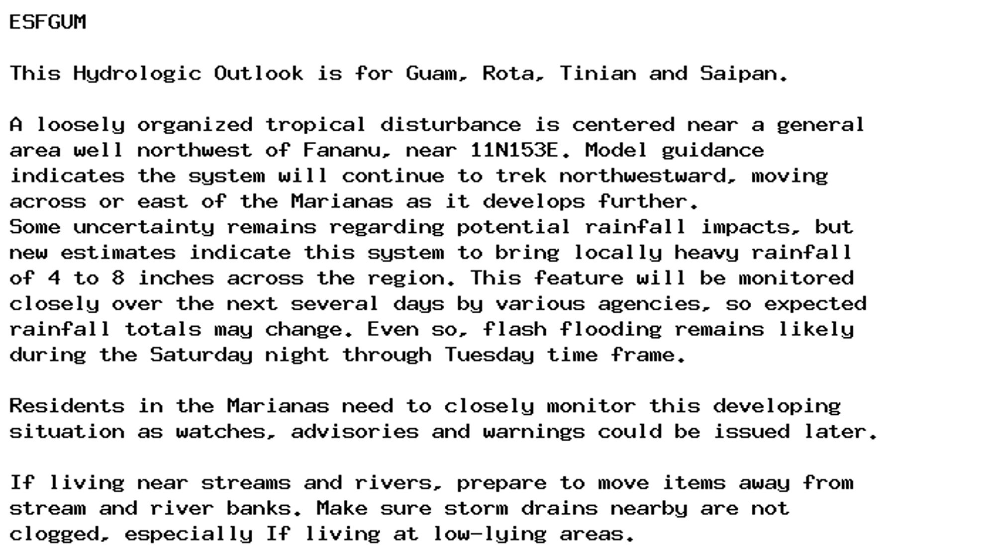
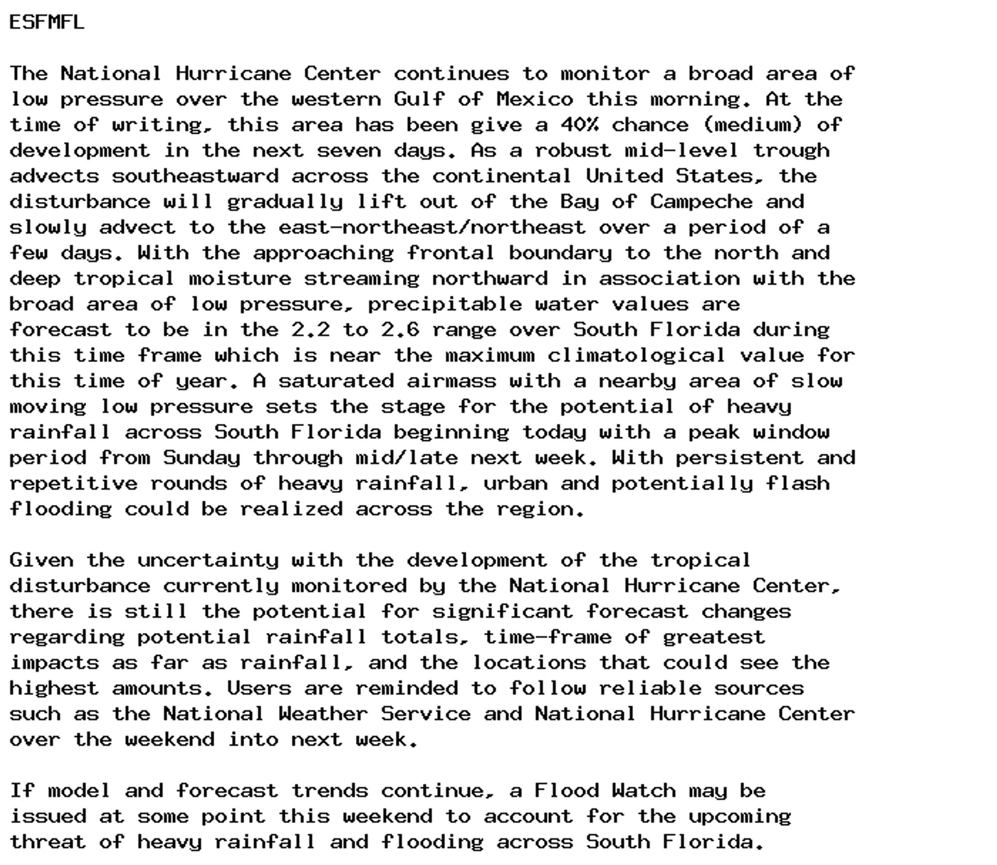
NEW WEATHER ADVISORY: Hydrologic Outlook ESFGUM This Hydrologic Outlook is for Guam, Rota, Tinian and Saipan. A loosely organized tropical disturbance is centered near a general area well northwest of Fananu, near 11N153E. Model guidance indicates... See more: watchedsky.social/app/alerts/...
NEW WEATHER ADVISORY: Hydrologic Outlook ESFGUM This Hydrologic Outlook is for Guam, Rota, Tinian and Saipan. A loosely organized tropical disturbance is centered near a general area well northwest of Fananu, near 11N153E. Model guidance indicates... See more: watchedsky.social/app/alerts/...
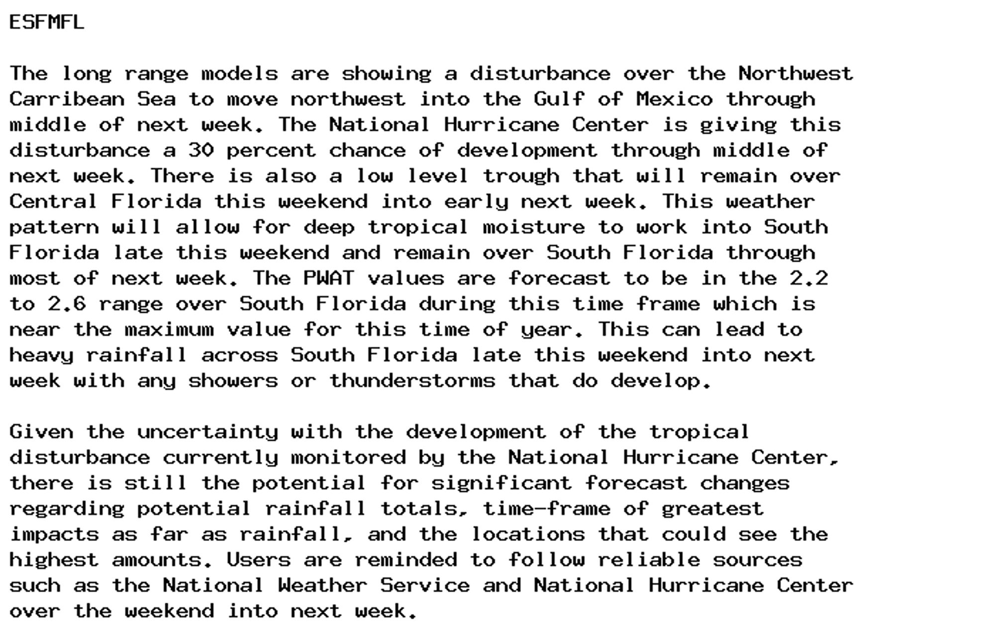
NEW WEATHER ADVISORY: Hydrologic Outlook ESFMFL The long range models are showing a disturbance over the Northwest Carribean Sea to move northwest into the Gulf of Mexico through middle of next week. The National Hurricane Center is giving this... See more: watchedsky.social/app/alerts/...