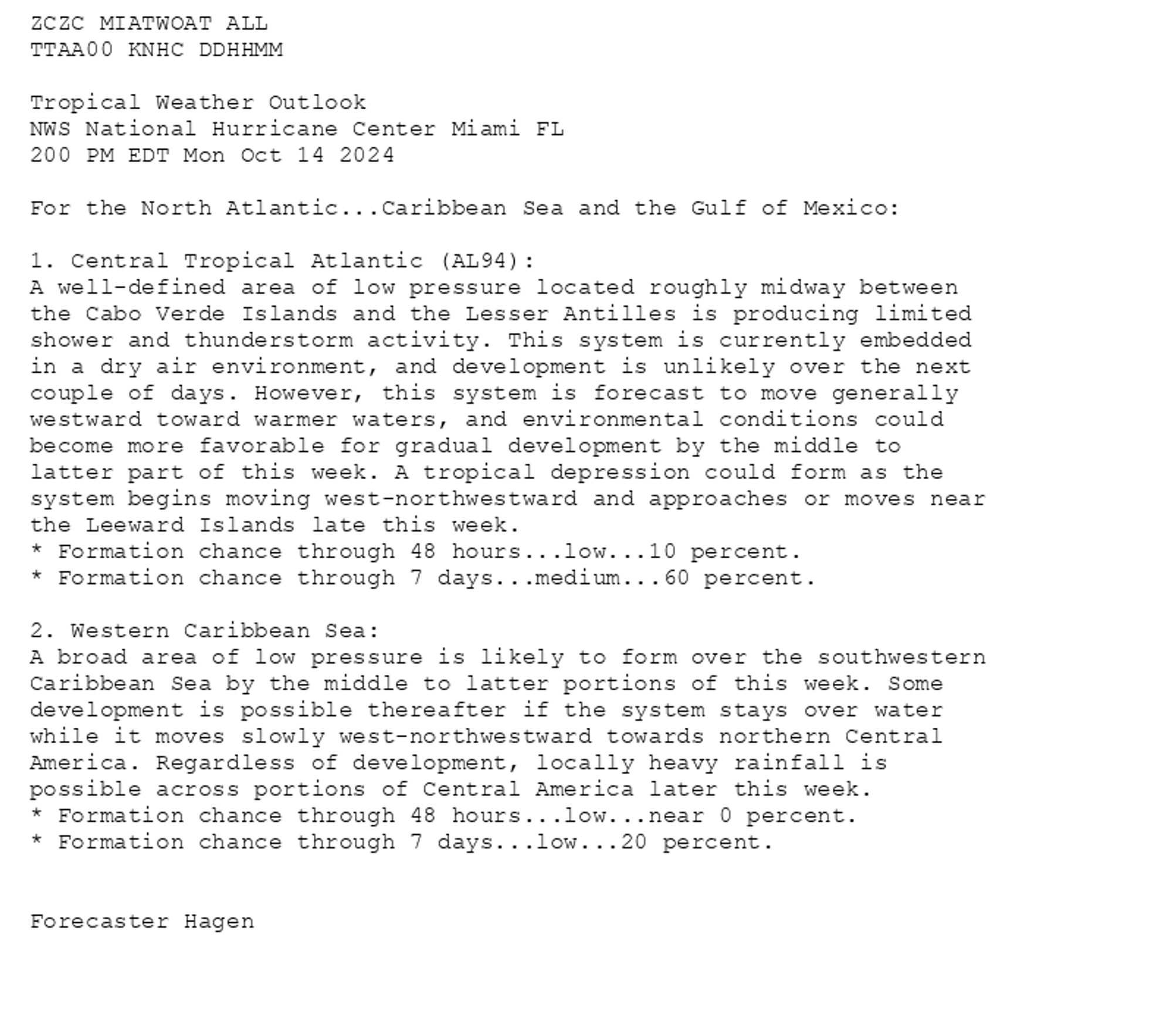
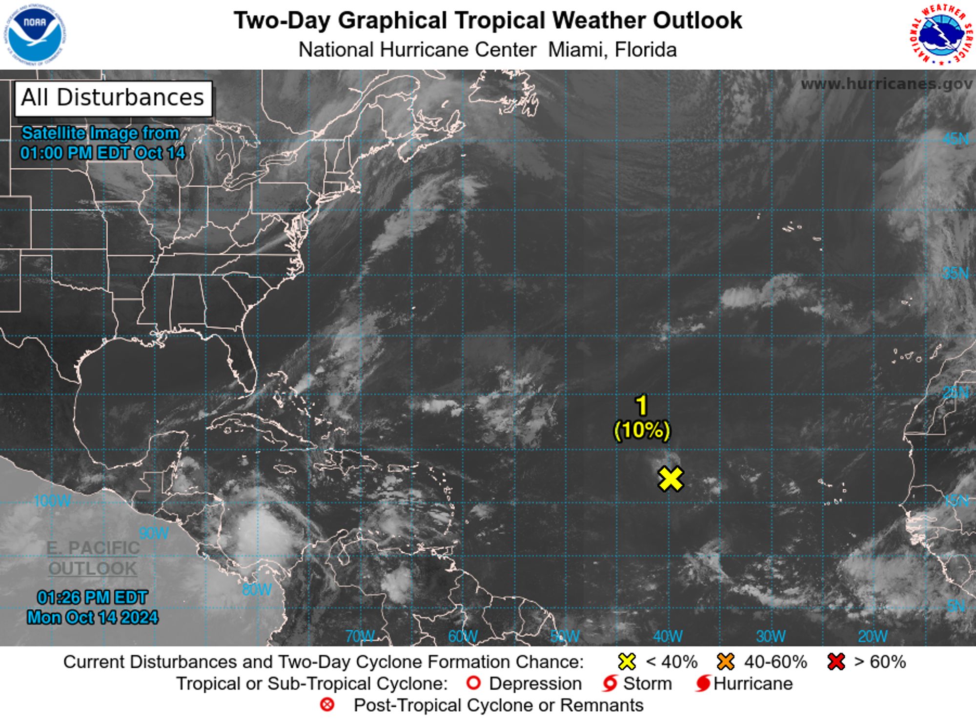
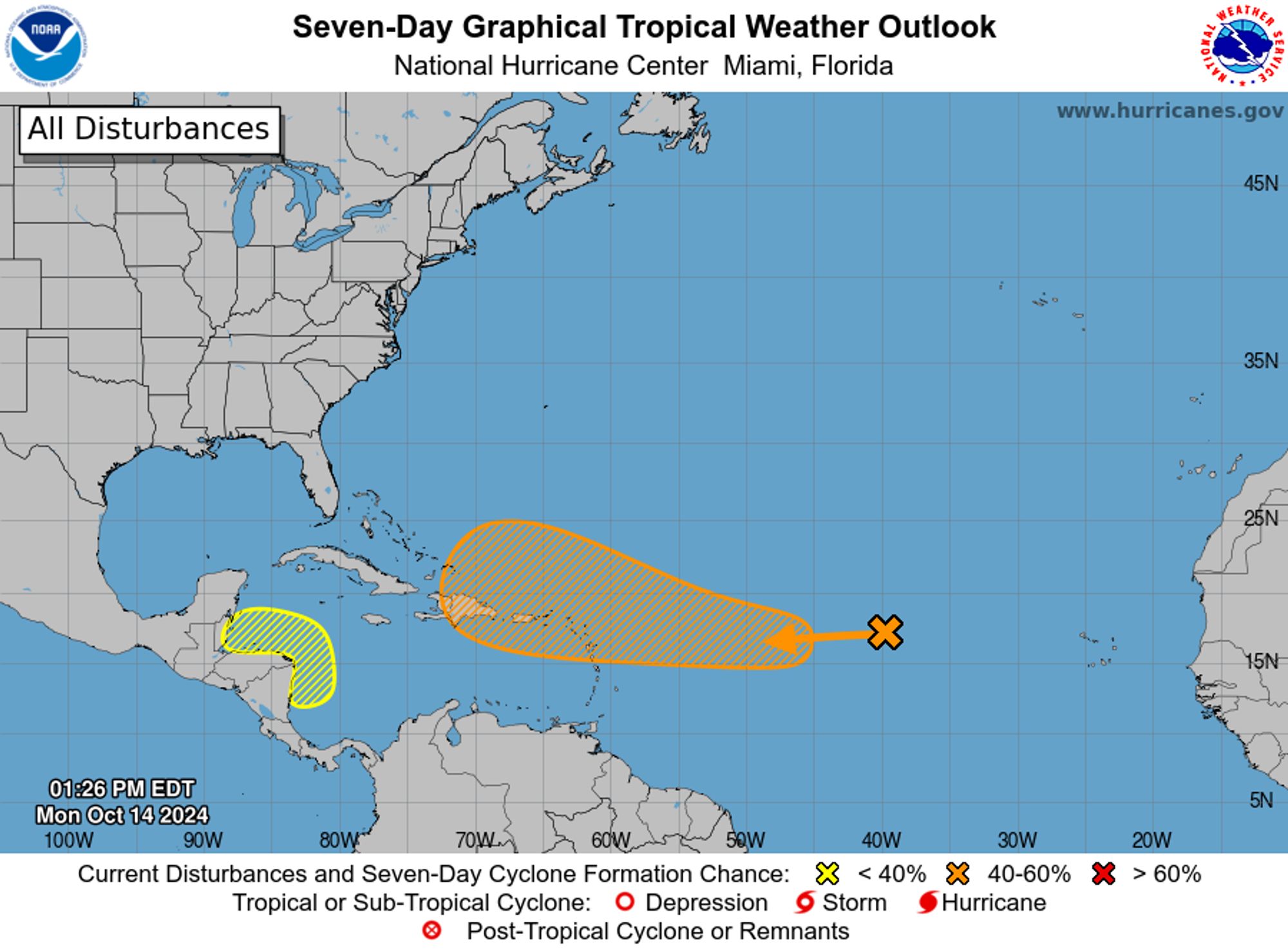
NWS National Hurricane Center Miami FL 200 PM EDT Mon Oct 14 2024 For the North Atlantic...Caribbean Sea and the Gulf of Mexico:


Near the end of Silent Hill 2 remake and enjoying most of it, combat definitely start to getting tired midway through the game, I feel this might be because the remake is significantly longer than the original, and survival horror benefits of a shorter campaign, but the game is insanely good!!
So far my impression of Midway is that it is nicely manageable in size and also constantly announcing worship opportunities in the on-site chapel. “All are welcome” to the Christian service starting in 20 minutes.
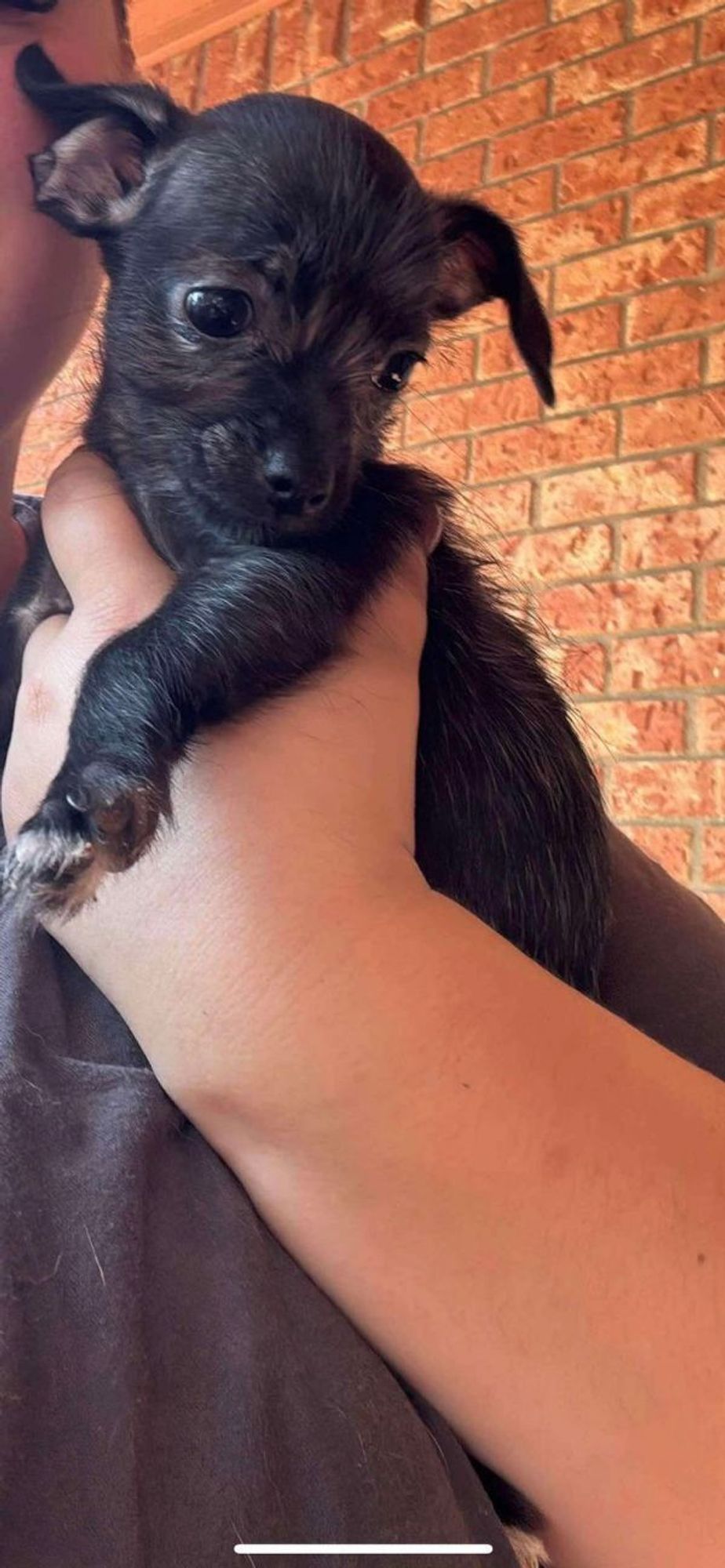
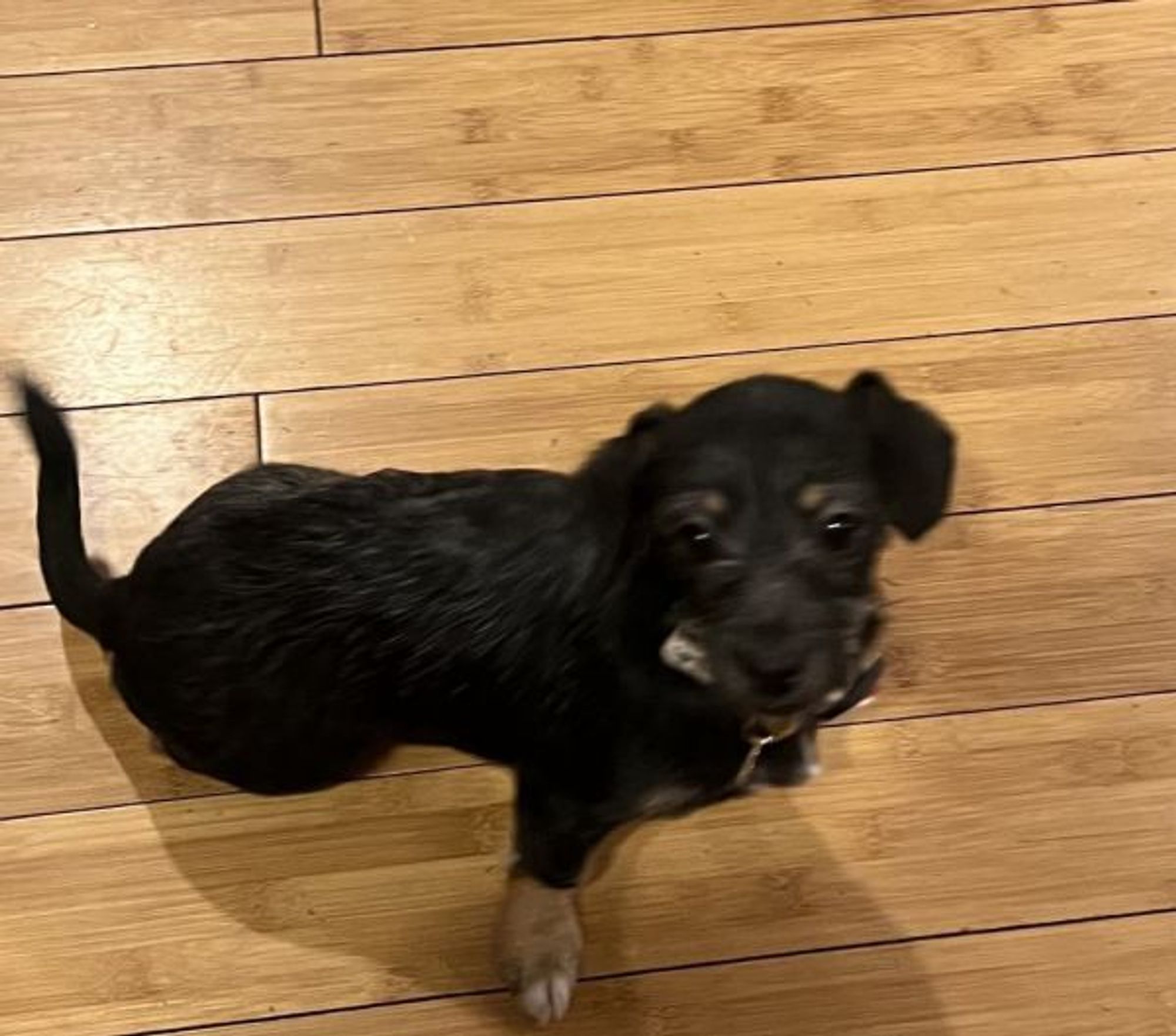
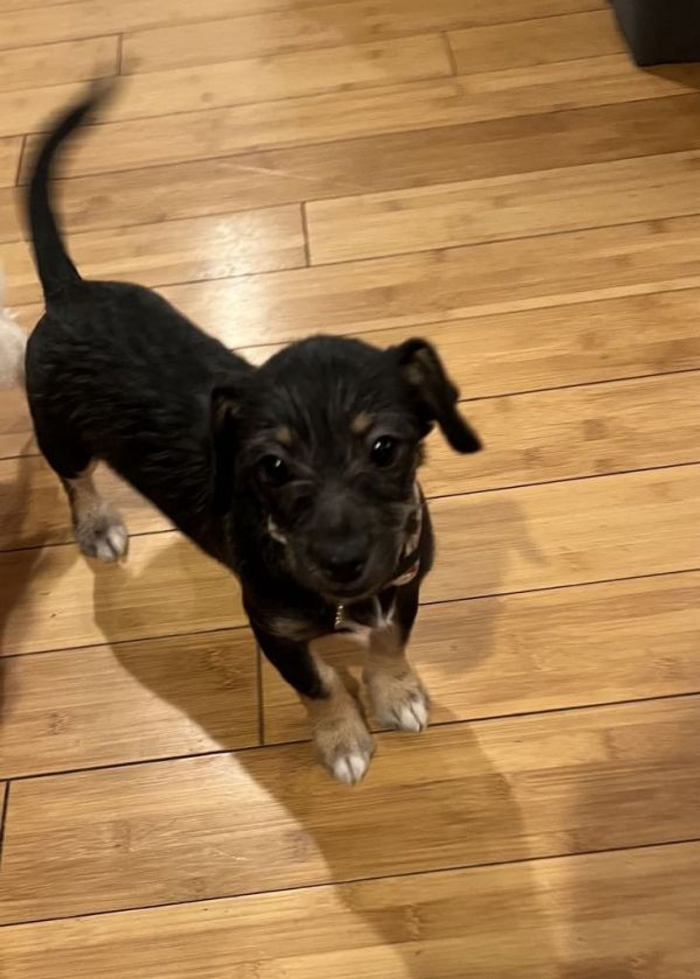
Let the tail wags and adventures begin! Meet, Cardi, located in Midway, UT. Learn more: https://www.petfinde...http://dlvr.it/TFKvr0
Let the tail wags and adventures begin! Meet, Cardi, located in Midway, UT. Learn more: https://www.petfinde...http://dlvr.it/TFKvrB
Let the tail wags and adventures begin! Meet, Cardi, located in Midway, UT. Learn more: https://www.petfinder.com/dog/cardi-73092464/ut/midway/mountain-mama-pyrs-and-pups-ut246/
Cheers to the BIG shopper who picked up loads of my stock packs! I super appreciate the support and hope you enjoy the stock photos :D ❤️ ko-fi.com/sambeawesome...#artresources#artref#drawingref#kofishop


🚍 Eastbound 55 Garfield buses are temporarily rerouted via Exit Midway 🟧 Orange Line Terminal, 59th, Pulaski and 55th : due to, street blockage near 55th/Pulaski.
i feel like the niche reddit fights are 90% people midway through their phd because they are involved in the subject enough to understand what the fight is about but unemployed enough to full-time reddit