BLUE
EPellispratt.bsky.social

Fun and usual, but usually midweek or weekend afternoons: storytelling for adults. crickcrackclub.com/whats-on/londondreamtime.com/top-ten-stor...

0
SEstanedward.com

Who wants to take a lil midweek road trip in Jan

0
SFspc-fire.nws-bot.us

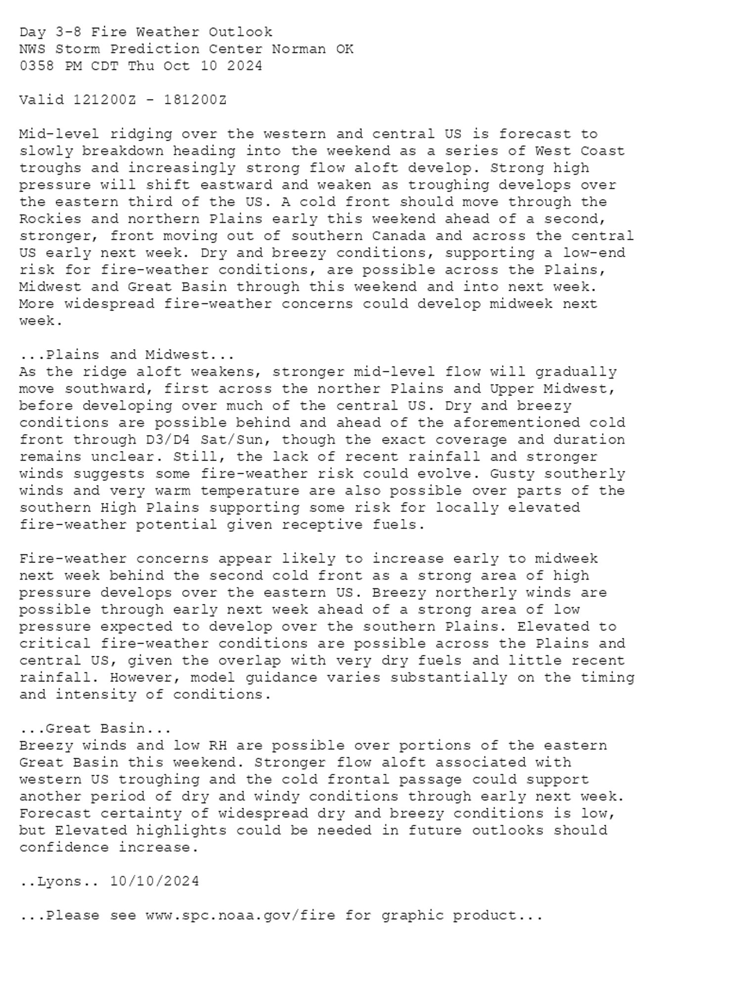
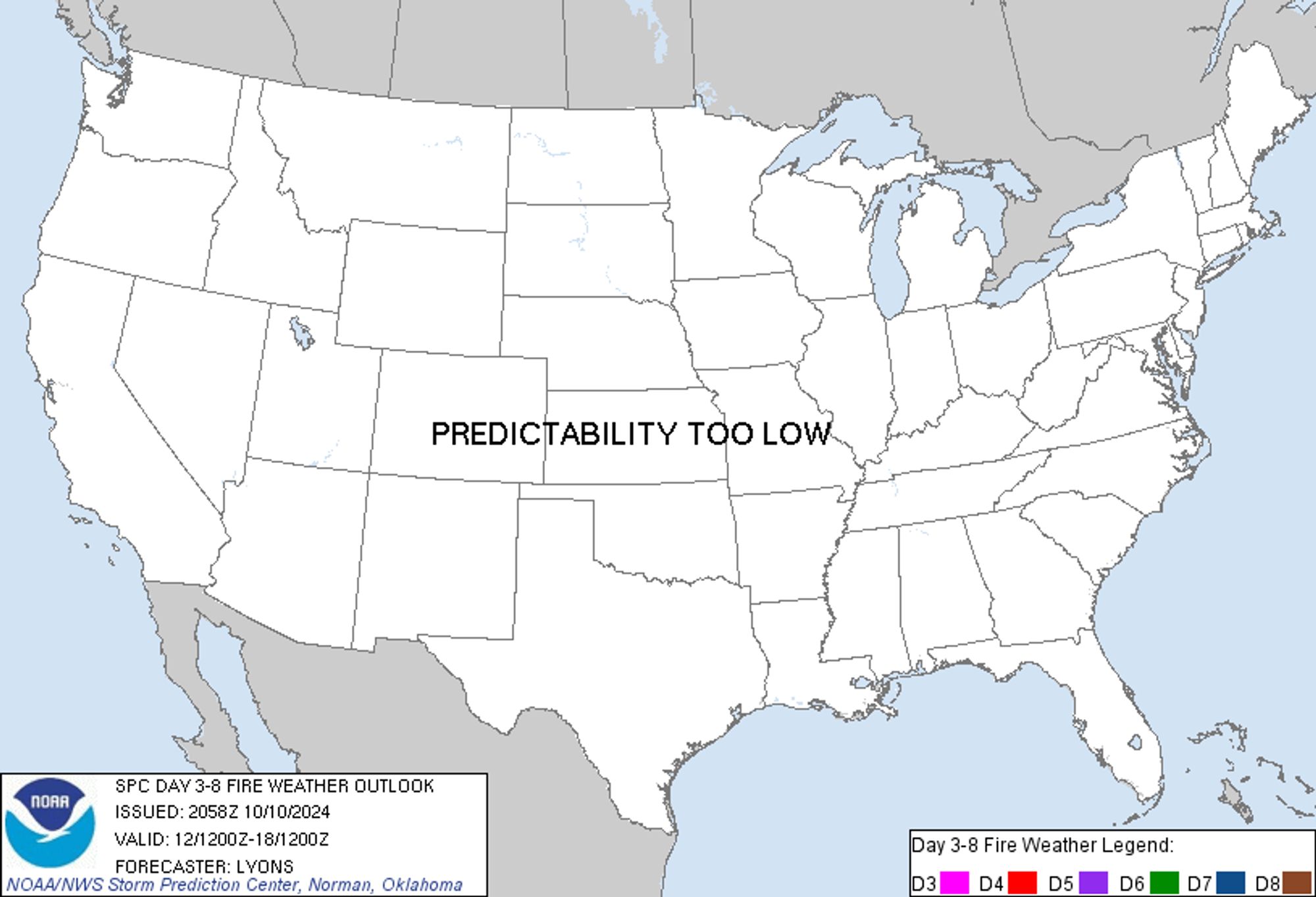
SPC Day 3-8 Fire Weather Outlook posted at Thu, 10 Oct 2024 21:03:20 +0000 🔥Plains and Midwest🔥 Additional Details Here.


Day 3-8 Fire Weather Outlook  
NWS Storm Prediction Center Norman OK
0358 PM CDT Thu Oct 10 2024

Valid 121200Z - 181200Z

Mid-level ridging over the western and central US is forecast to
slowly breakdown heading into the weekend as a series of West Coast
troughs and increasingly strong flow aloft develop. Strong high
pressure will shift eastward and weaken as troughing develops over
the eastern third of the US. A cold front should move through the
Rockies and northern Plains early this weekend ahead of a second,
stronger, front moving out of southern Canada and across the central
US early next week. Dry and breezy conditions, supporting a low-end
risk for fire-weather conditions, are possible across the Plains,
Midwest and Great Basin through this weekend and into next week.
More widespread fire-weather concerns could develop midweek next
week. 

...Plains and Midwest...
As the ridge aloft weakens, stronger mid-level flow will gradually
move southward, first across the norther Plains and Upper Midwest,
before developing over much of the central US. Dry and breezy
conditions are possible behind and ahead of the aforementioned cold
front through D3/D4 Sat/Sun, though the exact coverage and duration
remains unclear. Still, the lack of recent rainfall and stronger
winds suggests some fire-weather risk could evolve. Gusty southerly
winds and very warm temperature are also possible over parts of the
southern High Plains supporting some risk for locally elevated
fire-weather potential given receptive fuels.

Fire-weather concerns appear likely to increase early to midweek
next week behind the second cold front as a strong area of high
pressure develops over the eastern US. Breezy northerly winds are
possible through early next week ahead of a strong area of low
pressure expected to develop over the southern Plains. Elevated to
critical fire-weather conditions are possible across the Plains and
central US, given the overlap with very dry fuels and little recent
rainfall. However, model guidance varies substantially on the timing
and intensity of conditions.

...Great Basin...
Breezy winds and low RH are possible over portions of the eastern
Great Basin this weekend. Stronger flow aloft associated with
western US troughing and the cold frontal passage could support
another period of dry and windy conditions through early next week.
Forecast certainty of widespread dry and breezy conditions is low,
but Elevated highlights could be needed in future outlooks should
confidence increase.

..Lyons.. 10/10/2024

...Please see www.spc.noaa.gov/fire for graphic product...
Day 3-8 Fire Weather Outlook Image
0
OCojcastle.bsky.social

Thoroughly enjoyed being on this week’s Midweek Drive podcast for Southside Broadcasting. It was a real mix of topics including burger eating etiquette, AI, Wimbledon, Halloween films and exclusive music from the very talented @chloeyrose. #podcast#music#films#lincoln

0
PLlupestripe.bsky.social

I tend to write once a week, usually on a Sunday or Monday - rare I do it midweek but there’s so much been happening it was my first chance

0
MWmartinwickham.bsky.social

(Cough *brothers in law* cough) Moore on a Ballydoyle horse is playing it straight (especially in Tabor colours). Wouldn’t touch his rare midweek domestic rides with a barge pole. Even less so with Stoute about to retire. Havlin and Spencer are also on my shit list

0
Jjarede.bsky.social