ich such jetzt nach emailadressen in meinem outlook und schick das an die; if they don't give two shits, why should I?
Morning Paula. Not a bad outlook for the start of the day!
I used Pine but never Alpine. Agree, MUA lost something. Where is the romance in Outlook or Mail?
Vielleicht sollte ich doch das neue Windows ausprobieren. Aber die dauernden Änderungen nerven und halten mich von der Arbeit ab.
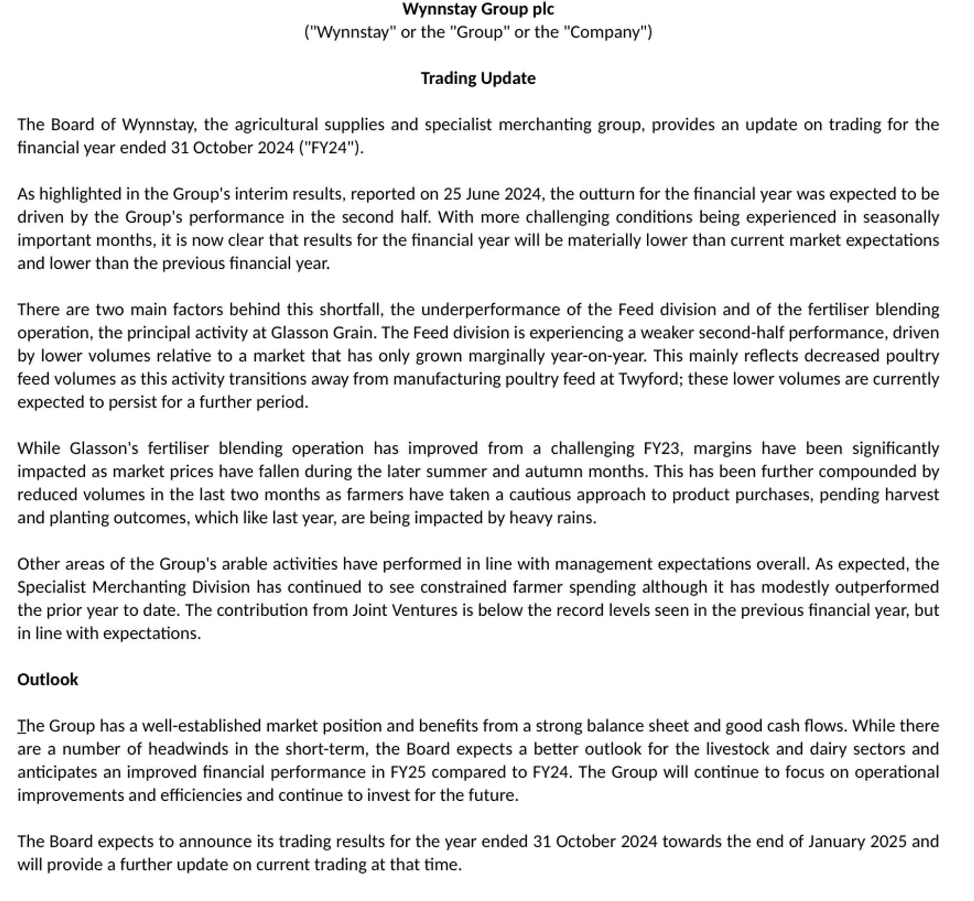
Wynnstay #WYN FY TU, the curse of the H2 weighting strikes. A significant warning, materially lower than expectations and lower than previous yr. Outlook - the Board expects a 'better outlook for livestock and dairy sectors and anticipates an improved financial performance in FY25 compared to FY24'
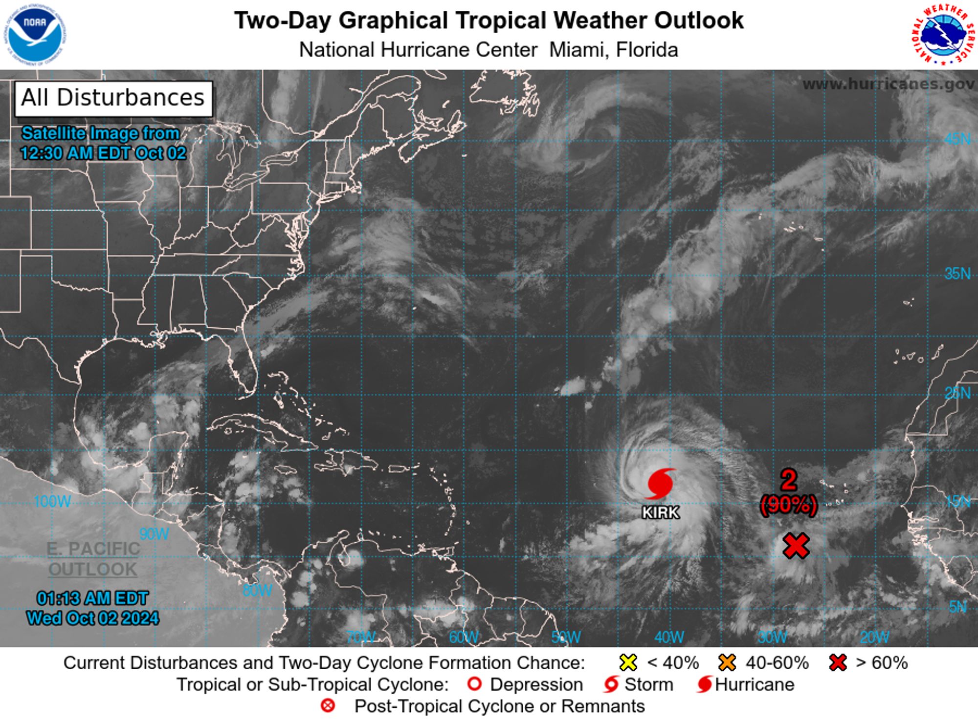
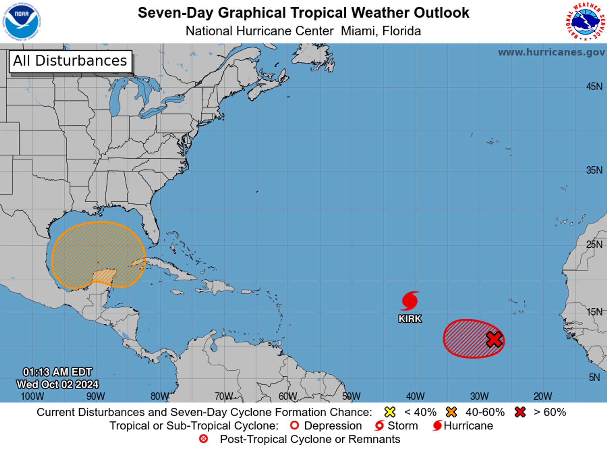
NWS National Hurricane Center Miami FL 200 AM EDT Wed Oct 2 2024 For the North Atlantic...Caribbean Sea and the Gulf of Mexico: Active Systems: The National Hurricane Center is issuing advisories on Hurricane Kirk, located over the central tropical Atlantic Ocean.
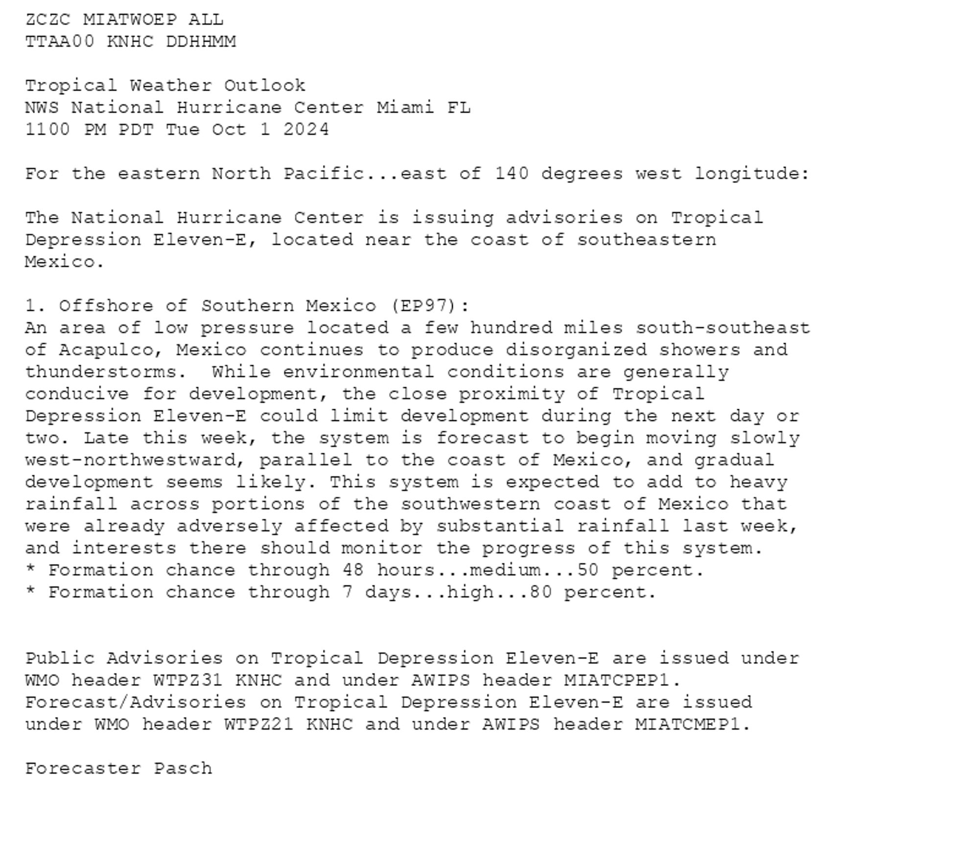
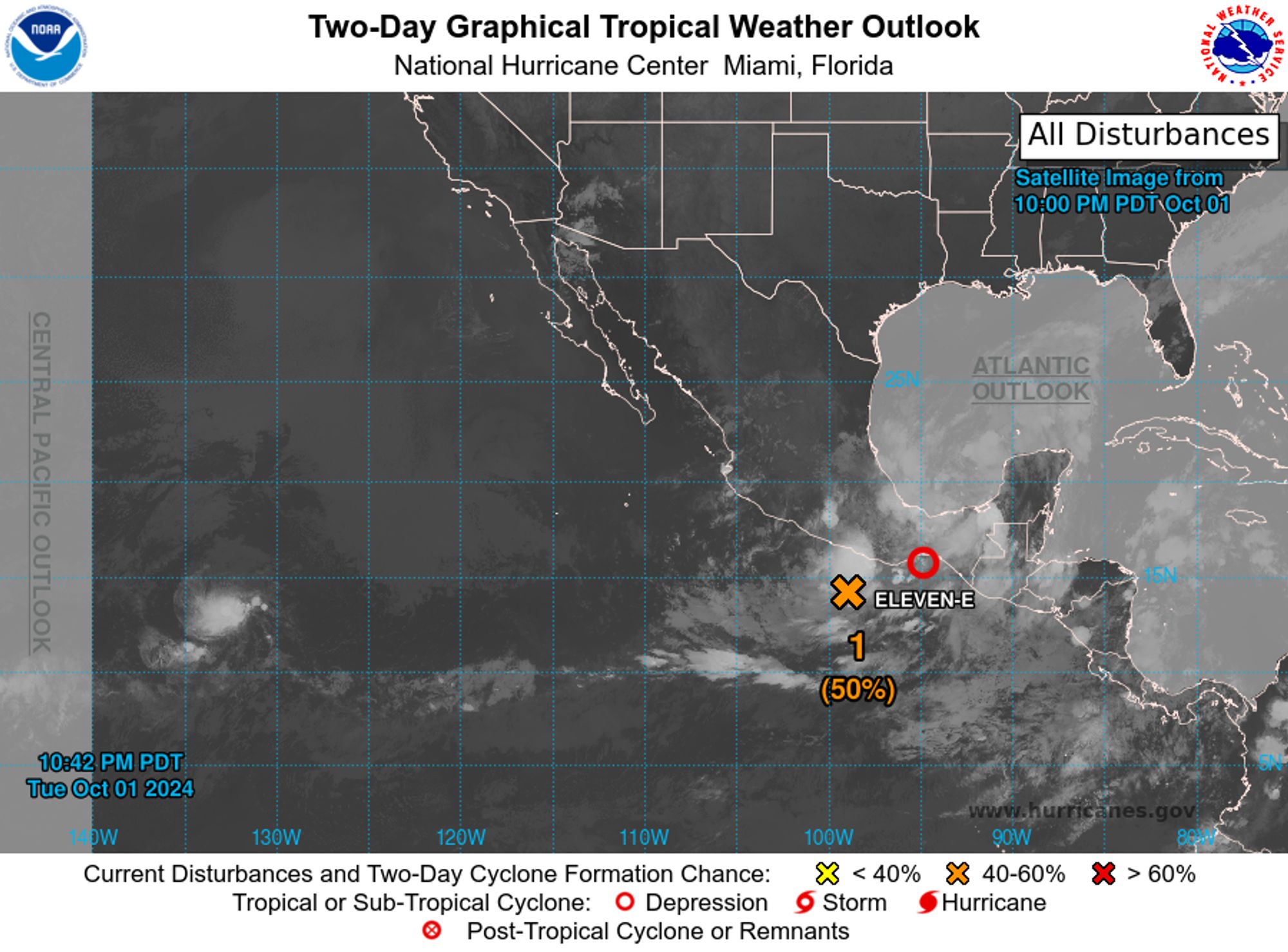
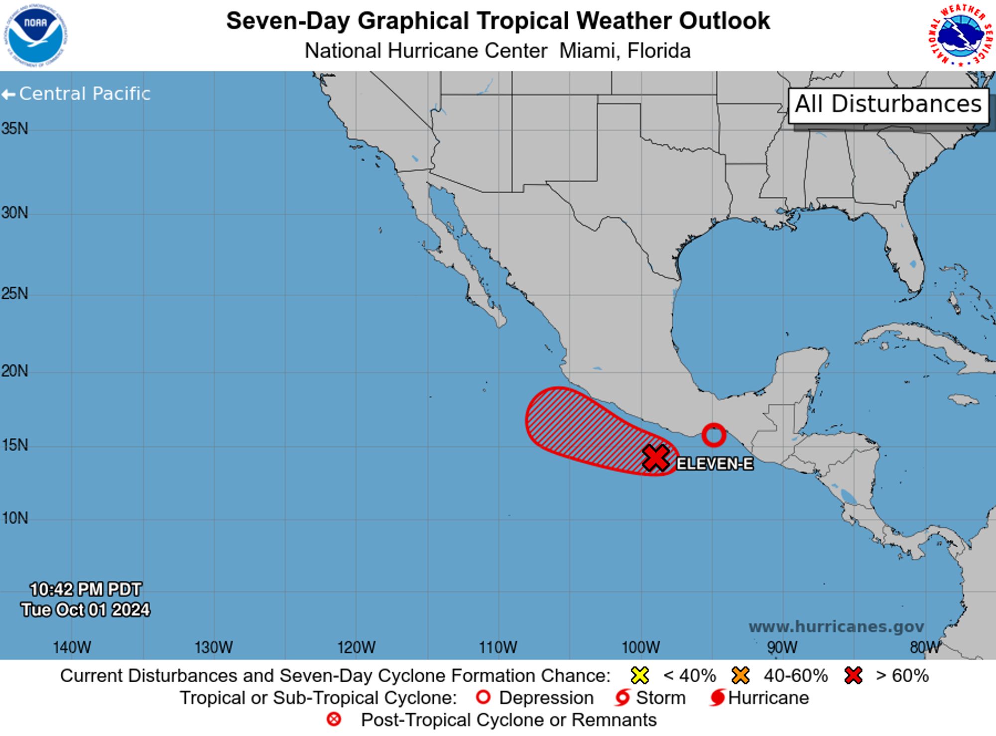
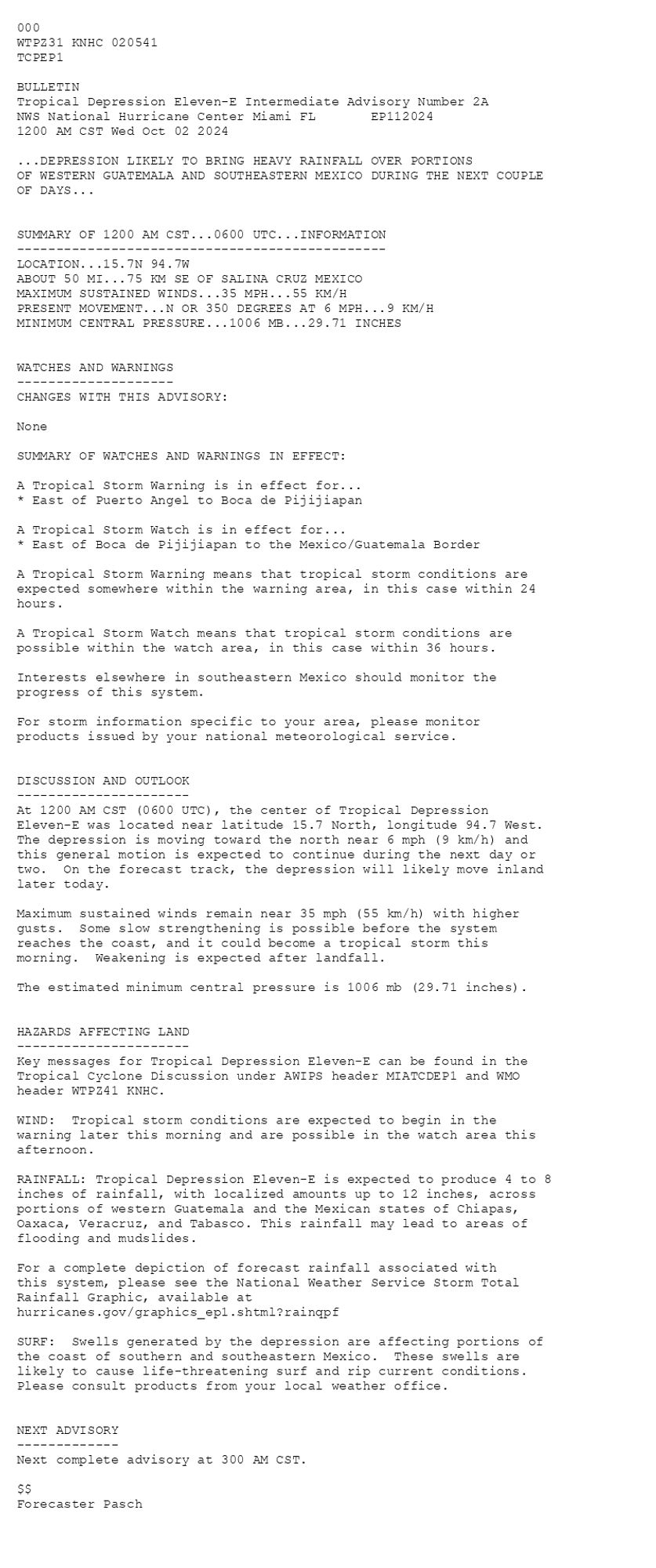
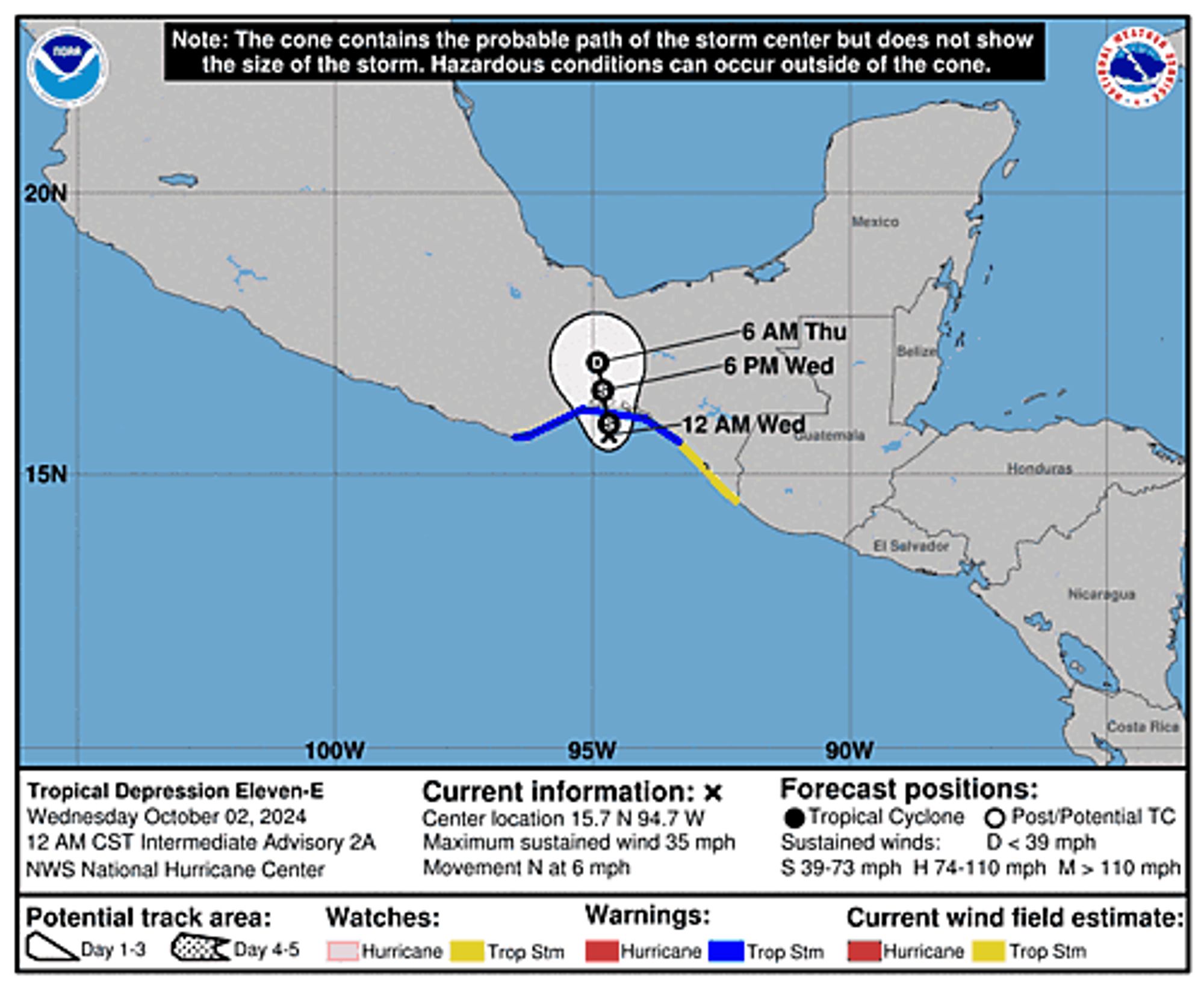
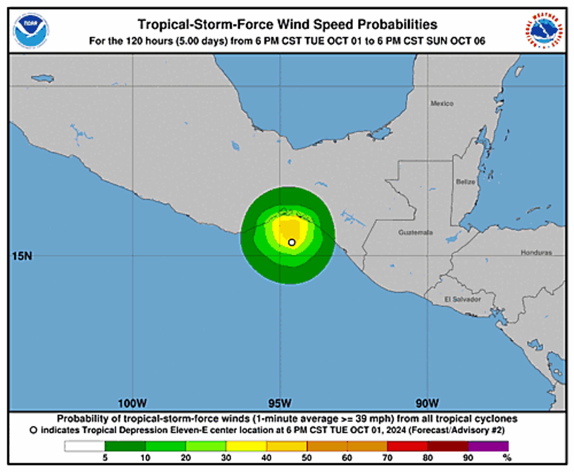
Eastern Pacific Tropical Depression Eleven-E Intermediate Advisory Number 2A issued at Wed, 02 Oct 2024 05:41:47 +0000 ...DEPRESSION LIKELY TO BRING HEAVY RAINFALL OVER PORTIONS OF WESTERN GUATEMALA AND SOUTHEASTERN MEXICO DURING THE NEXT COUPLE OF DAYS... Additional Details Here.
NHC Eastern North Pacific Outlook update for Wed, 02 Oct 2024 05:42:14 GMT Additional Details Here.